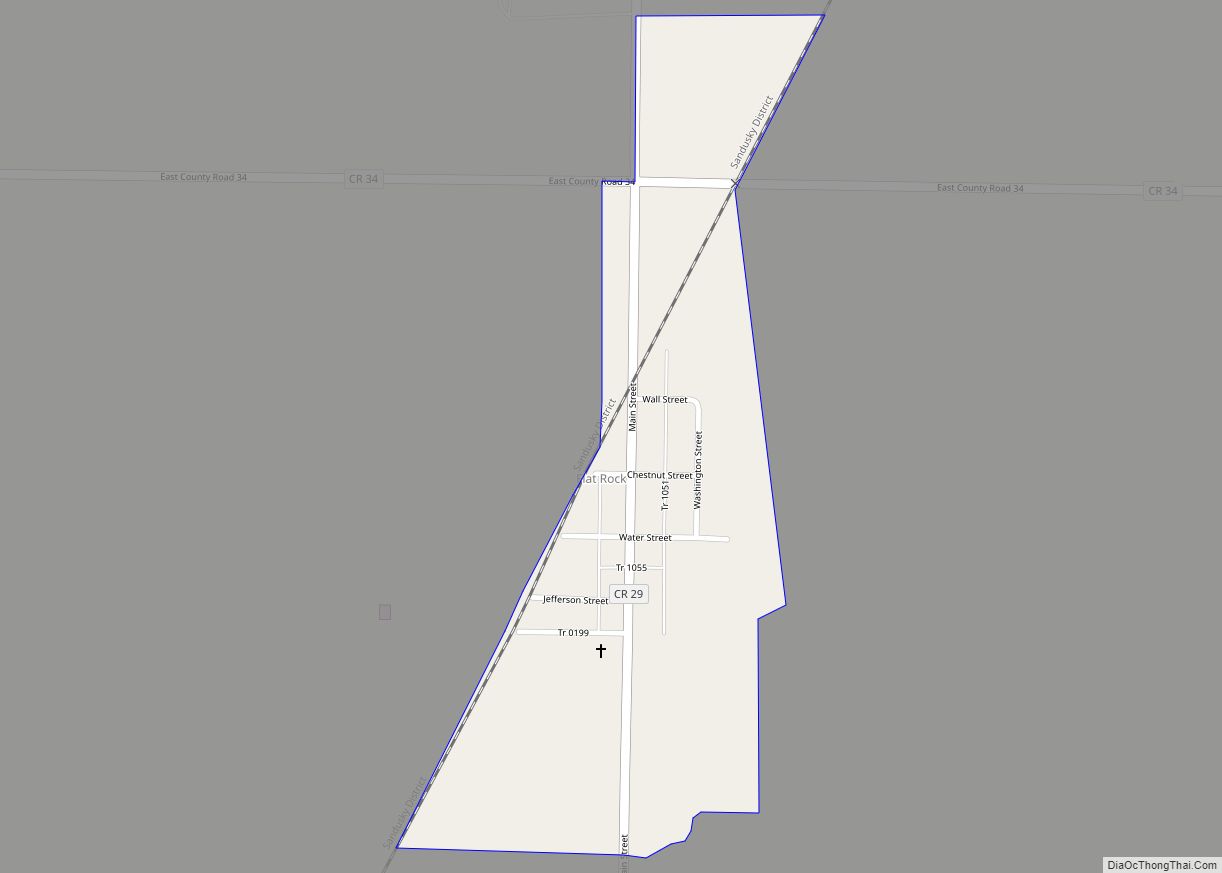
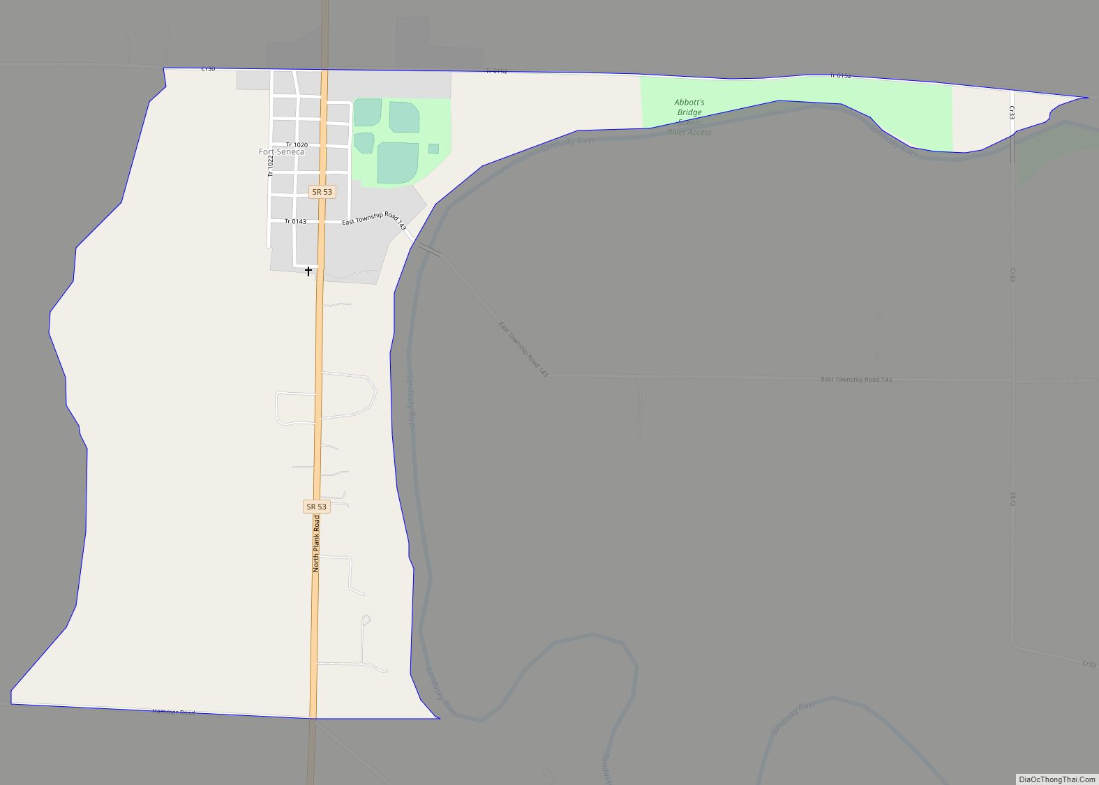
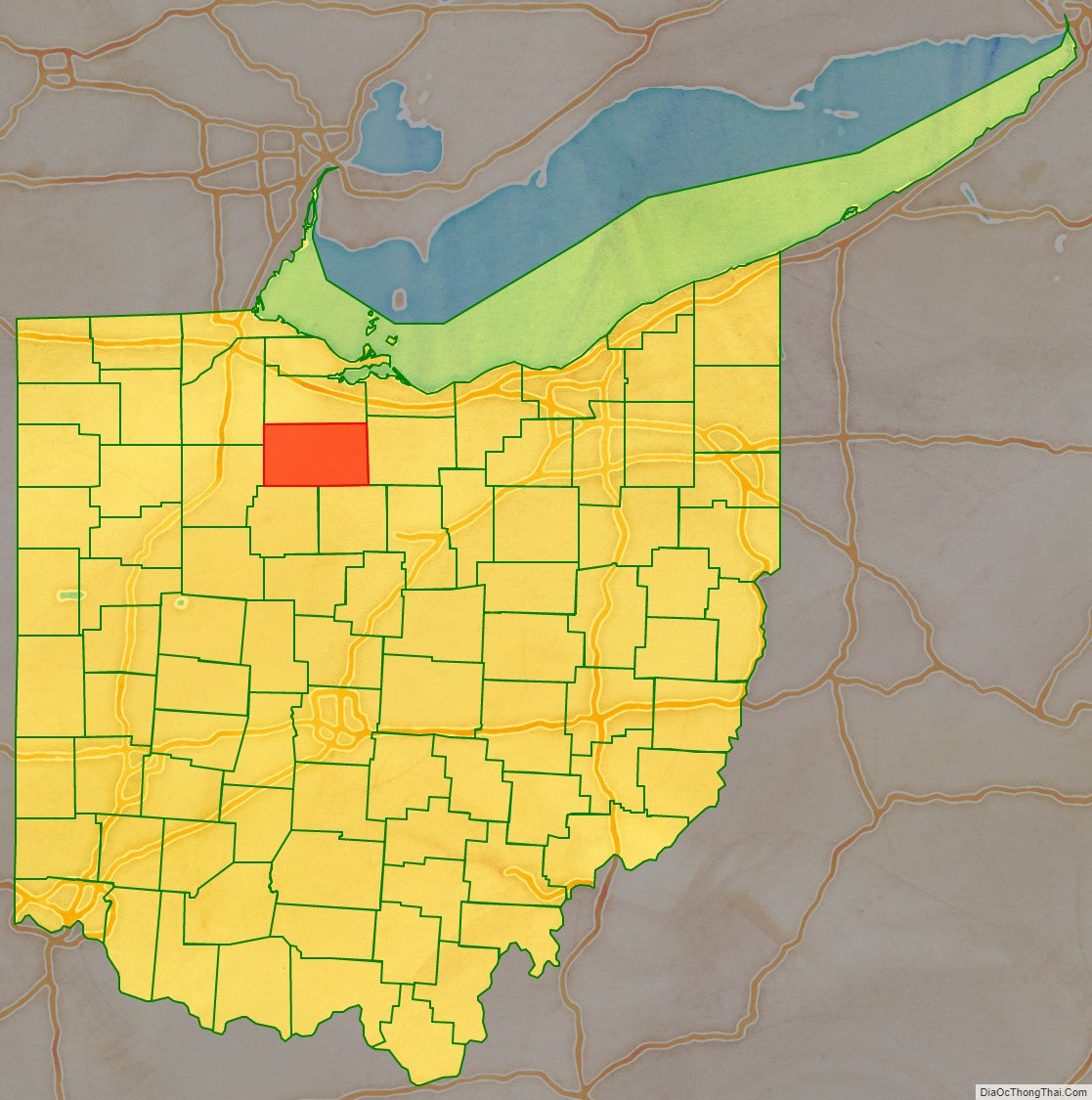
Seneca County is a county located in the northwestern part of the U.S. state of Ohio. As of the 2020 census, the population was 55,069. Its county seat is Tiffin. The county was created in 1820 and organized in 1824. It is named for the Seneca Indians, the westernmost nation of the Iroquois Confederacy. This people were based in present-day New York but had territory extending into Pennsylvania and Ohio.
Seneca County comprises the Tiffin, OH Micropolitan Statistical Area, which is also included in the Findlay-Tiffin, OH Combined Statistical Area.
| Name: | Seneca County |
|---|---|
| FIPS code: | 39-147 |
| State: | Ohio |
| Founded: | April 1, 1824 |
| Named for: | the Seneca nation |
| Seat: | Tiffin |
| Largest city: | Tiffin |
| Total Area: | 553 sq mi (1,430 km²) |
| Land Area: | 551 sq mi (1,430 km²) |
| Total Population: | 55,069 |
| Population Density: | 100/sq mi (38/km²) |
| Time zone: | UTC−5 (Eastern) |
| Summer Time Zone (DST): | UTC−4 (EDT) |
| Website: | senecacountyohio.gov |
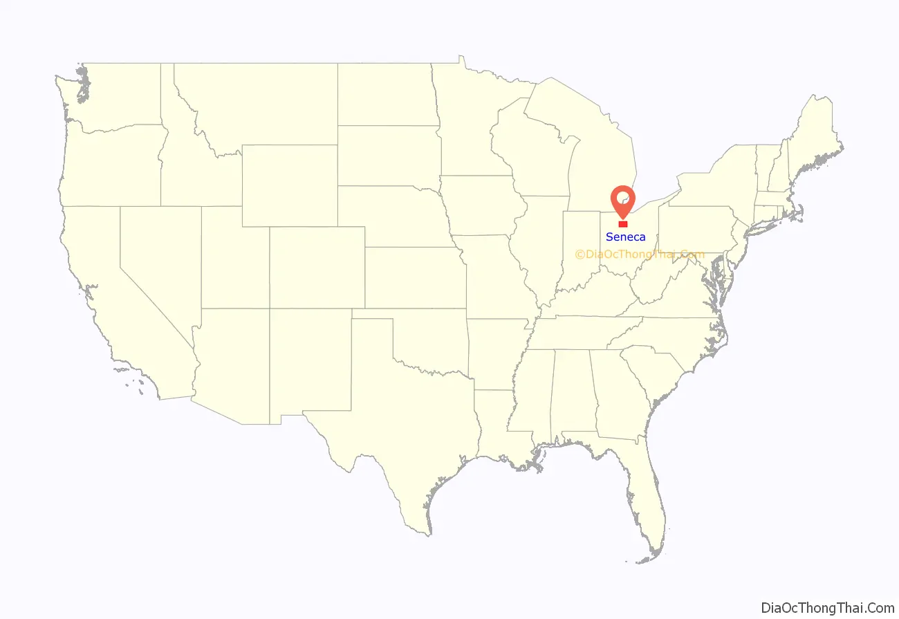
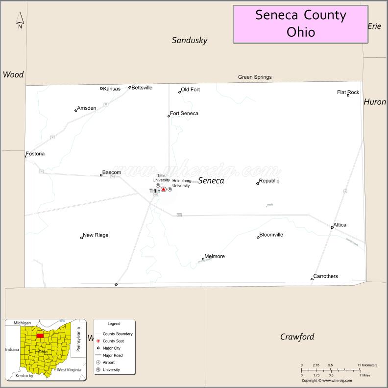
Seneca County location map. Where is Seneca County?
History
This area was long occupied by a succession of indigenous peoples. During and after the colonial period, French, British and American fur traders established relations with the historic peoples of the time.
The county was barely inhabited by European Americans until the 1830s, but this period was one of steady migration by settlers from New York and New England. The migration was stimulated by completion of the Erie Canal through New York, which connected the markets by the Great Lakes to the Hudson River and New York City. By 1860 the population of Seneca County had increased to about half the current number of residents. It was developed for agriculture, and grew slowly thereafter.
Toward the end of the 19th century, during the Great Depression, and the post–World War II baby boom, this area had periods of greater population increase. In 1980 the census recorded a population of 61,901; the total has since declined. Since about 2000, the county’s population declines by about 100–300 persons annually, mainly due to a migration deficit of about 300 persons annually. This decline is projected to continue in the future.
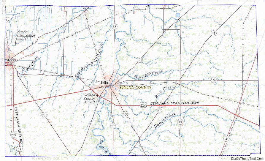
Seneca County Road Map

Geography
According to the U.S. Census Bureau, the county has a total area of 553 square miles (1,430 km), of which 551 square miles (1,430 km) is land and 1.8 square miles (4.7 km) (0.3%) is water.
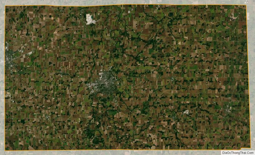
Almost 80% of the county’s total area is agricultural land. Some 10% is covered by forest. Most of the rest is developed, with some allocated for pastureland.
The terrain of Seneca County is nearly level, gently sloping from about 290 meters ASL in the southeast to about 210 m ASL at the edge of the Great Black Swamp in the northwest. Most of the county’s area is located between 230 and 260 m ASL, however. Almost the entire county belongs to the Sandusky River drainage basin; the river bisects the county from north to south slightly west of its middle. Tiffin developed on both sides of the river, which flows north to its mouth at Lake Erie. There is some steeper terrain along the river’s course, formed by the occasional ravine of its tributaries.
The Great Lakes moderate temperatures somewhat, but Seneca County has essentially a continental climate. After most of the forests were cleared for agricultural development, the microclimate was disrupted. Winters can be harsh, with plentiful snowfall due to lake-effect snow. Summers are often hot and oppressively humid, bordering on subtropical. The mostly featureless surface does not form any obstacles to the winter winds sweeping south from Canada, resulting in extreme wind chill at times. In a 1906 description, the local climate was described as “rather unhealthful”.
Adjacent counties
- Sandusky County (north)
- Huron County (east)
- Crawford County (southeast)
- Wyandot County (southwest)
- Hancock County (west)
- Wood County (northwest)
Seneca County Topographic Map
Seneca County Satellite Map
Seneca County Outline Map