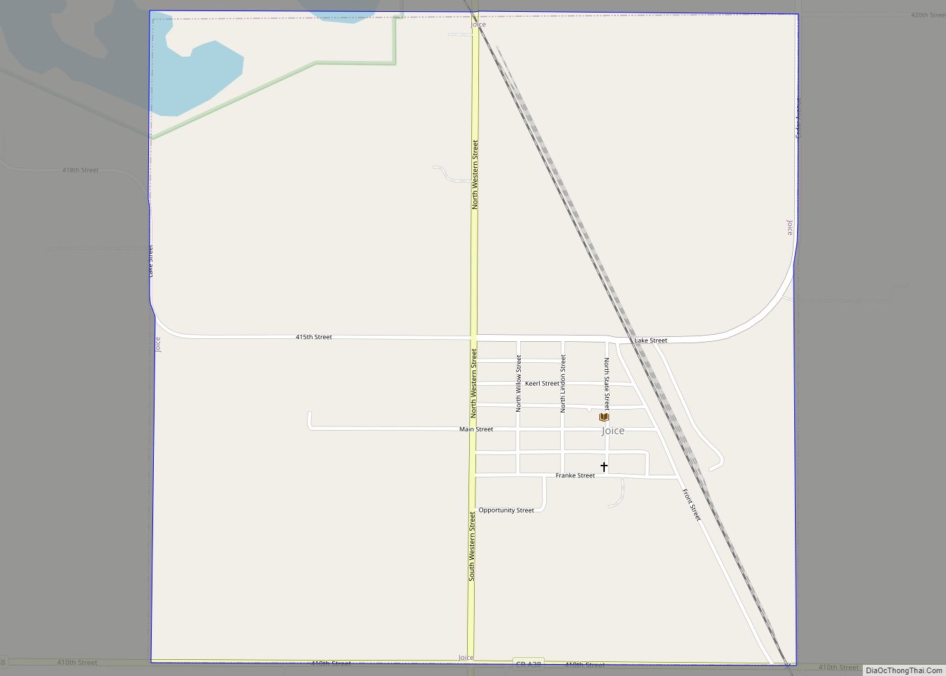
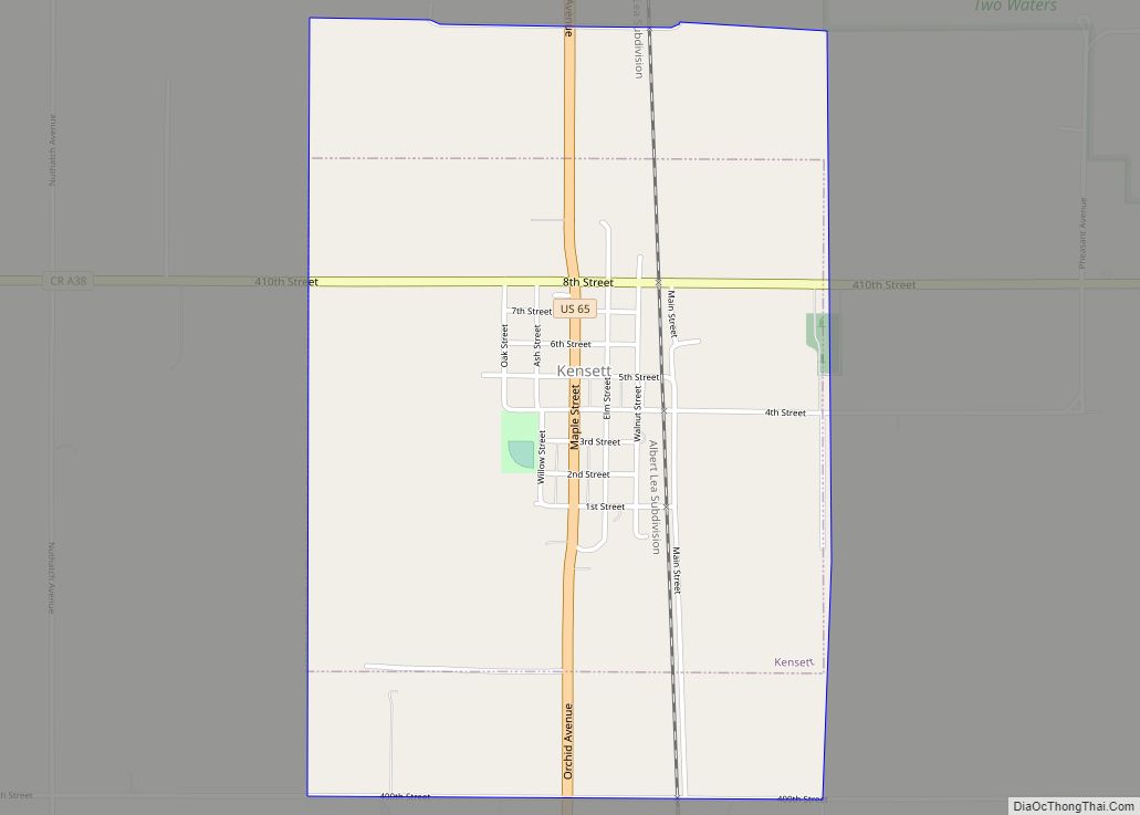
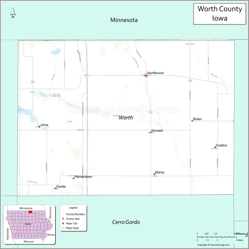
Worth County is a county located in the U.S. state of Iowa. As of the 2020 census, the population was 7,443. The county seat is Northwood. The county was founded in 1851 and named for Major General William Jenkins Worth (1794–1849), an officer in both the Seminole War and the Mexican–American War.
Worth County is part of the Mason City, IA Micropolitan Statistical Area.
| Name: | Worth County |
|---|---|
| FIPS code: | 19-195 |
| State: | Iowa |
| Founded: | 1851 |
| Named for: | William Jenkins Worth |
| Seat: | Northwood |
| Largest city: | Northwood |
| Total Area: | 402 sq mi (1,040 km²) |
| Land Area: | 400 sq mi (1,000 km²) |
| Total Population: | 7,443 |
| Population Density: | 19/sq mi (7.1/km²) |
| Time zone: | UTC−6 (Central) |
| Summer Time Zone (DST): | UTC−5 (CDT) |
| Website: | worthcountyiowa.gov |
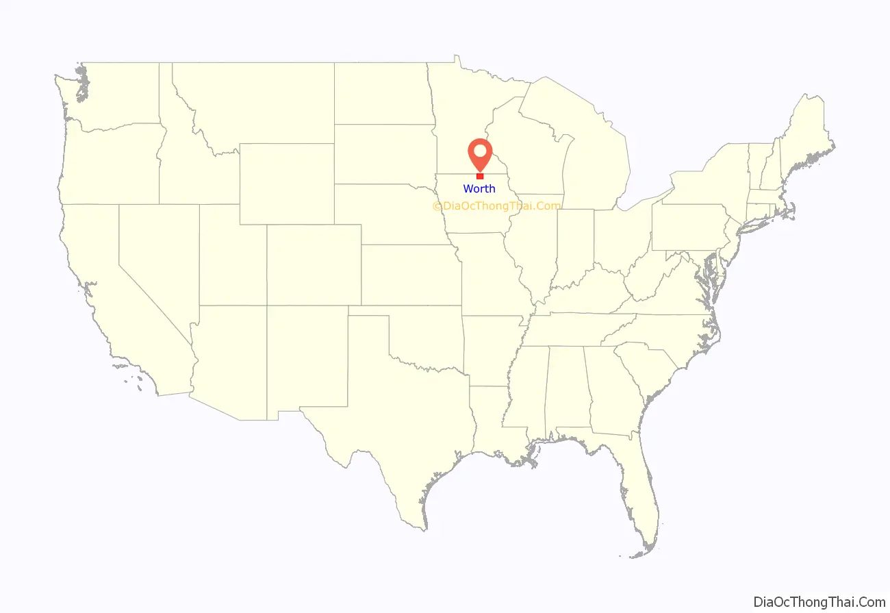
Worth County location map. Where is Worth County?
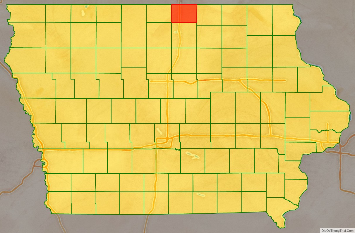
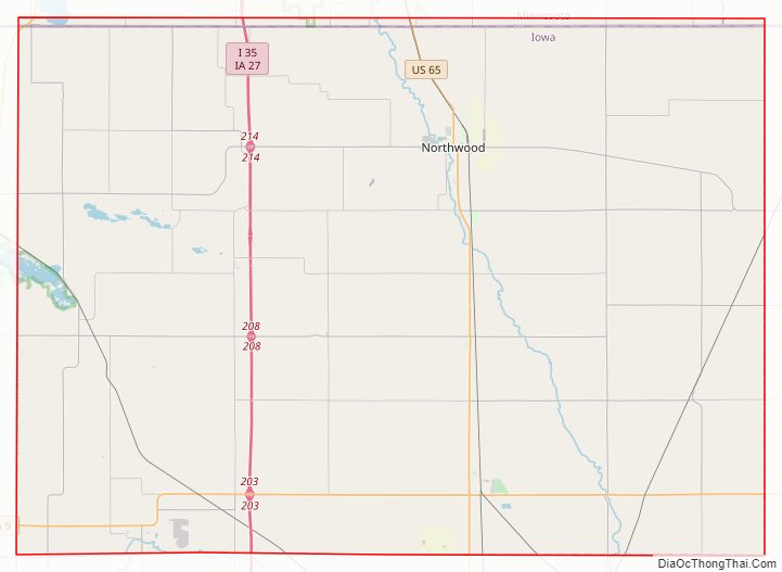
Worth County Road Map
Geography
According to the U.S. Census Bureau, the county has a total area of 402 square miles (1,040 km), of which 400 square miles (1,000 km) is land and 1.8 square miles (4.7 km) (0.5%) is water. It is the fourth-smallest county in Iowa by land area and third-smallest by total area.
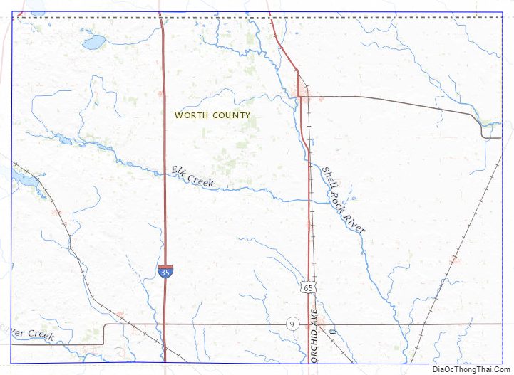
Major highways
- Interstate 35/Iowa Highway 27
- U.S. Highway 65
- U.S. Highway 69
- Iowa Highway 9
Adjacent counties
- Freeborn County, Minnesota (north)
- Mower County, Minnesota (northeast)
- Mitchell County (east)
- Cerro Gordo County (south)
- Winnebago County (west)
Worth County Topographic Map
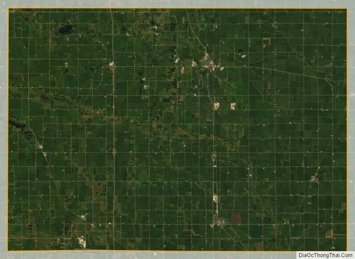
Worth County Satellite Map
Worth County Outline Map