Cass County is a county in the U.S. state of Nebraska. As of the 2010 United States Census, the population was 25,241. Its county seat and largest city is Plattsmouth. The county was formed in 1855, and was named for General Lewis Cass.
Cass County is included in the Omaha–Council Bluffs, NE-IA Metropolitan Statistical Area.
In the Nebraska license plate system, Cass County is represented by the prefix 20 (it had the 20th-largest number of vehicles registered in the county when the license plate system was established in 1922).
| Name: | Cass County |
|---|---|
| FIPS code: | 31-025 |
| State: | Nebraska |
| Founded: | 1855 |
| Named for: | Lewis Cass |
| Seat: | Plattsmouth |
| Largest city: | Plattsmouth |
| Total Area: | 566 sq mi (1,470 km²) |
| Land Area: | 557 sq mi (1,440 km²) |
| Total Population: | 26,598 |
| Population Density: | 48.5/sq mi (18.7/km²) |
| Time zone: | UTC−6 (Central) |
| Summer Time Zone (DST): | UTC−5 (CDT) |
| Website: | www.cassne.org |
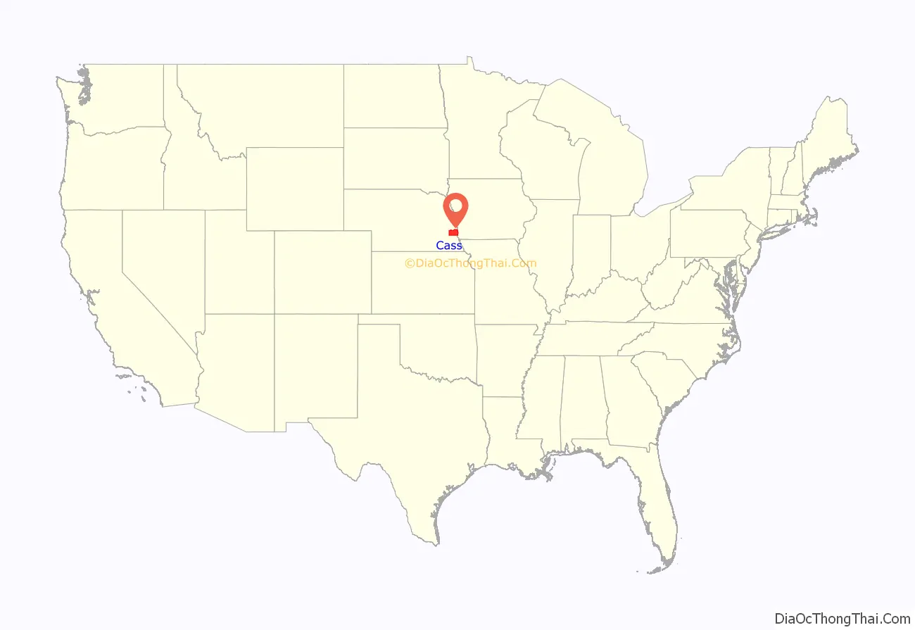
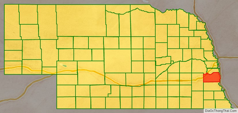
Cass County location map. Where is Cass County?
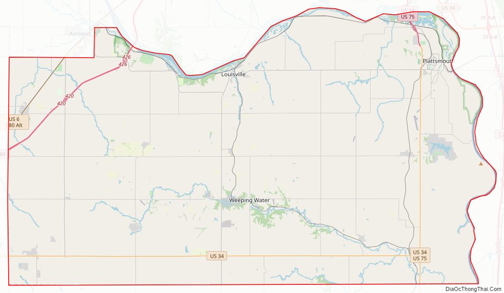
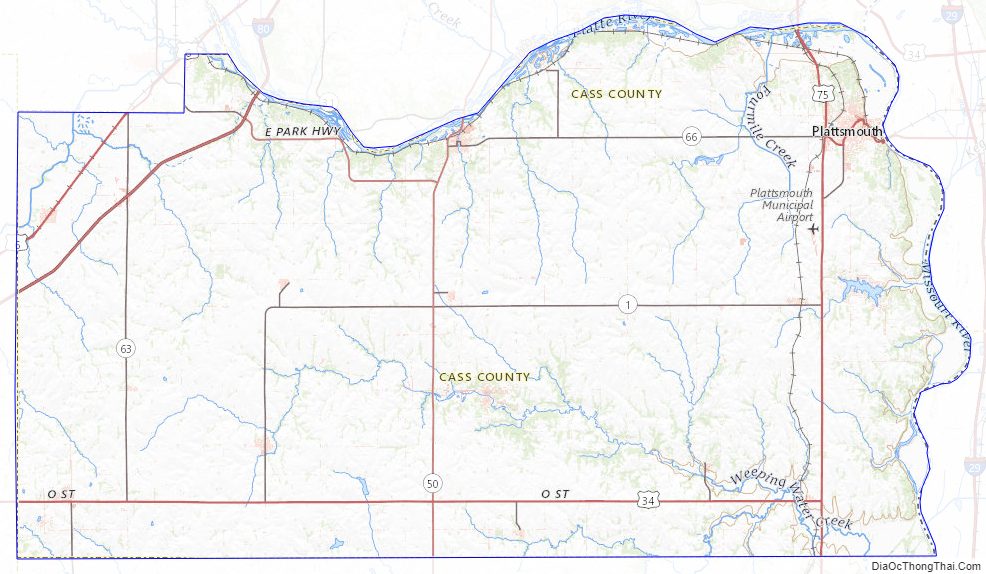
Cass County Road Map
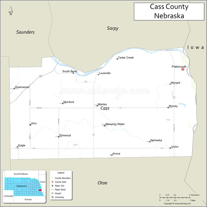
Geography
Cass County lies on the east side of Nebraska. Its east boundary line abuts the west boundary line of the state of Iowa, across the Missouri River. According to the US Census Bureau, the county has an area of 566 square miles (1,470 km), of which 557 square miles (1,440 km) is land and 8.4 square miles (22 km) (1.5%) is water.
Major highways
- Interstate 80
- U.S. Highway 6
- U.S. Highway 34
- U.S. Highway 75
- Nebraska Highway 1
- Nebraska Highway 43
- Nebraska Highway 50
- Nebraska Highway 63
- Nebraska Highway 66
- Nebraska Highway 67
Protected areas
- Beaver Lake
- Louisville State Recreation Area
- Eugene T. Mahoney State Park
- Platte River State Park
- Schilling Wildlife Management Area
Adjacent counties
- Sarpy County – north
- Mills County, Iowa – northeast
- Fremont County, Iowa – southeast
- Otoe County – south
- Lancaster County – west
- Saunders County – northwest
Due to its proximity to Cass County, Iowa, and because both of those counties receive most of their broadcasts from Omaha, Nebraska, references to ‘Cass County’ must be frequently disambiguated, or result in confusion.
Cass County Topographic Map
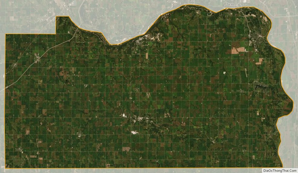
Cass County Satellite Map
Cass County Outline Map