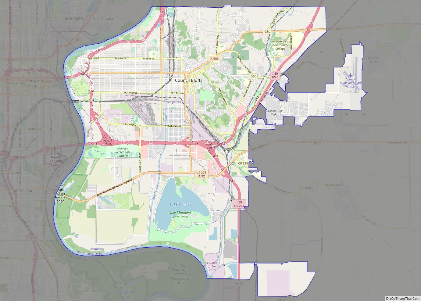
Council Bluffs is a city in and the county seat of Pottawattamie County, Iowa, United States. It is the most populous city in Southwest Iowa, as well as the third largest and a primary city of the Omaha-Council Bluffs Metropolitan Area. It is located on the east bank of the Missouri River, across from Omaha, Nebraska. Until about 1853 Council Bluffs was known as Kanesville. Kanesville was the historic starting point of the Mormon Trail. Kanesville is also the northernmost anchor town of the other emigrant trails because there was a steam-powered boat which ferried the settlers’ wagons and cattle across the Missouri River. In 1869, the first transcontinental railroad to California was connected to the existing U.S. rail network at Council Bluffs.
Council Bluffs’ population was 62,799 at the time of the 2020 census, making it the state’s tenth largest city. The Omaha metropolitan region of which Council Bluffs is a part, is the 58th largest in the United States, with an estimated population of 967,604 (2020).
| Name: | Council Bluffs city |
|---|---|
| LSAD Code: | 25 |
| LSAD Description: | city (suffix) |
| State: | Iowa |
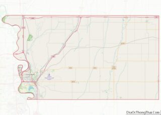
| County: | Pottawattamie County |
| Incorporated: | January 19, 1853 |
| Elevation: | 1,090 ft (332 m) |
| Land Area: | 42.96 sq mi (111.27 km²) |
| Water Area: | 2.71 sq mi (7.02 km²) |
| Population Density: | 1,461.73/sq mi (564.38/km²) |
| ZIP code: | 51501-51503 |
| Area code: | 712 |
| FIPS code: | 1916860 |
| GNISfeature ID: | 0455672 |
| Website: | councilbluffs-ia.gov |
Online Interactive Map
Click on ![]() to view map in "full screen" mode.
to view map in "full screen" mode.
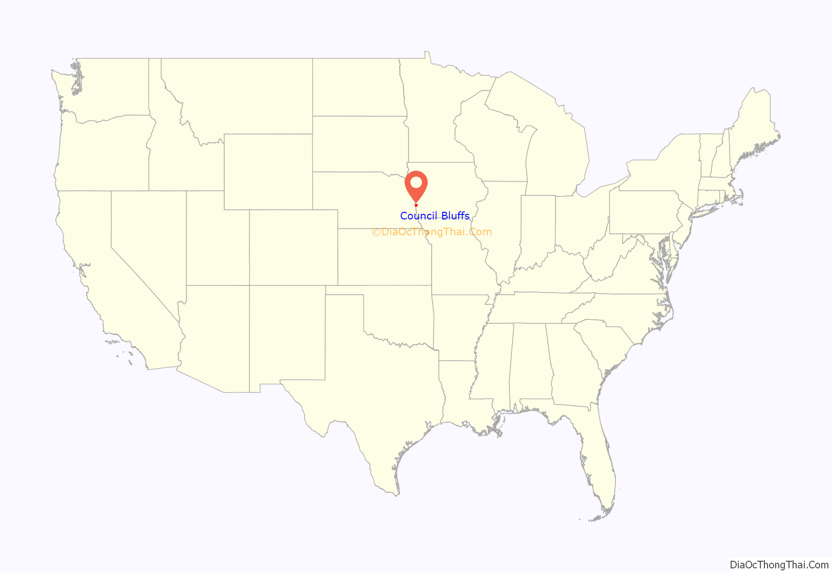
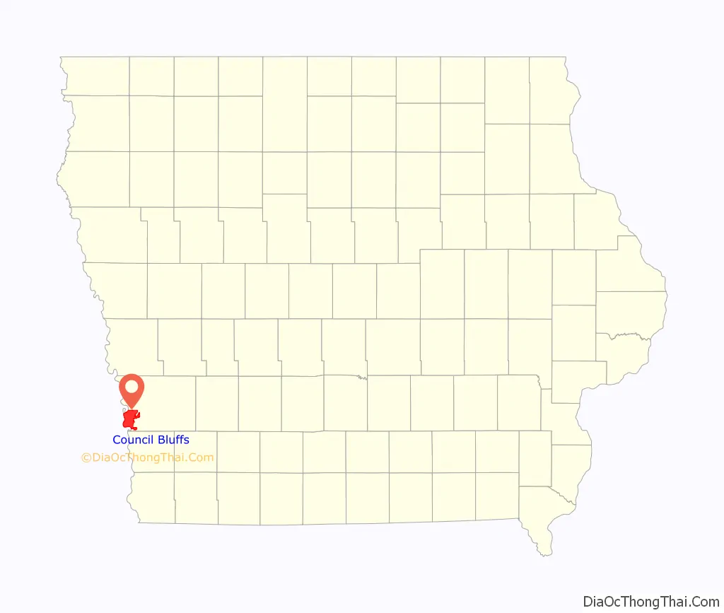
Council Bluffs location map. Where is Council Bluffs city?
History
1804–1843: Pottawattamie reservation and Caldwell’s Camp
The first Council Bluff (which is singular) was on the Nebraska side of the river at Fort Atkinson, about 20 miles (32 km) northwest of the current city of Council Bluffs. It was named by Lewis and Clark for a bluff where they met the Otoe tribe on August 2, 1804.
The Iowa side of the river became an Indian Reservation in the 1830s for members of the Council of Three Fires of Chippewa, Ottawa, and Potawatomi who were forced to leave the Chicago area under the Treaty of Chicago clearing the way for the city of Chicago to incorporate.
The largest group of Native Americans who moved to the area were the Pottawatomi, who were led by their chief Sauganash (“one who speaks English”), the son of the British loyalist William Caldwell, who founded Canadian communities on the south side of the Detroit River, and a Pottawatomi woman.
Seeking to avoid confrontation with the Sioux, who were natives of the Council Bluffs area, the 1,000 to 2,000 Pottawattamie initially had settled east of the Missouri River in Indian territory between Leavenworth, Kansas and St. Joseph, Missouri. When the area was bought from Ioway, Sac and Fox tribes in the Platte Purchase and part of Missouri in 1837, Sauganash and the Pottawatomi were forced to move to their assigned reservation in Council Bluffs. Sauganash’s English name was Billy Caldwell, and his village was called Caldwell’s Camp. The tribe were sometimes called the Bluff Indians. U.S. Army Dragoons built a small fort nearby.
In 1838–39, the missionary Pierre-Jean De Smet founded St. Joseph’s Mission to minister to the Potawatomi. De Smet was appalled by the violence and brutality caused by the whiskey trade, and tried to protect the tribe from unscrupulous traders. However he had little success in persuading tribal members to convert to Christianity and resorted to secret baptisms of Indian children.
During this time, De Smet contributed to Joseph Nicollet’s work in mapping the upper midwest. De Smet produced the first European-recorded, detailed map of the Council Bluffs area; it detailed the Missouri River valley system, from below the Platte River to the Big Sioux River.
De Smet wrote an early description of the Potawatomi settlement:
As more Native Americans were pushed into the Council Bluffs area by pressure of European-American settlement to the east, intertribal conflict increased, fueled by the illegal whiskey trade. The US Army built Fort Croghan in 1842, to keep order and try to control liquor traffic on the Missouri River. However the fort was destroyed in a flood later in the same year.
By 1846 the Pottawatomi were forced to move again to a new reservation at Osawatomie, Kansas.
1844–1851: Mormon community of Kanesville
In 1844, the Stephens-Townsend-Murphy Party crossed the Missouri River here, on their way to blaze a new path into California across the Sierra Nevada Mountains. Beginning in 1846 there was a large influx of Latter-day Saints into the area, although in the winter of 1847–1848 most Latter-day Saints crossed to the Nebraska side of the Missouri River. Initially, the area was called “Miller’s Hollow”, after Henry W. Miller, who would be the first member of the Iowa State Legislature from the area. Miller also was the foreman for the construction of the Kanesville Tabernacle.
By 1848, the town had become known as Kanesville, named for benefactor Thomas L. Kane who had helped negotiate federal permission in Washington, D.C. for the Mormons to use Indian land along the Missouri as their winter encampment of 1846–47. Built next to or at Caldwell’s Camp, Kanesville became the main outfitting point for the Mormon Exodus to Utah; it is the recognized head end of the Mormon Trail.
Edwin Carter, who would become a noted naturalist in Colorado, worked here from 1848 to 1859 in a dry goods store. He helped supply Mormon wagon trains.
Settlers who departed west from Kanesville into the sparsely settled, unorganized parts of the Territory of Missouri traveled to the Oregon Country and the newly conquered California Territory. They traversed the (eventual) Nebraska Territory traveling in wagon trains along the much-storied Oregon, Mormon, or California Trails into the newly expanded United States western lands.
After the first large organized wagon trains left Missouri in 1841, the annual migration waves began in earnest by the spring of 1843. They built up thereafter, with the opening of the Mormon Trail (1846) and peaked in the later 1860s, when news of the progress of railroads had a braking effect on the number of travelers.
By the 1860s, virtually all migration wagon trains passed near the town now named Council Bluffs. The wagon train trails became less important with the advent of the first complete transcontinental railway in 1869, but while trail use diminished after that, their use continued on at lesser rates until late in the nineteenth century.
The Mormon Battalion began its march from Kanesville to California during the Mexican–American War. The area was where plural marriage first began to be openly practiced. Orson Hyde began to publish The Frontier Guardian newspaper, and Brigham Young was named as the second president of the Church of Jesus Christ of Latter-day Saints (LDS church). The community was transformed by the California Gold Rush, and the majority of Mormons left for Utah by 1852.
1852–1900: Council Bluffs and the beginning of the railroad era
In 1852, the town was renamed Council Bluffs. It continued as a major outfitting point on the Missouri River for the Emigrant Trail and Pike’s Peak Gold Rush, and entertained a lively steamboat trade.
In 1863 an anonymous soldier on his way to fight the Dakota Uprising passed through Council Bluffs describing it as a hardscrabble town:
Council Bluffs (rather than Omaha) was designated by President Abraham Lincoln as being the official starting point of the transcontinental railroad which was completed in 1869. The official “Mile 0” start is at 21st Street and 9th Avenue which is now marked by a gold spike that was used for the promotion of the movie Union Pacific Council Bluffs physical connection to the Transcontinental Railroad was delayed until 1872 when the Union Pacific Missouri River Bridge opened (railroad cars had to be ferried across the Missouri River from Council Bluffs to Omaha in the early days of the Transcontinental).
The Chicago and North Western Railway arrived in 1867. Other railroads operating in the city were the Chicago, Rock Island and Pacific Railroad, Chicago Great Western Railway, Wabash Railroad, Illinois Central Railroad, and the Chicago, Burlington and Quincy Railroad as well as the Chicago, Milwaukee, St. Paul and Pacific Railroad.
1901–present
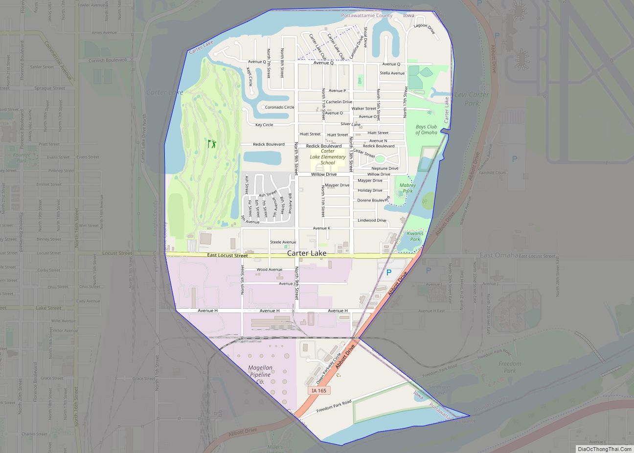
In 1926, the portion of Council Bluffs west of the Missouri River seceded to form Carter Lake, Iowa. Carter Lake had been cut off by a change in the course of the Missouri River.
By the 1930s, Council Bluffs had grown into the country’s fifth largest rail center. The railroads helped the city become a center for grain storage, and massive grain elevators continue to mark the city’s skyline. Other industries in the city included Blue Star Foods, Dwarfies Cereal, Frito-Lay, Georgie Porgie Cereal, Giant Manufacturing, Kimball Elevators, Mona Motor Oil, Monarch, Reliance Batteries, Woodward’s Candy, and World Radio. During the 1940s Meyer Lansky operated a greyhound racing track in Council Bluffs.
Restructuring of the railroad industry caused the loss of many jobs after the mid-20th century, as did the restructuring of heavy industry. Many jobs moved offshore. By the late 20th century the city and region were suffering economic stagnation and a declining population, as they struggled to develop a new economy. Downtown urban renewal was undertaken to create a new future while emphasizing the strengths of heritage.
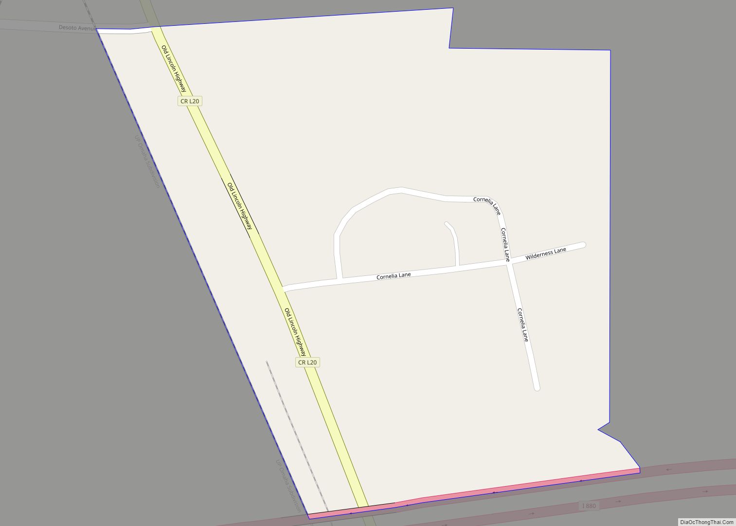
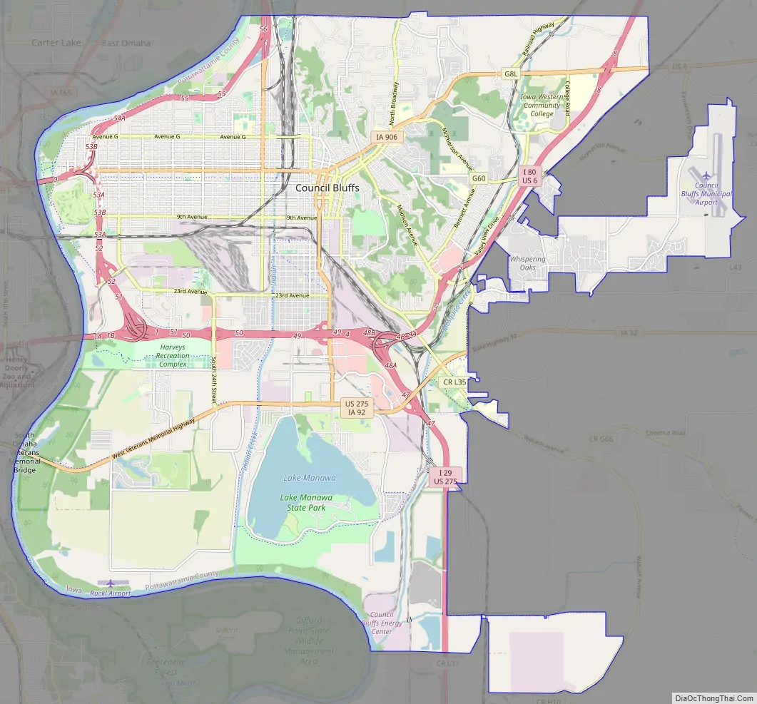
Council Bluffs Road Map
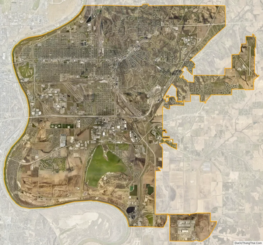
Council Bluffs city Satellite Map
Geography
According to the United States Census Bureau, the city has a total area of 43.62 square miles (112.98 km), of which 40.97 square miles (106.11 km) is land and 2.65 square miles (6.86 km) is water.
Council Bluffs covers a unique topographic region originally composed of prairie and savanna in the Loess Hills with extensive wetlands and deciduous forest along the Missouri River. Excellent vistas can be had from KOIL Point at Fairmont Park, the Lincoln Monument, Kirn Park, and the Lewis and Clark Monument. Lake Manawa State Park is located at the southern edge of the city.
Neighborhoods
Downtown Council Bluffs historically was the area along West Broadway and adjacent streets from Old Town west to the Chicago and North Western Transportation Company Railroad passenger depot at 11th Street. The downtown area developed as the economic rival of Old Town after the 1853 opening of the Pacific House Hotel by Samuel S. Bayliss and until the 1867 completion of the Chicago and Northwestern. In 1899, the Illinois Central passenger depot opened at 12th St. and West Broadway.
Downtown declined as the city’s primary retail center after the 1955 completion of the Broadway Viaduct, 1970s urban renewal, and the 1984 opening of the Kanesville Boulevard U.S. Route 6 bypass. Remaining buildings of note include the 1959 Council Bluffs Post Office and Federal Building at 6th Street, the 1986 “Red” Nelson Building, the 501 Main Building, the substantially altered 1909 City National Bank Building, and the 1968 First Federal Building. The 1947 State Savings Bank Building at 509 West Broadway and the seven-story 1924 Bennett Building at 405 West Broadway are both listed on the National Register of Historic Places. The 100 Block of West Broadway is a historic district listed on the National Register of Historic Places and the 1892 Broadway United Methodist Church at West Broadway and 1st St. remains a prominent community landmark.
Old Town Council Bluffs was adjudged by Judge Frank Street in the 1850s to be the area between West Broadway and Glen Avenue and East Broadway and Frank Street from Harmony Street south to Pierce Street. Today the area encompasses Billy Caldwell’s settlement of Potawatomi on Indian Creek during the 1830s and Kanesville established by the Mormons as Miller’s Hollow in 1848. Kanesville was the home of Mormon leaders Orson Hyde, George A. Smith, and Ezra T. Benson and was a major outfitting point on the Mormon Trail during the California Gold Rush. The reconstructed Kanesville Tabernacle in the 300 block of East Broadway is operated as a museum by the LDS Church.
The West End is a geographically large area on the flood plain east of the Missouri River and downtown Omaha, Nebraska, west of 10th St. and the Broadway Viaduct, and north of 9th Ave. and the Union Pacific Transfer railyards. These neighborhoods of long, tree-shaded avenues are divided by the commercial corridor of West Broadway (U.S. Route 6), once part of the Lincoln Highway. This stretch of West Broadway has traditionally had several drive-in fast food restaurants and automobile dealerships with several grain elevators adjacent along 1st Avenue. West Broadway ends at the Interstate 480 bridge to downtown Omaha. Iowa Highway 192 follows North 16th St. from West Broadway to Interstate 29. Neighborhood landmarks include the 1890s Illinois Central Railroad Missouri River bridge, Stan Bahnsen Park, the Golden Spike monument, the Narrows River Park, Big Lake Park, the site of Dodge Park Playland, the Dodge Christian Church (built with the N.P. Dodge Memorial funds and now known as Citylight West Council Bluffs), and many examples of late 19th and early 20th century residential architecture. The West End was used as a location by film director Alexander Payne in the movies Citizen Ruth and About Schmidt.
Casino Row is located on and near the Missouri River south of West Broadway and Interstate 480, west of South 35th St. and Interstate 29, and north of Interstate 80 along 23rd Avenue west of South 24th St. The opening of the Bluffs Run Greyhound Park in 1986, now the Horseshoe Council Bluffs, was followed in the mid-1990s by riverboat casinos operated by Ameristar and Harvey’s Casino Hotel (now Harrah’s Council Bluffs). New development in this previously industrial area has included the Mid-America Center, several restaurants and hotels, an AMC Theatres with an IMAX, and a Bass Pro Shops. The appearance of legalized gambling in Council Bluffs became a major issue in neighboring Omaha where Mayor Hal Daub had declared Iowa an “XXX state” in 1995 as horse-racing came to an end at Ak-Sar-Ben.
Twin City is located south of where Interstate 29 splits from Interstate 80, east of South Omaha, Nebraska, west of Indian Creek, and north of the South Omaha Bridge Road (U.S. Route 275 and Iowa Highway 92). This neighborhood developed mostly during the 1960s for workers in nearby Omaha factories and at Offutt Air Force Base. The Interstate 80 Exit at 1-B at South 24th Street includes two large truck stops, a Sapp Brothers and a Pilot Travel Centers, along with several motels, the Western Historic Trails Center, the Bluffs Acres manufactured home development, and The Marketplace shopping area with J.C. Penney as its primary tenant. The Willows on the South Omaha Bridge Road is an example of mid-20th century roadside motel architecture and Bart’s Motel further east at South 24th St featured prominent neon signage, was used as a location in the motion picture The Indian Runner, and has since been demolished.
Manawa is the portion of Council Bluffs from the combined Interstate 80 and Interstate 29 south to the city limits between Mosquito and Indian Creeks. The area was developed as a trolley park by the Omaha and Council Bluffs Streetcar Company after the former channel of the Missouri River was “cut-off” during an 1881 flood to become modern Lake Manawa State Park. Later development followed the establishment of U.S. Route 275 and the completion of Interstate 80 with additional growth during the 1990s. A variety of fast food restaurants, motels, big-box stores, a TravelCenters of America truck stop, automobile dealerships, and other businesses are located between Interstate 80 and Interstate 29 south to the state park. The Lake Manawa Inn hosts early examples of roadside cabin architecture. In February and March, bald eagles and red-tailed hawks can frequently be seen at Lake Manawa, particularly along the southwest shore.
The South End is bordered by 12th Avenue on the north, South 16th St. and the Union Pacific Transfer railyards on the west, Interstate 80 and Interstate 29 on the south, and the South Expressway (Iowa Highway 192) on the east. This neighborhood developed during the late 19th century with the railroads, especially the Chicago, Rock Island and Pacific Railroad, the Chicago, Milwaukee and St. Paul Railway, and the Chicago, Burlington and Quincy Railroad. In the early 20th century much of the area was dubbed “Dane Town” or “Little Copenhagen” for the large number of Danish immigrants with several Croatian and Mexican families closer to the Union Pacific railyards at “Little Vienna”. Neighborhood landmarks include Peterson Park, Longfellow School, and the 1899 Chicago, Rock Island and Pacific passenger depot, now the RailsWest Railroad Museum.
Oakland-Fairview developed during the 1890s and features a wealth of 19th-century architecture, including the Judge Finley Burke mansion at 510 Oakland built in 1893 out of Minnesota granite. The neighborhood is also home to the Lincoln Monument. Located at the western end of Lafayette Avenue, the monument was erected in 1911 by the local chapter of the Daughters of the American Revolution that, according to folklore, commemorates the spot where Abraham Lincoln decided on the location of the transcontinental railroad in 1859. The monument offers expansive views across the West End in the Missouri River Valley to Omaha, Nebraska. Nearby is the entrance to Fairview Cemetery, situated on the north side of Lafayette Avenue, which predates the establishment of the present city and includes the Kinsman Monument and the burial place of many early settlers, including Amelia Bloomer. At the east end of Lafayette Avenue where it intersects with North Second Street stands the Ruth Anne Dodge Memorial, the “Black Angel” designed by Daniel Chester French, although the wife of Grenville Dodge is actually buried elsewhere in Council Bluffs.
Madison Avenue is the area of Council Bluffs adjacent to Exit 5 of Interstate 80 along Madison and Bennett avenues, Valley View Drive, and the area between Iowa Highway 92 north to McPherson Avenue. Mosquito Creek flows through this area which was originally notable for the Potawatomi gristmill and now includes the usual roadside gas stations, fast food restaurants, motels, and the tracks of the Iowa Interstate Railroad. Plans for a shopping mall here first appeared in 1972 and construction finally began on the Mall of the Bluffs in 1985. A Sears, Old Navy, and Barnes & Noble later opened at the mall with adjacent commercial development by Hy-Vee and No Frills Supermarkets. Residential growth east of the railroad tracks towards State Orchard Road and the Council Bluffs Municipal Airport and north to U.S. Route 6 has included developments outside the Council Bluffs city limits. Original anchor stores J.C. Penney and Target both relocated from the Mall of the Bluffs in 2008.
Huntington Avenue consists of early 20th century Craftsman homes which wind along the top of the Loess Hills past the 1925 studio of radio station KOIL; the station is now apartments.
The historic “Council Bluffs’ Red-light district” was formed during the late 19th century, when at least 10 separate brothels were located on Pierce Street east of Park Avenue with another three brothels down the block on the south side of West Broadway east of Park. One 1890 newspaper article referenced in Lt. RL Miller’s “Selected History of the Council Bluffs Police” noted the “places of vice and corruption on Pierce” and Stella Long’s above the Ogden House along with the “terrible den at the corner of Market and Vine” and Belle Clover’s bagnio at 8th St. and West Broadway.
Environmental problems
In 2010, the Iowa Department of Natural Resources found that air in central Council Bluffs measured above the national air quality standard for lead, most likely due to lead emissions in this area by Griffin Pipe Products Company. In 2011, EPA found numerous violations of the Clean Water Act, because the plant’s contaminated stormwater commingled with treated process wastewater and was pumped out to the storm sewer, which discharged into the Missouri River.
See also
Map of Iowa State and its subdivision:- Adair
- Adams
- Allamakee
- Appanoose
- Audubon
- Benton
- Black Hawk
- Boone
- Bremer
- Buchanan
- Buena Vista
- Butler
- Calhoun
- Carroll
- Cass
- Cedar
- Cerro Gordo
- Cherokee
- Chickasaw
- Clarke
- Clay
- Clayton
- Clinton
- Crawford
- Dallas
- Davis
- Decatur
- Delaware
- Des Moines
- Dickinson
- Dubuque
- Emmet
- Fayette
- Floyd
- Franklin
- Fremont
- Greene
- Grundy
- Guthrie
- Hamilton
- Hancock
- Hardin
- Harrison
- Henry
- Howard
- Humboldt
- Ida
- Iowa
- Jackson
- Jasper
- Jefferson
- Johnson
- Jones
- Keokuk
- Kossuth
- Lee
- Linn
- Louisa
- Lucas
- Lyon
- Madison
- Mahaska
- Marion
- Marshall
- Mills
- Mitchell
- Monona
- Monroe
- Montgomery
- Muscatine
- O'Brien
- Osceola
- Page
- Palo Alto
- Plymouth
- Pocahontas
- Polk
- Pottawattamie
- Poweshiek
- Ringgold
- Sac
- Scott
- Shelby
- Sioux
- Story
- Tama
- Taylor
- Union
- Van Buren
- Wapello
- Warren
- Washington
- Wayne
- Webster
- Winnebago
- Winneshiek
- Woodbury
- Worth
- Wright
- Alabama
- Alaska
- Arizona
- Arkansas
- California
- Colorado
- Connecticut
- Delaware
- District of Columbia
- Florida
- Georgia
- Hawaii
- Idaho
- Illinois
- Indiana
- Iowa
- Kansas
- Kentucky
- Louisiana
- Maine
- Maryland
- Massachusetts
- Michigan
- Minnesota
- Mississippi
- Missouri
- Montana
- Nebraska
- Nevada
- New Hampshire
- New Jersey
- New Mexico
- New York
- North Carolina
- North Dakota
- Ohio
- Oklahoma
- Oregon
- Pennsylvania
- Rhode Island
- South Carolina
- South Dakota
- Tennessee
- Texas
- Utah
- Vermont
- Virginia
- Washington
- West Virginia
- Wisconsin
- Wyoming