Craven County is located in the U.S. state of North Carolina. As of the 2020 census, the population was 100,720. Its county seat is New Bern. The county was created in 1705 as Archdale Precinct from the now-extinct Bath County. It was renamed Craven Precinct in 1712 and gained county status in 1739. It is named for William, Earl of Craven, who lived from 1606 to 1697. Craven County is part of the New Bern, NC, Metropolitan Statistical Area.
| Name: | Craven County |
|---|---|
| FIPS code: | 37-049 |
| State: | North Carolina |
| Founded: | 1712 |
| Named for: | William, Earl of Craven |
| Seat: | New Bern |
| Largest city: | New Bern |
| Total Area: | 774 sq mi (2,000 km²) |
| Land Area: | 709 sq mi (1,840 km²) |
| Total Population: | 100,674 |
| Population Density: | 142/sq mi (55/km²) |
| Time zone: | UTC−5 (Eastern) |
| Summer Time Zone (DST): | UTC−4 (EDT) |
| Website: | www.cravencounty.com |
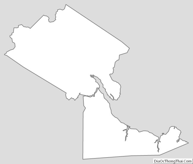
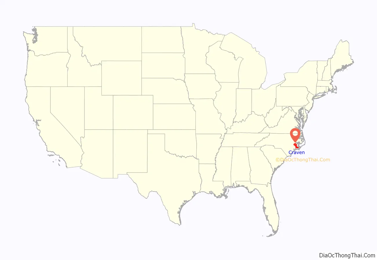
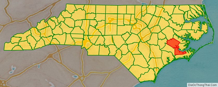
Craven County location map. Where is Craven County?
History
Early history
On August 4, 1661, George Durant purchased land from Cisketando, king of the Yeopim Indian tribe. On March 13, 1662, a second purchase was made from Kilcocanen, another Yeopim. By 1662 Durant was living in Virginia on a tract of land along the Perquimans River which flows into Albemarle Sound, which became part of the Carolina colony in 1665.
Creation
The land eventually constituting Craven was first organized as a portion of Bath County. On December 3, 1705, a portion of Bath was split off to form the new Archdale County. In about 1712 it was renamed Craven County. According to historian William S. Powell, it was most likely named in honor of William, Lord Craven a lord proprietor of the Carolina colony who died the previous year. Others state that the county was named for William’s great uncle, William, Earl of Craven, who was one of the original eight lords proprietor of the colony, or the Lord Craven’s son, also William, Lord Craven, who was actively serving as a lord proprietor at the time the county’s name was changed. In 1722 a portion of Craven was split off to form Carteret County. New Hanover County and Johnston County were formed from Craven in 1729 and 1746, respectively. Craven’s borders were altered and redrawn several times between 1757 and 1852.
During the initial years of colonization, the population of Craven County was sparse and grew slowly. By 1740, however, the town of New Bern began growing rapidly and became the seat for the Governorship. John Carter served as the first sheriff of Craven County, but died in 1740 in the line of duty, when ambushed by an outlaw he was trying to apprehend. In 1746 an act was passed establishing New Bern as the capital of the province and, although the act was later repealed, the General Court met at New Bern in Craven County after 1747.
In 1749 James Davis, the colony’s first printer, arrived at New Bern and became the official printer for the North Carolina Assembly. In 1751, Davis established and began printing the North-Carolina Gazette, North Carolina’s first newspaper. In 1754 he was elected Sheriff of Craven County.
Antebellum period
Craven developed an economy centered around agriculture, timber and turpentine, small manufacturing, and commerce emanating from the port of New Bern. Various fruits and vegetables were among the most popular crops, with cotton production declining in popularity after adverse weather conditions in 1821. Some cattle was also kept in the county. Commercial fishing became more common in the late 1840s, while shipbuilding declined later in the Antebellum period. Slaves served as a key labor force in the local economy, though unlike other eastern counties in the state, which had overwhelmingly rural slave populations, almost 40 percent of Craven’s slaves were kept in New Bern.
The Panic of 1819 heavily impacted the county and triggered a two decade-long period of economic contraction. Railroad service was introduced in the 1850s. The population rose from 13,394 in 1820 to 16,268 by 1860, though poverty remained a problem and many born in the country migrated elsewhere in search of better economic prospects. Despite the difficulties, Craven remained a center of political and social activity in the state and New Bern remained one of the largest cities in North Carolina throughout the antebellum period.
Civil War
Following North Carolina’s secession from the United States and entrance into the American Civil War on the side of the Confederate States of America in 1861, New Bern became a center for Confederate political and military activity. By March 1862, the white men of the county had formed nine permanent companies of troops and three temporary ones. Some of these forces served throughout the entire war’s duration. The Battle of Hatteras Inlet Batteries in August 1861 gave United States forces a foothold in eastern North Carolina and provoked the flight of women and children from New Bern.
Reconstruction
The county’s economy was heavily impacted by the Civil War with the depletion of livestock, damage of property, and the emancipation of slaves. Most food crop production also suffered, though cotton, tobacco, and rice yields increased. Lumber and naval stores industries persisted, though somewhat weakened. The conclusion of the conflict led to regained confidence in economic activity. The shipping industry in New Bern grew and several new businesses, including a bank, were established. Some black freedmen were assigned work by federal troops or enrolled into Freedmen’s Bureau schools. Most of the rest found unskilled work in the local farming, fishing, and turpentine industries. Those that entered skilled labor professions were faced with a rivalry from white contemporaries.
The advent of Congressional Reconstruction in 1867 and 1868 led to profound political changes in Craven County. General Edward Canby, the commander of the Second Military District, replaced New Bern’s municipal government and also chose the county’s sheriff. Following registration efforts, black voters outnumbered whites in the county, and remained a majority of the electorate until the end of the century. Together with local whites who had held Unionist sympathies before the war and recently arrived carpetbaggers, they constituted a strong base for the Republican Party. In the returns for the 1868 elections, Republicans’ margin of victory was the second largest among the counties in the state. A portion of Craven was annexed to the new Pamlico County in 1872.
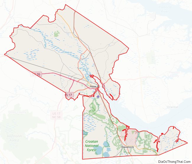
Craven County Road Map
Geography
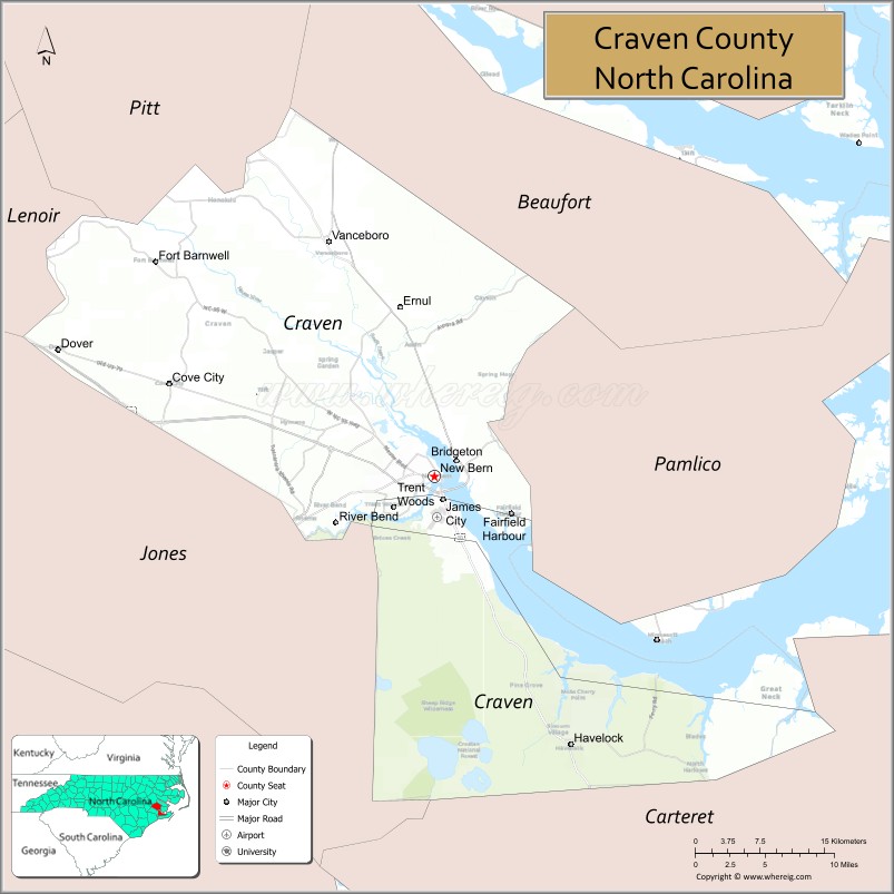
According to the U.S. Census Bureau, the county has a total area of 774 square miles (2,000 km), of which 709 square miles (1,840 km) is land and 65 square miles (170 km) (8.4%) is water. It is bordered by Pitt County, Beaufort County, Pamlico County, Carteret County, Jones County, and Lenoir County.
National protected area
- Catfish Lake South Wilderness (part)
- Croatan National Forest (part)
State and local protected areas/sites
- Croatan Game Land (part)
- Great Lake Recreation Site (part)
- New Bern Battlefield Site
- Pine Cliff Recreation Area
- Latham-Whitehurst Nature Park
- Special Secondary Nursery Areas
- Tryon Palace
Major water bodies
- Adams Creek
- Alligator Gut
- Catfish Lake
- Clubfoot Creek
- Ellis Simon Lake
- Hancock Creek
- Intracoastal Waterway
- Little Lake
- Long Lake
- Neuse River
- Trent River
- Great Lake
- Upper Broad Creek
Major highways
- Future I-42 (Concurrency with US 70)
- US 17
- US 17 Bus. (New Bern)
- US 17 Bus. (Vanceboro)
- US 70
- NC 41
- NC 43
- NC 55
- NC 101
- NC 118
- NC 306
Major infrastructure
- Amtrak Thruway (New Bern and Havelock)
- Cherry Branch – Minnesott Beach Ferry (To Pamlico County)
- Coastal Carolina Regional Airport
- MCAS Cherry Point, military base located in Havelock
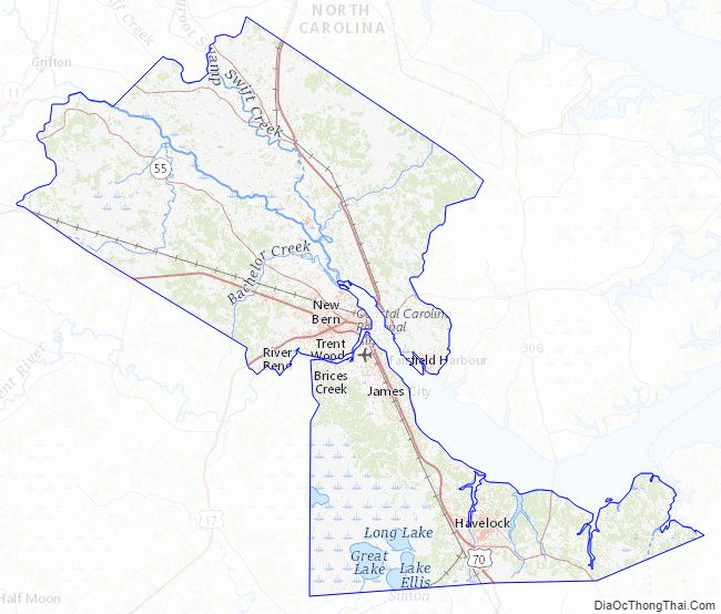
Craven County Topographic Map
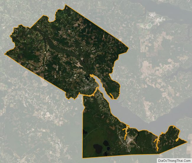
Craven County Satellite Map
Craven County Outline Map