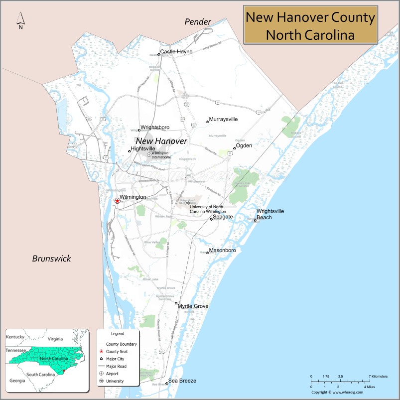
New Hanover County is a county located in the U.S. state of North Carolina. As of the 2020 census, the population was 225,702. Though the second-smallest NC county in land area, it is one of the most populous, as its county seat, Wilmington, is one of the state’s largest cities. The county was created in 1729 as New Hanover Precinct and gained county status in 1739. New Hanover County is included in the Wilmington, NC Metropolitan Statistical Area, which also includes neighboring Pender County.
| Name: | New Hanover County |
|---|---|
| FIPS code: | 37-129 |
| State: | North Carolina |
| Founded: | 1729 |
| Named for: | House of Hanover |
| Seat: | Wilmington |
| Largest city: | Wilmington |
| Total Area: | 328 sq mi (850 km²) |
| Land Area: | 192 sq mi (500 km²) |
| Total Population: | 229,018 |
| Population Density: | 1,192.8/sq mi (460.5/km²) |
| Time zone: | UTC−5 (Eastern) |
| Summer Time Zone (DST): | UTC−4 (EDT) |
| Website: | www.nhcgov.com |
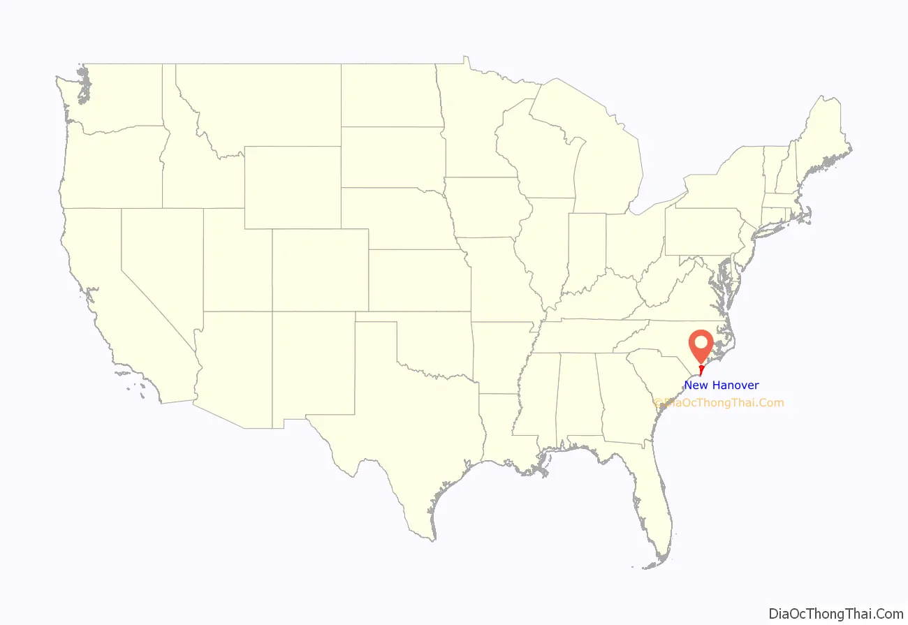
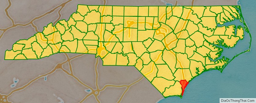
New Hanover County location map. Where is New Hanover County?
History
Located in the Low Country or Tidewater of North Carolina, the county was formed in 1729 as New Hanover Precinct of Bath County, from Craven Precinct. It was named for the House of Hanover, a German royal family then ruling Great Britain.
In 1734 parts of New Hanover Precinct became Bladen Precinct and Onslow Precinct. With the abolition of Bath County in 1739, all of its constituent precincts became counties.
In 1750 the northern part of New Hanover County became Duplin County. In 1764 another part of New Hanover County was combined with part of Bladen County to form Brunswick County. Finally, in 1875 the separation of northern New Hanover County to form Pender County reduced it to its present dimensions. The county was developed as plantations, largely for the cultivation of tobacco and other commodity crops by enslaved African Americans.
By 1860, the county seat and county were majority-black in population, with most of those people enslaved. Some of the closing battles of the American Civil War took place in this county, including the Second Battle of Fort Fisher (the last major coastal stronghold of the Confederacy) and the Battle of Wilmington. White Democrats were resentful when freedmen were given the vote.
Following the Reconstruction era, white Democrats regained control of the state legislature and continued to impose white supremacy across the state through Jim Crow laws. Violence by whites against blacks increased in the late 19th century, with 22 lynching deaths of African Americans recorded before the mid-20th century.
Racial terrorism on a larger scale took place in the Wilmington Insurrection of 1898, when a group of white Democrats rejected a duly elected, biracial city government. After overthrowing the Fusionist government, the mayor and city council, they led mobs that rioted and attacked the city’s black neighborhoods and residents. A total of 60 to 300 blacks are believed to have been killed in the rioting, leaders were driven out of the city, and the presses of a black-owned newspaper were destroyed, along with many houses and businesses.
The insurrection was planned by a group of nine conspirators, who included Hugh MacRae. He later donated land to New Hanover County for a park; it was named in his honor. A plaque was installed there explaining the donation and his life; it does not refer to his role in the 1898 coup d’état.
Soon after, the state passed a new constitution raising barriers to voter registration: this effectively disenfranchised most blacks and imposed Jim Crow laws, forcing blacks out of the political system and into legal second-class status. These civil rights injustices were largely maintained into the 1960s, three generations later.
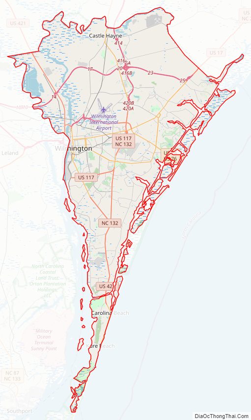
New Hanover County Road Map
Geography
According to the U.S. Census Bureau, the county has a total area of 328 square miles (850 km), of which 192 square miles (500 km) is land and 137 square miles (350 km) (42%) is water. It is the second-smallest county in North Carolina by land area (ahead of only Chowan County).
Islands
- Eagle Island
- Pleasure Island
- Figure Eight Island
- Masonboro Island
- Wrightsville Beach
- Zeke’s Island
Major water bodies
- Atlantic Ocean
- Banks Channel
- Bradley Creek
- Brunswick River
- Cape Fear River
- Frying Pan Shoals
- Futch Creek
- Greenfield Lake
- Howe Creek
- Intracoastal Waterway
- Lake Sutton
- Leutze Lake
- Northeast Cape Fear River
- Onslow Bay
- Smith Creek
- Snow’s Cut
- Whiskey Creek
State and Local protected areas/sites
- Airlie Gardens
- Battleship North Carolina
- Battery Buchanan
- Bellhammon Tract (part)
- Bluethenthal Wildflower Preserve
- Carolina Beach State Park
- Federal Point
- Fort Fisher State Historic Site
- Fort Fisher State Recreation Area
- Masonboro Island Estuarine Reserve Dedicated Nature Preserve
- Masonboro Island Reserve
- Masonboro Sound Area Outstanding Resource Water
- New Hanover County Arboretum
- Pages Creek Park Preserve
- South of Onslow County Mechanical Harvesting of Oysters Prohibited Area (part)
- The Rocks at Fort Fisher
- Topsail Sound and Middle Sound Area Outstanding Resource Water
- Wilmington Historic District
- Zekes Island Estuarine Reserve Dedicated Nature Preserve (part)
- Zeke’s Island Reserve (part)
Adjacent counties
- Pender County – north
- Brunswick County – west
Major highways
- I-40
- I-140 / NC 140
- US 17
- US 17 Byp. (To be the Military Cutoff Extension and the Hampstead Bypass, ending in Pender County)
- US 17 Bus.
- US 74
- US 76
- US 117
- US 421
- US 421 Truck
- NC 132
- NC 133
- NC 211
Major infrastructure
- Amtrak Thruway (Forden Station)
- Cape Fear Public Transportation Authority
- Fort Fisher – Southport Ferry (To Brunswick County)
- Pilots Ridge, small private airport near Myrtle Grove
- Port of Wilmington
- Wilmington International Airport
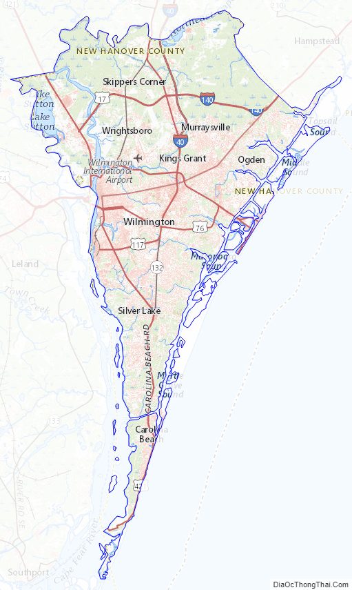
New Hanover County Topographic Map
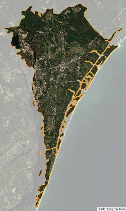
New Hanover County Satellite Map
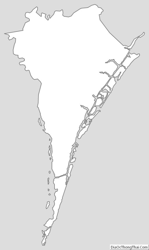
New Hanover County Outline Map