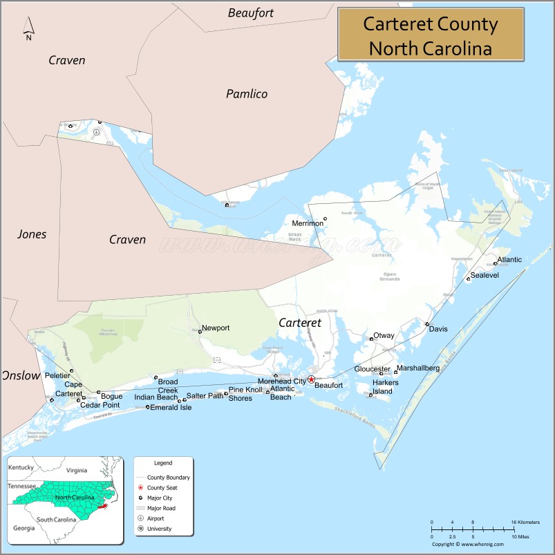
Carteret County is located in the U.S. state of North Carolina. As of the 2020 census, the population was 67,686. Its county seat is Beaufort. The county was created in 1722 as Carteret Precinct and gained county status in 1739. It was named for Sir George Carteret, one of the 17th century English Lords Proprietor, or for his descendant and heir John Carteret, 2nd Earl Granville.
Carteret County comprises the Morehead City, NC Micropolitan Statistical Area, which is also included in the New Bern-Morehead City, NC Combined Statistical Area. Most of the county is part of the Crystal Coast.
| Name: | Carteret County |
|---|---|
| FIPS code: | 37-031 |
| State: | North Carolina |
| Founded: | 1722 |
| Named for: | Sir George Carteret |
| Seat: | Beaufort |
| Largest town: | Morehead City |
| Total Area: | 1,341 sq mi (3,470 km²) |
| Land Area: | 506 sq mi (1,310 km²) |
| Total Population: | 68,541 |
| Population Density: | 135.5/sq mi (52.3/km²) |
| Time zone: | UTC−5 (Eastern) |
| Summer Time Zone (DST): | UTC−4 (EDT) |
| Website: | www.carteretcountync.gov |
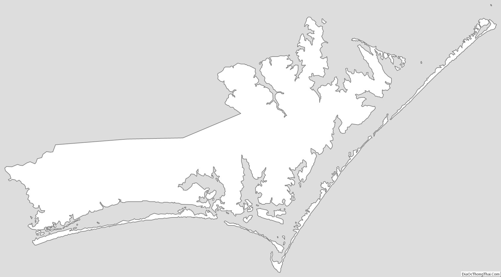
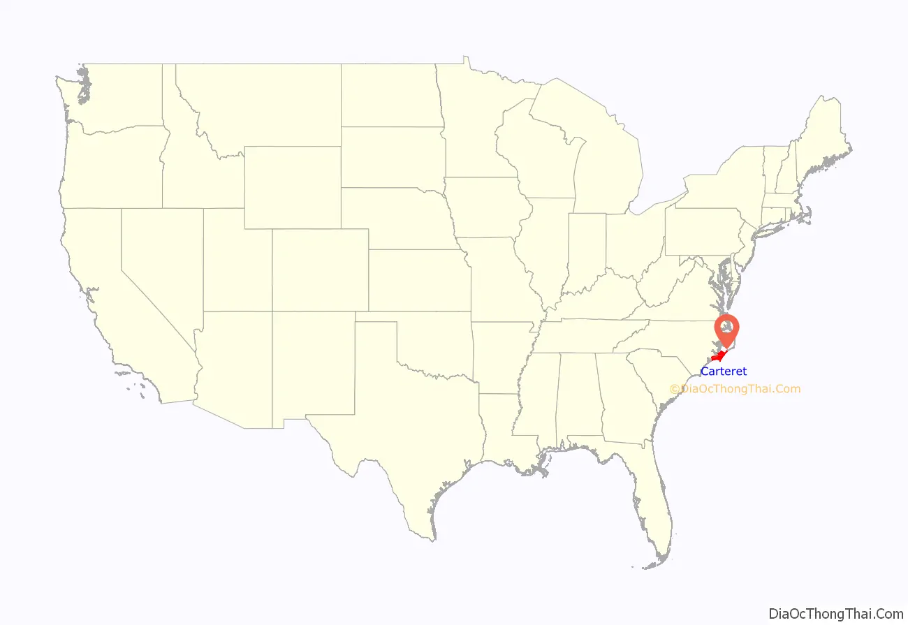
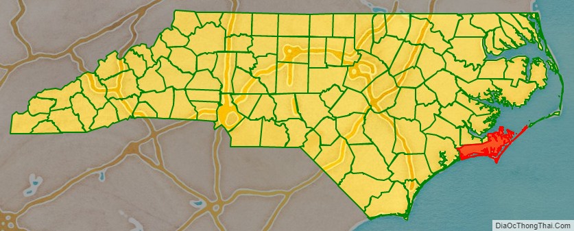
Carteret County location map. Where is Carteret County?
History
The first male of English parents born in the current area of North Carolina was John Fulford. He was born in 1629 in what is now Carteret County. He settled in this area and died in 1729. An article dated Sept. 18, 1893, in The New Bern Daily Journal, identified Fulford’s grave in a cemetery outside the county seat of Beaufort, in an area called the Straits. It was described as “bricked up with English brick.” In 1971 a survey by the Carteret County Historical Society found such a grave in the Fulford Cemetery off Piper Lane in Gloucester. The unmarked, bricked-up grave matching this description survives today.
One of the more prominent families from Carteret County was the Dennis family. William Dennis Sr. (b.1720 – d.1800) was an extremely colorful landowner, Revolutionary War officer, and defender of the county. In 1747, he assisted with the successful defense of the county during the War of Jenkins’ Ear (fighting against Spanish pirates). During the Revolutionary War he served as a 2nd Major in the Carteret County Regiment of the North Carolina militia. In 1782, he fought alongside Lieutenant Colonel John Easton to drive the British from Carteret County. Dennis once owned the Hammock House, which became well known as the house owned by the pirate Blackbeard. His son, William Dennis Junior was a Captain in the 8th North Carolina Regiment (1777-1778), was present at Valley Forge and also fought in the Carteret County Regiment (1781-1782). In the 1790 US Census, Dennis was one of the largest land owners in the county. Branches of the Dennis family include the Bells, Watsons and Pelletiers, many of whom continued to live in the area for many years. In a typical pattern of following the availability of new lands in the Deep South, some branches of this family later migrated to Mississippi and Texas in the 19th century.
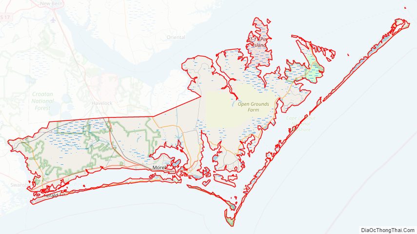
Carteret County Road Map
Geography
According to the U.S. Census Bureau, the county has a total area of 1,341 square miles (3,470 km), of which 506 square miles (1,310 km) is land and 834 square miles (2,160 km) (62%) is water. It is the third-largest county in North Carolina by total area.
National protected areas/sites
- Cape Lookout Lighthouse
- Cape Lookout National Seashore
- Cedar Island National Wildlife Refuge
- Croatan National Forest (part)
State and local protected areas
- Croatan Game Land (part)
- Fort Macon State Park
- Rachel Carson Reserve
- Theodore Roosevelt State Natural Area
Outstanding water sources and protected areas:
- Back Bay Mechanical Harvesting of Oysters Prohibited Area
- Back Sound Mechanical Harvesting of Oysters Prohibited Area
- Back Sound Outstanding Resource Water
- Bardens Inlet Crab Spawning Sanctuary
- Bear Island Area Outstanding Resource Water (part)
- Bogue Sound Mechanical Harvesting of Oysters Prohibited Area
- Bogue Sound Outstanding Resource Water
- Core Sound, Neuse River Basin Outstanding Resource Water
- Core Sound, White Oak River Basin Outstanding Resource Water
- Drum Inlet Crab Spawning Sanctuary
- Neuse-Southeast Pamlico Sound Area Outstanding Resource Water (part)
- Newport River Mechanical Harvesting of Oysters Prohibited Area
- North Bay Mechanical Harvesting of Oysters Prohibited Area
- North River Mechanical Harvesting of Oysters Prohibited Area
- Ocracoke Inlet Crab Spawning Sanctuary (part)
- Rachel Carson Estuarine Reserve Dedicated Nature Preserve
- The Straits Mechanical Harvesting of Oysters Prohibited Area
- White Oak River Mechanical Harvesting of Oysters Prohibited Area (part)
Major water bodies
- Adams Creek
- Atlantic Ocean
- Back Sound
- Barden Inlet
- Barry Bay
- Bogue Sound
- Calico Bay
- Cedar Island Bay
- Core Sound
- Drum Inlet
- Harlowe Creek
- Intracoastal Waterway
- Jarrett Bay
- Long Bay
- Nelson Bay
- Newport River
- Neuse River
- North River
- Ocracoke Inlet
- Onslow Bay
- Pamlico Sound
- Raleigh Bay
- South River
- Thorofare Bay
- Turnagain Bay
- West Bay
- West Thorofare Bay
- White Oak River
Adjacent counties
- Pamlico County – north
- Craven County – north
- Jones County – north
- Onslow County – west
- Hyde County – northeast
Major highways
- Future I-42 (Concurrency with US 70)
- US 70
- NC 12
- NC 24
- NC 58
- NC 101
Major infrastructure
- Amtrak Thruway (Morehead City)
- Cedar Island – Ocracoke Ferry (To Hyde County)
- Michael J. Smith Field
- Local ferries to the uninhabited Cape Lookout National Seashore
- Port of Morehead City
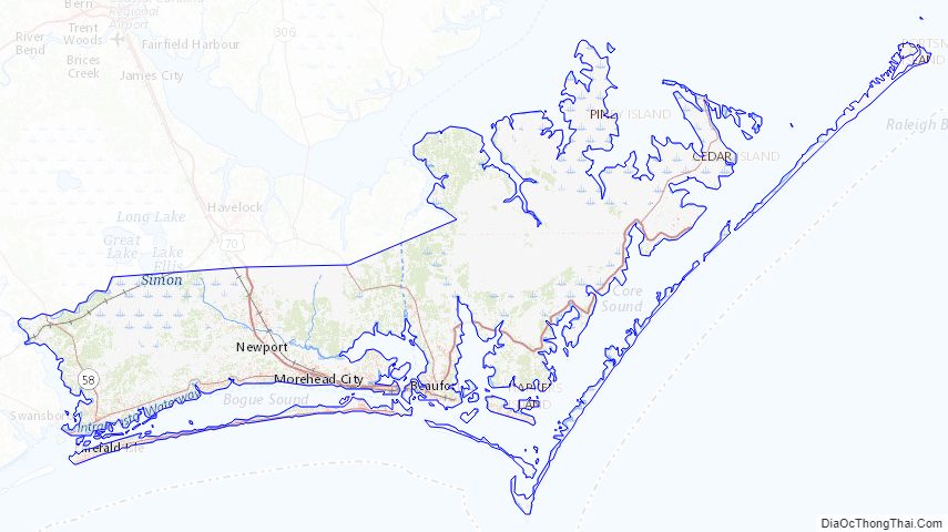
Carteret County Topographic Map
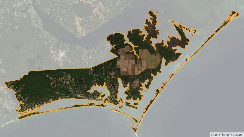
Carteret County Satellite Map
Carteret County Outline Map