Custer County is a county in the U.S. state of South Dakota. As of the 2020 United States Census, the population was 8,318. Its county seat is Custer. The county was created in 1875, and was organized in 1877.
| Name: | Custer County |
|---|---|
| FIPS code: | 46-033 |
| State: | South Dakota |
| Founded: | 1875 |
| Named for: | George Armstrong Custer |
| Seat: | Custer |
| Largest city: | Custer |
| Total Area: | 1,559 sq mi (4,040 km²) |
| Land Area: | 1,557 sq mi (4,030 km²) |
| Total Population: | 8,318 |
| Population Density: | 5.3/sq mi (2.1/km²) |
| Time zone: | UTC−7 (Mountain) |
| Summer Time Zone (DST): | UTC−6 (MDT) |
| Website: | www.custercountysd.com |
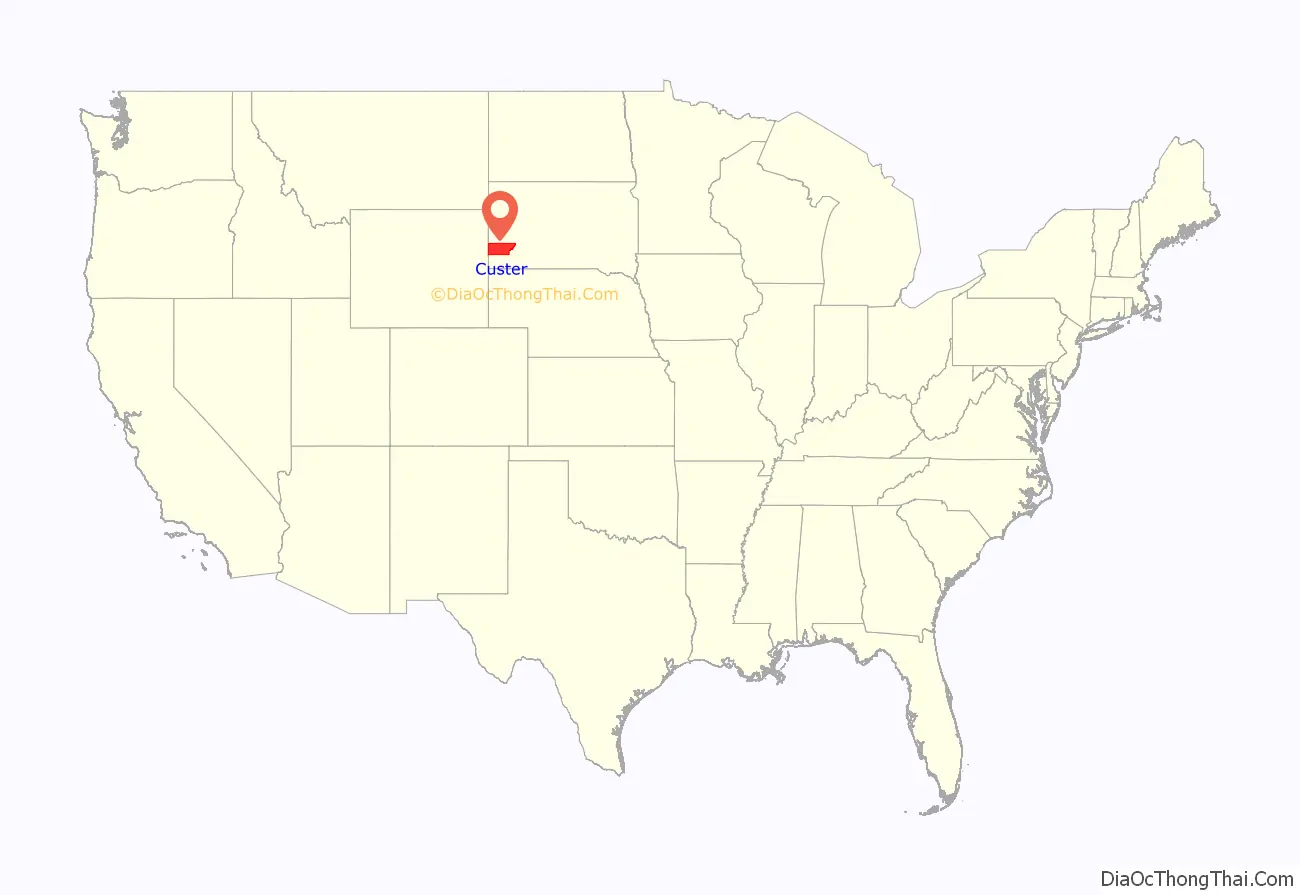
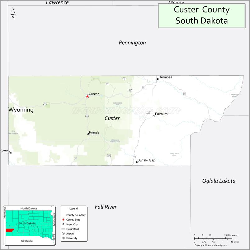
Custer County location map. Where is Custer County?
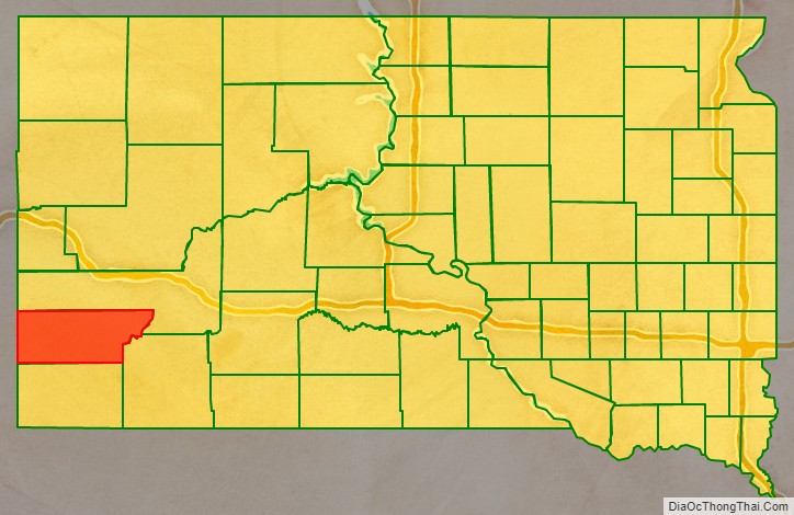
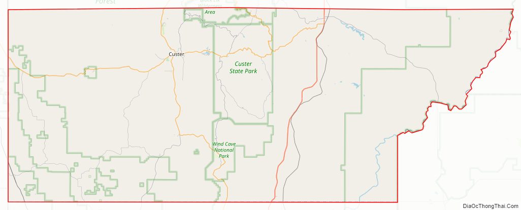
Custer County Road Map
Geography
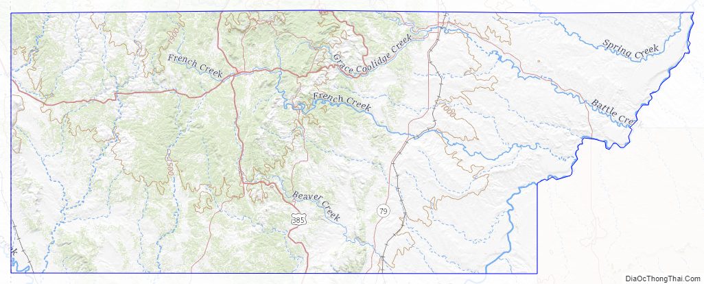
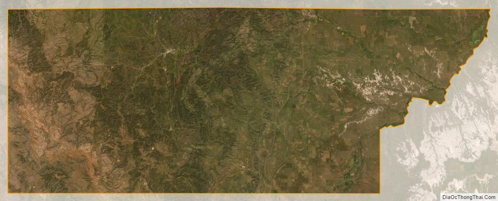
Custer County lies on the west line of South Dakota. Its west boundary line abuts the east boundary line of the state of Wyoming. The Cheyenne River flows northeastward along the upper portion of the county’s east boundary. Battle Creek flows southeastward in the upper eastern part of the county, discharging into Cheyenne River along the county’s northeastern boundary line. Spring Creek flows northeastward through the upper eastern part of the county, discharging into the river just north of the county border. The county terrain is mountainous, especially its western portion. The terrain slopes to the east; its lowest point is its NE corner at 2,461′ (750m) above sea level (ASL). Its highest point is a mountain crest along the north boundary line, at 6,657′ (2029m) ASL.
Custer County has a total area of 1,559 square miles (4,040 km), of which 1,557 square miles (4,030 km) is land and 2.1 square miles (5.4 km) (0.1%) is water.
Major highways
- U.S. Highway 16
- U.S. Highway 385
- U.S. Highway 16A
- South Dakota Highway 36
- South Dakota Highway 40
- South Dakota Highway 79
- South Dakota Highway 87
- South Dakota Highway 89
Adjacent counties
- Pennington County – north
- Oglala Lakota County – southeast
- Fall River County – south
- Niobrara County, Wyoming – southwest
- Weston County, Wyoming – west
Protected areas
- Black Hills National Forest (part)
- Black Elk Wilderness (part)
- Buffalo Gap National Grassland (part)
- Custer State Park
- Jewel Cave National Monument
- Wind Cave National Park
Custer County Topographic Map
Custer County Satellite Map
Custer County Outline Map