Brookings County is a county in the U.S. state of South Dakota. As of the 2020 United States Census, the population was 34,375, making it the fifth-most populous county in South Dakota. Its county seat is Brookings. The county was created in 1862 and organized in 1871.
Brookings County comprises the Brookings, SD Micropolitan Statistical Area.
| Name: | Brookings County |
|---|---|
| FIPS code: | 46-011 |
| State: | South Dakota |
| Founded: | 1862 |
| Named for: | Wilmot Wood Brookings |
| Seat: | Brookings |
| Largest city: | Brookings |
| Total Area: | 805 sq mi (2,080 km²) |
| Land Area: | 792 sq mi (2,050 km²) |
| Total Population: | 34,375 |
| Population Density: | 43/sq mi (16/km²) |
| Time zone: | UTC−6 (Central) |
| Summer Time Zone (DST): | UTC−5 (CDT) |
| Website: | www.brookingscountysd.gov |
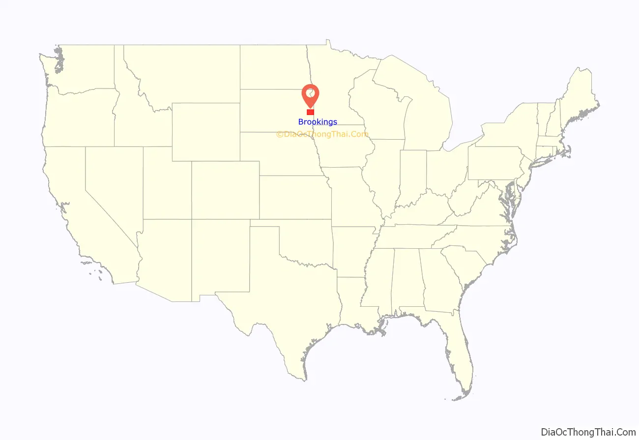
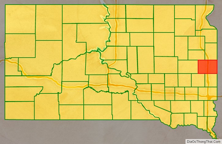
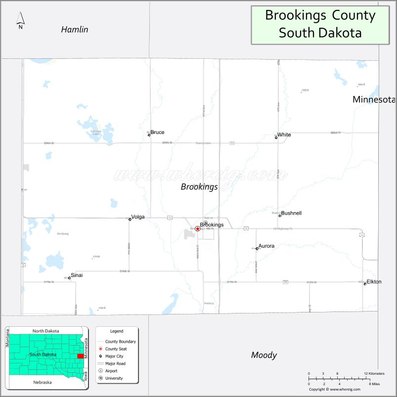
Brookings County location map. Where is Brookings County?
History
The county was founded July 3, 1871, and was named for Wilmot Wood Brookings (1830-1905), a politician and pioneer of southeastern South Dakota. Medary was the first county seat, from 1871 to 1879, when it was moved to the city of Brookings.
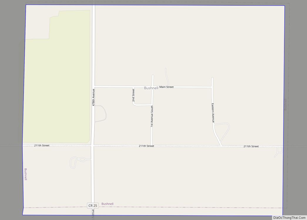
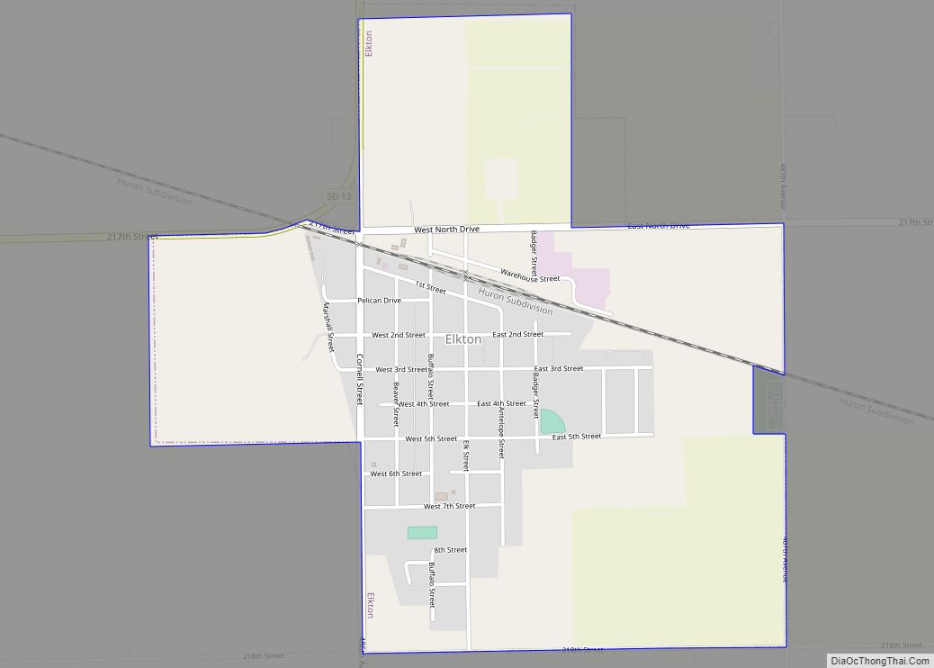
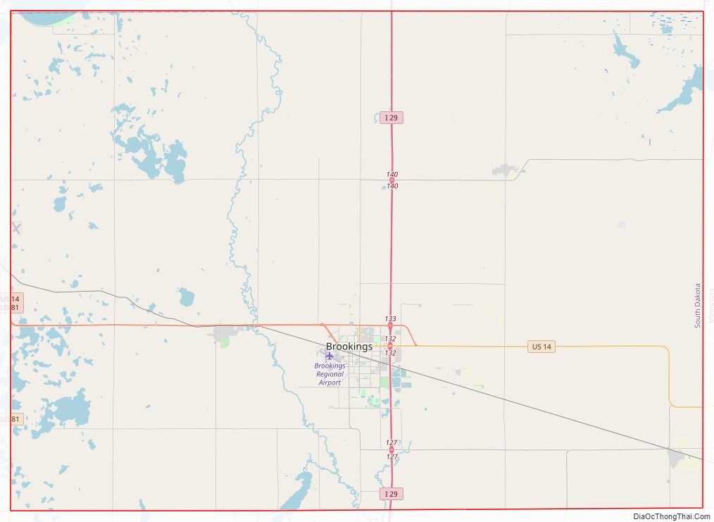
Brookings County Road Map
Geography
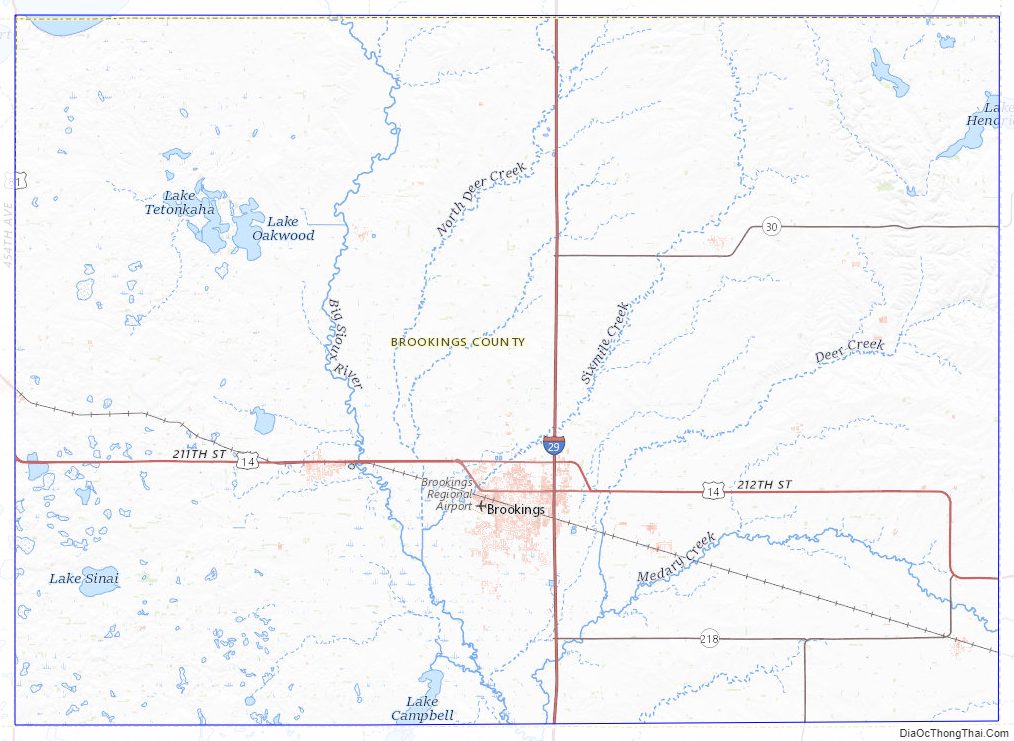
Brookings County is on the east side of South Dakota. Its east boundary line abuts the west boundary line of the state of Minnesota. The Big Sioux River flows south-southeastward through the east central part of the county; its point of entry into Moody County marks Brookings County’s lowest elevation: 1,568′ (478m) ASL.
The county terrain consists of sloped flatlands, marked by numerous lakes and ponds especially in the western part. The area is largely devoted to agricultural use. The county has a total area of 805 square miles (2,080 km), of which 782 square miles (2,030 km) is land and 13 square miles (34 km) (1.6%) is water.
Major highways
- Interstate 29
- U.S. Highway 14
- U.S. Highway 14 Bypass
- U.S. Highway 81
- South Dakota Highway 13
- South Dakota Highway 30
- South Dakota Highway 324
Airports
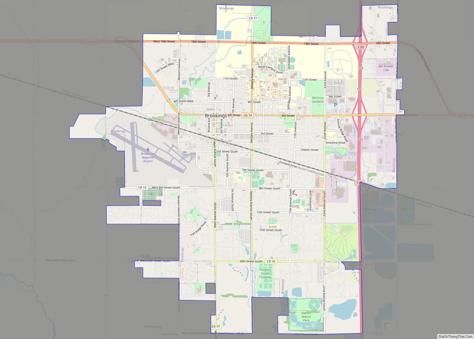
- Brookings Regional Airport
- Arlington Municipal Airport
Adjacent counties
- Deuel County – north
- Lincoln County, Minnesota – east
- Pipestone County, Minnesota – southeast
- Moody County – south
- Lake County – southwest
- Kingsbury County – west
- Hamlin County – northwest
Lakes
- Brush Lake
- Johnson Lake
- Lake Campbell
- Lake Goldsmith
- Lake Hendricks (partial)
- Lake Poinsett
- Lake Sinai
- Lake Tetonkaha
- Oak Lake
- Oakwood Lake
Protected areas
- Aurora Prairie Nature Preserve
- Black Slough State Game Production Area
- Brookings County State Game Production Area
- Brookings Prairie Park
- Dakota Nature Park
- Deer Creek State Game Production Area
- Kvernmoe Slough State Game Production Area
- Lake Hendricks State Lakeside Use Area
- Lake Poinsett State Recreation Area
- Mehegan State Game Production Area
- Moe Slough State game Production Area
- Nelson State Game Production Area
- Oak Lake State Game Production Area
- Oakwood Lake State Game Production Area
- Oakwood Lakes State Park
Brookings County Topographic Map
Brookings County Satellite Map
Brookings County Outline Map