Wyoming (/waɪˈoʊmɪŋ/ (listen)) is a state in the Mountain West subregion of the Western United States. It is bordered by Montana to the north and northwest, South Dakota and Nebraska to the east, Idaho to the west, Utah to the southwest, and Colorado to the south. With a population of 576,851 in the 2020 United States census, Wyoming is the least populous state despite being the 10th largest by area, with the second-lowest population density after Alaska. The state capital and most populous city is Cheyenne, which had an estimated population of 63,957 in 2018.
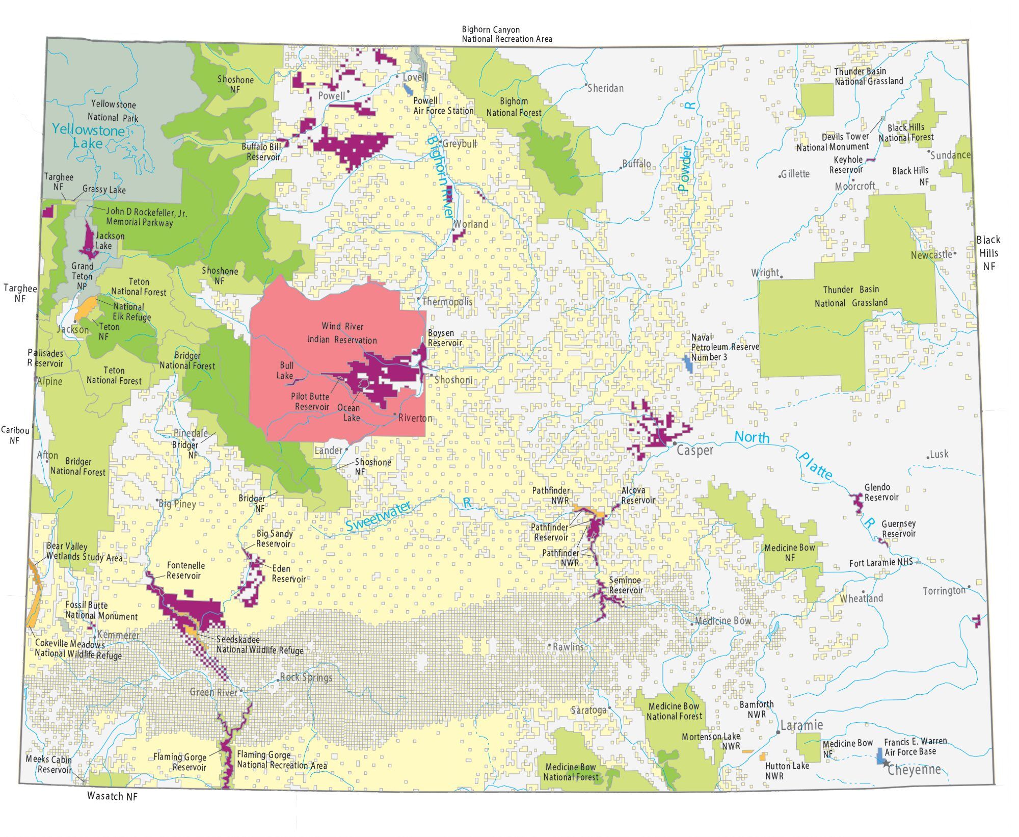
Wyoming’s western half is covered mostly by the ranges and rangelands of the Rocky Mountains, while the eastern half of the state is high-elevation prairie called the High Plains. It is drier and windier than the rest of the country, being split between semi-arid and continental climates with greater temperature extremes. Almost half of the land in Wyoming is owned by the federal government, generally protected for public uses. The state ranks 6th by area and fifth by proportion of a state’s land owned by the federal government. Federal lands include two national parks (Grand Teton and Yellowstone), two national recreation areas, two national monuments, several national forests, historic sites, fish hatcheries, and wildlife refuges.
Indigenous peoples inhabited the region for thousands of years. Historic and current federally recognized tribes include the Arapaho, Crow, Lakota, and Shoshone. During European exploration, the Spanish Empire was the first to “claim” southern Wyoming. With Mexican independence, it became part of that republic. After defeat in the Mexican–American War, Mexico ceded this territory to the U.S. in 1848.
The region was named “Wyoming” in a bill introduced to Congress in 1865 to provide a temporary government for the territory of Wyoming. It had been used earlier by colonists for the Wyoming Valley in Pennsylvania, and is derived from the Lenape language Munsee word xwé:wamənk, meaning “at the big river flat”.
Bills for Wyoming Territory’s admission to the union were introduced in both the U.S. Senate and U.S. House of Representatives in December 1889. On March 27, 1890, the House passed the bill and President Benjamin Harrison signed Wyoming’s statehood bill; Wyoming became the 44th state in the union.
Historically, European Americans farmed and ranched here, with shepherds and cattle ranchers in conflict over lands. Today Wyoming’s economy is largely based on tourism and the extraction of minerals such as coal, natural gas, oil, and trona. Agricultural commodities include barley, hay, livestock, sugar beets, wheat, and wool. It was the first state (barring New Jersey before 1807) to allow women the right to vote and the right to assume elected office, as well as the first state to elect a female governor. Due to this part of its history, its main nickname is “The Equality State” and its official state motto is “Equal Rights”. It has been a politically conservative state since the 1950s. The Republican presidential nominee has carried the state in every election since 1968.
| Before statehood: | Wyoming Territory |
|---|---|
| Admitted to the Union: | July 10, 1890 (44th) |
| Capital: | Cheyenne |
| Capital – largest city: | largest city |
| Largest metro and urban areas: | Cheyenne |
| Elevation: | 6,700 ft (2,040 m) |
| Total Area: | 97,914 sq mi (253,600 km) |
| Area Rank: | 10th |
| Total Population: | 576,851 |
| Population Rank: | 50th |
| Population Density: | 5.97/sq mi (2.31/km) |
| Population Density Rank: | 49th |
| Median Household Income: | $62,268 |
| Income Rank: | 19th |
| Demonym(s): | Wyomingite, Wyomingian |
| USPS abbreviation: | WY |
| ISO 3166 code: | US-WY |
| Website: | wyo.gov |
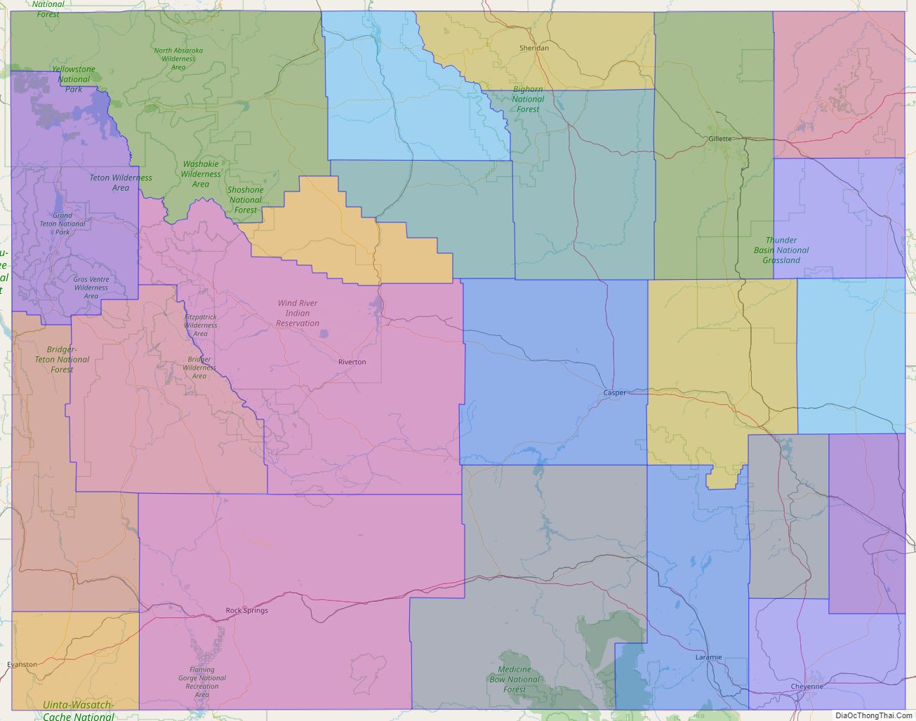
Online Interactive Map
Click on ![]() to view map in "full screen" mode.
to view map in "full screen" mode.
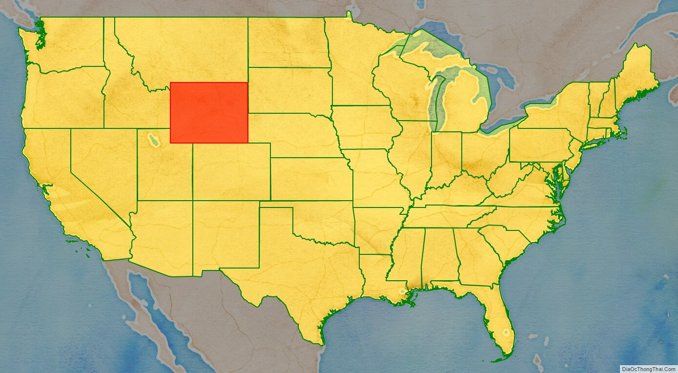
Wyoming location map. Where is Wyoming state?
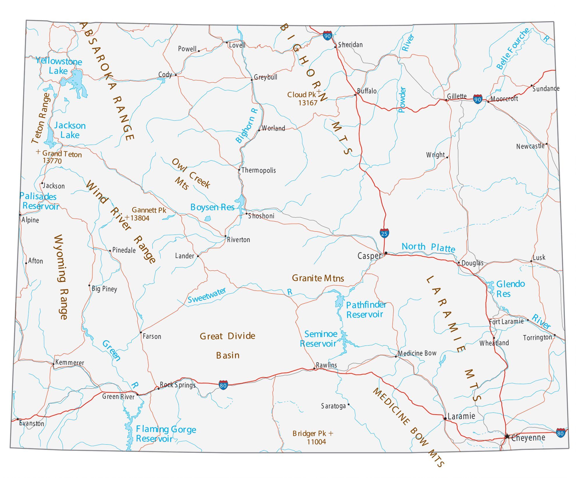
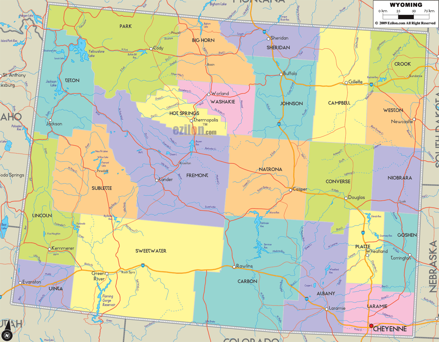
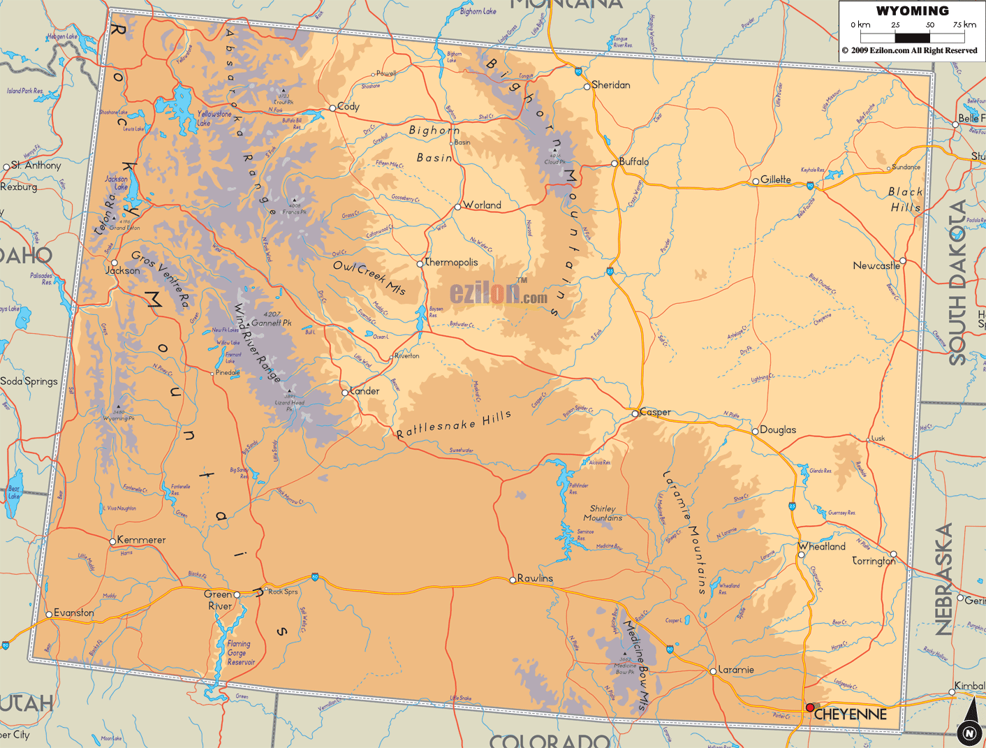
Wyoming Road Map
Wyoming Map – Roads & Cities
Wyoming Street Map
History
Several Native American groups originally inhabited the region today known as Wyoming. The Crow, Arapaho, Lakota, and Shoshone were but a few of the original inhabitants European explorers encountered when they first visited the region. What is now southwestern Wyoming was claimed by the Spanish Empire, which extended through the Southwest and Mexico. With Mexican independence in 1821, it was considered part of Alta California. U.S. expansion brought settlers who fought for control. Mexico ceded these territories after its defeat in 1848 in the Mexican–American War.
From the late 18th century, French-Canadian trappers from Québec and Montréal regularly entered the area for trade with the tribes. French toponyms such as Téton and La Ramie are marks of that history.
American John Colter first recorded a description in English of the region in 1807. He was a member of the Lewis and Clark Expedition, which was guided by French Canadian Toussaint Charbonneau and his young Shoshone wife, Sacagawea. At the time, Colter’s reports of the Yellowstone area were considered fictional. On a return from Astoria, Robert Stuart and a party of five men discovered South Pass in 1812.
The Oregon Trail later followed that route as emigrants moved to the west coast. In 1850, mountain man Jim Bridger found what is now known as Bridger Pass. Bridger also explored Yellowstone, and filed reports on the region that, like Colter’s, were largely regarded at the time as tall tales. The Union Pacific Railroad constructed track through Bridger Pass in 1868. It was used as the route for construction of Interstate 80 through the mountains 90 years later.
The region acquired the name Wyoming by 1865, when Representative James Mitchell Ashley of Ohio introduced a bill to Congress to provide a “temporary government for the territory of Wyoming”. The territory was named after the Wyoming Valley in Pennsylvania. Thomas Campbell wrote his 1809 poem “Gertrude of Wyoming”, inspired by the Battle of Wyoming in the American Revolutionary War. The name ultimately derives from the Lenape Munsee word xwé:wamənk (“at the big river flat”).
After the Union Pacific Railroad reached Cheyenne in 1867, population growth was stimulated. The federal government established the Wyoming Territory on July 25, 1868. Lacking significant deposits of gold and silver, unlike mineral-rich Colorado, Wyoming did not have such a population boom. But South Pass City had a short-lived boom after the Carissa Mine began producing gold in 1867. Copper was mined in some areas between the Sierra Madre Mountains and the Snowy Range near Grand Encampment.
Once government-sponsored expeditions to the Yellowstone country began, Colter’s and Bridger’s descriptions of the region’s landscape were confirmed. In 1872, Yellowstone National Park was created as the world’s first, to protect this area. Nearly all of the park lies within the northwestern corner of Wyoming.
On December 10, 1869, territorial Governor John Allen Campbell extended the right to vote to women, making Wyoming the first territory to do so. It kept that franchise when it established its state constitution. Women first served on juries in Wyoming (Laramie in 1870).
Wyoming was also a pioneer in welcoming women into electoral politics. It had the first female court bailiff (Mary Atkinson, Laramie, in 1870), and the first female justice of the peace in the country (Esther Hobart Morris, South Pass City, in 1870). In 1924, Wyoming was the first state to elect a female governor, Nellie Tayloe Ross, who took office in January 1925. Due to its civil-rights history, one of Wyoming’s state nicknames is “The Equality State”, and the official state motto is “Equal Rights”.
Wyoming’s constitution included women’s suffrage and a pioneering article on water rights. Congress admitted Wyoming into the Union as the 44th state on July 10, 1890.
Wyoming was the location of the Johnson County War of 1892, which erupted between competing groups of cattle ranchers. The passage of the Homestead Act led to an influx of small ranchers. A range war broke out when either or both of the groups chose violent conflict over commercial competition in the use of the public land.
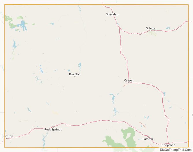
Wyoming State Map – Places and Landmarks
Wyoming Political Map
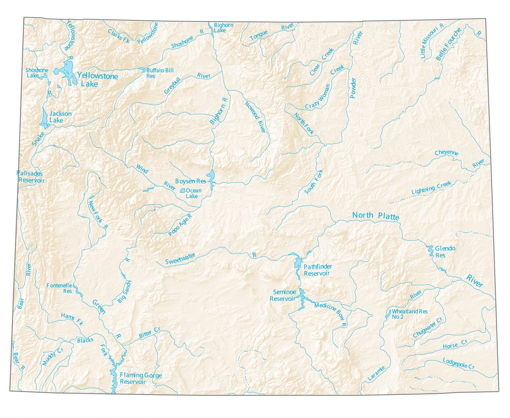
Wyoming Lakes and Rivers Map
Geography
Climate
Wyoming’s climate is generally semi-arid and continental (Köppen climate classification BSk) and is drier and windier in comparison to most of the United States with greater temperature extremes. Much of this is due to the topography of the state. Summers in Wyoming are warm with July high temperatures averaging between 80 and 90 °F (27 and 32 °C) in most of the state. With increasing elevation, however, this average drops rapidly with locations above 9,000 feet (2,700 m) averaging around 70 °F (21 °C). Summer nights throughout the state are characterized by a rapid cooldown with even the hottest locations averaging in the 50–60 °F (10–16 °C) range at night. In most of the state, most of the precipitation tends to fall in the late spring and early summer. Winters are cold, but are variable with periods of sometimes extreme cold interspersed between generally mild periods, with Chinook winds providing unusually warm temperatures in some locations.
Wyoming is a dry state with much of the land receiving less than 10 inches (250 mm) of rainfall per year. Precipitation depends on elevation with lower areas in the Big Horn Basin averaging 5–8 inches (130–200 mm), making the area nearly a true desert. The lower areas in the North and on the eastern plains typically average around 10–12 inches (250–300 mm), making the climate there semi-arid. Some mountain areas do receive a good amount of precipitation, 20 inches (510 mm) or more, much of it as snow, sometimes 200 inches (510 cm) or more annually. The state’s highest recorded temperature is 114 °F (46 °C) at Basin on July 12, 1900, and the lowest recorded temperature is −66 °F (−54 °C) at Riverside on February 9, 1933.
The number of thunderstorm days varies across the state with the southeastern plains of the state having the most days of thunderstorm activity. Thunderstorm activity in the state is highest during the late spring and early summer. The southeastern corner of the state is the most vulnerable part of the state to tornado activity. Moving away from that point and westwards, the incidence of tornadoes drops dramatically with the west part of the state showing little vulnerability. Tornadoes, where they occur, tend to be small and brief, unlike some of those that occur farther east.
Location and size
As specified in the designating legislation for the Territory of Wyoming, Wyoming’s borders are lines of latitude 41°N and 45°N, and longitude 104°3’W and 111°3’W (27 and 34 west of the Washington Meridian)—a geodesic quadrangle. Wyoming is one of only three states (the others being Colorado and Utah) to have borders defined by only “straight” lines. Due to surveying inaccuracies during the 19th century, Wyoming’s legal border deviates from the true latitude and longitude lines by up to one-half mile (0.80 km) in some spots, especially in the mountainous region along the 45th parallel. Wyoming is bordered on the north by Montana, on the east by South Dakota and Nebraska, on the south by Colorado, on the southwest by Utah, and on the west by Idaho. It is the tenth largest state in the United States in total area, containing 97,814 square miles (253,340 km) and is made up of 23 counties. From the north border to the south border it is 276 miles (444 km); and from the east to the west border is 365 miles (587 km) at its south end and 342 miles (550 km) at the north end.
Natural landforms
The Great Plains meet the Rocky Mountains in Wyoming. The state is a great plateau broken by many mountain ranges. Surface elevations range from the summit of Gannett Peak in the Wind River Mountain Range, at 13,804 feet (4,207 m), to the Belle Fourche River valley in the state’s northeast corner, at 3,125 feet (952 m). In the northwest are the Absaroka, Owl Creek, Gros Ventre, Wind River, and the Teton ranges. In the north central are the Big Horn Mountains; in the northeast, the Black Hills; and in the southern region the Laramie, Snowy, and Sierra Madre ranges.
The Snowy Range in the south central part of the state is an extension of the Colorado Rockies both in geology and in appearance. The Wind River Range in the west central part of the state is remote and includes more than 40 mountain peaks in excess of 13,000 ft (4,000 m) tall in addition to Gannett Peak, the highest peak in the state. The Bighorn Mountains in the north central portion are somewhat isolated from the bulk of the Rocky Mountains.
The Teton Range in the northwest extends for 50 miles (80 km), part of which is included in Grand Teton National Park. The park includes the Grand Teton, the second-highest peak in the state.
The Continental Divide spans north–south across the central portion of the state. Rivers east of the divide drain into the Missouri River Basin and eventually the Gulf of Mexico. They are the North Platte, Wind, Bighorn, and Yellowstone rivers. The Snake River in northwest Wyoming eventually drains into the Columbia River and the Pacific Ocean, as does the Green River through the Colorado River Basin.
The Continental Divide forks in the south central part of the state in an area known as the Great Divide Basin where water that precipitates onto or flows into it cannot reach an ocean—it all sinks into the soil and eventually evaporates.
Several rivers begin in or flow through the state, including the Yellowstone River, Bighorn River, Green River, and the Snake River.
Much of Wyoming is covered with large basins containing different eco-regions, from shrublands to smaller patches of desert. Regions of the state classified as basins contain everything from large geologic formations to sand dunes and vast unpopulated spaces. Basin landscapes are typically at lower elevations and include rolling hills, valleys, mesas, terraces and other rugged terrain, but also include natural springs as well as rivers and artificial reservoirs. They have common plant species such as various subspecies of sagebrush, juniper and grasses such as wheatgrass, but basins are known for their diversity of plant and animal species.
Wyoming has 32 named islands; the majority are in Jackson Lake and Yellowstone Lake, within Yellowstone National Park in the northwest portion of the state. The Green River in the southwest also contains a number of islands.
Regions and administrative divisions
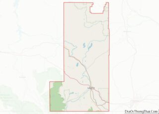
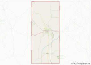
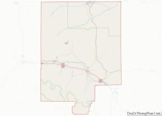
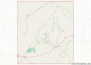
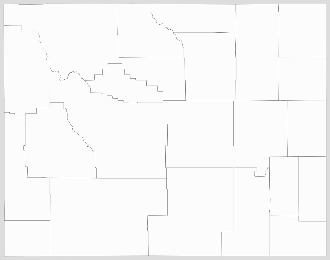
The state of Wyoming has 23 counties.
Wyoming license plates have a number on the left that indicates the county where the vehicle is registered, ranked by an earlier census. Specifically, the numbers are representative of the property values of the counties in 1930. The county license plate numbers are:
The State of Wyoming has 99 incorporated municipalities.
In 2005, 50.6% of Wyomingites lived in one of the 13 most populous Wyoming municipalities.
The United States Census Bureau has defined two metropolitan statistical areas (MSA) and seven micropolitan statistical areas (MiSA) for the state. In 2008, 30.4% of Wyomingites lived in either of the metropolitan statistical areas, and 73% lived in either a metropolitan or a micropolitan area.
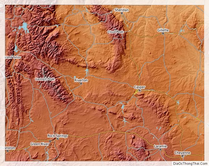
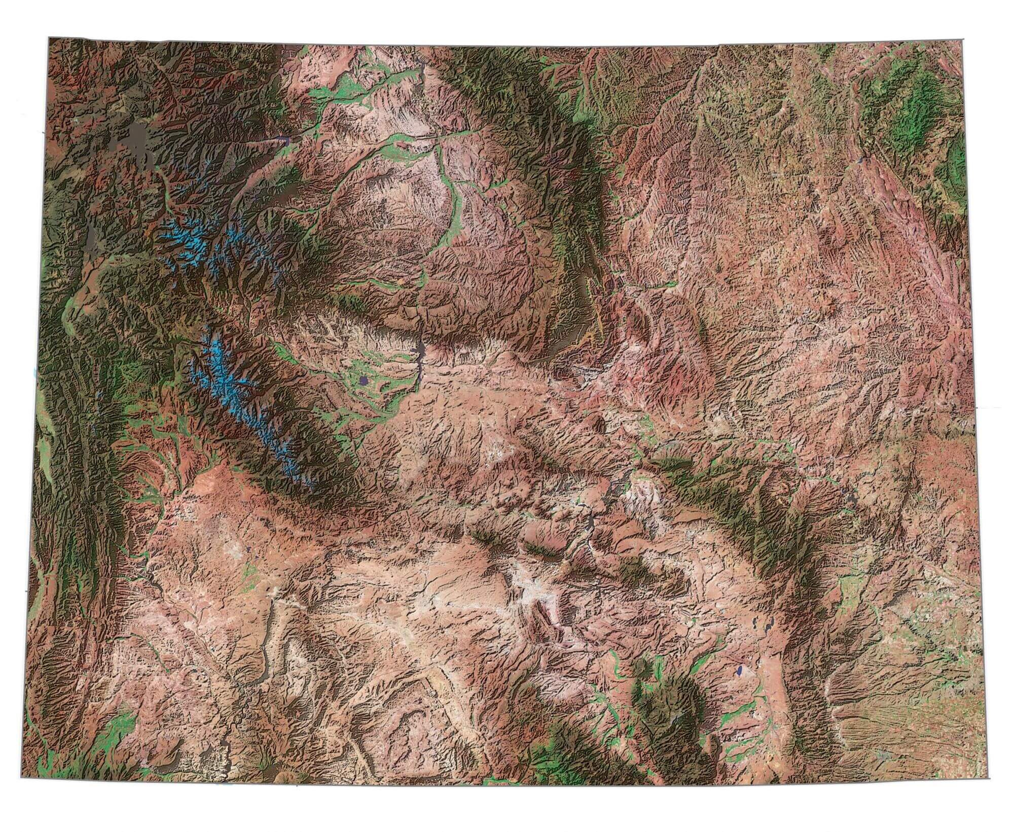
Wyoming Physical Map
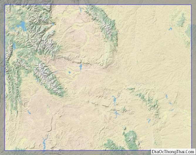
Wyoming Topographic Map
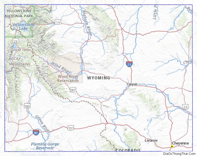
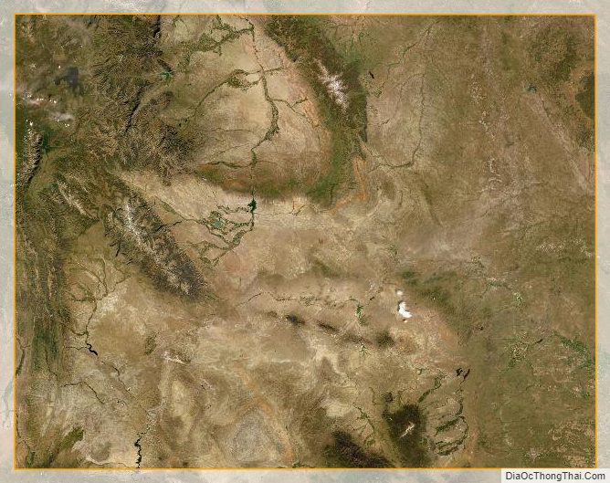
Wyoming Satellite Map
Others printable maps
Wyoming Outline Map

Blank Wyoming County Map
See also
Map of Wyoming State and its subdivision: Map of other states:- Alabama
- Alaska
- Arizona
- Arkansas
- California
- Colorado
- Connecticut
- Delaware
- District of Columbia
- Florida
- Georgia
- Hawaii
- Idaho
- Illinois
- Indiana
- Iowa
- Kansas
- Kentucky
- Louisiana
- Maine
- Maryland
- Massachusetts
- Michigan
- Minnesota
- Mississippi
- Missouri
- Montana
- Nebraska
- Nevada
- New Hampshire
- New Jersey
- New Mexico
- New York
- North Carolina
- North Dakota
- Ohio
- Oklahoma
- Oregon
- Pennsylvania
- Rhode Island
- South Carolina
- South Dakota
- Tennessee
- Texas
- Utah
- Vermont
- Virginia
- Washington
- West Virginia
- Wisconsin
- Wyoming