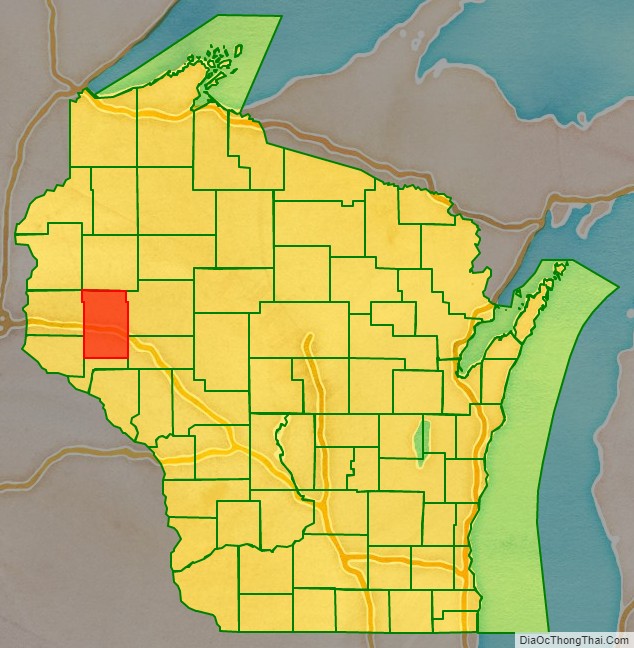
Dunn County is a county in the U.S. state of Wisconsin. As of the 2020 census, the population was 45,440. Its county seat is Menomonie. Dunn County comprises the Menomonie Micropolitan Statistical Area and is included in the Eau Claire-Menomonie, WI Combined Statistical Area.
| Name: | Dunn County |
|---|---|
| FIPS code: | 55-033 |
| State: | Wisconsin |
| Founded: | 1857 |
| Named for: | Charles Dunn |
| Seat: | Menomonie |
| Largest city: | Menomonie |
| Total Area: | 864 sq mi (2,240 km²) |
| Land Area: | 850 sq mi (2,200 km²) |
| Total Population: | 45,440 |
| Population Density: | 53.4/sq mi (20.6/km²) |
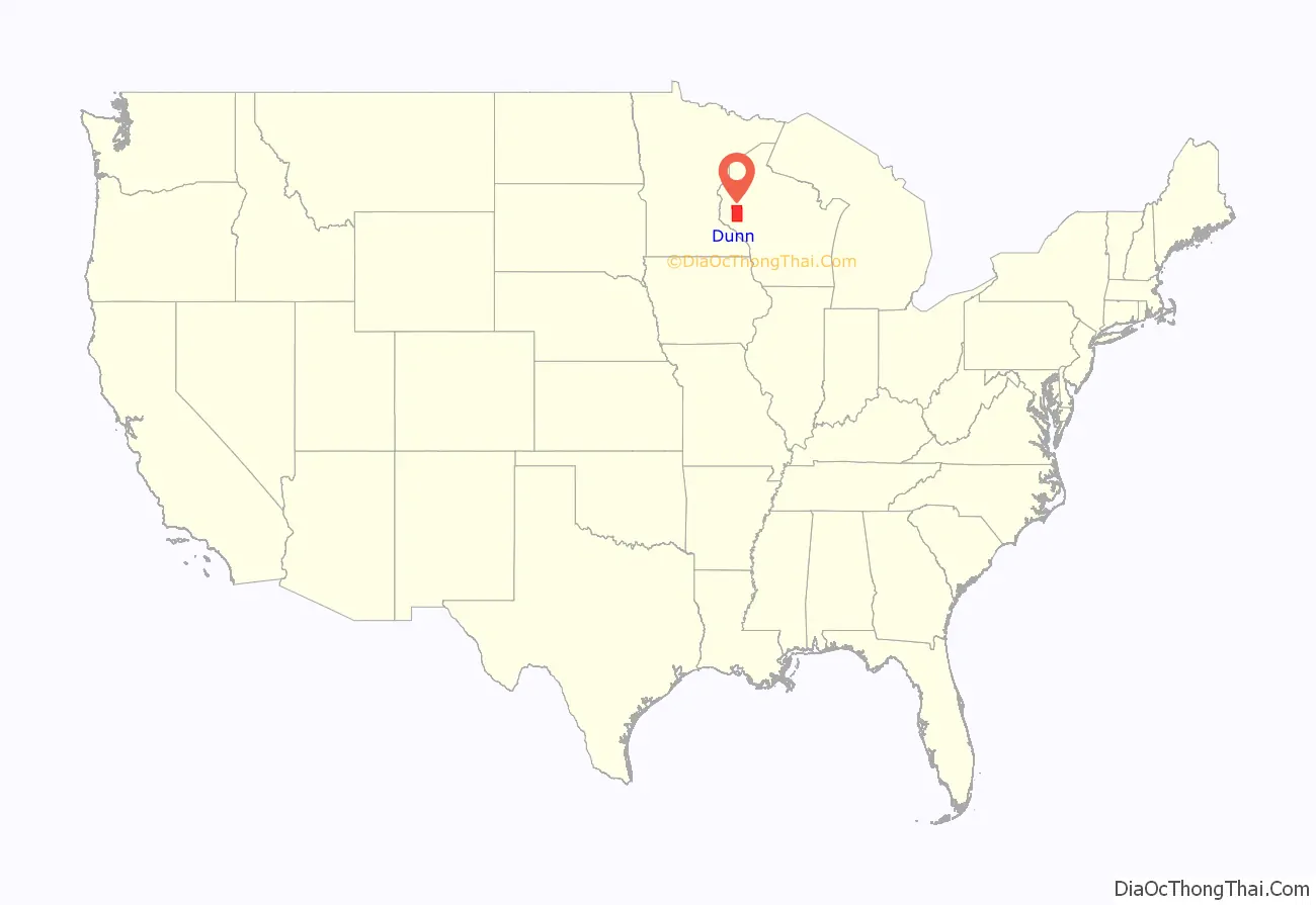
Dunn County location map. Where is Dunn County?
History
Dunn county was founded in 1854 from Chippewa County and organized in 1857. It is named for Charles Dunn, the territory’s first chief justice.
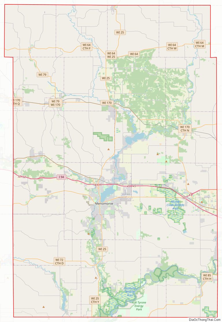
Dunn County Road Map
Geography
According to the U.S. Census Bureau, the county has a total area of 864 square miles (2,240 km), of which 850 square miles (2,200 km) is land and 14 square miles (36 km) (1.6%) is water.
Adjacent counties
- Barron County – north
- Chippewa County – east
- Eau Claire County – southeast
- Pepin County – south
- Pierce County – southwest
- Polk County – northwest
- Saint Croix County – west
Major highways
Railroads
- Canadian National
- Union Pacific
Buses
- Dunn County Transit
- List of intercity bus stops in Wisconsin
Airports
- Menomonie Municipal Airport (KLUM) serves the county and surrounding communities.
- Boyceville Municipal Airport (3T3) enhances county service.
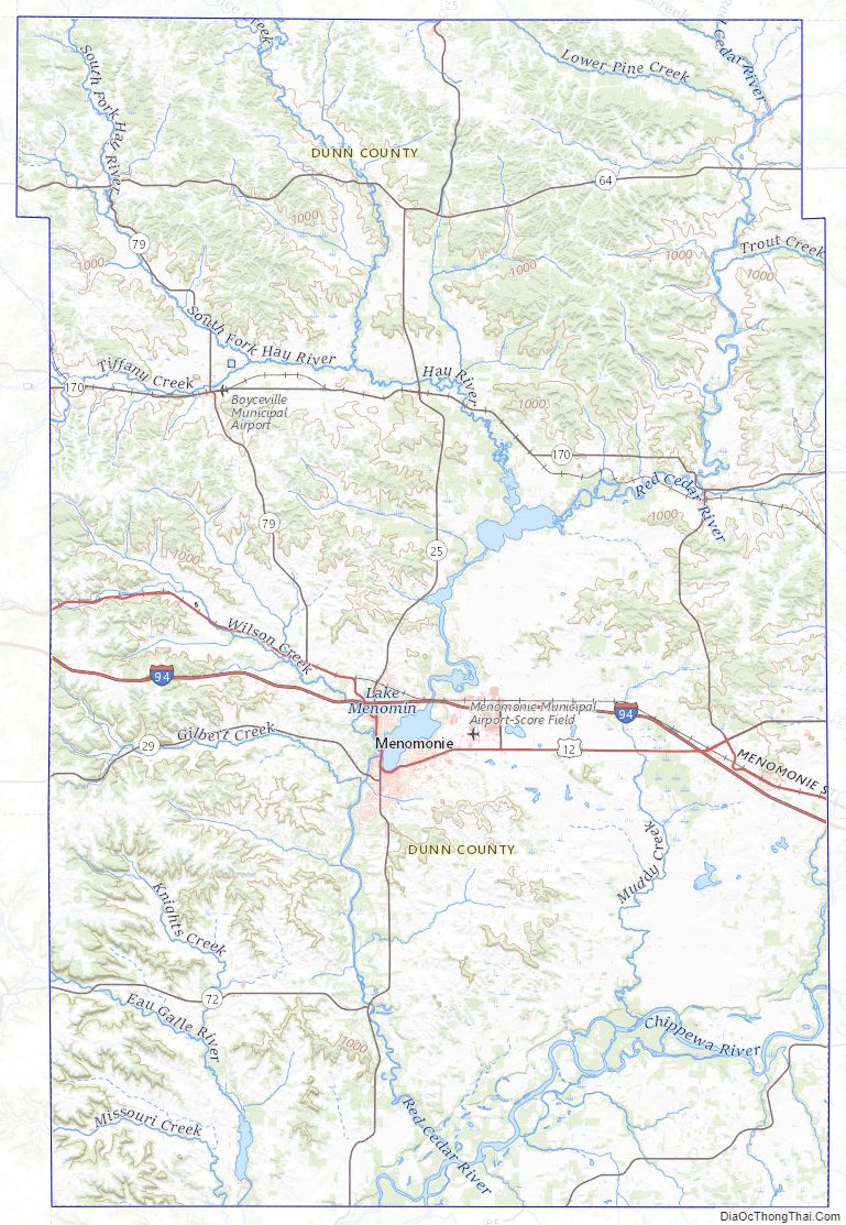
Dunn County Topographic Map
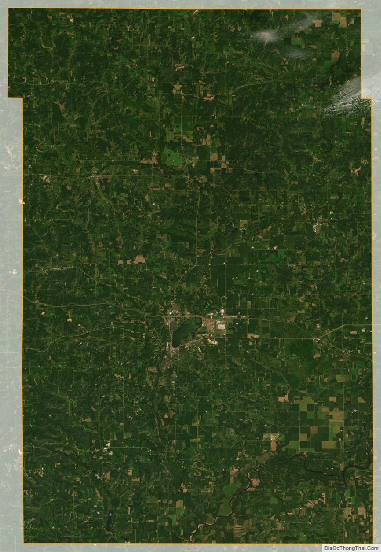
Dunn County Satellite Map
Dunn County Outline Map