Eau Claire (/oʊˈklɛər/; French: [o klɛʁ]) (French for “clear water”) is a city mostly located in Eau Claire County, Wisconsin, of which it is the county seat, and with a small portion in Chippewa County, Wisconsin. It had a population of 69,421 in 2020, making it the state’s eighth largest city. Eau Claire is the principal city of the Eau Claire, Wisconsin Metropolitan Statistical Area, locally known as the Chippewa Valley, and is also part of the larger Eau Claire-Menomonie Combined Statistical Area.
Eau Claire is at the confluence of the Eau Claire and Chippewa Rivers on traditional Ojibwe, Dakota, and Ho-Chunk land. The area’s first permanent European American settlers arrived in 1845, and Eau Claire was incorporated as a city in 1872. The city’s early growth came from its extensive logging and timber industries. After Eau Claire’s lumber industry declined in the early 20th century, the city’s economy diversified to encompass manufacturing and Eau Claire became an educational center with the opening of the University of Wisconsin–Eau Claire in 1916. Eau Claire is also a regional commercial and business center and home to the headquarters of home improvement store chain Menards.
Eau Claire is known regionally for its arts and music scenes and is the hometown of indie folk band Bon Iver, whose lead singer Justin Vernon co-curates the city’s annual Eaux Claires Music & Arts Festival. Eau Claire is the second fastest-growing major city in Wisconsin after Madison, with 5.4% population growth between 2010 and 2020.
| Name: | Eau Claire city |
|---|---|
| LSAD Code: | 25 |
| LSAD Description: | city (suffix) |
| State: | Wisconsin |
| County: | Chippewa County, Eau Claire County |
| Elevation: | 787 ft (240 m) |
| Land Area: | 32.86 sq mi (85.10 km²) |
| Water Area: | 2.09 sq mi (5.42 km²) 6.15% |
| Population Density: | 2,112.8/sq mi (815.8/km²) |
| Area code: | 715 & 534 |
| FIPS code: | 5522300 |
| GNISfeature ID: | 1583124 |
| Website: | http://www.eauclairewi.gov |
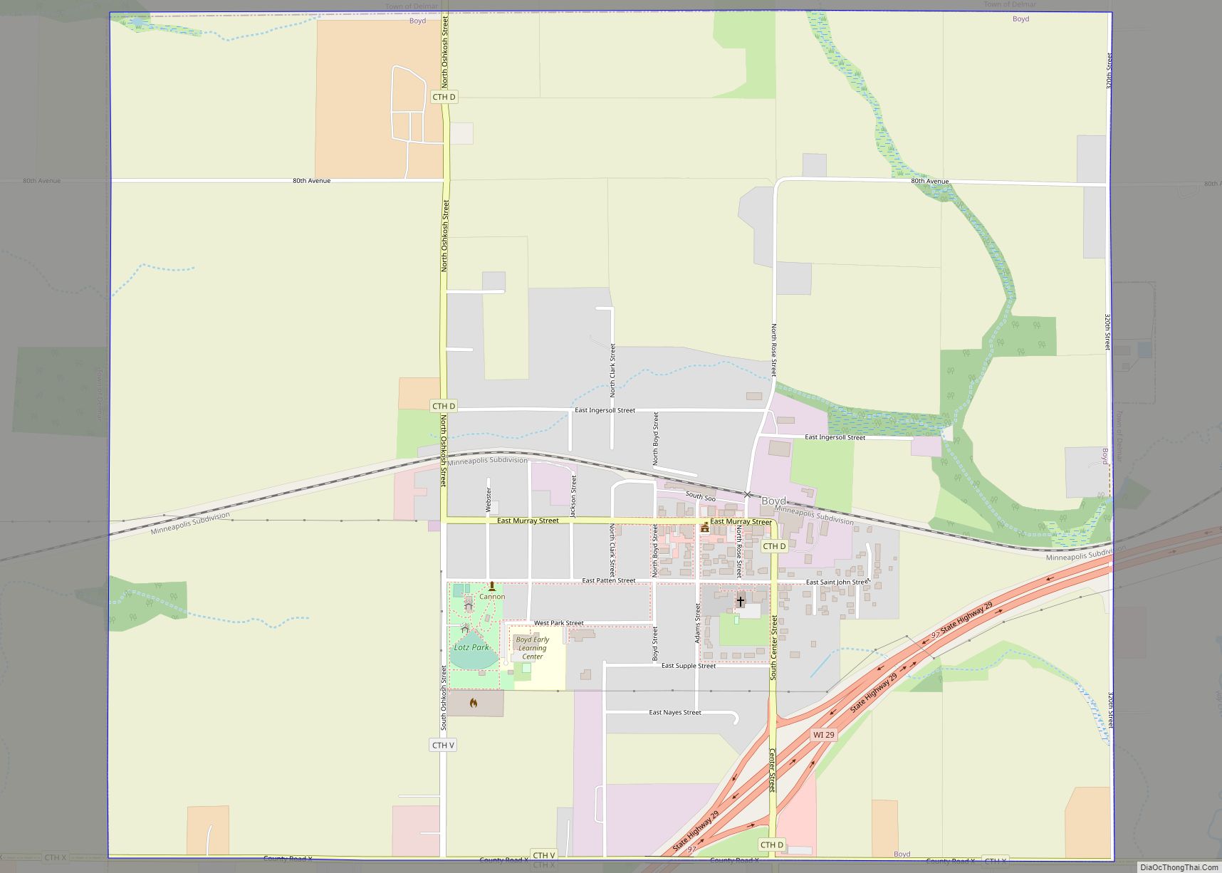
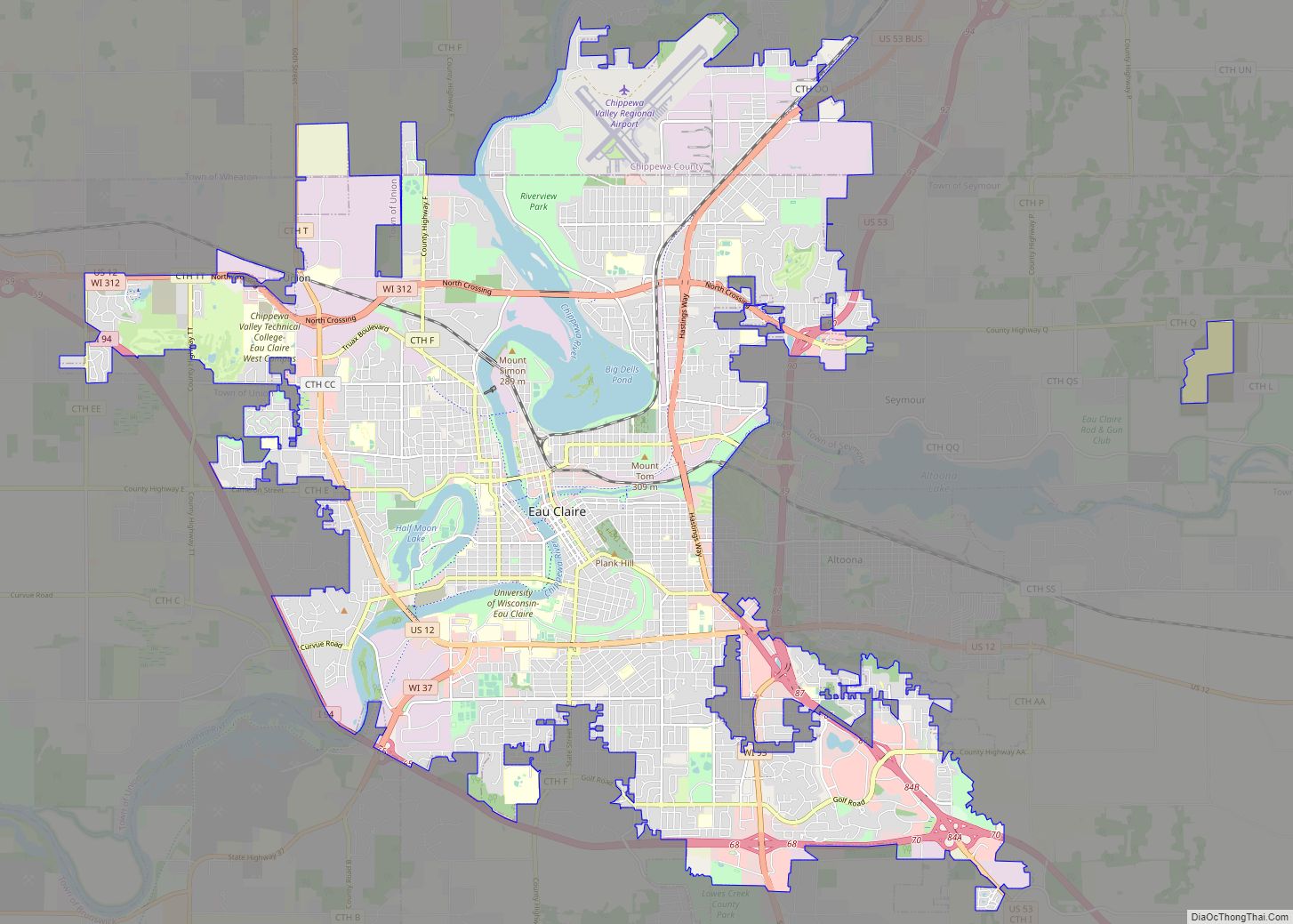
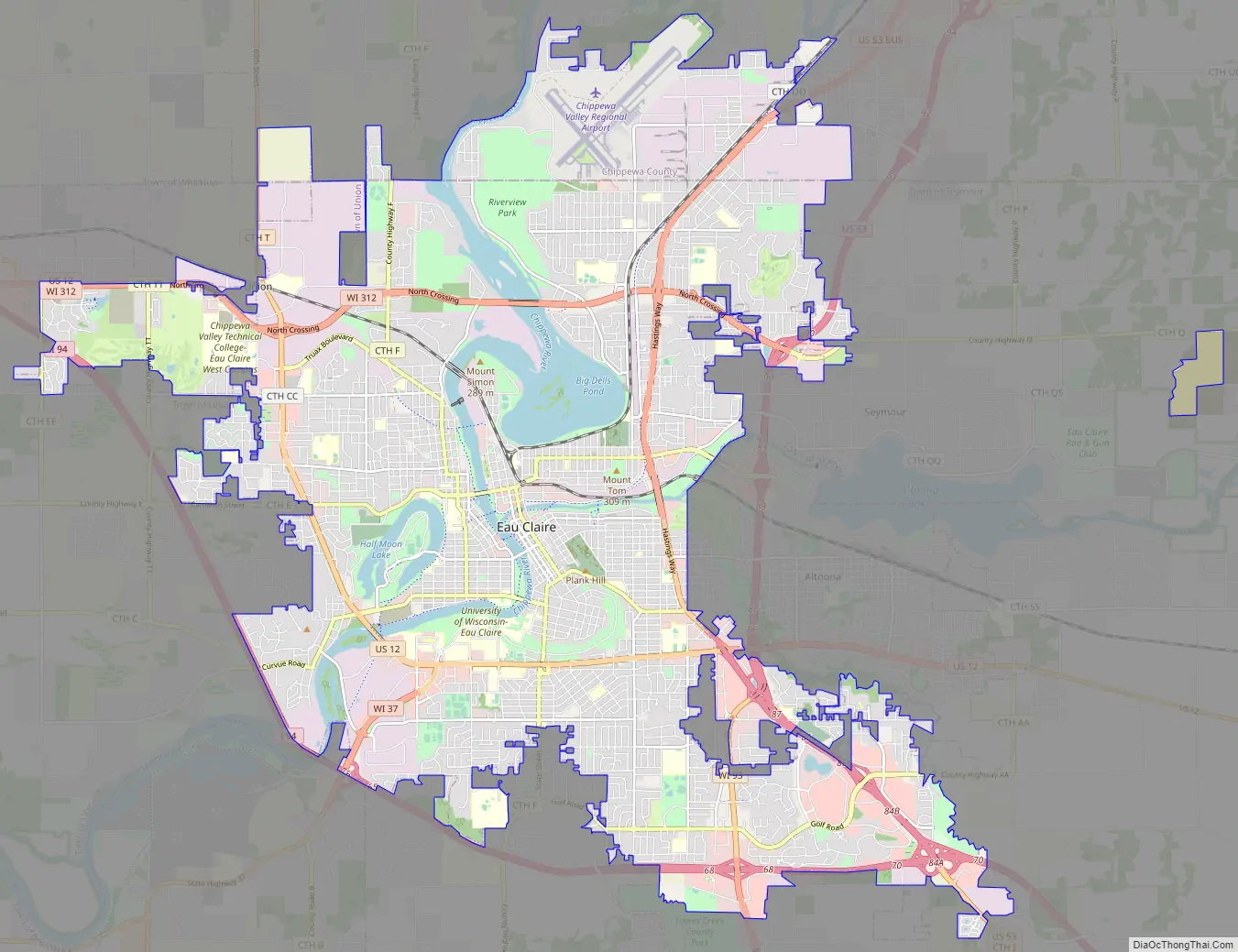
Online Interactive Map
Click on ![]() to view map in "full screen" mode.
to view map in "full screen" mode.
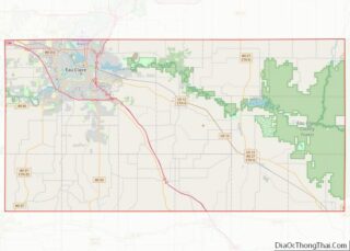
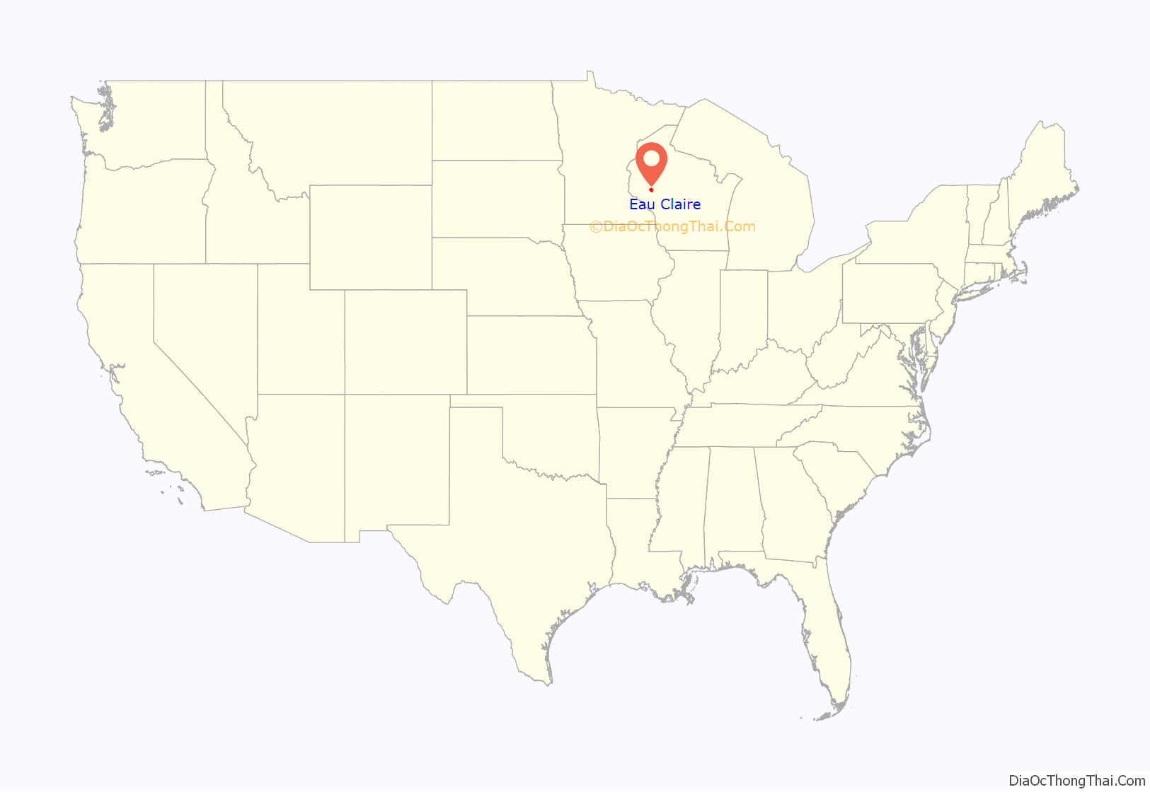
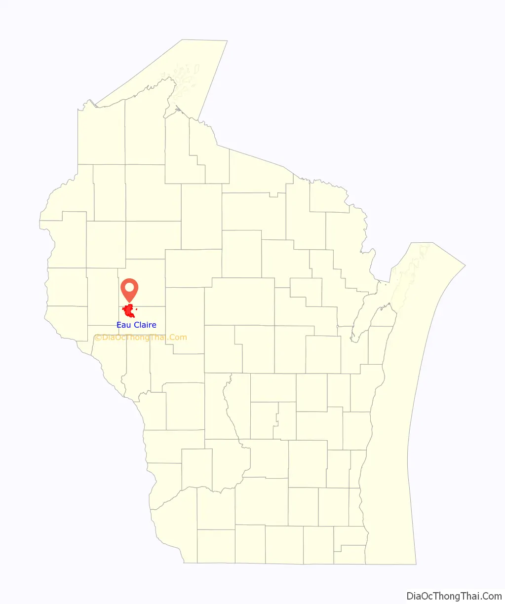
Eau Claire location map. Where is Eau Claire city?
History
The Eau Claire area was first visited by Europeans in the late 17th century. It had been occupied for thousands of years before European fur traders began settling there for trade with local Native American tribes.
The First Treaty of Prairie du Chien, signed in 1825, established the Chippewa River “half a day’s march below the falls” as the boundary between the Sioux and Chippewa, and the “Clear Water River, a branch of the Chippewa” as the boundary between the Chippewa and Winnebago.
The first permanent European-American settlers arrived in 1845, and the city was officially incorporated in 1872. Extensive timber was harvested and logging was the major industry during this time; many sawmills were built as part of the lumber industry. Sawmills and other manufacturing made Eau Claire an industrial city by the late 19th century.
The city was founded near the confluence of the Eau Claire and Chippewa rivers as three separate settlements. The main section of downtown is on the site of the original European-American village, where Stephen McCann, in partnership with J. C. Thomas, put up three buildings in 1845. Although these structures were erected primarily to establish a claim to the land site, the McCann family moved into one of them and became the first permanent settlers.
West Eau Claire, founded in 1856, was across the river, near the site of the current county courthouse, and was incorporated in 1872. Between a mile and a half and two miles downstream, the Daniel Shaw & Co. lumber company founded Shawtown, beyond the west end of what is now the Water Street historic district. Shawtown was annexed to the city of Eau Claire by the 1930s. By the 1950s, the entire city had spread far enough to the east to adjoin Altoona.
In 1916, the University of Wisconsin–Eau Claire was founded, which marked the turn from a mostly lumber production based economy into one centered around manufacturing, education, and healthcare.
In 1917, Gillette Safety Tire Company built a large factory in Eau Claire along the Eau Claire River less than a mile where the rivers meet. The factory mainly created rubber tires and tubing. It had about 1,600 workers in 1920, producing almost 500 tires and 500 rubber tubing everyday. These numbers have increased every year since it opened in 1917. In 1931, United States Rubber Company agreed to purchase Gillette, a sale not completed until 1940 owing to the Great Depression. Due to the start of World War II, the US War Department brought the facility in 1942 to use as an ammunition plant. At the height of the war effort, the plant had over 6,000 employees. Toward the end of the war, the government sold the building back to its original owners, and it was quickly converted back to manufacturing tire products. Throughout the decades after the war, the plant received multiple expansions and was renamed Uniroyal in 1967.
In 1991, Uniroyal, one of the largest factories in Eau Claire at the time, announced it would shutter the facility, ultimately causing 1,358 workers to lose their jobs. Although this factory shutdown was detrimental to Eau Claire’s economy, the unemployment rate fell from 1991 to 1992. Today the building, now named Banbury Place, is used as a small business incubator and leased to existing businesses and organizations.
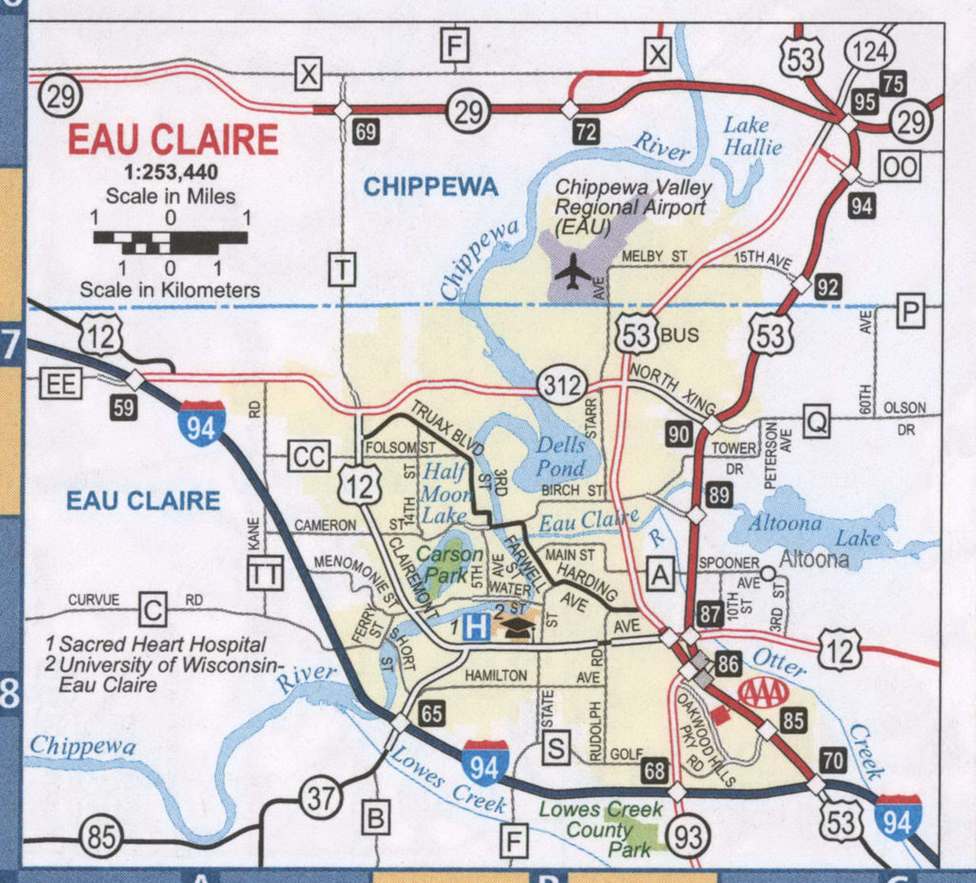
Eau Claire Road Map
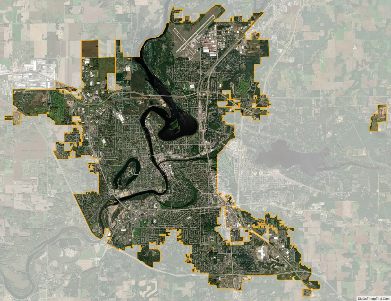
Eau Claire city Satellite Map
Geography
Eau Claire is about 90 miles (145 kilometers) east of Minneapolis and St. Paul, Minnesota, on the northern fringes of the Driftless Zone.
According to the United States Census Bureau, the city has an area of 34.14 square miles (88.42 km), of which 32.04 square miles (82.98 km) is land and 2.10 square miles (5.44 km) is water.
The city’s terrain is characterized by the river valleys, with steep slopes leading from the center to the eastern and southern sections of the city. The lands into which the urban area is expanding are increasingly hilly.
There are two lakes in the city, Dells Pond and Half Moon Lake. Dells Pond is a reservoir created by a hydroelectric dam, and was formerly used as a holding pool for logs. Half Moon Lake is an oxbow lake created as part of the former course of the Chippewa River.
Climate
In the Köppen climate classification, Eau Claire is classified as Dfa/Dfb borderline, usually termed as the subtype of warm, sometimes hot, summer. Its climate is due to its latitude and interior location in North America. The average annual temperature is only 46 °F (8 °C). Although the extremes exceed 110 °F (43 °C) upwards and −40 °F, which demonstrates the four well-defined seasons of the year, with severe winters generally colder than the winters of European Russia south of Moscow at a much lower latitude. The amount of annual snowfall (47″) exceeds the amount of annual rainfall (31″), the total precipitation is greater than other major cities in Wisconsin such as Milwaukee and Madison. July has an average temperature of 71.6 °F (22.0 °C) and January an average of 14.4 °F (−9.8 °C), where temperatures below freezing point can remain for a long duration.
See also
Map of Wisconsin State and its subdivision:- Adams
- Ashland
- Barron
- Bayfield
- Brown
- Buffalo
- Burnett
- Calumet
- Chippewa
- Clark
- Columbia
- Crawford
- Dane
- Dodge
- Door
- Douglas
- Dunn
- Eau Claire
- Florence
- Fond du Lac
- Forest
- Grant
- Green
- Green Lake
- Iowa
- Iron
- Jackson
- Jefferson
- Juneau
- Kenosha
- Kewaunee
- La Crosse
- Lafayette
- Lake Michigan
- Lake Superior
- Langlade
- Lincoln
- Manitowoc
- Marathon
- Marinette
- Marquette
- Menominee
- Milwaukee
- Monroe
- Oconto
- Oneida
- Outagamie
- Ozaukee
- Pepin
- Pierce
- Polk
- Portage
- Price
- Racine
- Richland
- Rock
- Rusk
- Saint Croix
- Sauk
- Sawyer
- Shawano
- Sheboygan
- Taylor
- Trempealeau
- Vernon
- Vilas
- Walworth
- Washburn
- Washington
- Waukesha
- Waupaca
- Waushara
- Winnebago
- Wood
- Alabama
- Alaska
- Arizona
- Arkansas
- California
- Colorado
- Connecticut
- Delaware
- District of Columbia
- Florida
- Georgia
- Hawaii
- Idaho
- Illinois
- Indiana
- Iowa
- Kansas
- Kentucky
- Louisiana
- Maine
- Maryland
- Massachusetts
- Michigan
- Minnesota
- Mississippi
- Missouri
- Montana
- Nebraska
- Nevada
- New Hampshire
- New Jersey
- New Mexico
- New York
- North Carolina
- North Dakota
- Ohio
- Oklahoma
- Oregon
- Pennsylvania
- Rhode Island
- South Carolina
- South Dakota
- Tennessee
- Texas
- Utah
- Vermont
- Virginia
- Washington
- West Virginia
- Wisconsin
- Wyoming