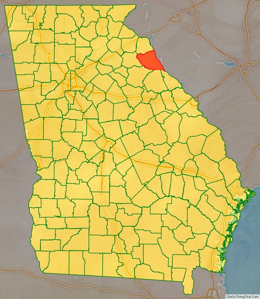
Elbert County is a county located in the northeastern part of the U.S. state of Georgia. As of the 2020 census, the population was 19,637. The county seat is Elberton. The county was established on December 10, 1790, and was named for Samuel Elbert.
| Name: | Elbert County |
|---|---|
| FIPS code: | 13-105 |
| State: | Georgia |
| Founded: | 1790 |
| Named for: | Samuel Elbert |
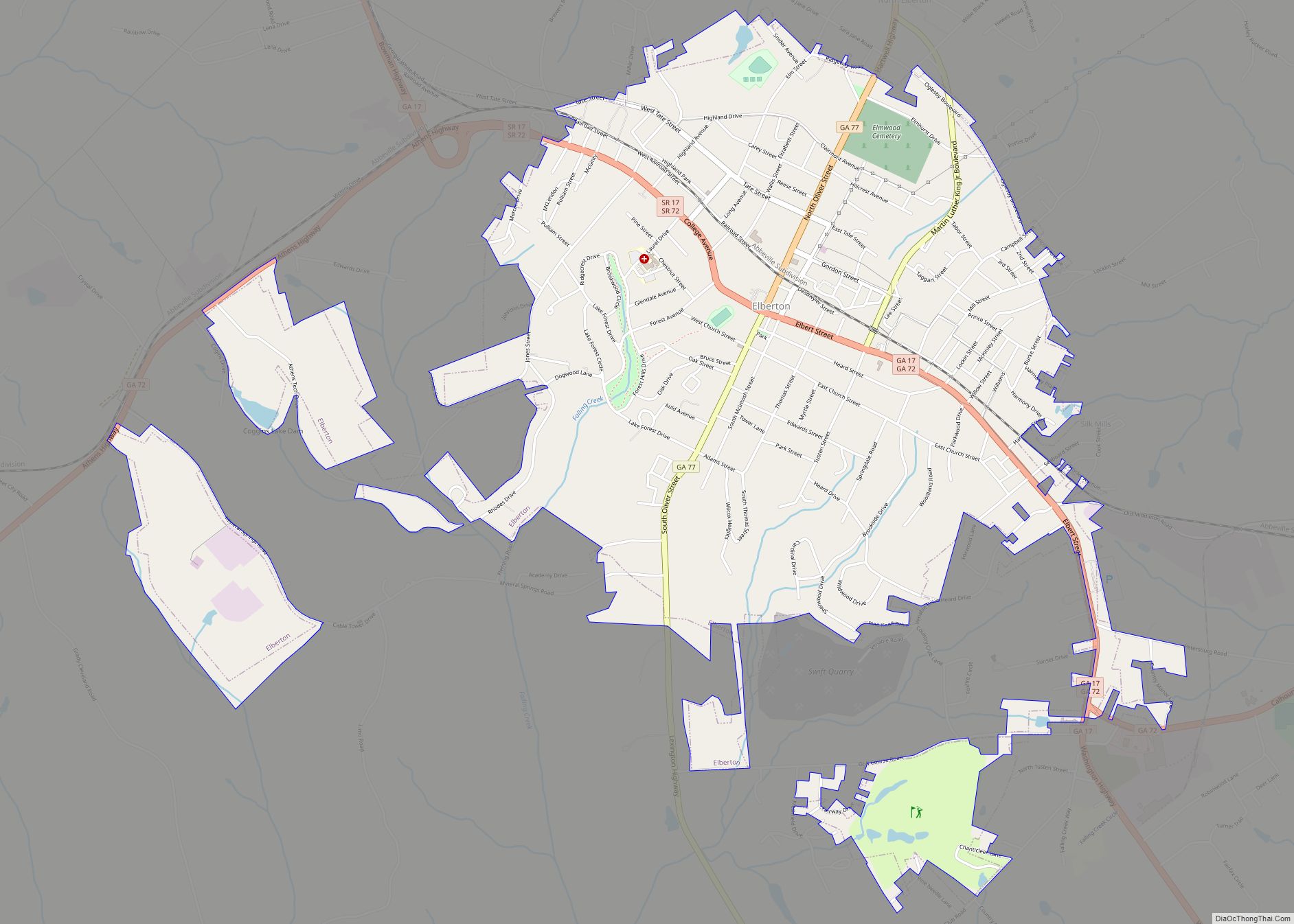
| Seat: | Elberton |
| Largest city: | Elberton |
| Total Area: | 374 sq mi (970 km²) |
| Land Area: | 351 sq mi (910 km²) |
| Total Population: | 19,637 |
| Population Density: | 56/sq mi (22/km²) |
| Time zone: | UTC−5 (Eastern) |
| Summer Time Zone (DST): | UTC−4 (EDT) |
| Website: | www.elbertga.us |
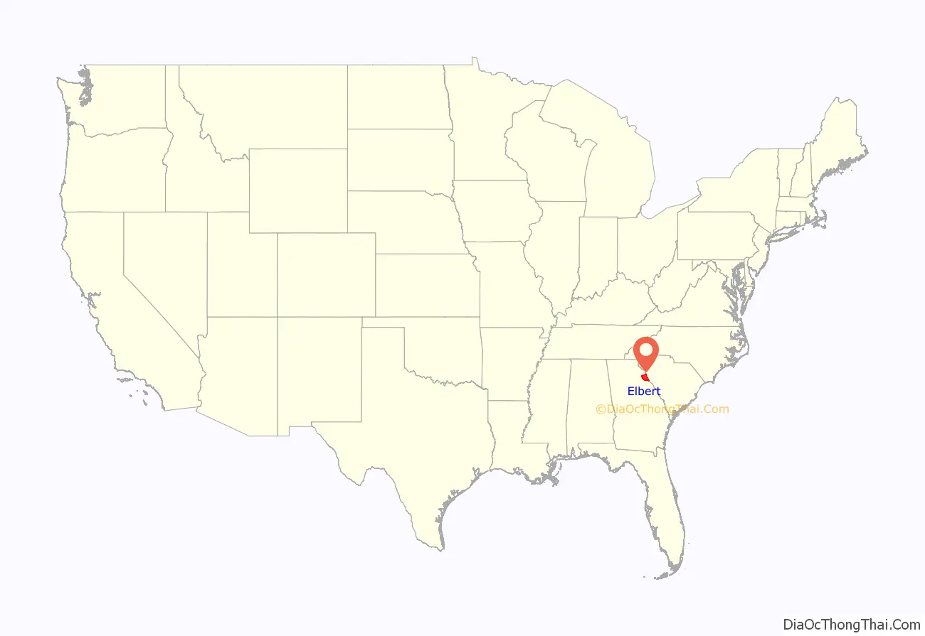
Elbert County location map. Where is Elbert County?
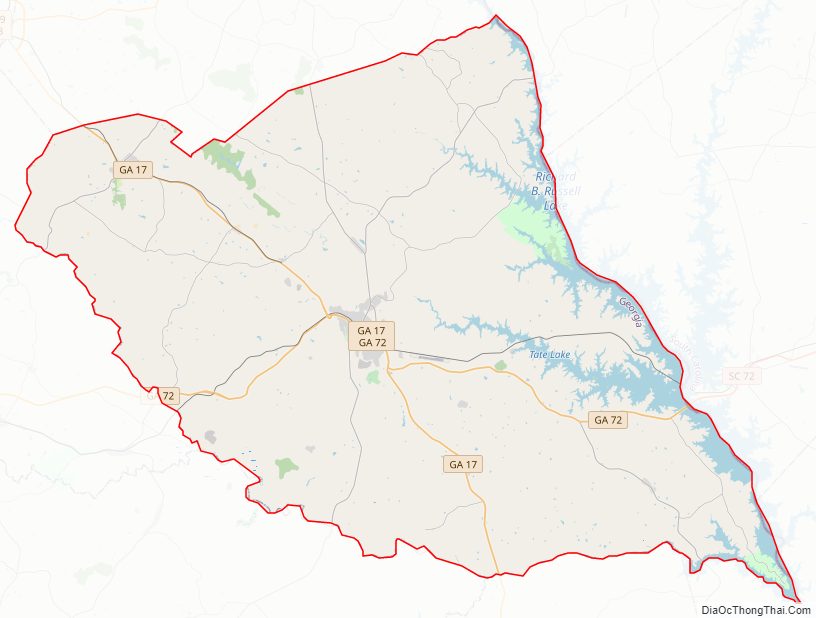
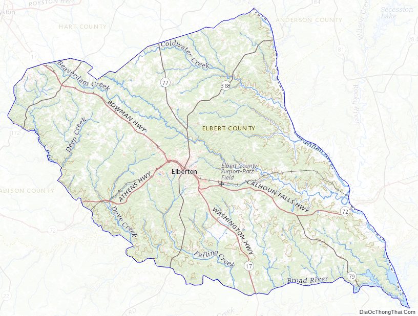
Elbert County Road Map
Geography
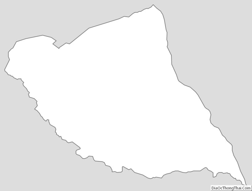
According to the U.S. Census Bureau, the county has a total area of 374 square miles (970 km), of which 351 square miles (910 km) is land and 23 square miles (60 km) (6.2%) is water. The county is located in the Piedmont region of the state.
The northern half of Elbert County, north of a line made by following State Route 17 from Bowman southeast to Elberton, and then following State Route 72 east to just before the South Carolina border, and then heading south along the shores of Lake Richard B. Russell & Clarkes Hill to the county’s southeastern tip, is located in the Upper Savannah River sub-basin of the larger Savannah River basin. The portion of the county south of this line is located in the Broad River sub-basin of the Savannah River basin.
Major highways
- State Route 17
- State Route 72
- State Route 77
- State Route 77 Connector
- State Route 79
- State Route 172
- State Route 368
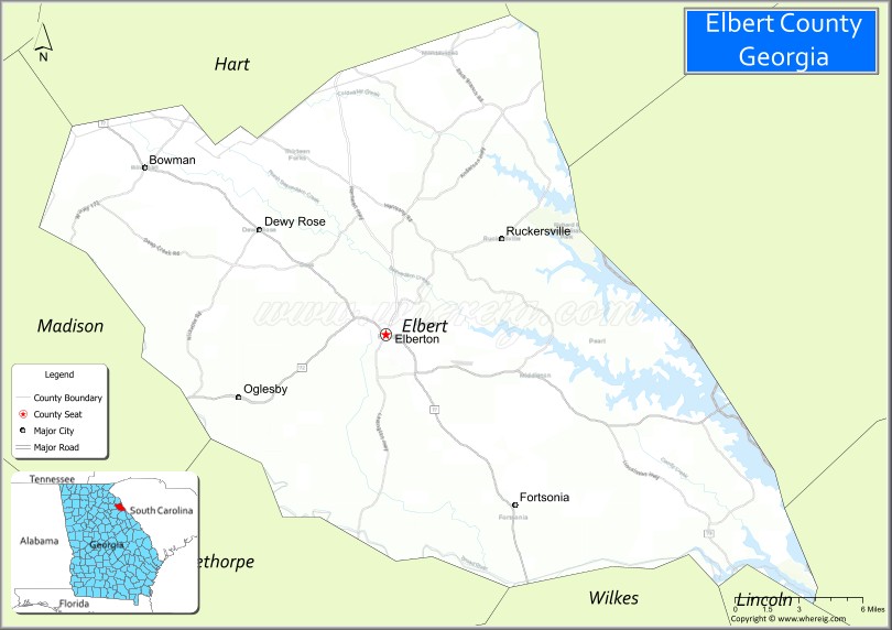
Adjacent counties
- Anderson County, South Carolina (northeast)
- Abbeville County, South Carolina (east)
- McCormick County, South Carolina (southeast)
- Lincoln County (southeast)
- Wilkes County (south)
- Oglethorpe County (southwest)
- Madison County (west)
- Hart County (north)
- Franklin County (northwest)
Elbert County Topographic Map
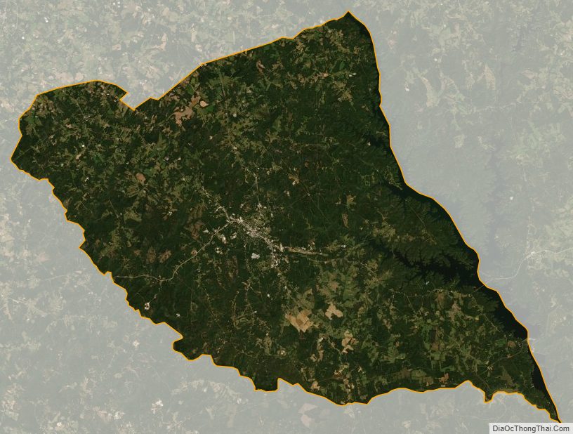
Elbert County Satellite Map
Elbert County Outline Map