Elberton is the largest city in Elbert County, Georgia, United States. The population was 4,653 at the 2010 census. The city is the county seat of Elbert County.
| Name: | Elberton city |
|---|---|
| LSAD Code: | 25 |
| LSAD Description: | city (suffix) |
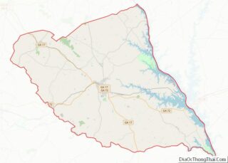
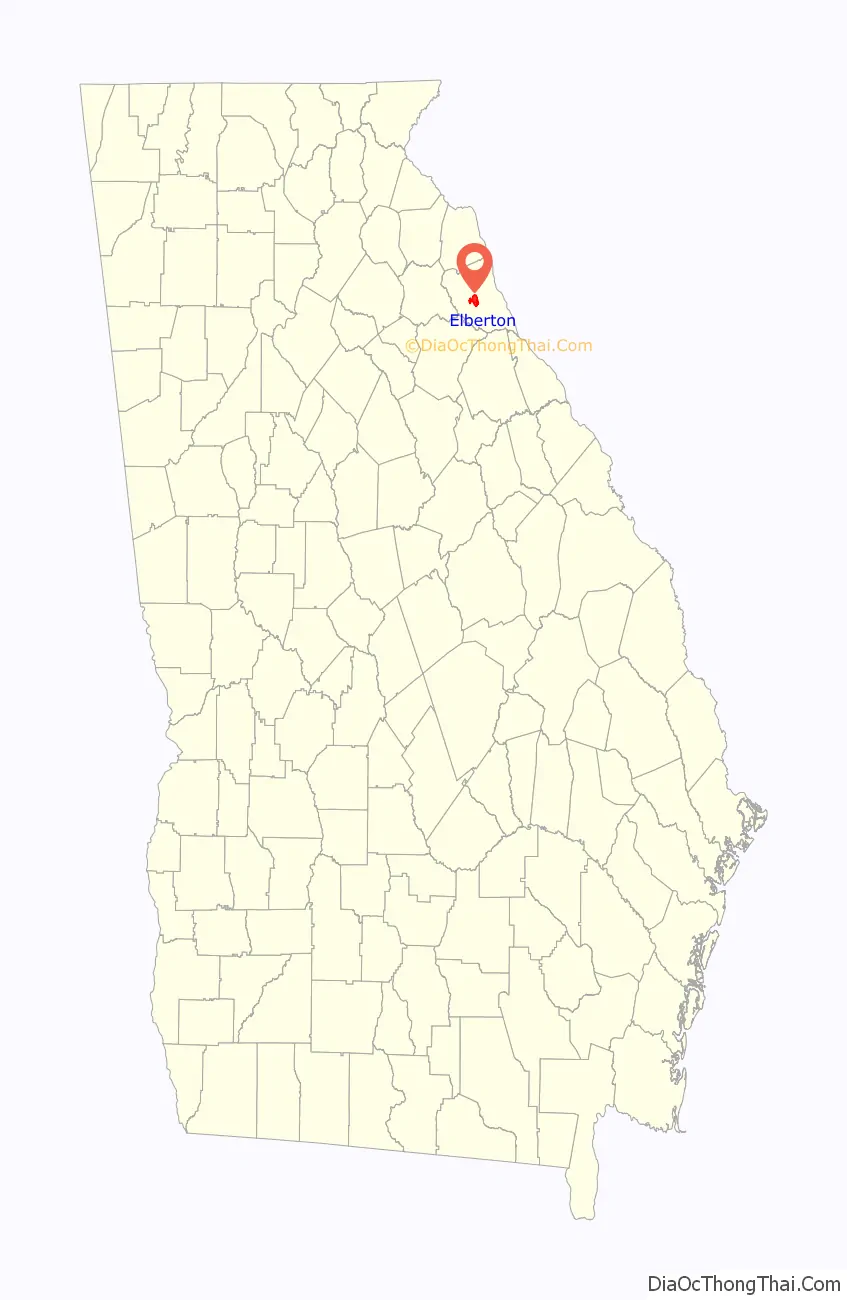
| State: | Georgia |
| County: | Elbert County |
| Elevation: | 702 ft (214 m) |
| Total Area: | 4.57 sq mi (11.85 km²) |
| Land Area: | 4.54 sq mi (11.76 km²) |
| Water Area: | 0.03 sq mi (0.09 km²) |
| Total Population: | 4,640 |
| Population Density: | 1,022.03/sq mi (394.64/km²) |
| ZIP code: | 30635 |
| Area code: | 706 |
| FIPS code: | 1326616 |
| GNISfeature ID: | 0355658 |
| Website: | www.cityofelberton.net |
Online Interactive Map
Click on ![]() to view map in "full screen" mode.
to view map in "full screen" mode.
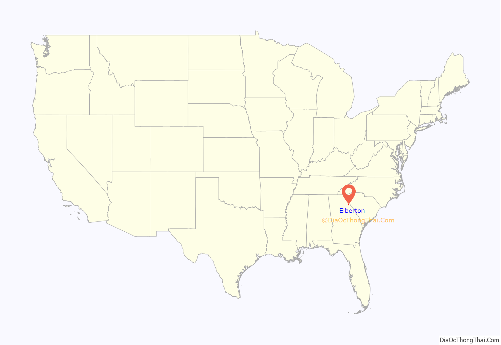
Elberton location map. Where is Elberton city?
History
Settled in the 1780s, Elbert was designated seat of the newly formed Elbert County in 1790. It was incorporated as a town in 1803 and as a city in 1896. Like Elbert County, Elberton is named for Samuel Elbert.
Elberton is known as the “Granite Capital of the World”.
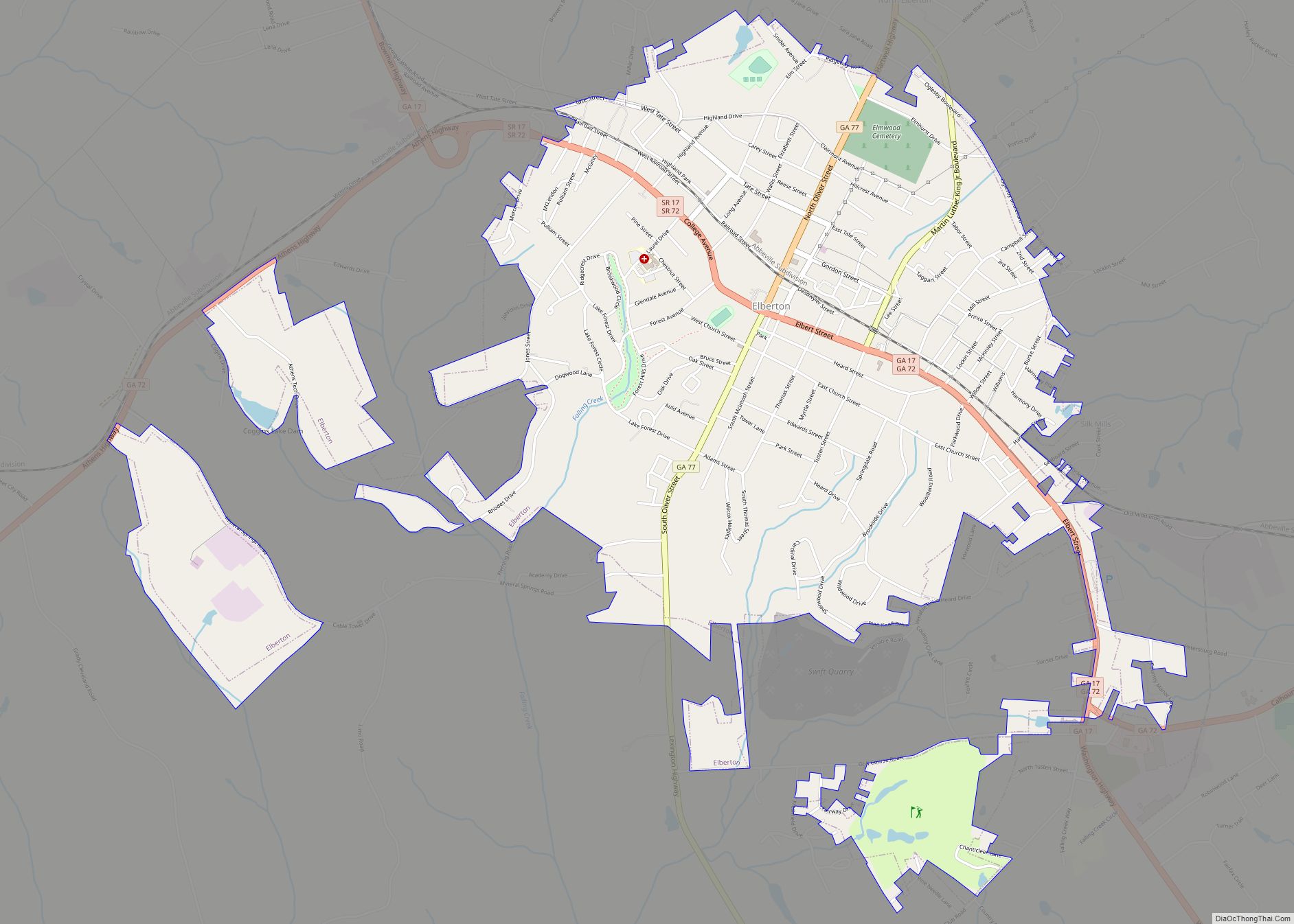
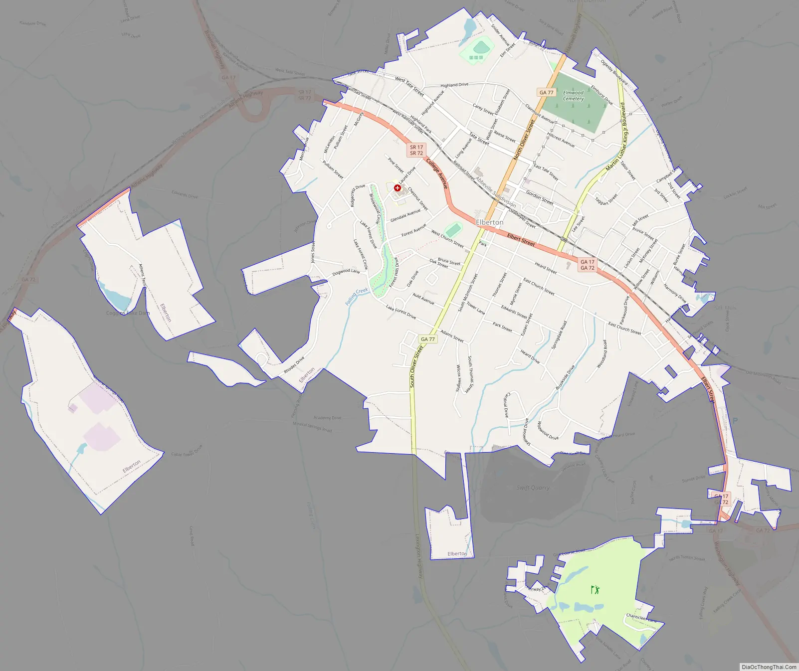
Elberton Road Map
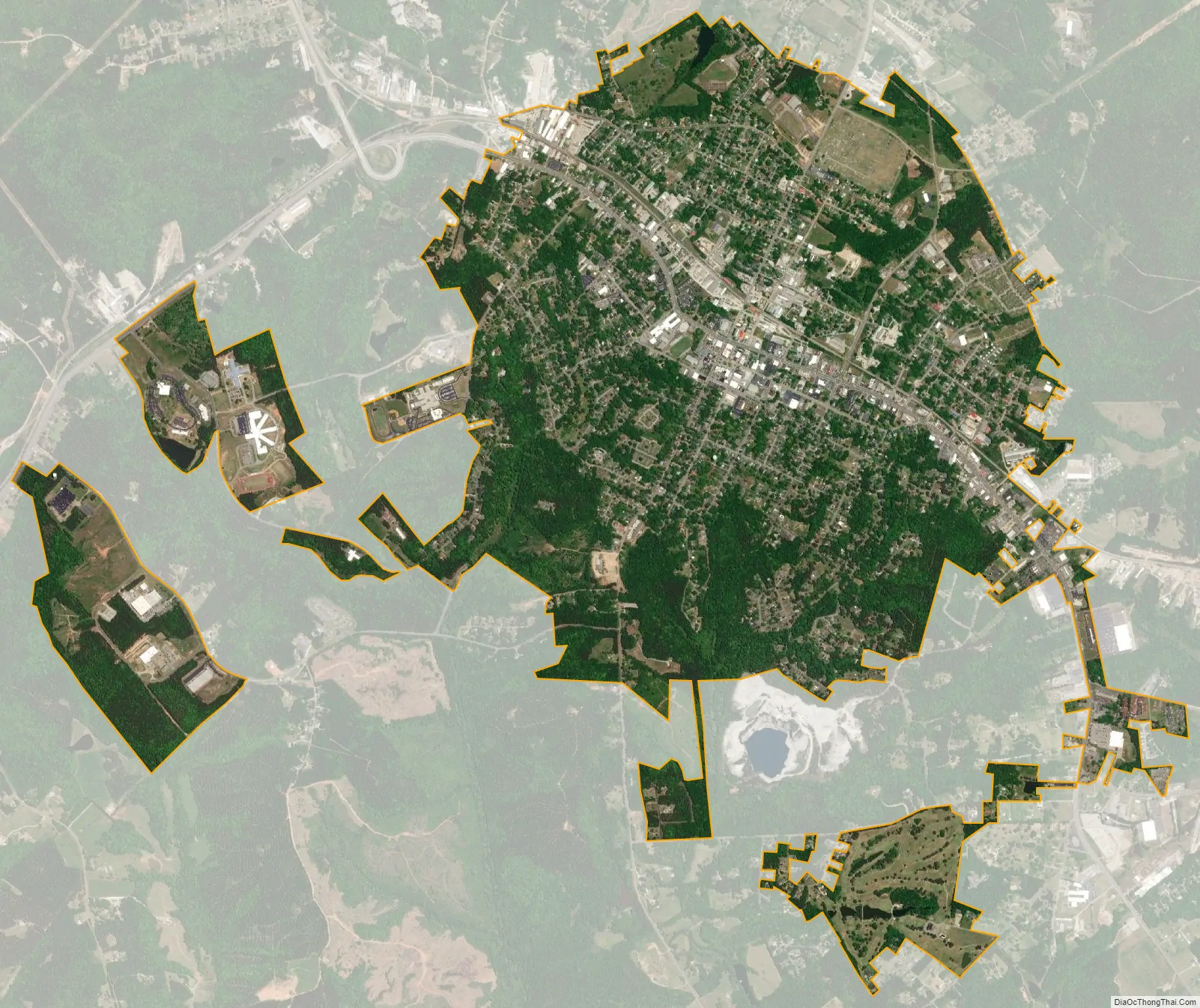
Elberton city Satellite Map
Geography
Elberton is located near the center of Elbert County at 34°6′35″N 82°51′56″W / 34.10972°N 82.86556°W / 34.10972; -82.86556 (34.109628, -82.865669). State Routes 17 and 72 pass east–west through the center of town as College Avenue, while 77 crosses north–south on Oliver Street. GA 17 leads northwest 19 miles (31 km) to Royston and southeast 29 miles (47 km) to Washington, GA 72 leads east 15 miles (24 km) to the South Carolina border at Richard B. Russell Lake on the Savannah River and west 35 miles (56 km) to Athens, and GA 77 leads north 18 miles (29 km) to Hartwell and southwest 25 miles (40 km) to Lexington.
According to the United States Census Bureau, Elberton has a total area of 4.8 square miles (12.4 km), of which 4.7 square miles (12.3 km) is land and 0.04 square miles (0.1 km), or 0.72%, is water.
See also
Map of Georgia State and its subdivision:- Appling
- Atkinson
- Bacon
- Baker
- Baldwin
- Banks
- Barrow
- Bartow
- Ben Hill
- Berrien
- Bibb
- Bleckley
- Brantley
- Brooks
- Bryan
- Bulloch
- Burke
- Butts
- Calhoun
- Camden
- Candler
- Carroll
- Catoosa
- Charlton
- Chatham
- Chattahoochee
- Chattooga
- Cherokee
- Clarke
- Clay
- Clayton
- Clinch
- Cobb
- Coffee
- Colquitt
- Columbia
- Cook
- Coweta
- Crawford
- Crisp
- Dade
- Dawson
- Decatur
- DeKalb
- Dodge
- Dooly
- Dougherty
- Douglas
- Early
- Echols
- Effingham
- Elbert
- Emanuel
- Evans
- Fannin
- Fayette
- Floyd
- Forsyth
- Franklin
- Fulton
- Gilmer
- Glascock
- Glynn
- Gordon
- Grady
- Greene
- Gwinnett
- Habersham
- Hall
- Hancock
- Haralson
- Harris
- Hart
- Heard
- Henry
- Houston
- Irwin
- Jackson
- Jasper
- Jeff Davis
- Jefferson
- Jenkins
- Johnson
- Jones
- Lamar
- Lanier
- Laurens
- Lee
- Liberty
- Lincoln
- Long
- Lowndes
- Lumpkin
- Macon
- Madison
- Marion
- McDuffie
- McIntosh
- Meriwether
- Miller
- Mitchell
- Monroe
- Montgomery
- Morgan
- Murray
- Muscogee
- Newton
- Oconee
- Oglethorpe
- Paulding
- Peach
- Pickens
- Pierce
- Pike
- Polk
- Pulaski
- Putnam
- Quitman
- Rabun
- Randolph
- Richmond
- Rockdale
- Schley
- Screven
- Seminole
- Spalding
- Stephens
- Stewart
- Sumter
- Talbot
- Taliaferro
- Tattnall
- Taylor
- Telfair
- Terrell
- Thomas
- Tift
- Toombs
- Towns
- Treutlen
- Troup
- Turner
- Twiggs
- Union
- Upson
- Walker
- Walton
- Ware
- Warren
- Washington
- Wayne
- Webster
- Wheeler
- White
- Whitfield
- Wilcox
- Wilkes
- Wilkinson
- Worth
- Alabama
- Alaska
- Arizona
- Arkansas
- California
- Colorado
- Connecticut
- Delaware
- District of Columbia
- Florida
- Georgia
- Hawaii
- Idaho
- Illinois
- Indiana
- Iowa
- Kansas
- Kentucky
- Louisiana
- Maine
- Maryland
- Massachusetts
- Michigan
- Minnesota
- Mississippi
- Missouri
- Montana
- Nebraska
- Nevada
- New Hampshire
- New Jersey
- New Mexico
- New York
- North Carolina
- North Dakota
- Ohio
- Oklahoma
- Oregon
- Pennsylvania
- Rhode Island
- South Carolina
- South Dakota
- Tennessee
- Texas
- Utah
- Vermont
- Virginia
- Washington
- West Virginia
- Wisconsin
- Wyoming