Hughes County is a county in the U.S. state of South Dakota. As of the 2020 United States Census, the population was 17,765, making it the least populous capital county in the nation, and the twelfth-most populous county in South Dakota. Its county seat is Pierre, which is also the state capital. The county was created in 1873, and was organized in 1880. It was named for Alexander Hughes, a legislator. On 4 June 1891, the county’s area was increased by the addition of Farm Island, in the Missouri River downstream of Pierre.
Hughes County is part of the Pierre, SD Micropolitan Statistical Area.
| Name: | Hughes County |
|---|---|
| FIPS code: | 46-065 |
| State: | South Dakota |
| Founded: | 1880 |
| Named for: | Alexander Hughes |
| Seat: | Pierre |
| Largest city: | Pierre |
| Total Area: | 801 sq mi (2,070 km²) |
| Land Area: | 742 sq mi (1,920 km²) |
| Total Population: | 17,765 |
| Population Density: | 22/sq mi (8.6/km²) |
| Time zone: | UTC−6 (Central) |
| Summer Time Zone (DST): | UTC−5 (CDT) |
| Website: | www.hughescounty.org |
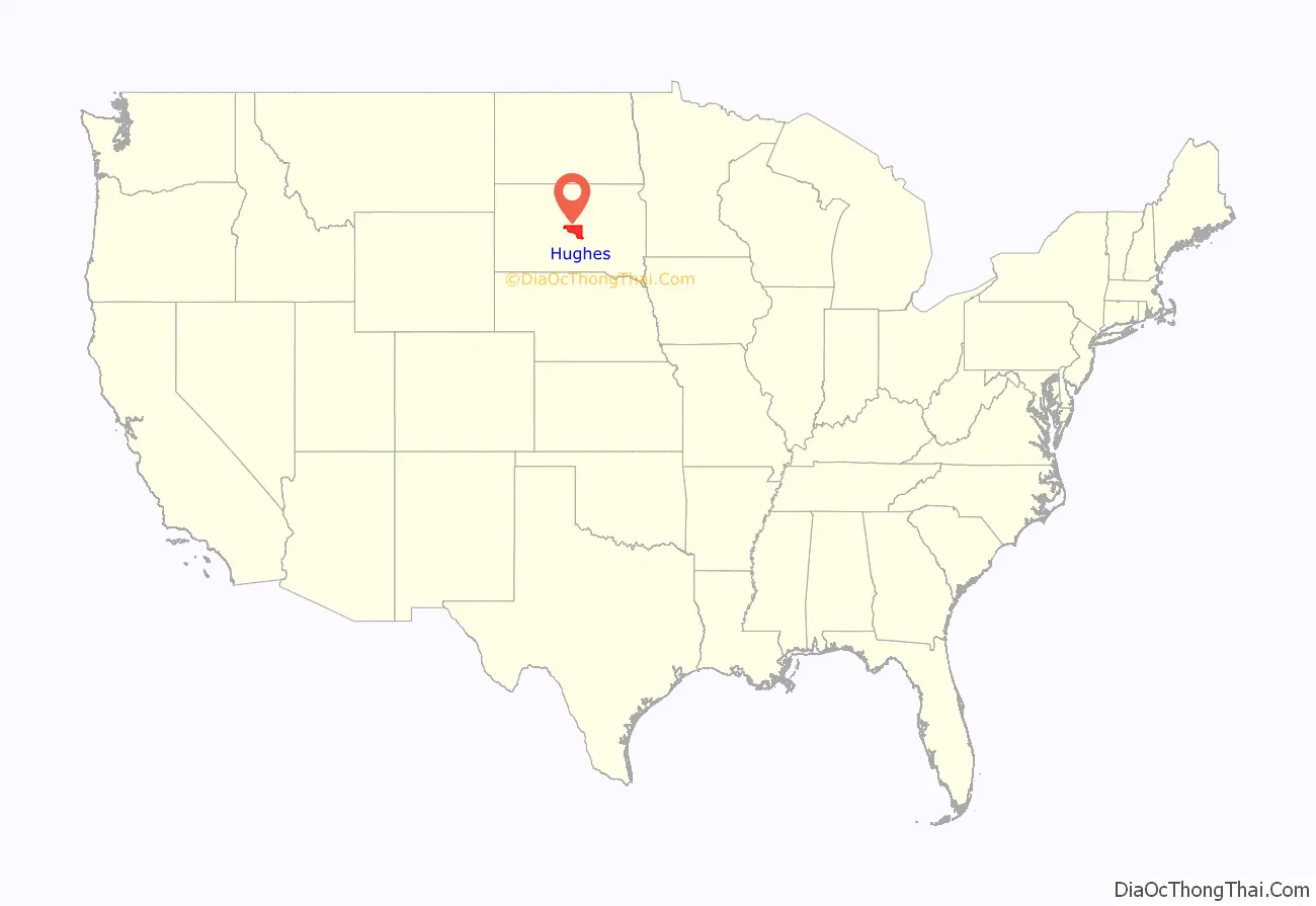
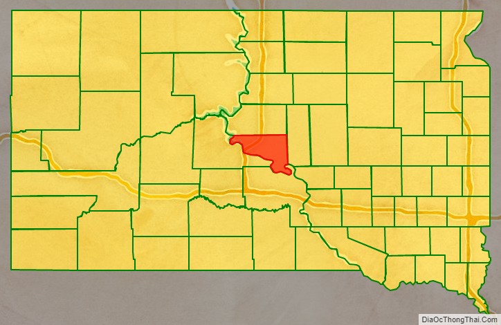
Hughes County location map. Where is Hughes County?
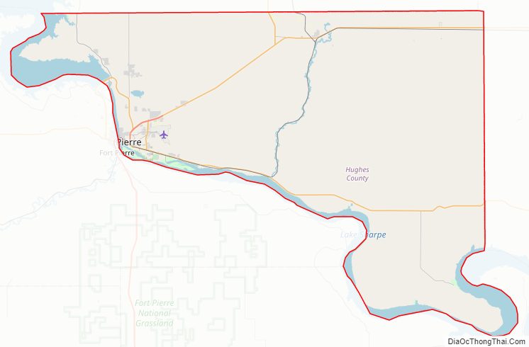
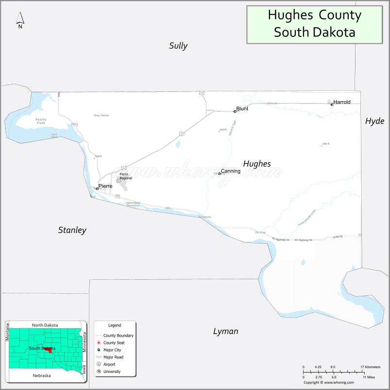
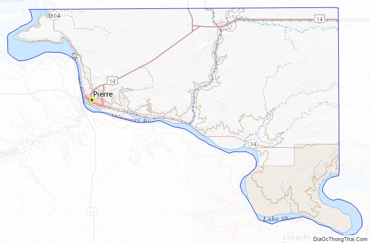
Hughes County Road Map
Geography
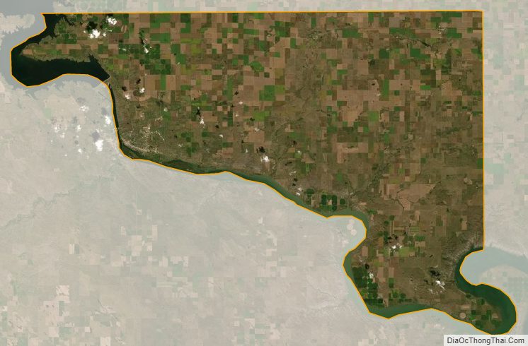
The Missouri River forms the southwestern boundary line of Hughes County. The county’s terrain consists of rolling hills cut by gullies and drainages. The area is partially dedicated to agriculture, including the use of center pivot irrigation.
The county terrain generally slopes to the southeast, although the hills along the west fall off into the river valley. The county’s highest point is on the upper part of the east boundary line, at 1,952′ (595m) ASL. The county has a total area of 801 square miles (2,070 km), of which 742 square miles (1,920 km) is land and 59 square miles (150 km) (7.4%) is water.
Major highways
- U.S. Highway 14
- U.S. Highway 83
- South Dakota Highway 34
- South Dakota Highway 1804
Airport
Pierre Regional Airport (PIR) serves Hughes County and the surrounding communities.
Adjacent counties
- Sully County – north
- Hyde County – east
- Lyman County – south
- Stanley County – west
Protected areas
- Arikara State Game Production Area
- Buckeye State Game Production Area
- Cowan State Game Production Area
- DeGrey State Game Production Area
- DeGrey State Lakeside Use Area
- Dry Run State Game Production Area
- East Shore State Lakeside Use Area
- Farm Island State Recreation Area
- Fort George State Game Production Area
- Fort George State Lakeside Use Area
- Gutenkauf State Game Production Area
- Joe Creek Recreation Area
- LaFramboise Island State Nature Area
- North Bend State Lakeside Use Area
- North Big Bend State Game Production Area
- Oahe Mission Recreation Area
- Peoria Flats State Game Production Area
- Peoria Flats State Lakeside Use Area
- Rousseau State Game Production Area
- Rousseau State Lakeside Use Area
- Sand Creek State Game Production Area
- Spring Creek State Recreation Area
- Tailrace Recreation Area
- Valley state Game Production Area
- West Bend State Recreation Area
- West Big Bend State Game Production Area
- West DeGrey State Game Production Area
- Woodruff Lake State Game Production Area
Lakes
- Lake Oahe (part)
- Lake Sharpe (part)
- Woodruff Lake
Hughes County Topographic Map
Hughes County Satellite Map
Hughes County Outline Map