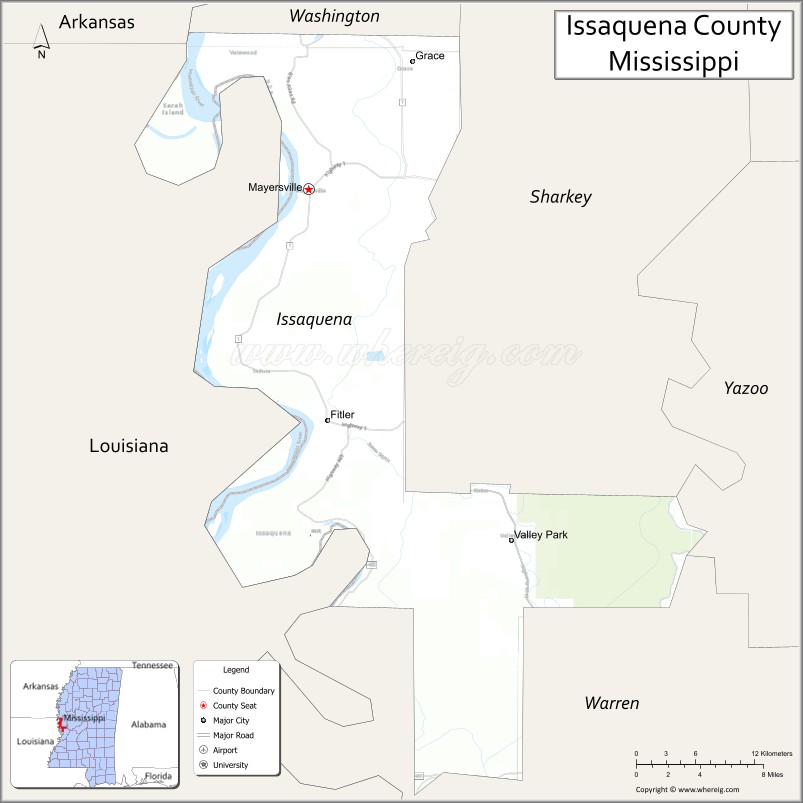
Issaquena County is a county located in the U.S. state of Mississippi. As of the 2020 Census, its population was 1,338, making it the least populous county in the United States east of the Mississippi River. Its county seat is Mayersville. With a per-capita income of $18,598, Issaquena County is, by that measure, one of the poorest counties in the United States.
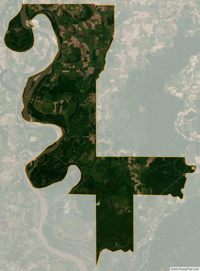
Issaquena County is located in the Mississippi Delta region. The Mississippi River flows along the entire western boundary of the county, and many of the earliest communities were river ports.
The county’s economy is chiefly based on agriculture, though a number of hunting camps are also located here and contribute to the economy. Mississippi’s two most recent records for the heaviest alligator taken by a hunter have both been in Issaquena County, the latest in 2012 when a 697.5 lb (316.4 kg) alligator was killed at a camp near Fitler.
| Name: | Issaquena County |
|---|---|
| FIPS code: | 28-055 |
| State: | Mississippi |
| Founded: | 1844 |
| Seat: | Mayersville |
| Largest town: | Mayersville |
| Total Area: | 441 sq mi (1,140 km²) |
| Land Area: | 413 sq mi (1,070 km²) |
| Total Population: | 1,338 |
| Population Density: | 3.0/sq mi (1.2/km²) |
| Time zone: | UTC−6 (Central) |
| Summer Time Zone (DST): | UTC−5 (CDT) |
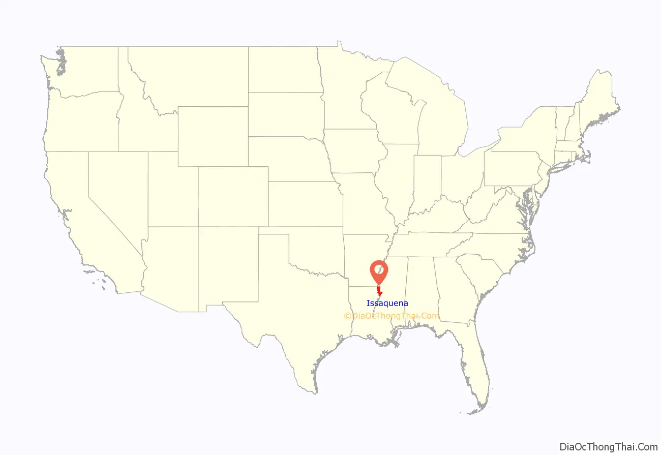
Issaquena County location map. Where is Issaquena County?
History
“Issaquena” (isi okhina) is a Choctaw word meaning “Deer River”; it is the Indian name for Deer Creek. The Choctaw people were the first inhabitants of the county, and were removed from their land in 1820. Non-Native settlers began arriving in the early 1830s.
Issaquena county was established on January 23, 1844, from the southern portion of Washington County. The first county seat was located in Skipwith, and then moved to Duncansby (both communities are now ghost towns). In 1848, the county seat moved to Tallula, and in 1871, to Mayersville.
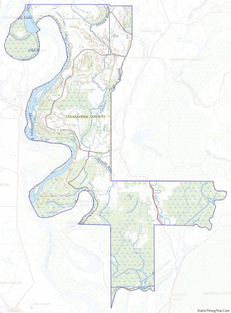
The county lies entirely in the Mississippi Alluvial Plain, and hardwood forest known as “bottomland” grows thick in the nutrient-rich, high-clay “buckshot” soil. Early settlers cleared many forests, and by the early 1890s about 50,000 acres (20,000 ha) of the county was growing corn, cotton, and oats. About that same time, the Louisville, New Orleans and Texas Railway was completed along a north–south route through the center of the county.
In 1876, Sharkey County was created from portions of Issaquena, Warren, and Washington counties.
Slavery
In 1860, 92.5% of Issaquena County’s total population were enslaved people, the highest concentration anywhere in the United States. The U.S. Census for that year showed that 7,244 slaves were held in Issaquena County, and of 115 slave owners, 39 held 77 or more slaves. Stephen Duncan of Issaquena County held 858 slaves, second only to Joshua John Ward of South Carolina. This large “value of slave property” made Issaquena County the second richest county in the United States, with “mean total wealth per freeman” at $26,800 in 1860 (equivalent to $674,000 in 2021). By 1880—just 15 years after the abolition of slavery—the county had developed “a strong year-round market for wage labor”, and Issaquena was the only county in Mississippi to report “no sharecropping or sharerenting whatsoever”.
Civil War
During the winter of 1862 and spring of 1863, Union Army General Ulysses S. Grant conducted a series of amphibious operations aimed at capturing the Confederate stronghold of Vicksburg, located south of Issaquena County.
The Steele’s Bayou Expedition occurred on waterways within Issaquena County, including Steele Bayou, Little Sunflower River, Big Sunflower River, Deer Creek, Black Bayou, Little Black Bayou, and the Yazoo River.
The shallow waterways proved difficult for the large Union boats, and Confederate defenses were robust. The Steele’s Bayou Expedition was a defeat for Union forces in Issaquena County.
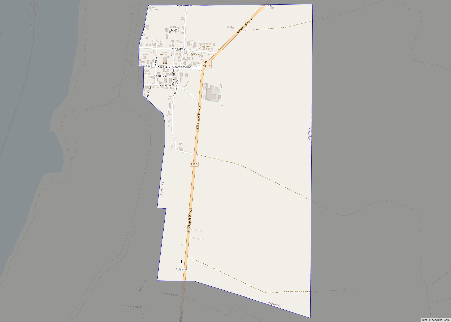
Issaquena County Road Map
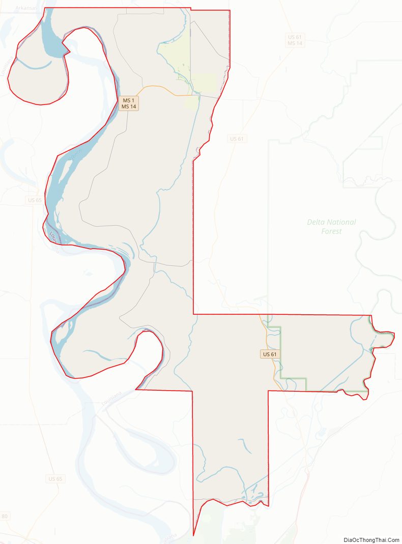
Geography
According to the U.S. Census Bureau, the county has a total area of 441 square miles (1,140 km), of which 413 square miles (1,070 km) is land and 28 square miles (73 km) (6.4%) is water.
Major highways
- U.S. Route 61
- Mississippi Highway 1
- Mississippi Highway 14
- Mississippi Highway 16
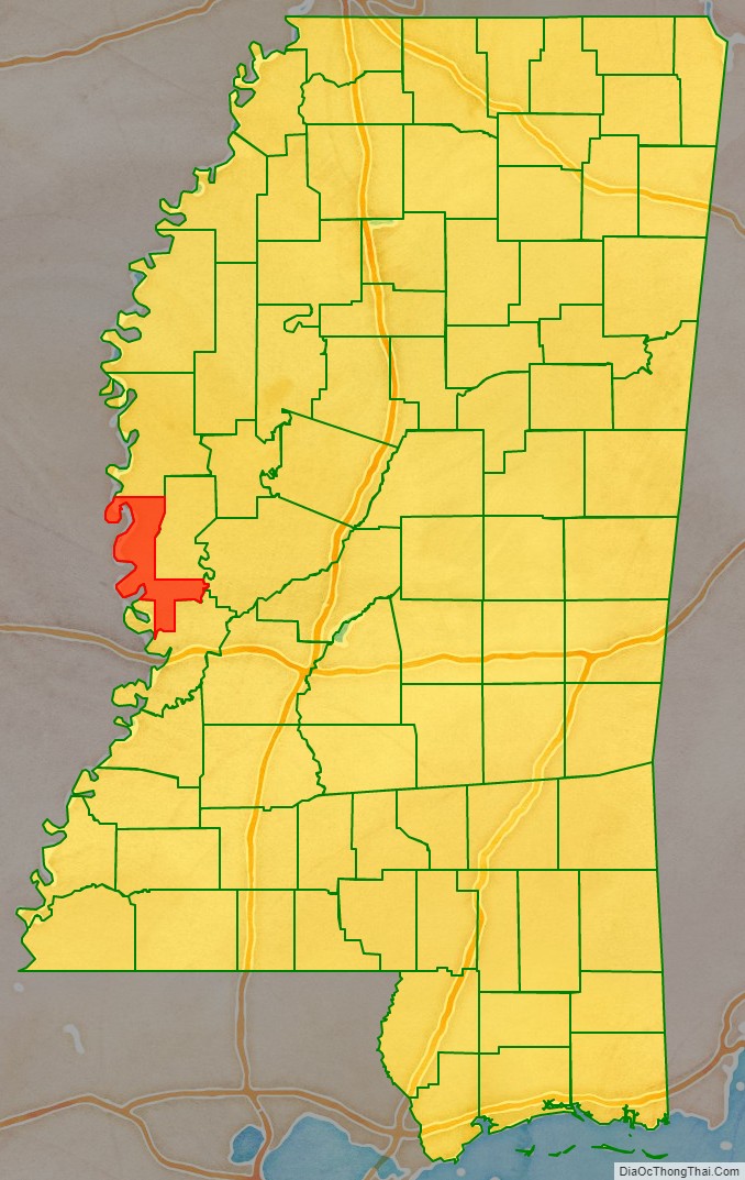
Adjacent counties
- Washington County (north)
- Sharkey County (northeast)
- Yazoo County (east)
- Warren County (south)
- East Carroll Parish, Louisiana (west)
- Chicot County, Arkansas (northwest)
Issaquena County Topographic Map
Issaquena County Satellite Map
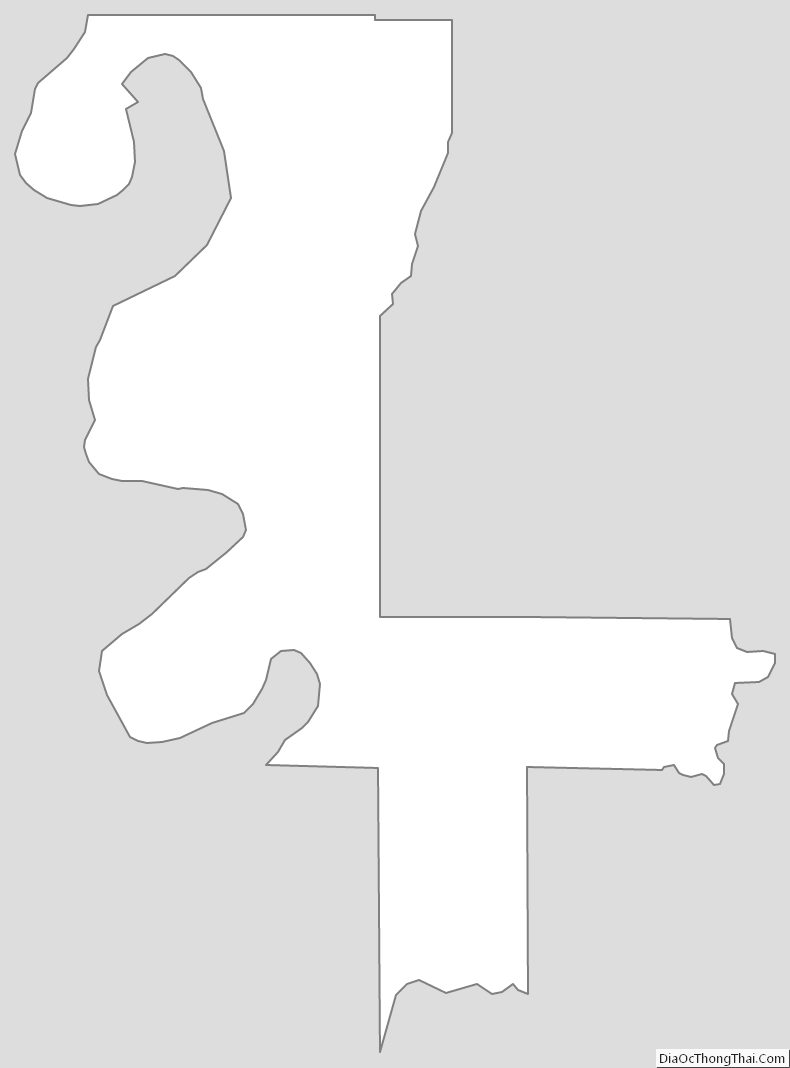
Issaquena County Outline Map