Mayersville is a town on the east bank of the Mississippi River, and the county seat for Issaquena County, Mississippi, United States. It is located in the Mississippi Delta region, known for cotton cultivation in the antebellum era. Once the trading center for the county, the town was superseded when railroads were built into the area. The population of the majority-black town was 547 at the 2010 census, down from 795 at the 2000 census.
| Name: | Mayersville town |
|---|---|
| LSAD Code: | 43 |
| LSAD Description: | town (suffix) |
| State: | Mississippi |
| County: | Issaquena County |
| Elevation: | 105 ft (32 m) |
| Total Area: | 1.10 sq mi (2.85 km²) |
| Land Area: | 1.10 sq mi (2.85 km²) |
| Water Area: | 0.00 sq mi (0.00 km²) |
| Total Population: | 433 |
| Population Density: | 393.28/sq mi (151.82/km²) |
| ZIP code: | 39113 |
| Area code: | 662 |
| FIPS code: | 2846000 |
| GNISfeature ID: | 0673260 |
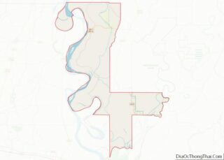
Online Interactive Map
Click on ![]() to view map in "full screen" mode.
to view map in "full screen" mode.
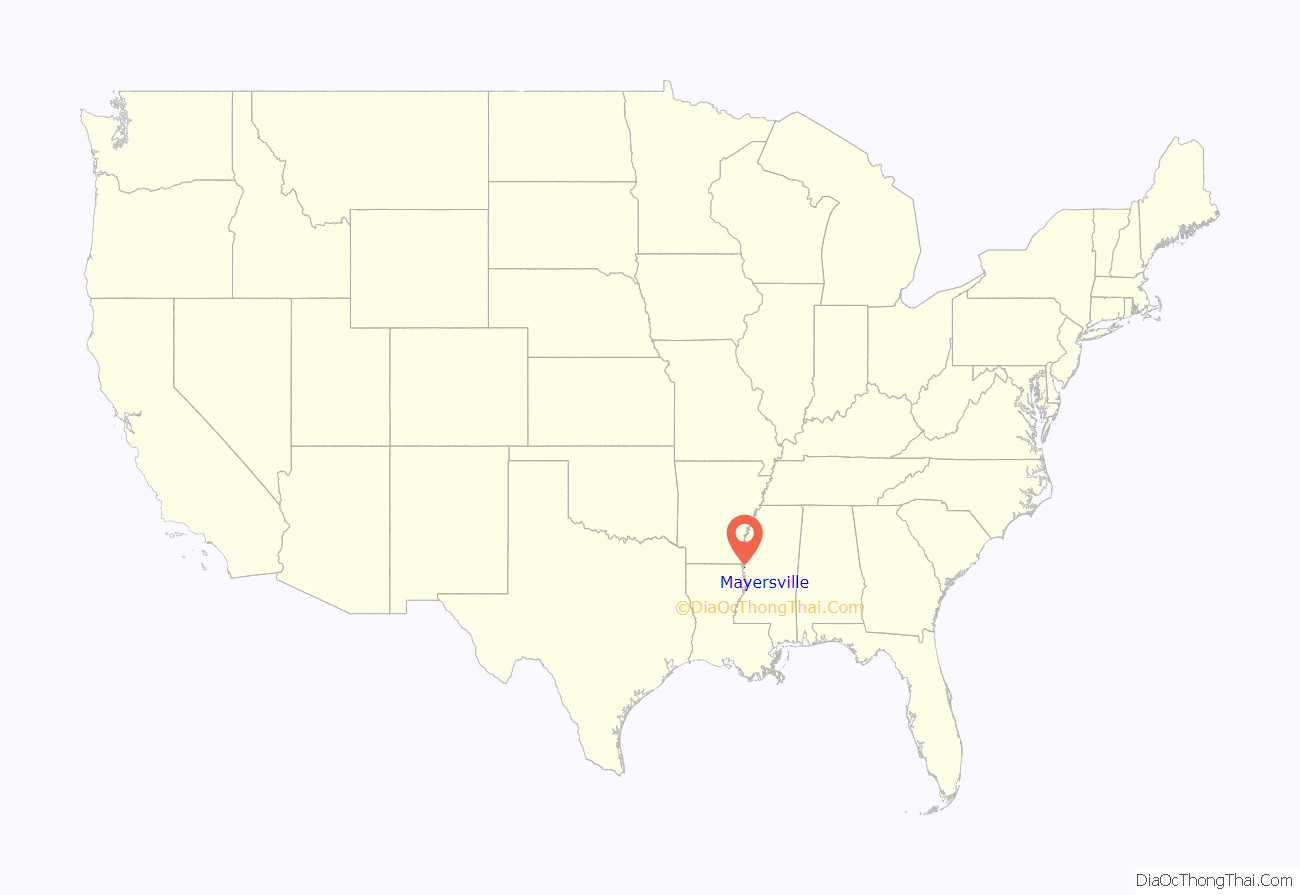
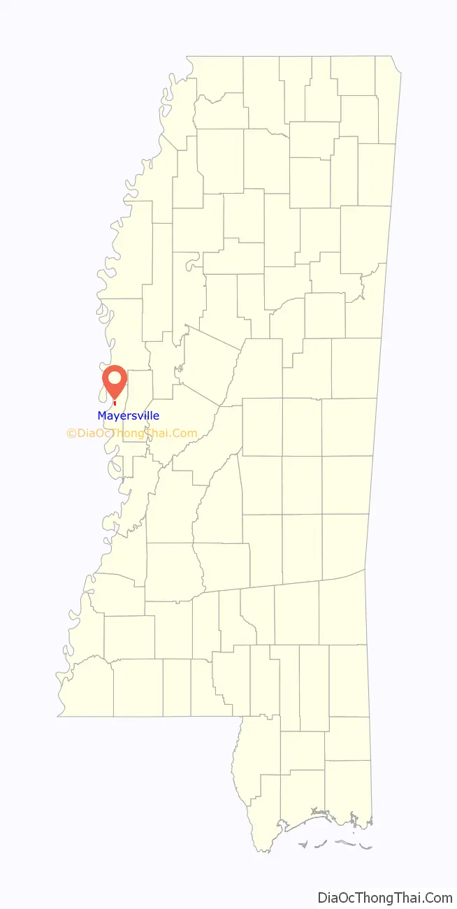
Mayersville location map. Where is Mayersville town?
History
Native Americans had lived in this area since prehistoric times. The Mayersville Archeological Site, added to the National Register of Historic Places in 1980, is on privately owned land. It contains the remains of earthwork mounds constructed primarily in the Mayersville phase ( AD 1200–1400) of the earlier Mississippian culture.
A 1950 survey by Philip Phillips of the Peabody Museum of Archaeology and Ethnology reported eleven ancient mounds. By the time the site was nominated by the state to the National Register of Historic Places, two mounds had been completely destroyed, a third one was nearly gone, three were reduced in size by plowing, and five remained nearly as described. Three mounds had enclosed a large plaza measuring roughly 560 by 790 feet (170 by 240 m). The fourth side was bounded by three mounds. Among these was Mound I, which was found to have been re-occupied from 1400 to 1600, perhaps by the succeeding Choctaw people. A European-American family cemetery associated with a 19th-century plantation was developed on Mound A.
The first record of non-Native settlement was in 1830, when European-American Ambrose Gipson purchased a large body of land along the Mississippi River and founded “Gipson’s Landing”. This soon became the port on the river for shipping out the cotton of Issaquena and Sharkey counties. It attracted shifting populations of river crews, gamblers, and traders, as well as show boats during low water times. The shipping records for David Mayer, who owned nearby Mout Level Plantation, show that river freight was shipped from the port via steamboat to points in Arkansas, Louisiana, Missouri, and Mississippi.
Mayer purchased Gipson’s Landing in 1870, and the town of Mayersville was founded in 1871. The town was established in 1872 by the legislature as the Issaquena County seat.
In January 1885, black saloon keeper Ebenzer Fowler was rumored to have sent an insulting letter to a white woman in the town. An armed white posse confronted Fowler on the main street just before dark on January 30, 1885. They claimed that Fowler grabbed a gun from a posse member and fired a shot at them; they returned fire and shot him dead. Tension between the town’s blacks, a majority of the population, and whites flared following the shooting. The county sheriff called in 22 members of Vicksburg’s militia, the “Volunteer Southrons”, for assistance. The militia left the following day when tensions had eased.
Mayersville’s popularity as a shipping port began to decline in the mid-1800s when it had to compete with the railways being built across the South, though no railway was built to the town. The construction of a levee following the hugely destructive flood of 1927 cut off direct river access for the town, causing further decline. In the 21st century, Bunge North America operates a large grain port in Millers Landing north of town.
In 1958, the current county courthouse in Mayersville was built.
With federal legislation in the mid-1960s, African Americans regained the ability to register and vote. In 1976, famed civil rights activist Unita Blackwell was elected mayor of Mayersville and the first female African-American mayor in Mississippi.
Mayersville’s small population and quiet character are in sharp contrast to its years as a booming Mississippi River port.
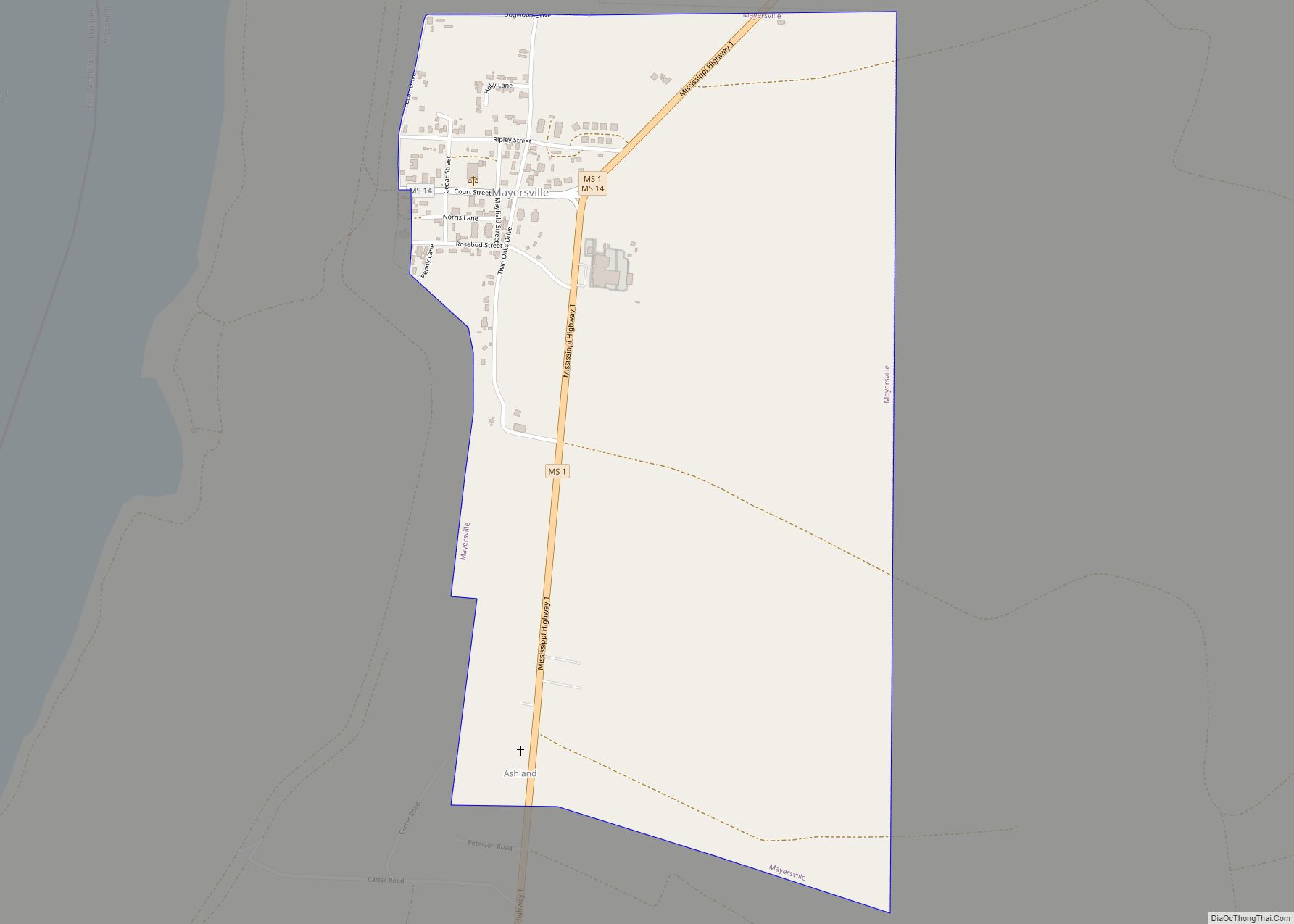
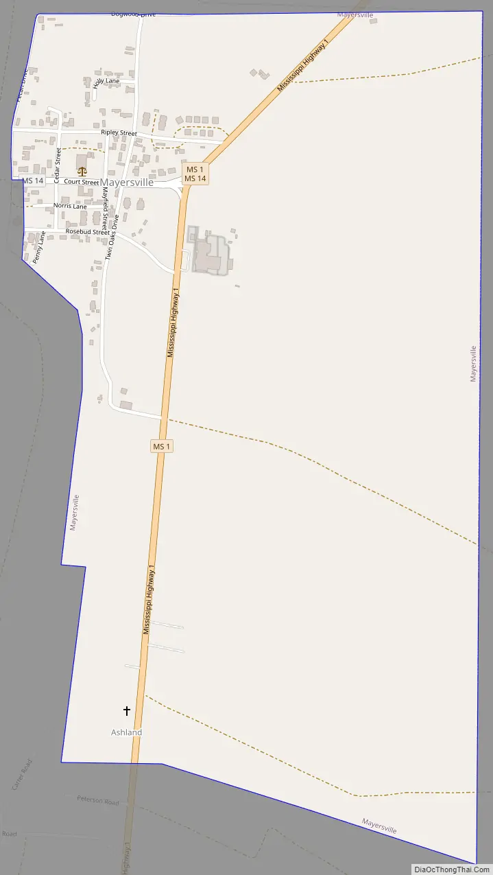
Mayersville Road Map
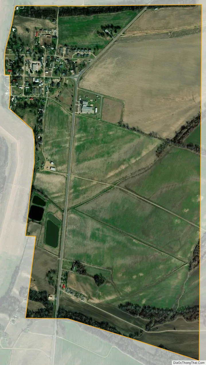
Mayersville city Satellite Map
Geography
Mayersville is in northern Issaquena County, just east of the Mississippi River, from which it is separated by a levee. Mississippi Highway 1 passes through the town, leading north 39 miles (63 km) to Greenville and south 22 miles (35 km) to U.S. Route 61 at Onward. Vicksburg is 53 miles (85 km) south of Mayersville via Highways 1 and 61. Mississippi Highway 14 has its western terminus in Mayersville and runs out of town to the northeast with Highway 1. Highway 14 leads east 11 miles (18 km) to US-61 at Rolling Fork.
According to the United States Census Bureau, the town of Mayersville has a total area of 1.1 square miles (2.9 km), all land.
See also
Map of Mississippi State and its subdivision:- Adams
- Alcorn
- Amite
- Attala
- Benton
- Bolivar
- Calhoun
- Carroll
- Chickasaw
- Choctaw
- Claiborne
- Clarke
- Clay
- Coahoma
- Copiah
- Covington
- Desoto
- Forrest
- Franklin
- George
- Greene
- Grenada
- Hancock
- Harrison
- Hinds
- Holmes
- Humphreys
- Issaquena
- Itawamba
- Jackson
- Jasper
- Jefferson
- Jefferson Davis
- Jones
- Kemper
- Lafayette
- Lamar
- Lauderdale
- Lawrence
- Leake
- Lee
- Leflore
- Lincoln
- Lowndes
- Madison
- Marion
- Marshall
- Monroe
- Montgomery
- Neshoba
- Newton
- Noxubee
- Oktibbeha
- Panola
- Pearl River
- Perry
- Pike
- Pontotoc
- Prentiss
- Quitman
- Rankin
- Scott
- Sharkey
- Simpson
- Smith
- Stone
- Sunflower
- Tallahatchie
- Tate
- Tippah
- Tishomingo
- Tunica
- Union
- Walthall
- Warren
- Washington
- Wayne
- Webster
- Wilkinson
- Winston
- Yalobusha
- Yazoo
- Alabama
- Alaska
- Arizona
- Arkansas
- California
- Colorado
- Connecticut
- Delaware
- District of Columbia
- Florida
- Georgia
- Hawaii
- Idaho
- Illinois
- Indiana
- Iowa
- Kansas
- Kentucky
- Louisiana
- Maine
- Maryland
- Massachusetts
- Michigan
- Minnesota
- Mississippi
- Missouri
- Montana
- Nebraska
- Nevada
- New Hampshire
- New Jersey
- New Mexico
- New York
- North Carolina
- North Dakota
- Ohio
- Oklahoma
- Oregon
- Pennsylvania
- Rhode Island
- South Carolina
- South Dakota
- Tennessee
- Texas
- Utah
- Vermont
- Virginia
- Washington
- West Virginia
- Wisconsin
- Wyoming