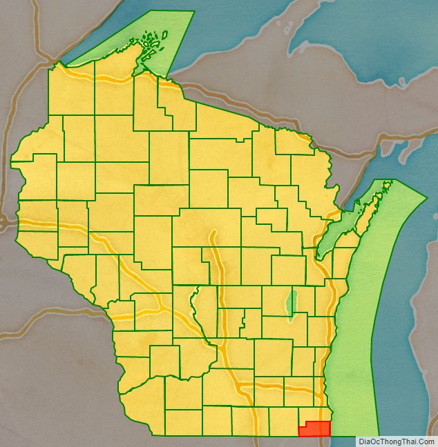
Kenosha County is located in the southeastern corner of the U.S. state of Wisconsin. The population was 169,151 as of the 2020 census, making it the eighth most populous county in Wisconsin. The county shares the same name as the city of Kenosha, the fourth largest city in Wisconsin. Kenosha County is part of the Chicago metropolitan area, the fourth most-populous metropolitan area in North America after the metro areas of Mexico City, New York, and Los Angeles. Kenosha County is situated on the southwestern shore of Lake Michigan.
In March 2008, the demographers of the Wisconsin Department of Administration reported that Kenosha County saw improvements in its roads and business’s need for personnel. The county also has a direct rail link to Chicago via Metra’s Union Pacific / North Line. Since 2000, the county saw a population increase of 12.6%, higher than the overall Wisconsin growth of 6.0%. According to Business Insider, Kenosha County is an exurb and benefits as part of the Chicago metropolitan area.
| Name: | Kenosha County |
|---|---|
| FIPS code: | 55-059 |
| State: | Wisconsin |
| Founded: | January 30, 1850 |
| Seat: | Kenosha |
| Largest city: | Kenosha |
| Total Area: | 754 sq mi (1,950 km²) |
| Land Area: | 272 sq mi (700 km²) |
| Total Population: | 169,151 |
| Population Density: | 224.3/sq mi (86.6/km²) |
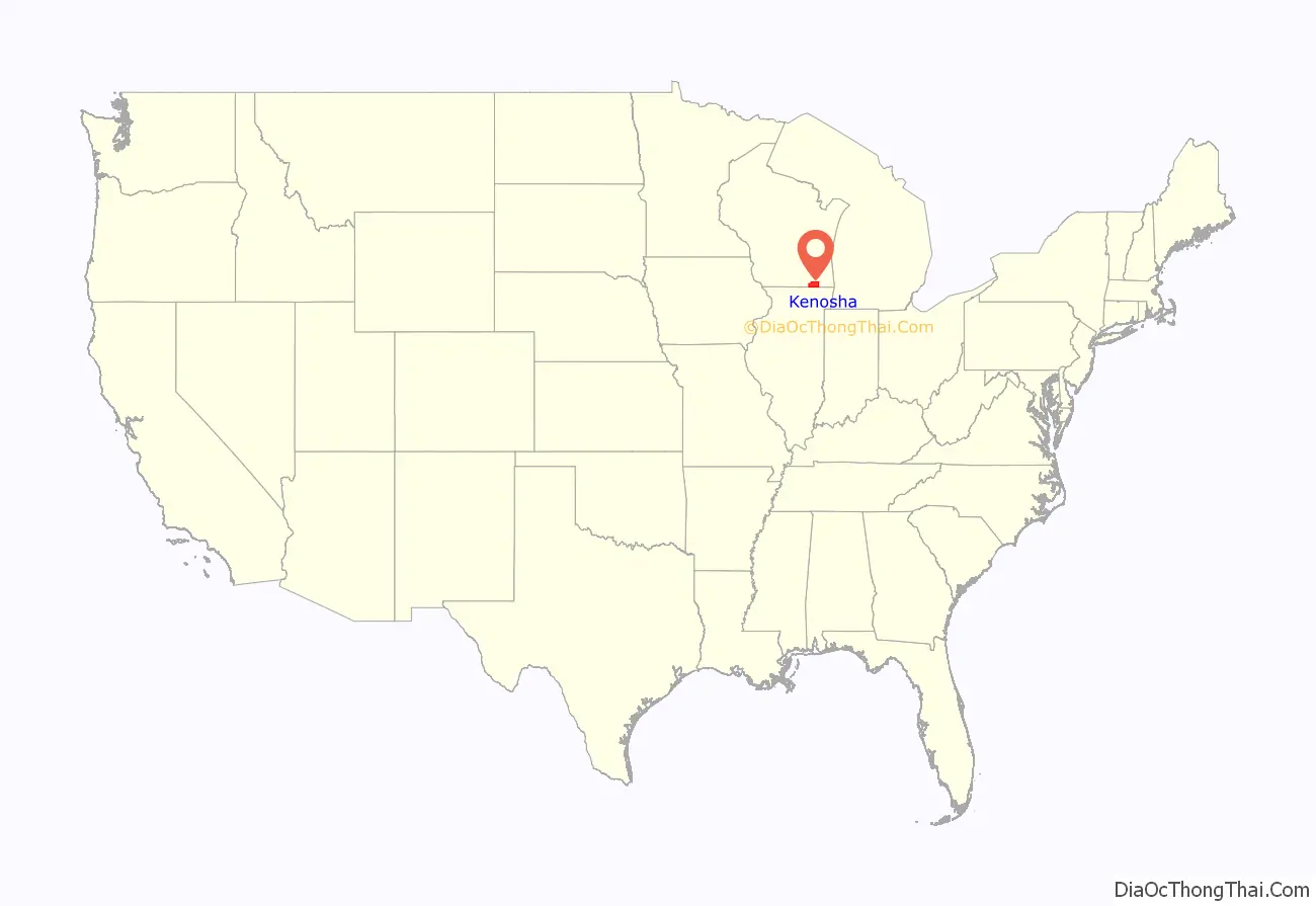
Kenosha County location map. Where is Kenosha County?
History
The Potowatomi inhabited the area that would become Kenosha County for centuries prior to the acquisition of the area in 1833. The city of Kenosha was founded in 1835, and Kenosha County was formed from Racine County on January 30, 1850. Its location led to development and factories being built in the 19th century. Manufacturing continued to be a key component of the economy into the 20th century.
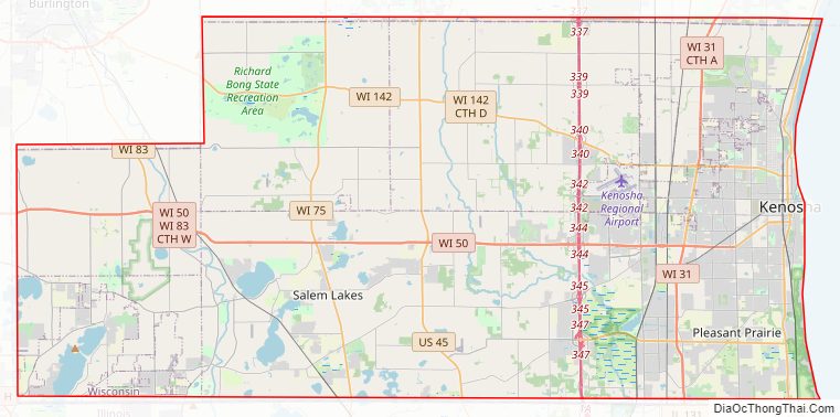
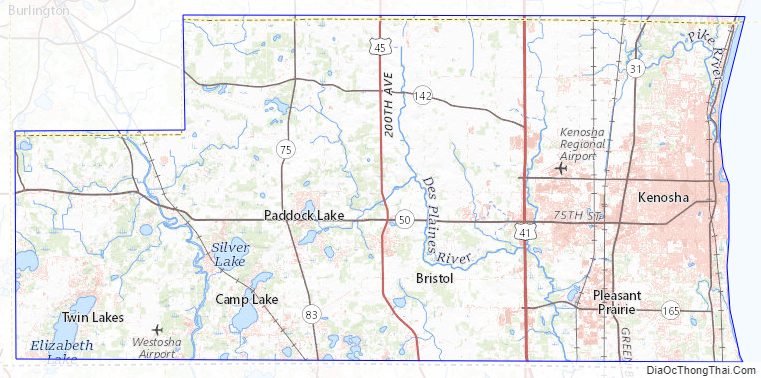
Kenosha County Road Map
Geography
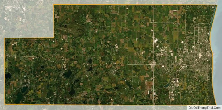
According to the U.S. Census Bureau, the county has a total area of 754 square miles (1,950 km), of which 272 square miles (700 km) is land and 482 square miles (1,250 km) (64%) is water. Although the county contains area from Lake Michigan, it is the fourth-smallest county in Wisconsin by land area.
Major highways
- Interstate 41
- Interstate 94
- U.S. Highway 41 (Skokie Highway)
- U.S. Highway 45
- Highway 31 (Wisconsin)
- Highway 32 (Wisconsin)
- Highway 50 (Wisconsin)
- Highway 75 (Wisconsin)
- Highway 83 (Wisconsin)
- Highway 142 (Wisconsin)
- Highway 158 (Wisconsin)
- Highway 165 (Wisconsin)
Railroads
- Canadian National
- Canadian Pacific
- Metra
- Union Pacific
- Kenosha station
- Kenosha Streetcar
Buses
- Kenosha Area Transit
- List of intercity bus stops in Wisconsin
Airport
Kenosha Regional Airport (KENW) serves the county and surrounding communities.
Adjacent counties
- Racine County (north)
- Allegan County, Michigan (east)
- Lake County, Illinois (south)
- McHenry County, Illinois (southwest)
- Walworth County (west)
Kenosha County Topographic Map
Kenosha County Satellite Map
Kenosha County Outline Map