Kenosha (/kəˈnoʊʃə/) is a city in the U.S. state of Wisconsin and the seat of Kenosha County. Per the 2020 census, the population was 99,986 which made it the fourth-largest city in Wisconsin. Situated on the southwestern shore of Lake Michigan, Kenosha is part of the Chicago metropolitan area as defined by the U.S. Census Bureau. Kenosha is located about halfway between Chicago and Milwaukee, and Interstate 94 connects Kenosha to both metropolitan areas.
Kenosha was once a center of industrial activity; it was home to large automotive factories which fueled its economy. Like some other Rust Belt cities, Kenosha lost these factories in the late 20th century, causing it to gradually transition into a services-based economy. In recent years, the city and surrounding county have benefited from increased job growth, and the city has worked on repairing roads and other infrastructure. It is home to the headquarters of the Fortune 1000 tool manufacturer Snap-on Inc., as well as the clothing company Jockey International. Kenosha is home to multiple educational institutions including the University of Wisconsin–Parkside, Carthage College, and Gateway Technical College. Residents of the city are called Kenoshans.
| Name: | Kenosha city |
|---|---|
| LSAD Code: | 25 |
| LSAD Description: | city (suffix) |
| State: | Wisconsin |
| County: | Kenosha County |
| Incorporated: | Kenosha, February 8, 1850 |
| Elevation: | 604 ft (184 m) |
| Total Area: | 28.45 sq mi (73.69 km²) |
| Land Area: | 28.36 sq mi (73.46 km²) |
| Water Area: | 0.09 sq mi (0.23 km²) |
| Total Population: | 99,986 |
| Population Density: | 3,684.1/sq mi (1,360.46/km²) |
| Area code: | 262 |
| FIPS code: | 5539225 |
| GNISfeature ID: | 1567416 |
| Website: | www.kenosha.org |
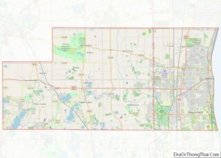
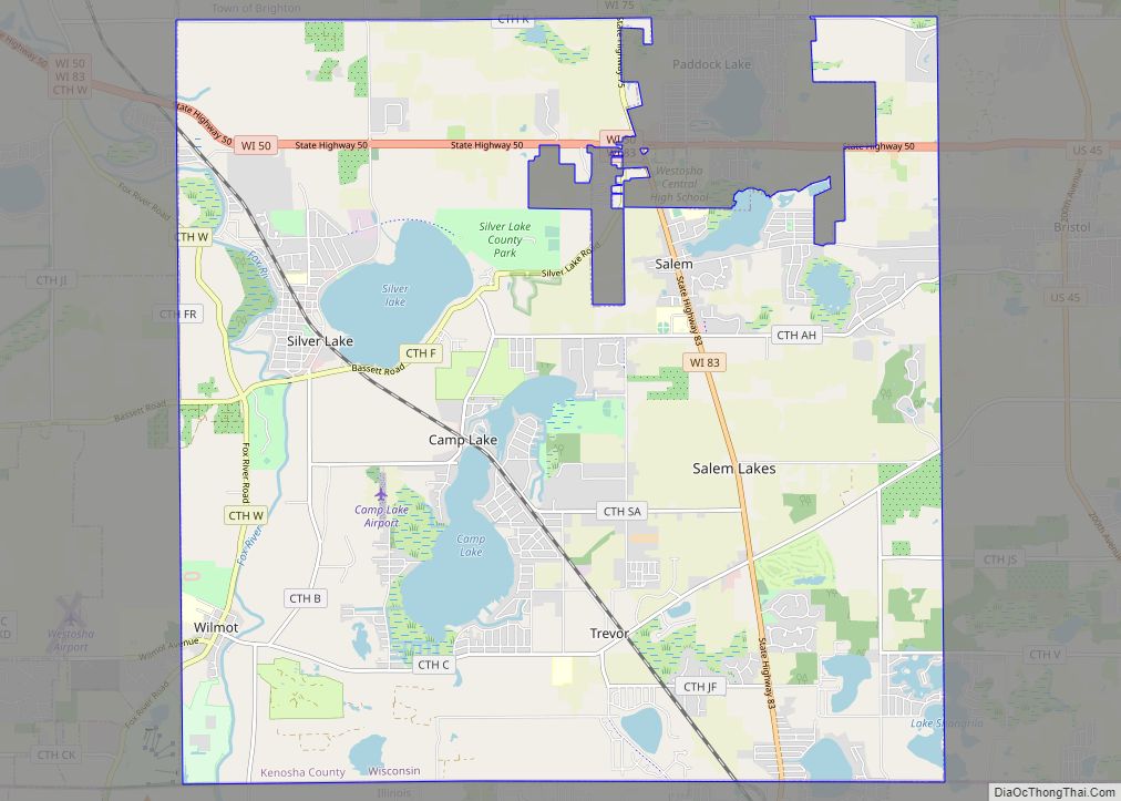
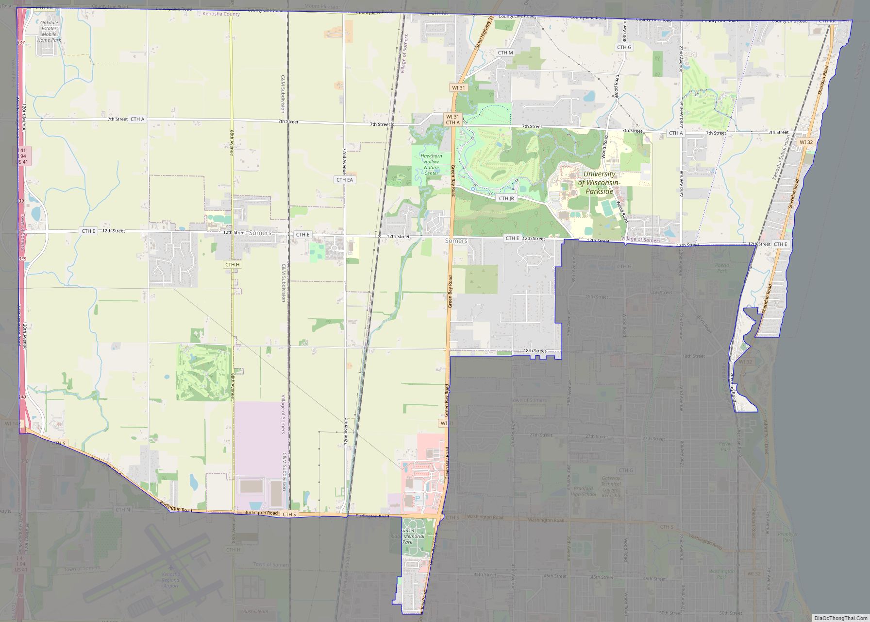
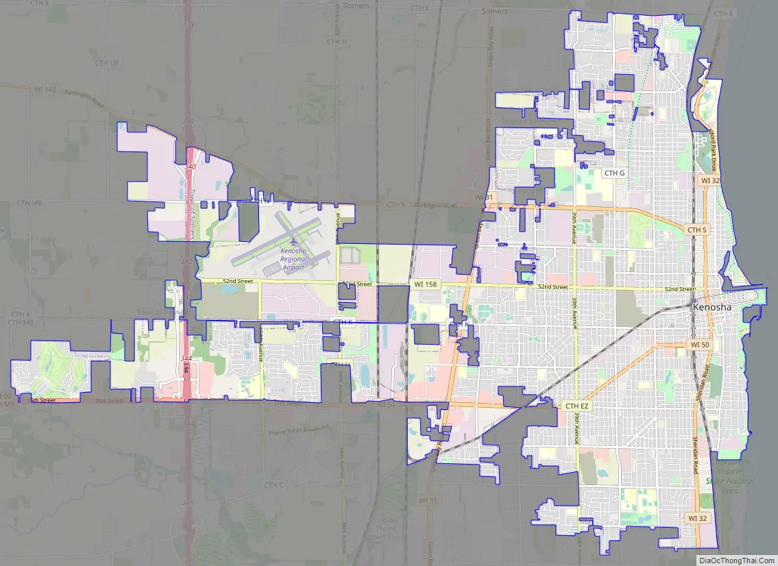
Online Interactive Map
Click on ![]() to view map in "full screen" mode.
to view map in "full screen" mode.
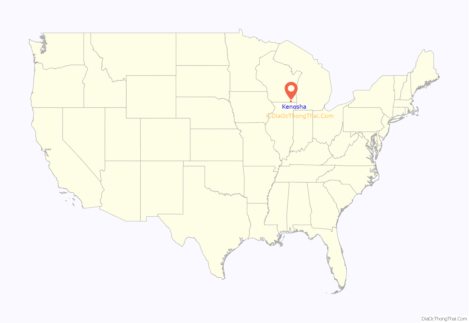
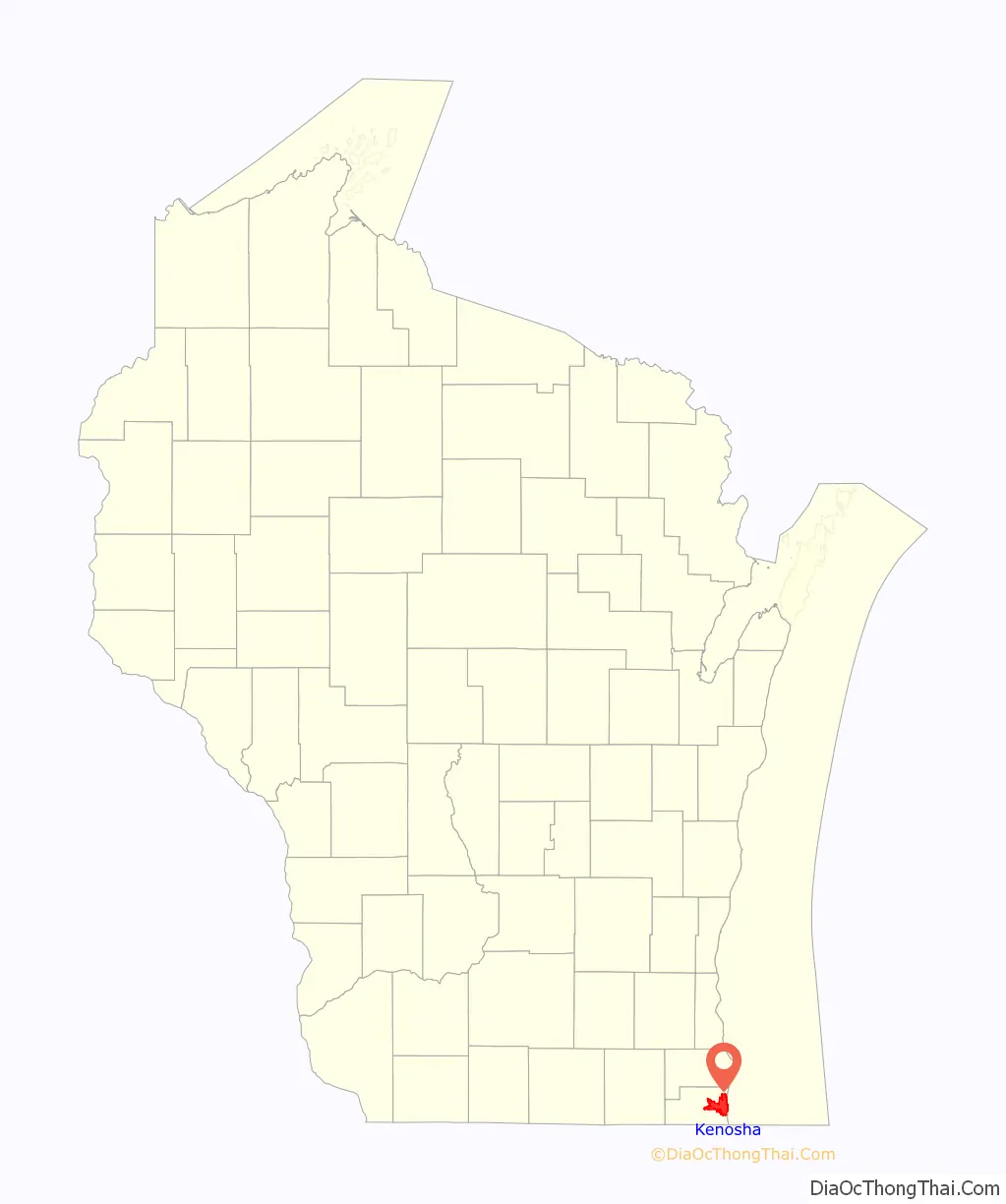
Kenosha location map. Where is Kenosha city?
History
The Potawatomi originally named the area Kenozia (also transcribed ginoozhe, kinoje) “place of the pike”, while the Menominee referred to the place as Kenūsīw, meaning “Northern Pike”. The early Ojibwa name is reported as Masu-kinoja “trout (pike) come all at once”. These refer to the annual spawning of trout, in which thousands of fish entered the rivers from Lake Michigan, providing food for the coming months.
Sites of early human habitation have been discovered in the Kenosha vicinity. It remains unclear if any sites pre-date the Clovis Culture but, if so, those sites would be contemporaneous with the Wisconsin glaciation. Paleo-Indians settled in the area at least 13,500 years ago.
European settlement
The first European settlers, part of the Western Emigration Company, arrived in the early 1830s, from Hannibal and Troy, New York, led by John Bullen, Jr., who sought to purchase enough land for a town. Thwarted in Milwaukee and Racine, the group arrived at Pike Creek on 6 June 1835, building log houses and later homes of frame, native stone, and brick. The first school and churches followed, with platting completed in 1836. As more settlers arrived and the first post office was established, the village was known as Pike Creek, then renamed Southport in 1837, a name which lives on as a southeast-side neighborhood, park, and elementary school, and has been adopted by several businesses.
The area became an important Great Lakes shipping port. In 1850, the village changed its name from Southport to Kenosha which is its current name. The name Kenosha was adapted from the Chippewa word kinoje (pike or pickerel).
Between 1902 and 1988, Kenosha produced millions of automobiles and trucks including makes and models such as Jeffery, Rambler, Nash, Hudson, LaFayette, and American Motors Corporation (AMC). In May 1954, Nash acquired Detroit-based Hudson and the new firm was named American Motors Corporation. A 47-acre (190,000 m) west side park and an elementary school are named for Charles W. Nash. A prototype steam car was built in Kenosha by the Sullivan-Becker engineering firm in 1900. Two years later, the Thomas B. Jeffery Company, builders of the Sterling bicycle, began production of the Rambler runabout. In 1902, Rambler and Oldsmobile were the first cars to employ mass-production techniques. The 1903 Rambler was also the first US-built production automobile to use a steering wheel, rather than the then-common tiller-controlled steering. Auto executive Charles W. Nash purchased Jeffery in 1916 and the new company became Nash Motors.
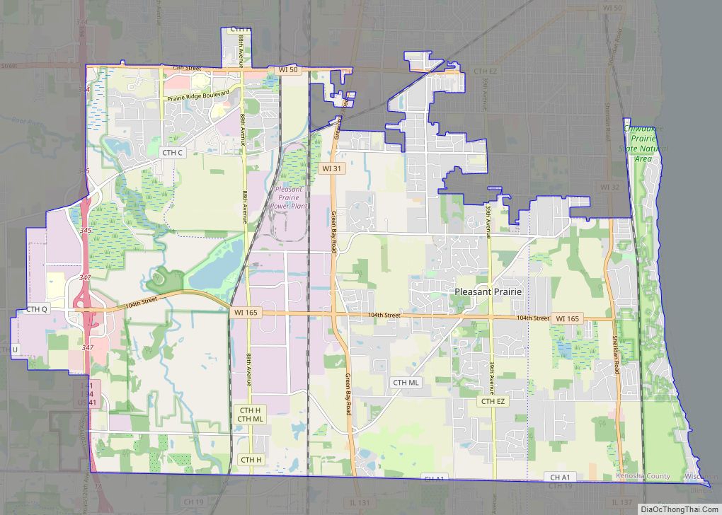
In 1973, residents in the Town of Pleasant Prairie sought to have territory annexed and rezoned to allow for the industrial development of agricultural property. In the ensuing legal battle between Kenosha and Pleasant Prairie, the town accused the city of improperly coercing or bribing agricultural property owners to file for rezoning and annexation in order to obtain city water and electric services that could not be provided by the town. The town argued that industrial development would jeopardize the town’s residential nature. The court found the annexation proper, with no illicit bribes or improper conduct by the city.
In partnership with French automaker Renault, AMC manufactured several models in Kenosha in the early 1980s, including the Alliance, which won the 1983 “Car of The Year” award from Motor Trend. Two decades earlier, AMC’s 1963 Rambler Classic had also received the award. In 1987, Renault sold its controlling interest in AMC to Chrysler Corporation, which had already contracted with AMC for the production of its M-body midsized cars at the Kenosha plant. The AMC Lakefront plant (1960–1988), a smaller facility, was demolished in 1990 (a chimney-demolition ceremony that June drew 10,000 spectators) and was redeveloped into HarborPark. The area now hosts lakeside condominiums, a large recreational marina, numerous parks and promenades, sculptures, fountains, the Kenosha Public Museum, and the Civil War Museum, all of which are connected by the Kenosha Electric Railway streetcar system.
From the beginning of the 20th century through the 1930s, Italian, Irish, Polish, and German immigrants, many of them skilled craftsmen, made their way to the city and contributed to the city’s construction, culture, architecture, music, and literature.
In June 1993, the city installed reproductions of the historic Sheridan LeGrande street lights that were specially designed for Kenosha by Westinghouse Electric in 1928; these can be seen on Sixth Avenue between 54th Street and 59th Place. A classic two-mile (3.2 km) downtown electric streetcar system was opened on June 17, 2000, and on September 22, 2014, the Kenosha city council approved a crosstown extension of the system incorporating the existing route between 48th and 61st Streets on both 6th and 8th Avenues.
On December 7, 2021, “Carl the Kenosha Turkey”, a turkey who became a social media sensation and local icon, was hit by a vehicle and killed. The turkey was named the city’s unofficial mascot in 2020 and was seen by some as a source of positivity as Kenosha faced hardships in 2020–2021.
August 2020 protests and unrest
In the aftermath of the August 2020 police shooting of Jacob Blake, protests, riots, and civil unrest occurred in Kenosha. Demonstrations were marked by daily peaceful protesting followed by confrontations with law enforcement and rioting, looting, vandalism, and arson at night. A state of emergency was declared on August 23, and the National Guard was activated the following day. On August 25, a controversial shooting occurred during the unrest, leading to a polarized response. Both then-President Donald Trump and then-Presidential candidate Joe Biden visited Kenosha.
Protests continued daily through August 29 with approximately 2,000 members of the National Guard assisting the city in restoring order. Damages exceeding $50 million occurred with over 100 businesses affected.
In November 2021, Kenosha once again became the subject of worldwide attention as the jury trial of Kyle Rittenhouse, the defendant in the 2020 unrest shooting, commenced. As part of the city’s emergency preparedness, over 500 members of the National Guard were activated ahead of the verdict. Judge Bruce Schroeder dismissed Rittenhouse’s unlawful possession charge and the curfew violation charge for being legally unsupported, and a unanimous jury found Rittenhouse not guilty of the remaining charges. Following the verdict on November 19, some protests occurred in Kenosha but remained peaceful.
Historic districts
Kenosha has 21 locations and four districts (Library Park Historic District, Third Avenue Historic District, Civic Center Historic District, and Pearl Street Historic District) listed on the National Register of Historic Places. The city has a Kenosha Landmarks Commission, and among the many local city-designated landmarks are the 1929 YMCA, the Manor House, the John McCaffary House, the St. Matthew Episcopal Church, the Washington Park Clubhouse, and the Justin Weed House.
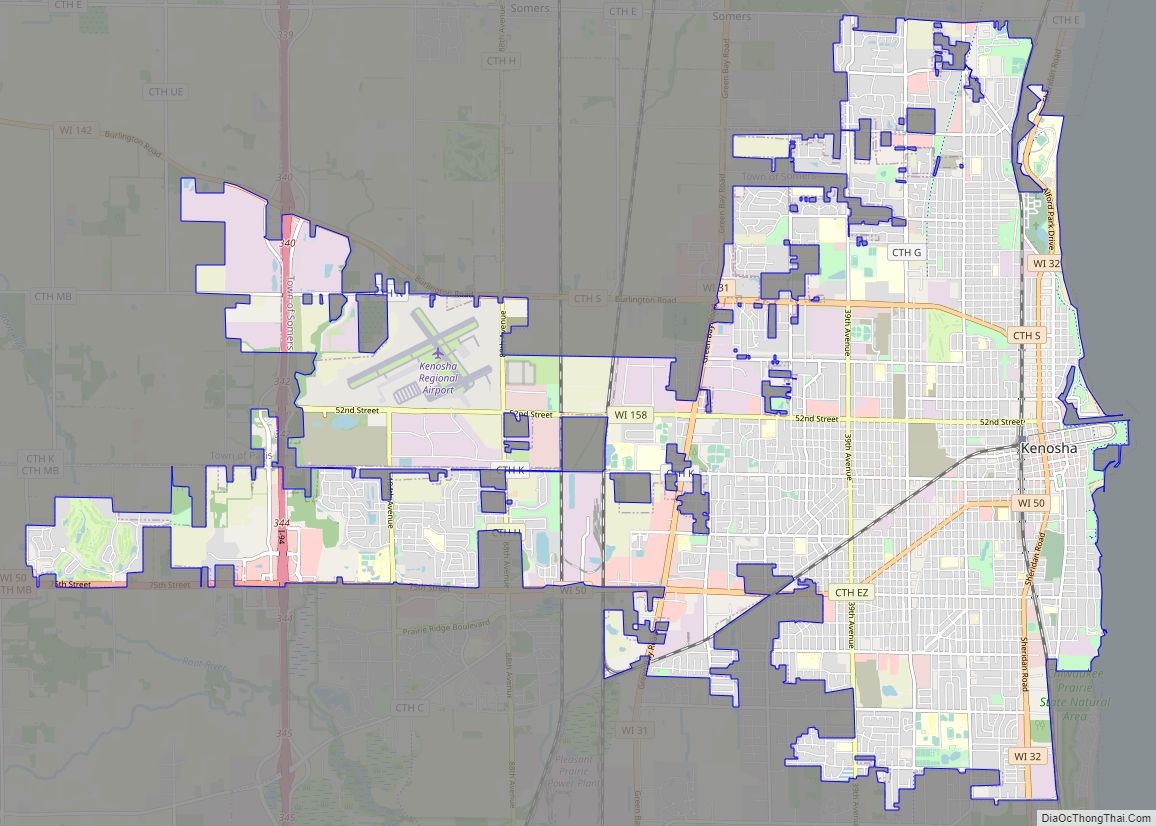
Kenosha Road Map
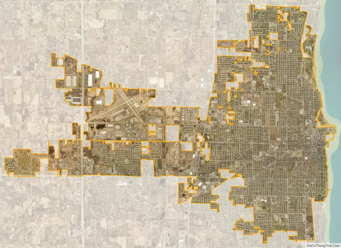
Kenosha city Satellite Map
Geography
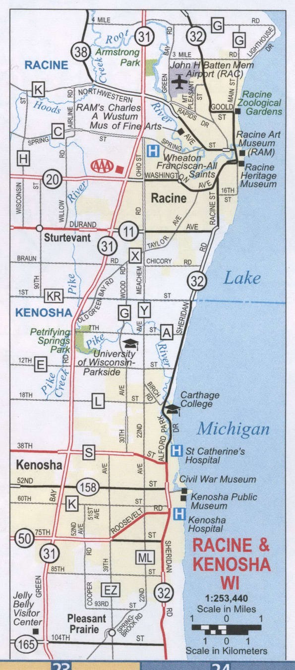
Kenosha is in southeastern Wisconsin, bordered by Lake Michigan to the east, the village of Somers to the north, the village of Bristol to the west, and the village of Pleasant Prairie to the south. Kenosha’s passenger train station is the last stop on Chicago’s Union Pacific North Metra Line. Kenosha is 32 miles south of Milwaukee and 49 miles north of Chicago.
According to the United States Census Bureau, the city has a total area of 27.03 square miles (70.01 km), of which, 26.93 square miles (69.75 km) is land and 0.10 square miles (0.26 km) is water.
Neighborhoods
Kenosha is home to a mixture of blue and white collar workers as well as students who attend the local universities. Kenosha consists of neighborhoods divided into three regions – Downtown, Uptown, and West of I-94 (referred to by locals at “West of the I” or simply “the county”). The city’s northside is home to both UW-Parkside and Carthage College.
Kenosha’s downtown is located along the Lake Michigan shoreline and consists of government buildings, parks, beaches, restaurants, shops, museums, and entertainment venues. The neighborhood of HarborPark is both a residential and commercial area. Directly south of the Downtown area is the neighborhood of Allendale.
Uptown Kenosha consists of a largely blue-collar population and is a mixture of locally owned businesses and residential areas. The neighborhood was heavily impacted by the damage caused during the August 2020 unrest but there are continued plans for ongoing development of the area. Prominent Uptown neighborhoods include Brass, Lincoln Park, and Wilson Heights.
Climate
Kenosha has a humid continental climate (Köppen Dfa, bordering on Dfb) with warm summers and cold winters. The record high is 105 °F (41 °C), set in July 2012. The record low is −31 °F (−35 °C) set in January 1985.
See also
Map of Wisconsin State and its subdivision:- Adams
- Ashland
- Barron
- Bayfield
- Brown
- Buffalo
- Burnett
- Calumet
- Chippewa
- Clark
- Columbia
- Crawford
- Dane
- Dodge
- Door
- Douglas
- Dunn
- Eau Claire
- Florence
- Fond du Lac
- Forest
- Grant
- Green
- Green Lake
- Iowa
- Iron
- Jackson
- Jefferson
- Juneau
- Kenosha
- Kewaunee
- La Crosse
- Lafayette
- Lake Michigan
- Lake Superior
- Langlade
- Lincoln
- Manitowoc
- Marathon
- Marinette
- Marquette
- Menominee
- Milwaukee
- Monroe
- Oconto
- Oneida
- Outagamie
- Ozaukee
- Pepin
- Pierce
- Polk
- Portage
- Price
- Racine
- Richland
- Rock
- Rusk
- Saint Croix
- Sauk
- Sawyer
- Shawano
- Sheboygan
- Taylor
- Trempealeau
- Vernon
- Vilas
- Walworth
- Washburn
- Washington
- Waukesha
- Waupaca
- Waushara
- Winnebago
- Wood
- Alabama
- Alaska
- Arizona
- Arkansas
- California
- Colorado
- Connecticut
- Delaware
- District of Columbia
- Florida
- Georgia
- Hawaii
- Idaho
- Illinois
- Indiana
- Iowa
- Kansas
- Kentucky
- Louisiana
- Maine
- Maryland
- Massachusetts
- Michigan
- Minnesota
- Mississippi
- Missouri
- Montana
- Nebraska
- Nevada
- New Hampshire
- New Jersey
- New Mexico
- New York
- North Carolina
- North Dakota
- Ohio
- Oklahoma
- Oregon
- Pennsylvania
- Rhode Island
- South Carolina
- South Dakota
- Tennessee
- Texas
- Utah
- Vermont
- Virginia
- Washington
- West Virginia
- Wisconsin
- Wyoming