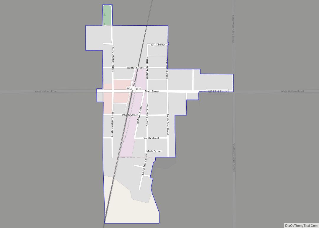
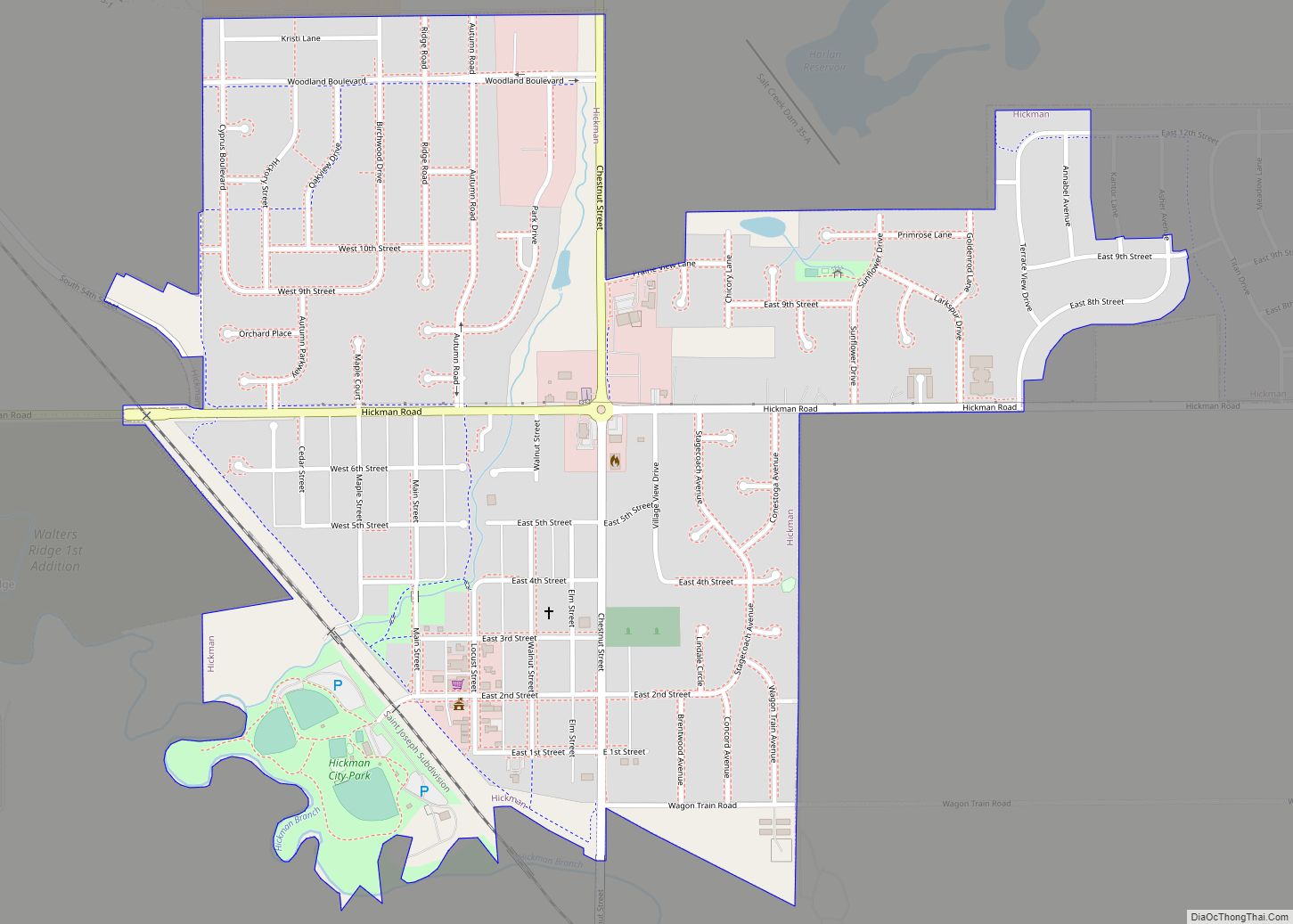
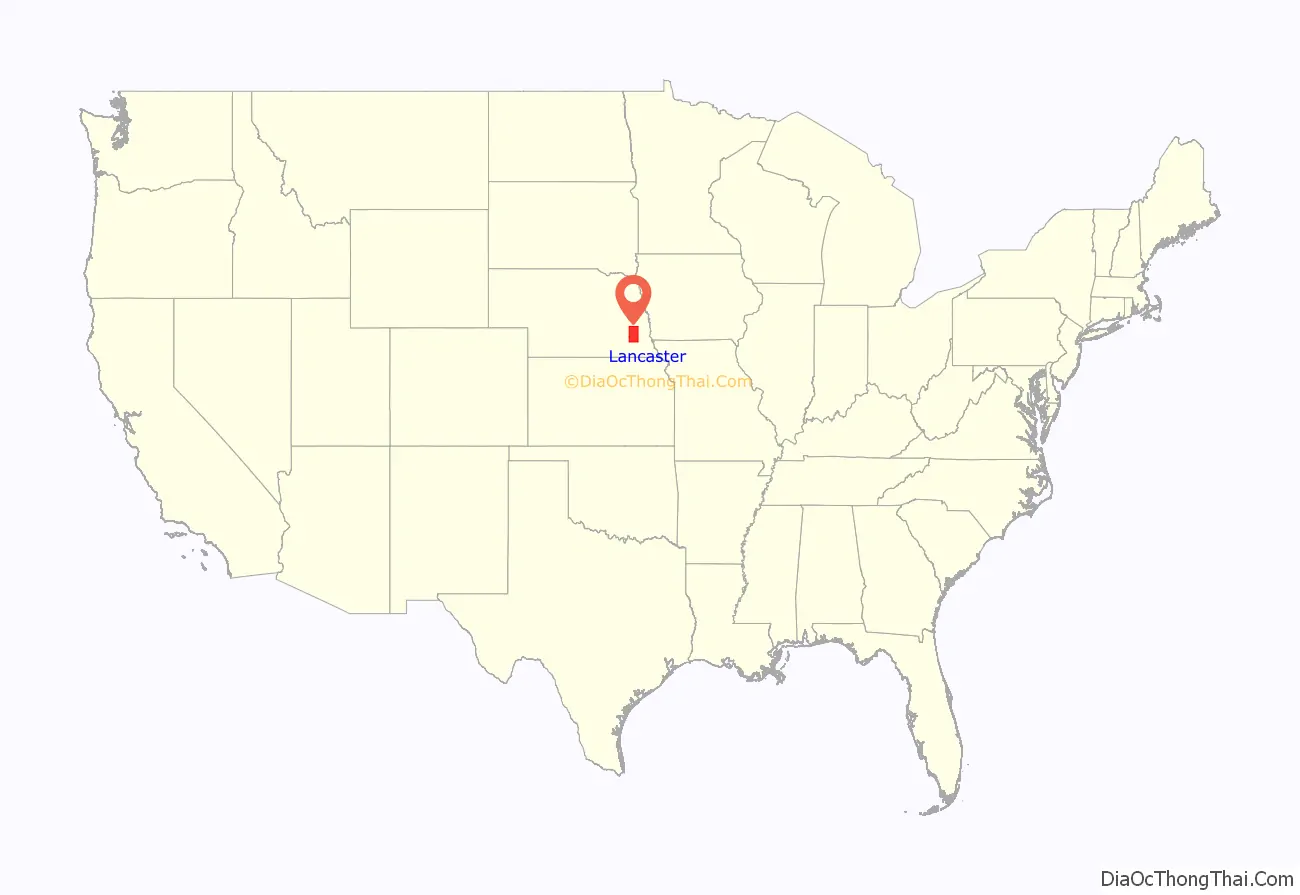
Lancaster County is a county located in the U.S. state of Nebraska. As of the 2020 United States Census, the population was 322,608, making it the second-most populous county in Nebraska. Its county seat is Lincoln, the state capital. The county was created in 1859.
Lancaster County is part of the Lincoln, NE Metropolitan Statistical Area.
In the Nebraska license plate system, Lancaster County was represented by the prefix 2 (it had the second-largest number of vehicles registered in the state when the license plate system was established in 1922). In 2002, the state discontinued the 1922 system in Lancaster, Douglas and Sarpy counties.
| Name: | Lancaster County |
|---|---|
| FIPS code: | 31-109 |
| State: | Nebraska |
| Founded: | 1859 |
| Named for: | Lancaster, England |
| Seat: | Lincoln |
| Largest city: | Lincoln |
| Total Area: | 846 sq mi (2,190 km²) |
| Land Area: | 838 sq mi (2,170 km²) |
| Total Population: | 324,514 |
| Population Density: | 375/sq mi (145/km²) |
| Time zone: | UTC−6 (Central) |
| Summer Time Zone (DST): | UTC−5 (CDT) |
| Website: | lancaster.ne.gov |
Lancaster County location map. Where is Lancaster County?
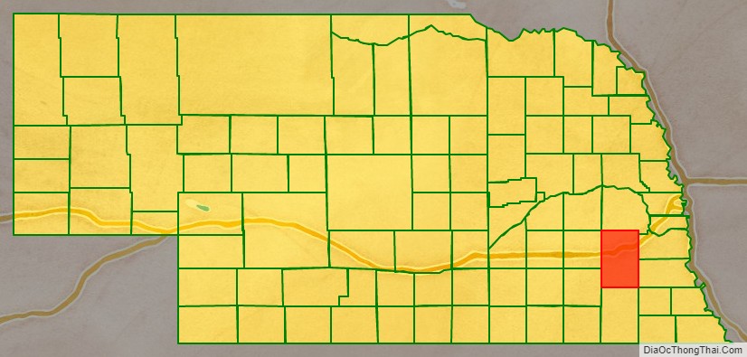
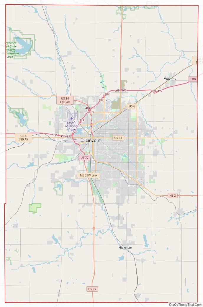
Lancaster County Road Map
Geography
According to the US Census Bureau, the county has a total area of 846 square miles (2,190 km), of which 838 square miles (2,170 km) is land and 8.8 square miles (23 km) (1.0%) is water.
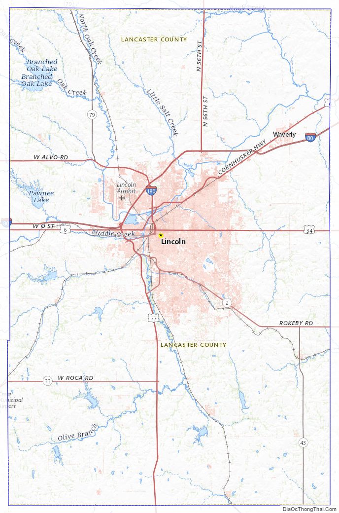
Major highways
- Interstate 80
- Interstate 180
- U.S. Highway 6
- U.S. Highway 34
- U.S. Highway 77
- Nebraska Highway 2
- Nebraska Highway 33
- Nebraska Highway 43
- Nebraska Highway 79
Climate
In 2004, Lancaster County was named a StormReady county by the National Weather Service.
Adjacent counties
- Saunders County – north
- Cass County – northeast
- Otoe County – southeast
- Johnson County – southeast
- Gage County – south
- Saline County – southwest
- Seward County – northwest
- Butler County – northwest
Protected areas
- Bluestem Lake State Recreation Area
- Branched Oak State Recreation Area
- Conestoga Lake State Recreation Area
- Frank Shoemaker Marsh (part of Lincoln Parks & Recreation System)
- Holmes Lake Recreation Area
- Olive Creek Lake State Recreation Area
- Pawnee State Recreation Area
- Pioneers Park Nature Center
- Stagecoach Lake State Recreation Area
- Wagon Train Lake State Recreation Area
- Wildwood Lake State Wildlife Management Area
- Yankee Hill State Wildlife Management Area
Lancaster County Topographic Map
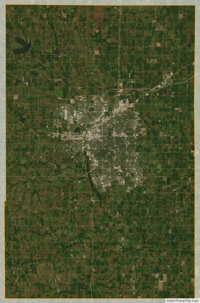
Lancaster County Satellite Map
Lancaster County Outline Map