Seward County is a county in the U.S. state of Nebraska. As of the 2010 United States Census, the population was 16,750. Its county seat is Seward. The county was formed in 1855, and was organized in 1867. It was originally called Greene County, and in 1862 it was renamed for William H. Seward, United States Secretary of State under Abraham Lincoln and Andrew Johnson. Seward County is part of the Lincoln, NE Metropolitan Statistical Area.
In the Nebraska license plate system, Seward County is represented by the prefix 16 (it had the sixteenth-largest number of vehicles registered in the county when the license plate system was established in 1922).
| Name: | Seward County |
|---|---|
| FIPS code: | 31-159 |
| State: | Nebraska |
| Founded: | 1855 |
| Named for: | William H. Seward |
| Seat: | Seward |
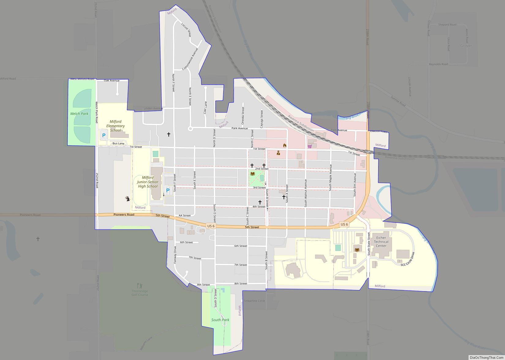
| Largest city: | Seward |
| Total Area: | 576 sq mi (1,490 km²) |
| Land Area: | 571 sq mi (1,480 km²) |
| Total Population: | 17,603 |
| Population Density: | 30.1/sq mi (11.6/km²) |
| Time zone: | UTC−6 (Central) |
| Summer Time Zone (DST): | UTC−5 (CDT) |
| Website: | countyofsewardne.com |
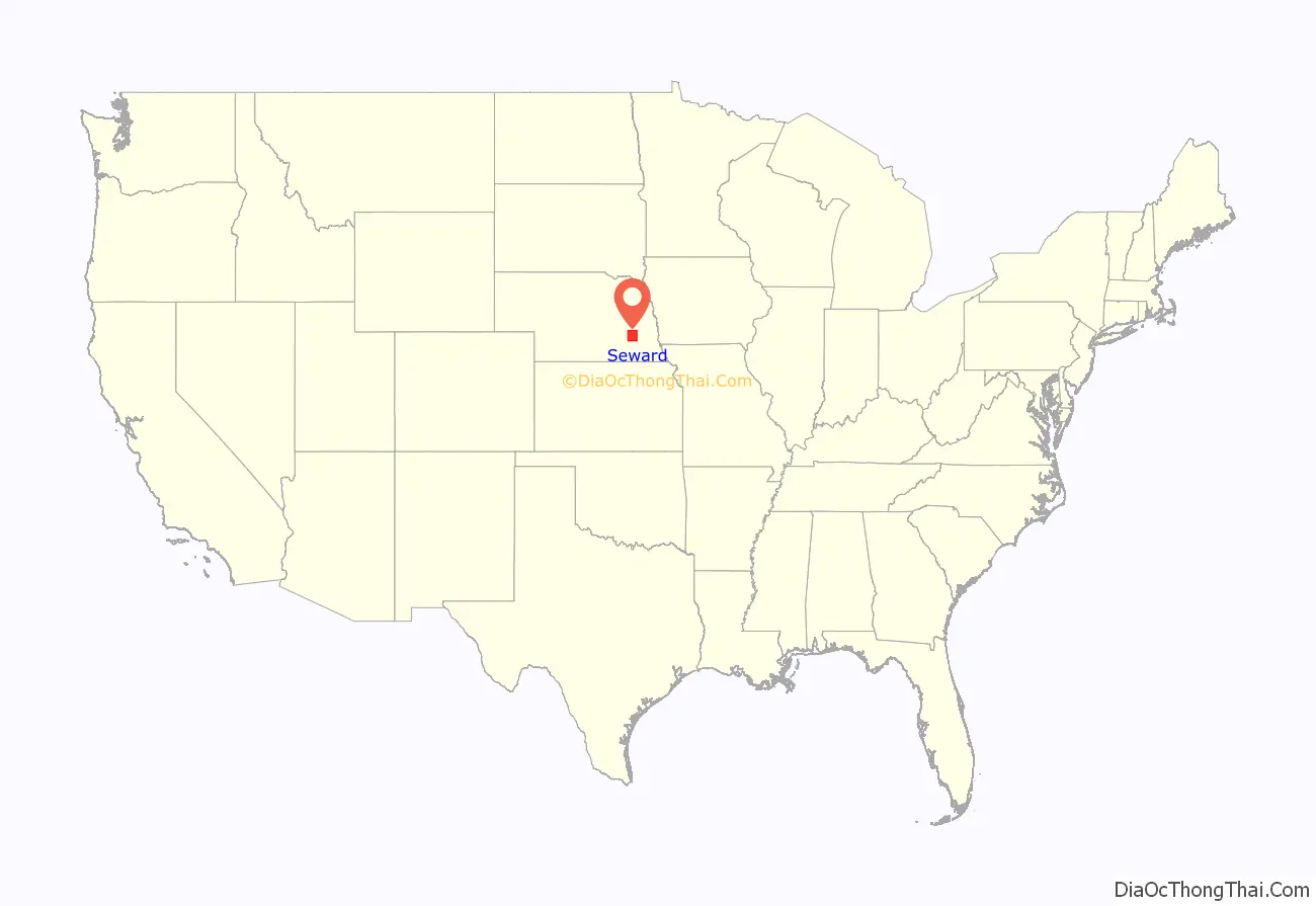
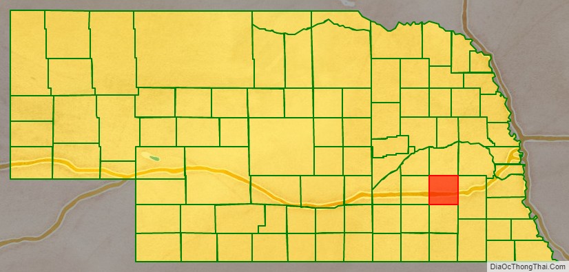
Seward County location map. Where is Seward County?
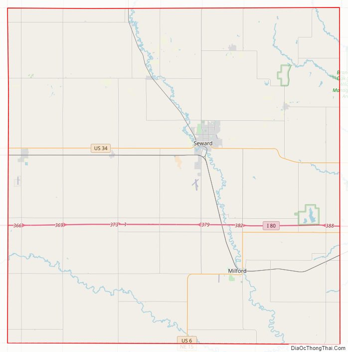
Seward County Road Map
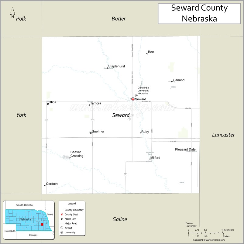
Geography
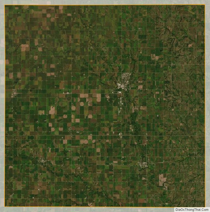
The Seward County terrain consists of low rolling hills, largely dedicated to agriculture including center pivot irrigation. The Big Blue River flows south-southeasterly through the central part of the county. The county has a total area of 576 square miles (1,490 km), of which 571 square miles (1,480 km) is land and 4.5 square miles (12 km) (0.8%) is water.
Major highways
- Interstate 80
- U.S. Highway 6
- U.S. Highway 34
- Nebraska Highway 15
- Nebraska Highway 103
Adjacent counties
- Butler County – north
- Lancaster County – east
- Saline County – south
- Fillmore County – southwest
- York County – west
- Polk County – northwest
Protected areas
- Bur Oak State Wildlife Management Area
- Freeman Lakes Waterfowl Production Area
- North Lake Basin State Wildlife Management Area
- Oak Glen State Wildlife Management Area
- Tamora Waterfowl Production Area
Seward County Topographic Map
Seward County Satellite Map
Seward County Outline Map