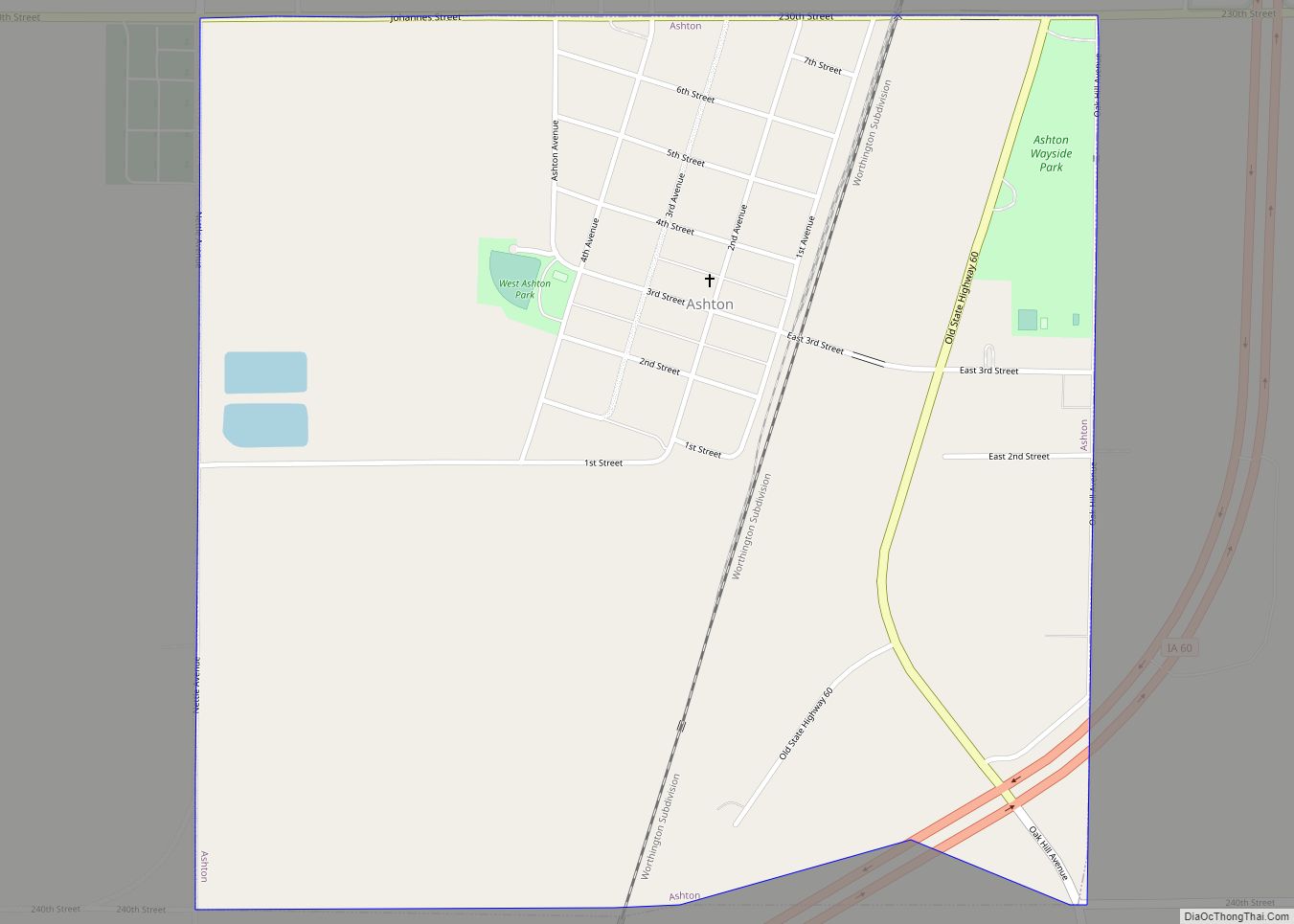
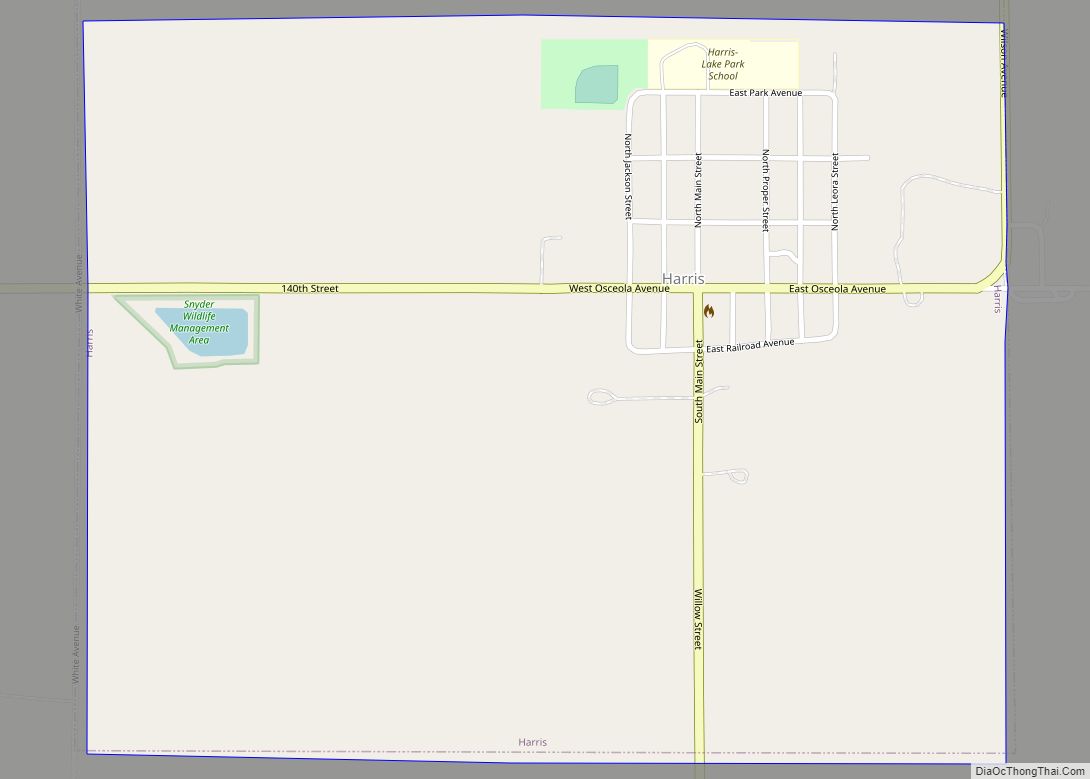
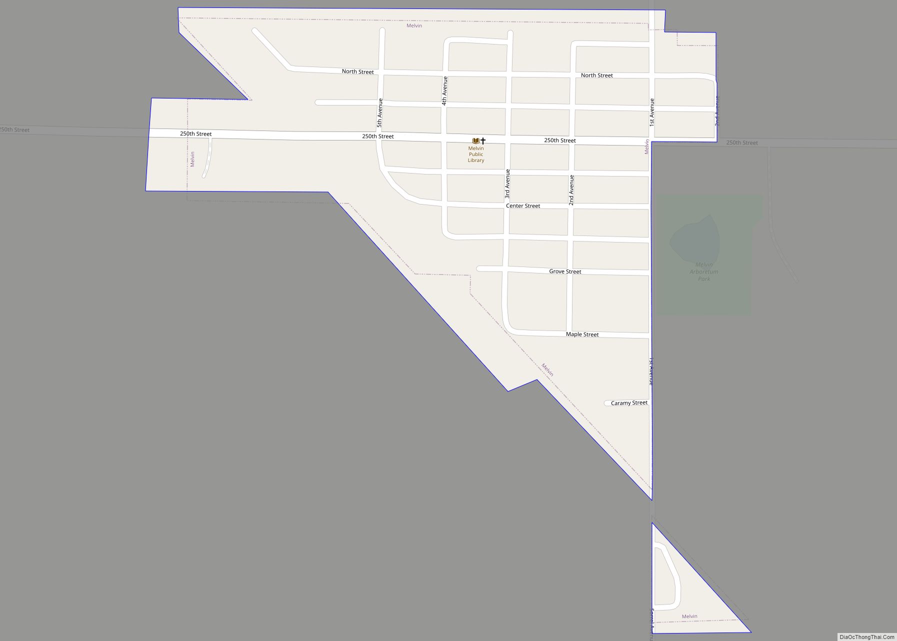
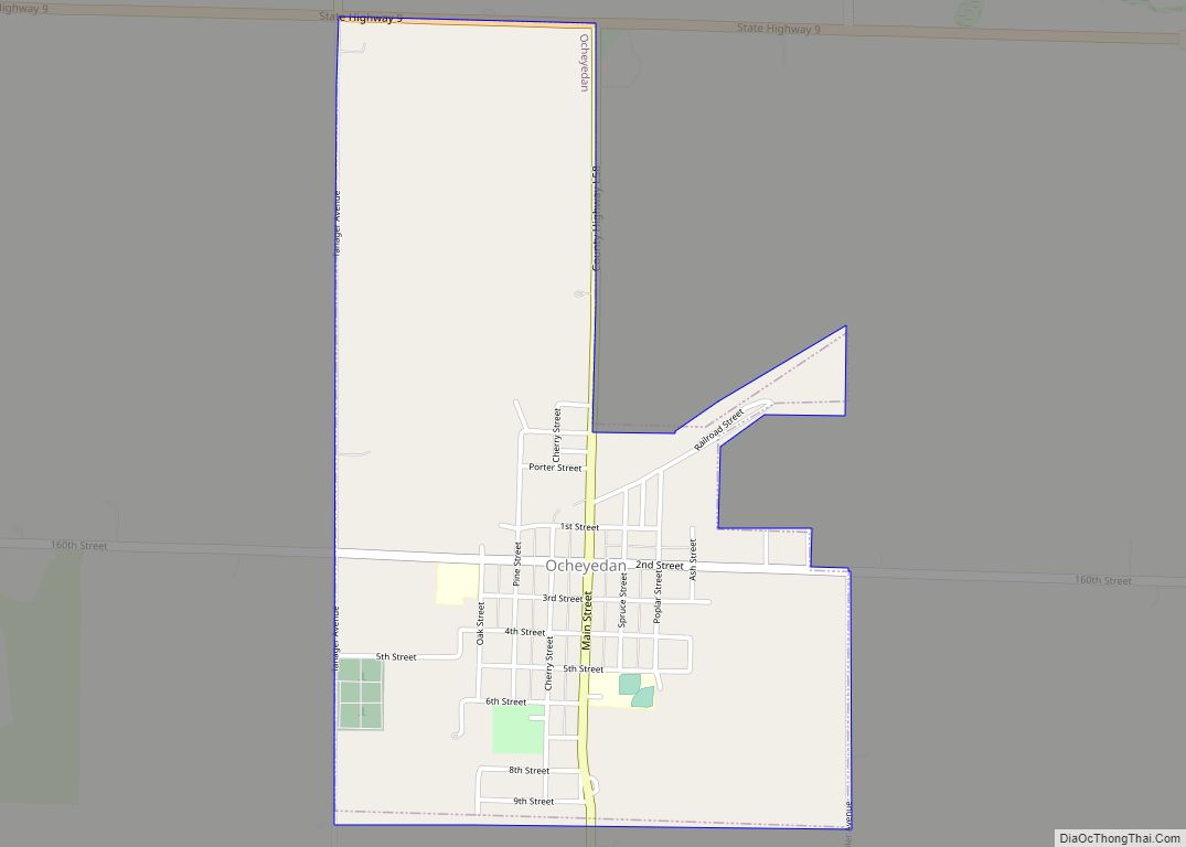
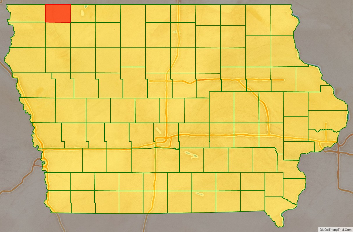
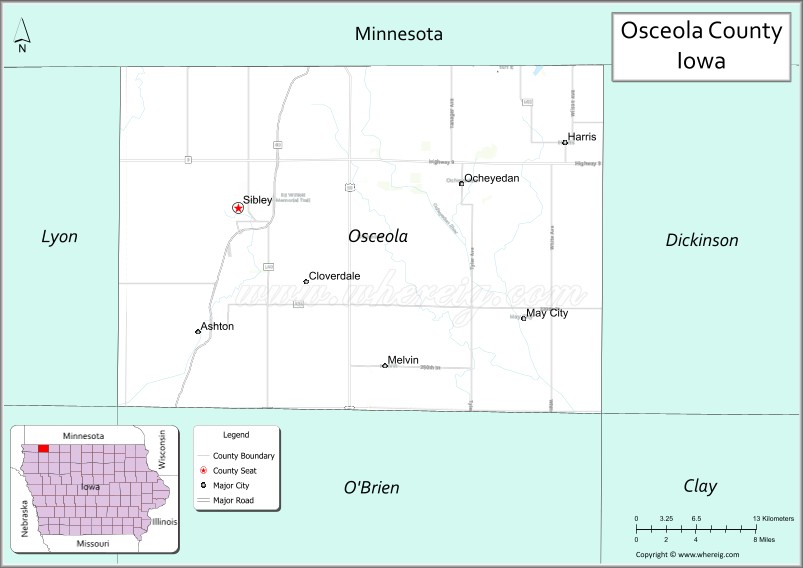
Osceola County (/ˌɒsiˈoʊlə/ AH-see-OH-lə) is a county located in the U.S. state of Iowa. As of the 2020 census the population was 6,192, making it the state’s fifth-least populous county. It is named for Seminole war chief Osceola. The county seat is Sibley, named for H. H. Sibley of Minnesota.
| Name: | Osceola County |
|---|---|
| FIPS code: | 19-143 |
| State: | Iowa |
| Founded: | 1871 |
| Named for: | Osceola |
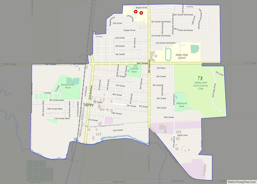
| Seat: | Sibley |
| Largest city: | Sibley |
| Total Area: | 399 sq mi (1,030 km²) |
| Land Area: | 399 sq mi (1,030 km²) |
| Total Population: | 6,192 |
| Population Density: | 16/sq mi (6.0/km²) |
| Time zone: | UTC−6 (Central) |
| Summer Time Zone (DST): | UTC−5 (CDT) |
| Website: | osceolacountyia.gov |
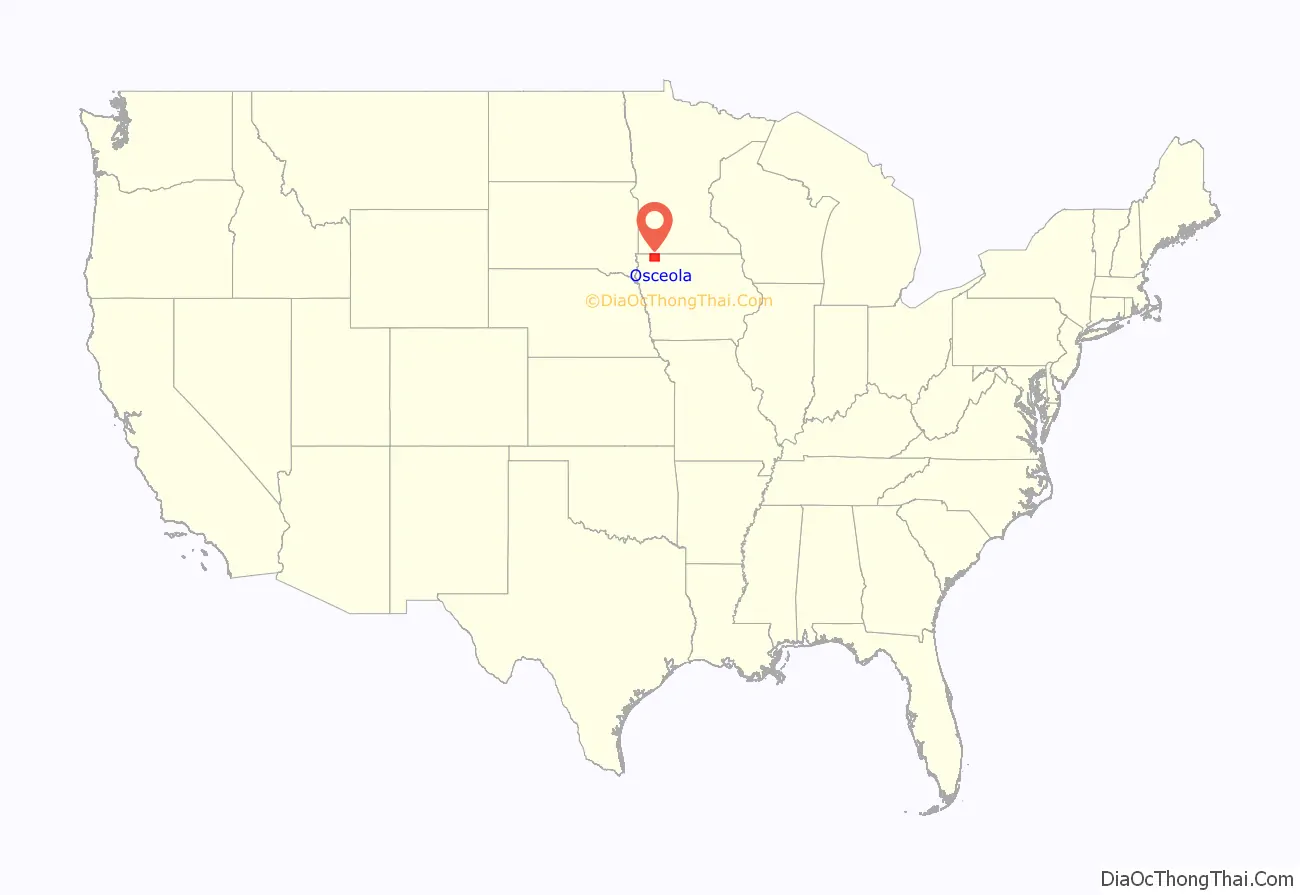
Osceola County location map. Where is Osceola County?
History
Osceola County was formed in 1871. It was named after the eponymous chief of the Seminole. It is the smallest and most recent county in Iowa. In the same year the first settler arrived, Captain Eldred Huff, and laid his claim. On January 1, 1872, the county government conferred for the first time. The first courthouse, constructed of wood, was built in November of the following year and simultaneously served as the conference chamber, school and church. In September 1903, the second courthouse was finished and was wired for electricity in October, 1915.
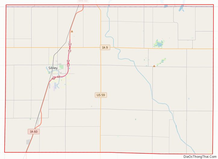
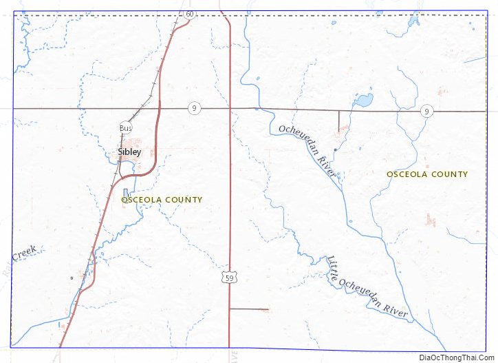
Osceola County Road Map
Geography
According to the U.S. Census Bureau, the county has a total area of 399 square miles (1,030 km), of which 399 square miles (1,030 km) is land and 0.7 square miles (1.8 km) (0.2%) is water. It is the third-smallest county in Iowa by land area and smallest by total area. The highest natural point in Iowa, Hawkeye Point at 1,670 feet (509 m), is located in Osceola County.
Major highways
- U.S. Highway 59
- Iowa Highway 9
- Iowa Highway 60
Adjacent counties
- Nobles County, Minnesota (northwest)
- Jackson County, Minnesota (northeast)
- Dickinson County (east)
- O’Brien County (south)
- Lyon County (west)
Osceola County Topographic Map
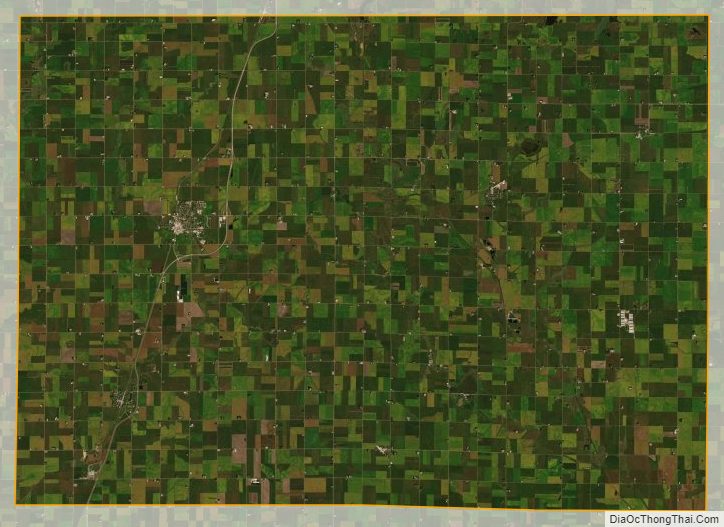
Osceola County Satellite Map
Osceola County Outline Map