Minnesota (/ˌmɪnɪˈsoʊtə/ (listen)) is a state in the Upper Midwestern region of the United States. It is the 12th largest U.S. state in area and the 22nd most populous, with over 5.75 million residents. Minnesota is home to western prairies, now given over to intensive agriculture; deciduous forests in the southeast, now partially cleared, farmed, and settled; and the less populated North Woods, used for mining, forestry, and recreation. Roughly a third of the state is covered in forests, and it is known as the “Land of 10,000 Lakes” for having over 14,000 bodies of fresh water covering at least ten acres. More than 60% of Minnesotans live in the Minneapolis–Saint Paul metropolitan area, known as the “Twin Cities”, the state’s main political, economic, and cultural hub. With a population of about 3.7 million, the Twin Cities is the 16th largest metropolitan area in the U.S. Other minor metropolitan and micropolitan statistical areas in the state include Duluth, Mankato, Moorhead, Rochester, and St. Cloud.
Minnesota, which gets its name from the Dakota language, has been inhabited by various indigenous peoples since the Woodland period of the 11th century BCE. Between roughly 200 and 500 CE, two areas of the indigenous Hopewell tradition emerged: the Laurel complex in the north, and Trempealeau Hopewell in the Mississippi River Valley in the south. The Upper Mississippian culture, consisting of the Oneota people and other Siouan speakers, emerged around 1000 CE and lasted through the arrival of Europeans in the 17th century. French explorers and missionaries were the earliest Europeans to enter the region, encountering the Dakota, Ojibwe, and various Anishinaabe tribes. Much of what is now Minnesota formed part of the vast French holding of Louisiana, which the United States purchased in 1803. After several territorial reorganizations, the Minnesota Territory was admitted to the Union as the 32nd state in 1858. Minnesota’s official motto, L’Étoile du Nord, is the only state motto in French; meaning “The Star of the North”, it was adopted shortly after statehood and reflects both the state’s early French explorers and its position as the northernmost state in the contiguous U.S.
As part of the American frontier, Minnesota attracted settlers and homesteaders from across the country, with its growth initially centered on timber, agriculture, and railroad construction. Into the early 20th century, European immigrants arrived in significant numbers, particularly from Scandinavia, Germany, and Central Europe; many were linked to the failed revolutions of 1848, which partly influenced the state’s development as a center of labor and social activism. Minnesota’s rapid industrialization and urbanization precipitated major social, economic, and political changes in the late 19th and early 20th centuries; the state was at the forefront of labor rights, women’s suffrage, and political reform. Minnesota is considered Democratic-leaning, having voted for every Democratic presidential nominee since 1976, longer than any other U.S. state.
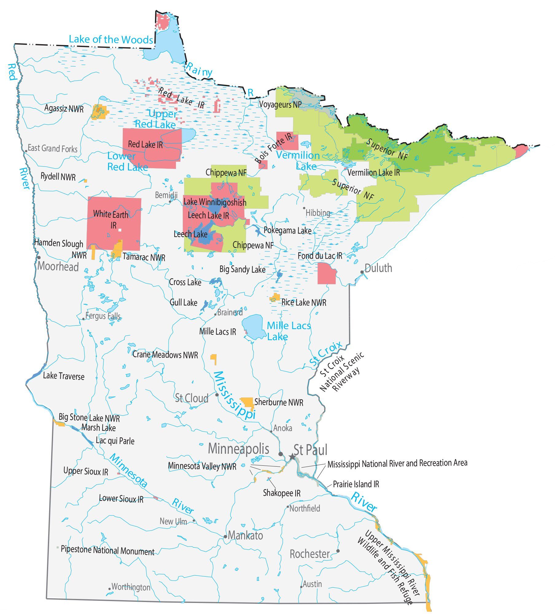
Since the late 20th century, the core of Minnesota’s economy has diversified, shifting from traditional industries such as agriculture and resource extraction to services, finance, and health care; it is consequently one of the richest in terms of GDP and per capita income. The state is home to 11 federally recognized Native American reservations (seven Ojibwe, four Dakota), and remains a center of Scandinavian and German cultures with an influence of Lutheranism. In more recent decades, Minnesota has become more multicultural, driven by both larger domestic migration and immigration from Latin America, Asia, the Horn of Africa, and the Middle East; the state has the nation’s largest population of Somali Americans and second largest Hmong population. Minnesota’s standard of living and level of education are among the highest in the U.S., and it is ranked among the best states in metrics such as employment, median income, safety, and governance.
| Before statehood: | Minnesota Territory |
|---|---|
| Admitted to the Union: | May 11, 1858 (32nd State in the Union) |
| Capital: | Saint Paul |
| Largest city: | Minneapolis |
| Largest metro and urban areas: | Minneapolis–Saint Paul |
| Elevation: | 1,200 ft (370 m) |
| Total Area: | 86,935.83 sq mi (225,163 km) |
| Area Rank: | 12th |
| Total Population: | 5,717,184 |
| Population Rank: | 22nd |
| Population Density: | 68.9/sq mi (26.6/km) |
| Population Density Rank: | 36th (2020 census) |
| Median Household Income: | $74,593 |
| Income Rank: | 13th |
| Demonym(s): | Minnesotan |
| USPS abbreviation: | MN |
| ISO 3166 code: | US-MN |
| Website: | mn.gov |
Online Interactive Map
Click on ![]() to view map in "full screen" mode.
to view map in "full screen" mode.
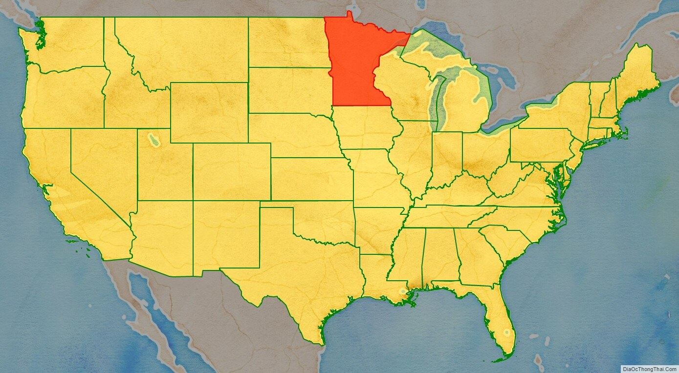
Minnesota location map. Where is Minnesota state?
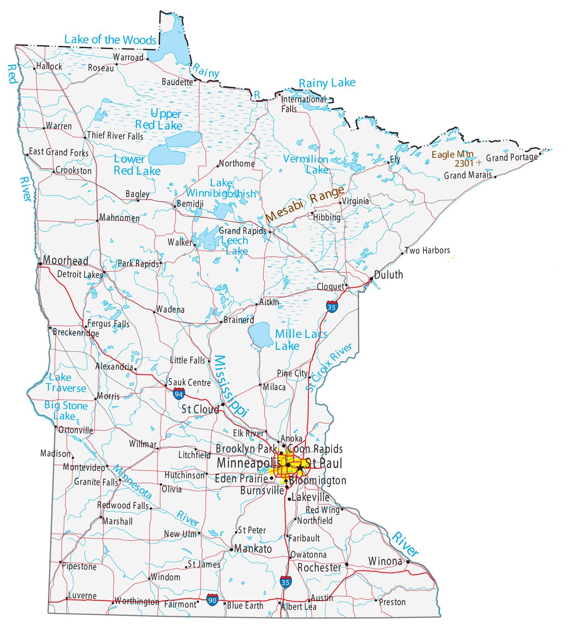
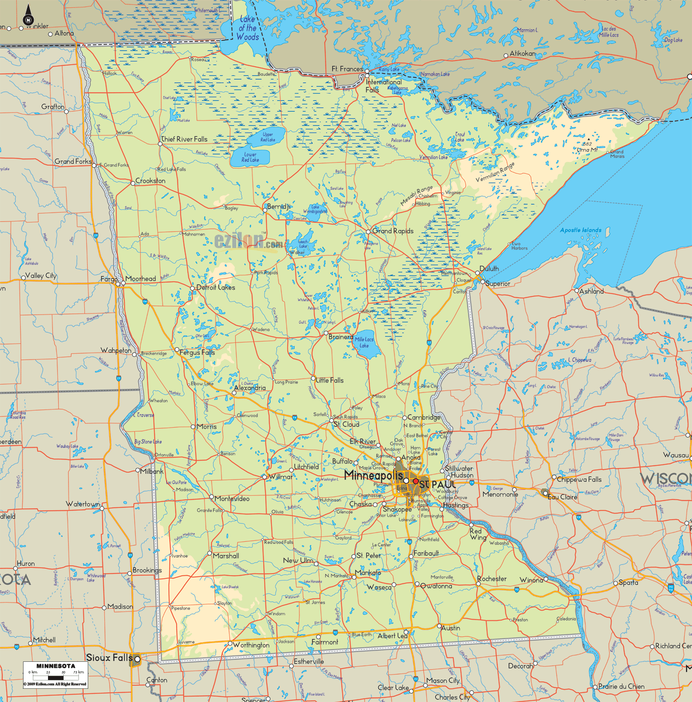
Minnesota Road Map
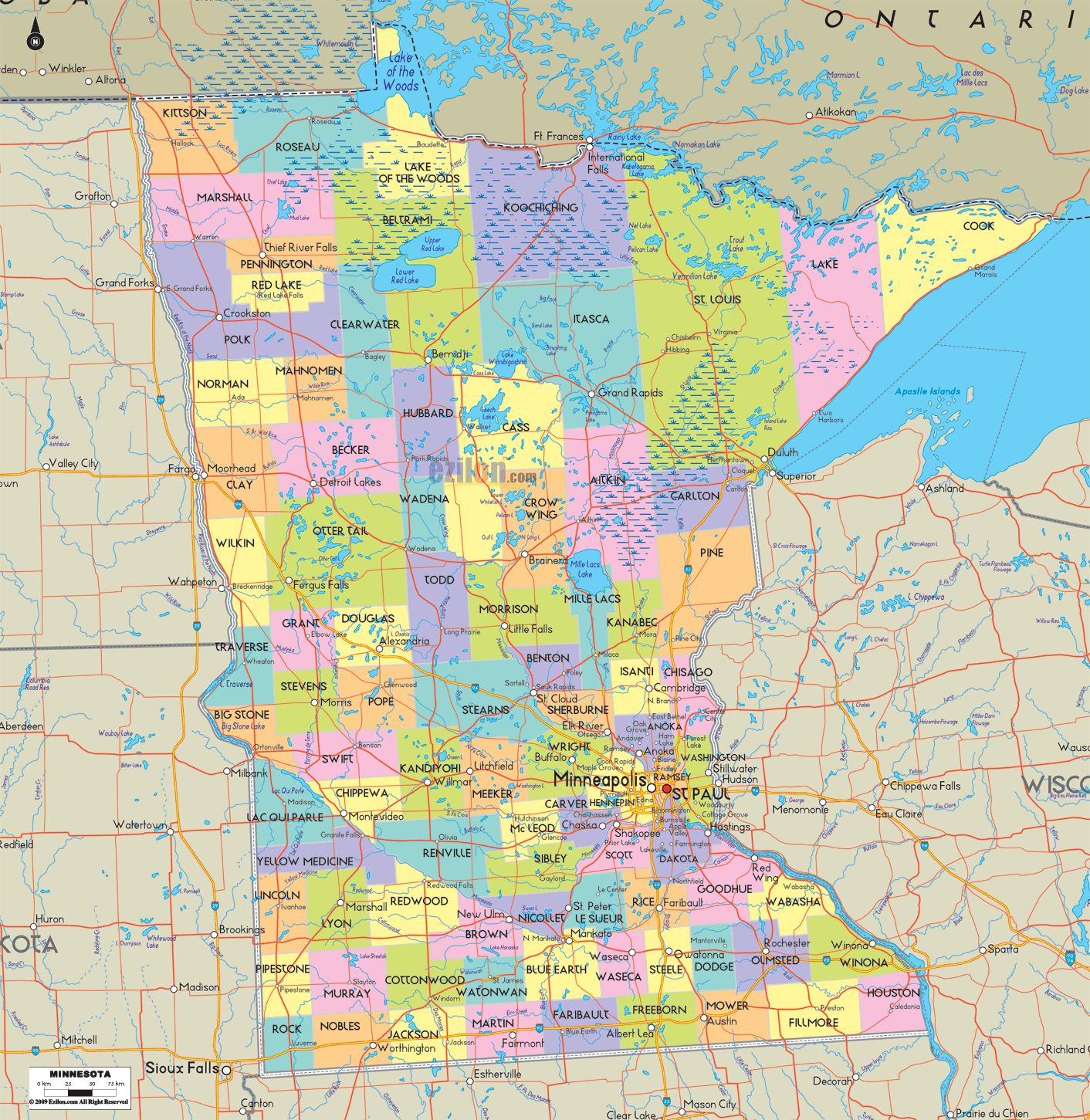
Minnesota Map – Roads & Cities
Minnesota Street Map
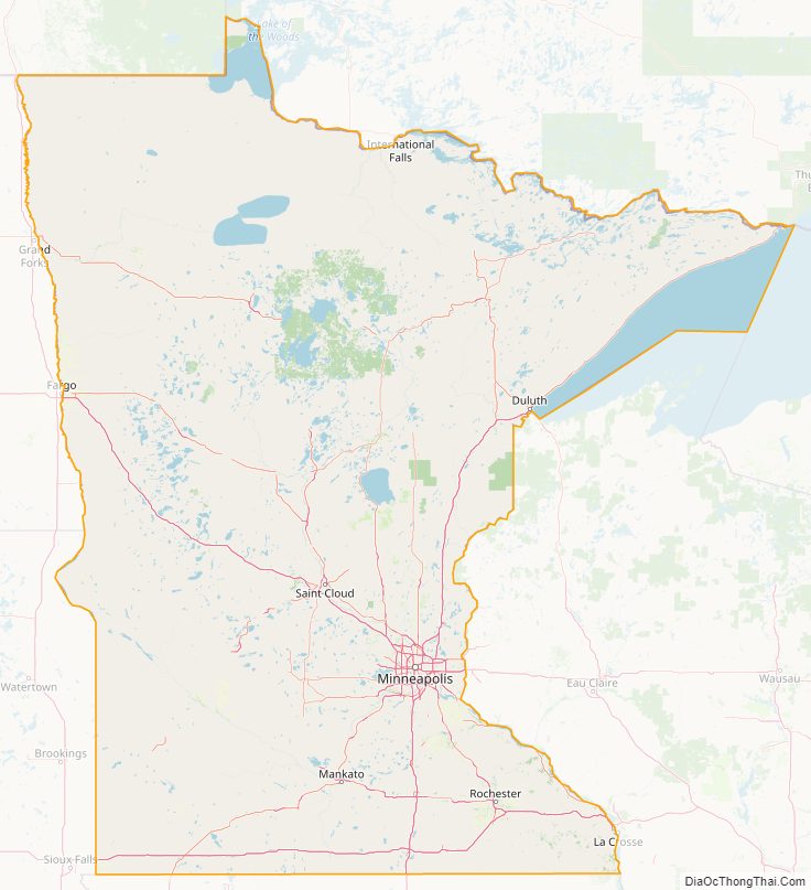
Minnesota State Map – Places and Landmarks
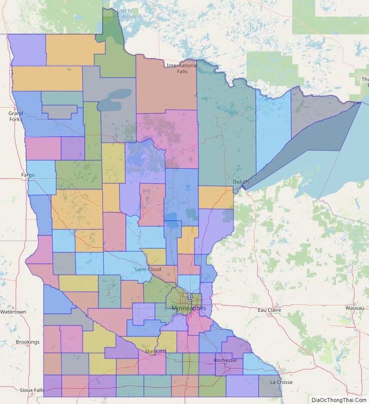
Minnesota Political Map
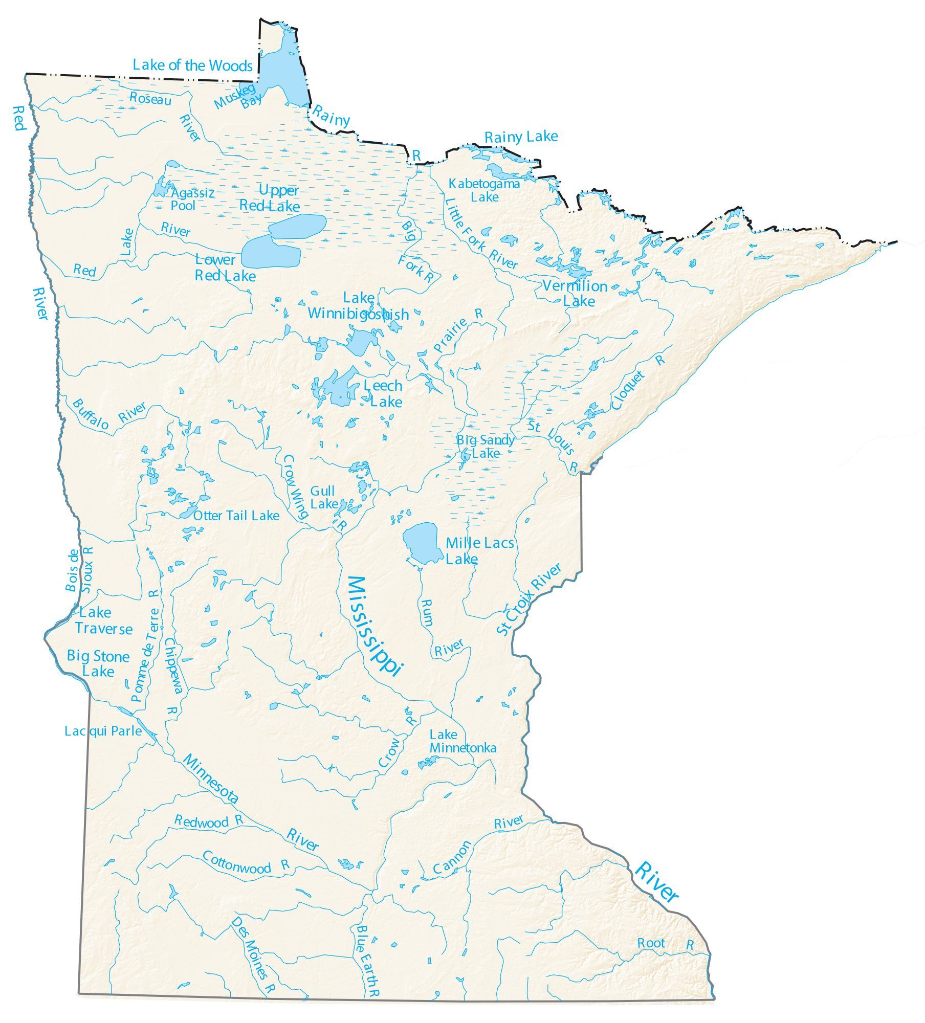
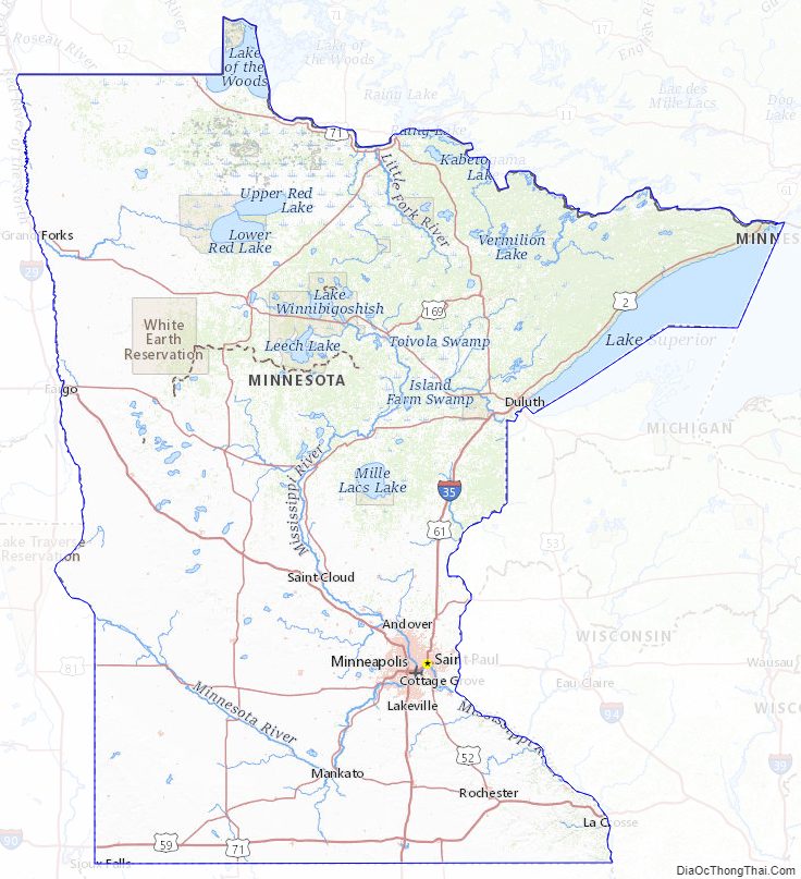
Minnesota Lakes and Rivers Map
Geography
Minnesota is the second northernmost U.S. state (after Alaska) and northernmost contiguous state, as the isolated Northwest Angle in Lake of the Woods County is the only part of the 48 contiguous states north of the 49th parallel. The state is part of the U.S. region known as the Upper Midwest and part of North America’s Great Lakes region. It shares a Lake Superior water border with Michigan and a land and water border with Wisconsin to the east. Iowa is to the south, North Dakota and South Dakota are to the west, and the Canadian provinces of Ontario and Manitoba are to the north. With 86,943 square miles (225,180 km), or approximately 2.25% of the United States, Minnesota is the 12th-largest state.
Geology
Minnesota has some of the earth’s oldest rocks, gneisses that are about 3.6 billion years old (80% as old as the planet). About 2.7 billion years ago basaltic lava poured out of cracks in the floor of the primordial ocean; the remains of this volcanic rock formed the Canadian Shield in northeast Minnesota. The roots of these volcanic mountains and the action of Precambrian seas formed the Iron Range of northern Minnesota. Since a period of volcanism 1.1 billion years ago, Minnesota’s geological activity has been more subdued, with no volcanism or mountain formation, but with repeated incursions of the sea, which left behind multiple strata of sedimentary rock.
In more recent times, massive ice sheets at least one kilometer thick ravaged the state’s landscape and sculpted its terrain. The Wisconsin glaciation left 12,000 years ago. These glaciers covered all of Minnesota except the far southeast, an area characterized by steep hills and streams that cut into the bedrock. This area is known as the Driftless Zone for its absence of glacial drift. Much of the remainder of the state has fifty feet (15 m) or more of glacial till left behind as the last glaciers retreated. Gigantic Lake Agassiz formed in the northwest 13,000 years ago. Its flatbed now is the fertile Red River valley, and its outflow, glacial River Warren, carved the valley of the Minnesota River and the Upper Mississippi downstream from Fort Snelling. Minnesota is geologically quiet today; it experiences earthquakes infrequently, most of them minor.
The state’s high point is Eagle Mountain at 2,301 feet (701 m), which is only 13 miles (21 km) away from the low point of 601 feet (183 m) at the shore of Lake Superior. Notwithstanding dramatic local differences in elevation, much of the state is a gently rolling peneplain.
Two major drainage divides meet in Minnesota’s northeast in rural Hibbing, forming a triple watershed. Precipitation can follow the Mississippi River south to the Gulf of Mexico, the Saint Lawrence Seaway east to the Atlantic Ocean, or the Hudson Bay watershed to the Arctic Ocean.
The state’s nickname “Land of 10,000 Lakes” is apt, as there are 11,842 Minnesota lakes over 10 acres (4 ha) in size. Minnesota’s portion of Lake Superior is the largest at 962,700 acres (389,600 ha; 3,896 km) and deepest (at 1,290 ft (390 m)) body of water in the state. Minnesota has 6,564 natural rivers and streams that cumulatively flow for 69,000 miles (111,000 km). The Mississippi River begins its journey from its headwaters at Lake Itasca and crosses the Iowa border 680 miles (1,090 km) downstream. It is joined by the Minnesota River at Fort Snelling, by the St. Croix River near Hastings, by the Chippewa River at Wabasha, and by many smaller streams. The Red River drains the northwest part of the state northward toward Canada’s Hudson Bay. Approximately 10.6 million acres (4,300,000 ha; 43,000 km) of wetlands are within Minnesota’s borders, the most of any state outside Alaska.
Flora and fauna
Minnesota has four ecological provinces: prairie parkland, in the southwestern and western parts of the state; the eastern broadleaf forest (Big Woods) in the southeast, extending in a narrowing strip to the state’s northwestern part, where it transitions into tallgrass aspen parkland; and the northern Laurentian mixed forest, a transitional forest between the northern boreal forest and the broadleaf forests to the south. These northern forests are a vast wilderness of pine and spruce trees mixed with patchy stands of birch and poplar.
Much of Minnesota’s northern forest has undergone logging, leaving only a few patches of old growth forest today in areas such as the Chippewa National Forest and the Superior National Forest, where the Boundary Waters Canoe Area Wilderness has some 400,000 acres (162,000 ha) of unlogged land. Although logging continues, regrowth and replanting keep about a third of the state forested. Nearly all Minnesota’s prairies and oak savannas have been fragmented by farming, grazing, logging, and suburban development.
While loss of habitat has affected native animals such as the pine marten, elk, woodland caribou, and bison, others like whitetail deer and bobcat thrive. Minnesota has the nation’s largest population of timber wolves outside Alaska, and supports healthy populations of black bears, moose, and gophers. Located on the Mississippi Flyway, Minnesota hosts migratory waterfowl such as geese and ducks, and game birds such as grouse, pheasants, and turkeys. It is home to birds of prey, including the largest number of breeding pairs of bald eagles in the lower 48 states as of 2007, red-tailed hawks, and snowy owls. Hawk Ridge is one of the premier birdwatching sites in North America. The lakes teem with sport fish such as walleye, bass, muskellunge, and northern pike, while brook, brown, and rainbow trout populate streams in the southeast and northeast.
Climate
Minnesota experiences temperature extremes characteristic of its continental climate, with cold winters and hot summers. The lowest temperature recorded was −60 °F (−51 °C) at Tower on February 2, 1996, and the highest was 114 °F (46 °C) at Moorhead on July 6, 1936. Meteorological events include rain, snow, blizzards, thunderstorms, hail, derechos, tornadoes, and high-velocity straight-line winds. The growing season varies from 90 days in the far northeast to 160 days in southeast Minnesota near the Mississippi River, and average temperatures range from 37 to 49 °F (3 to 9 °C). Average summer dewpoints range from about 58 °F (14 °C) in the south to about 48 °F (9 °C) in the north. Average annual precipitation ranges from 19 to 35 inches (48 to 89 cm), and droughts occur every 10 to 50 years.
Protected lands
Minnesota’s first state park, Itasca State Park, was established in 1891, and is the source of the Mississippi River. Today Minnesota has 72 state parks and recreation areas, 58 state forests covering about four million acres (16,000 km), and numerous state wildlife preserves, all managed by the Minnesota Department of Natural Resources. The Chippewa and Superior national forests comprise 5.5 million acres (22,000 km). The Superior National Forest in the northeast contains the Boundary Waters Canoe Area Wilderness, which encompasses over a million acres (4,000 km) and a thousand lakes. To its west is Voyageurs National Park. The Mississippi National River and Recreation Area (MNRRA) is a 72-mile-long (116 km) corridor along the Mississippi River through the Minneapolis–St. Paul Metropolitan Area connecting a variety of sites of historic, cultural, and geologic interest.
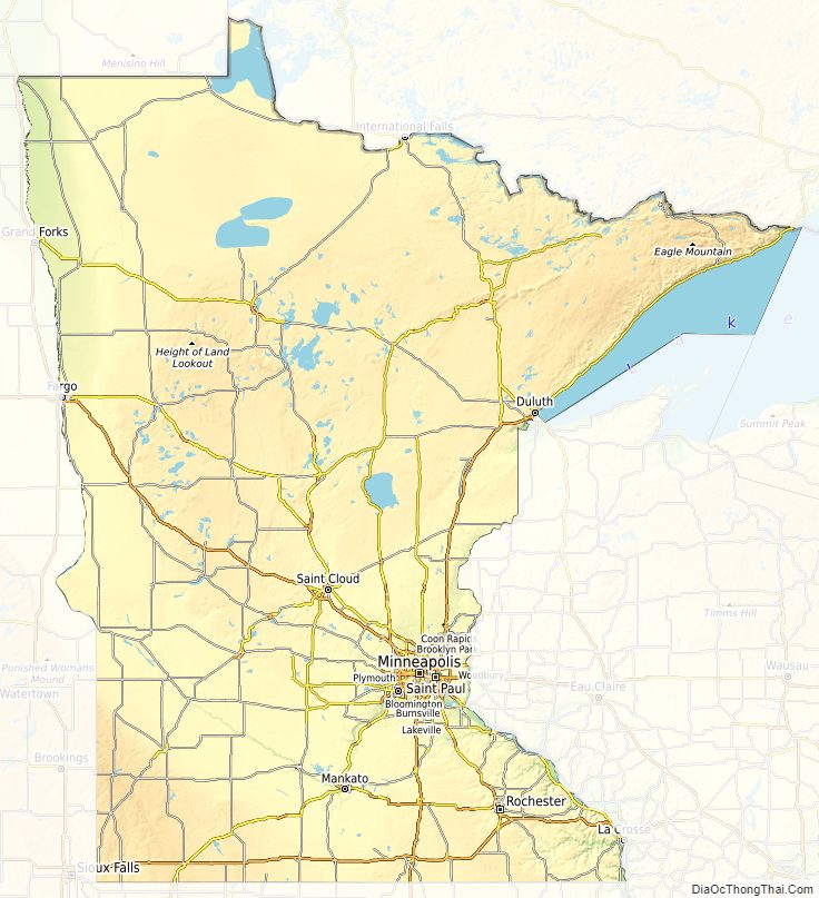
Minnesota Physical Map
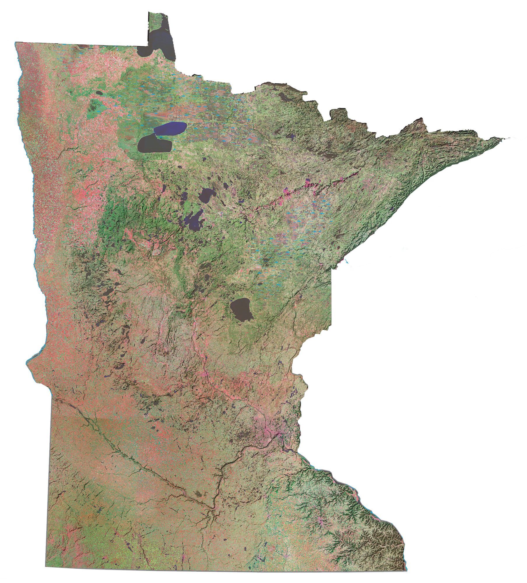
Minnesota Topographic Map
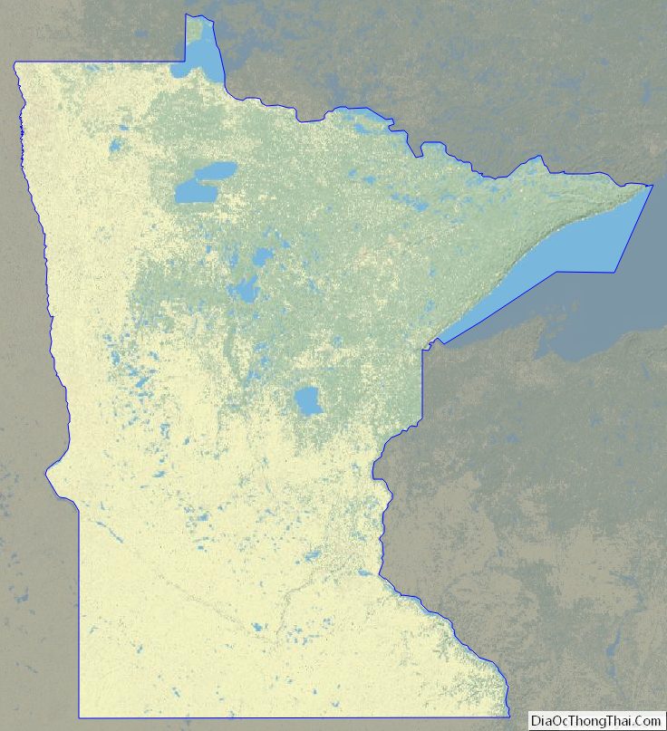
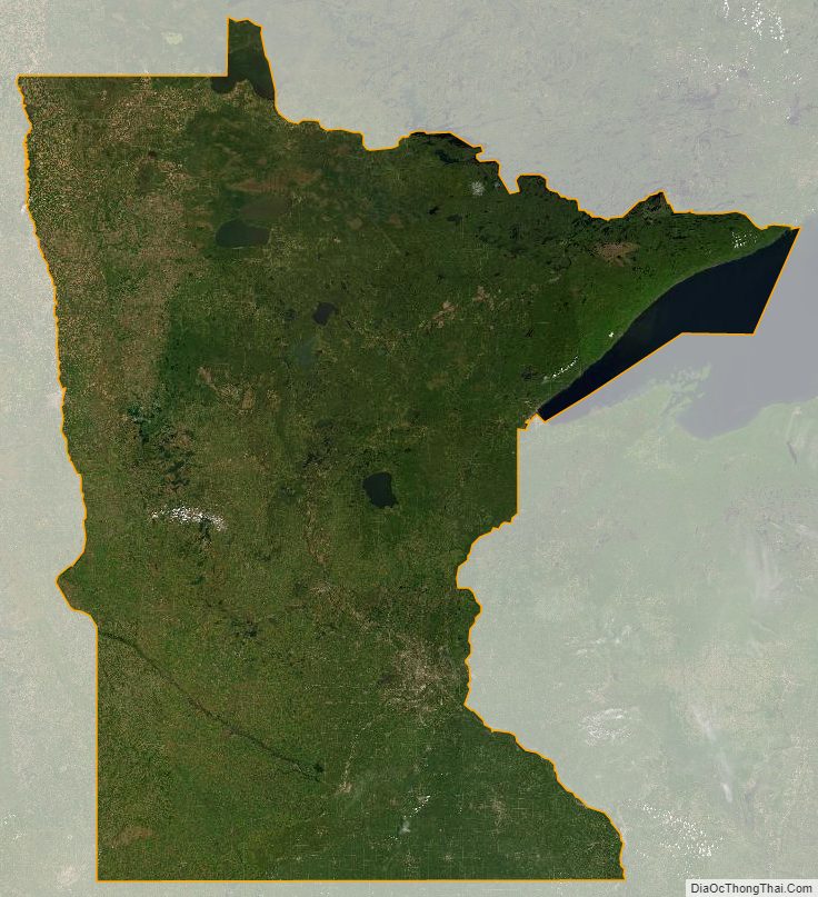
Minnesota Satellite Map
Others printable maps
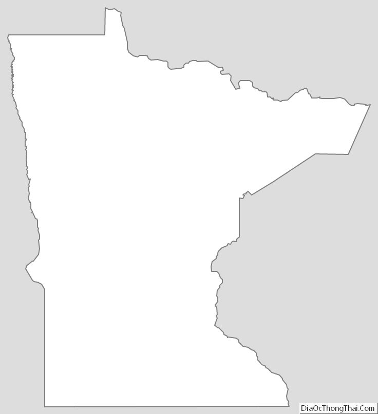
Minnesota Outline Map
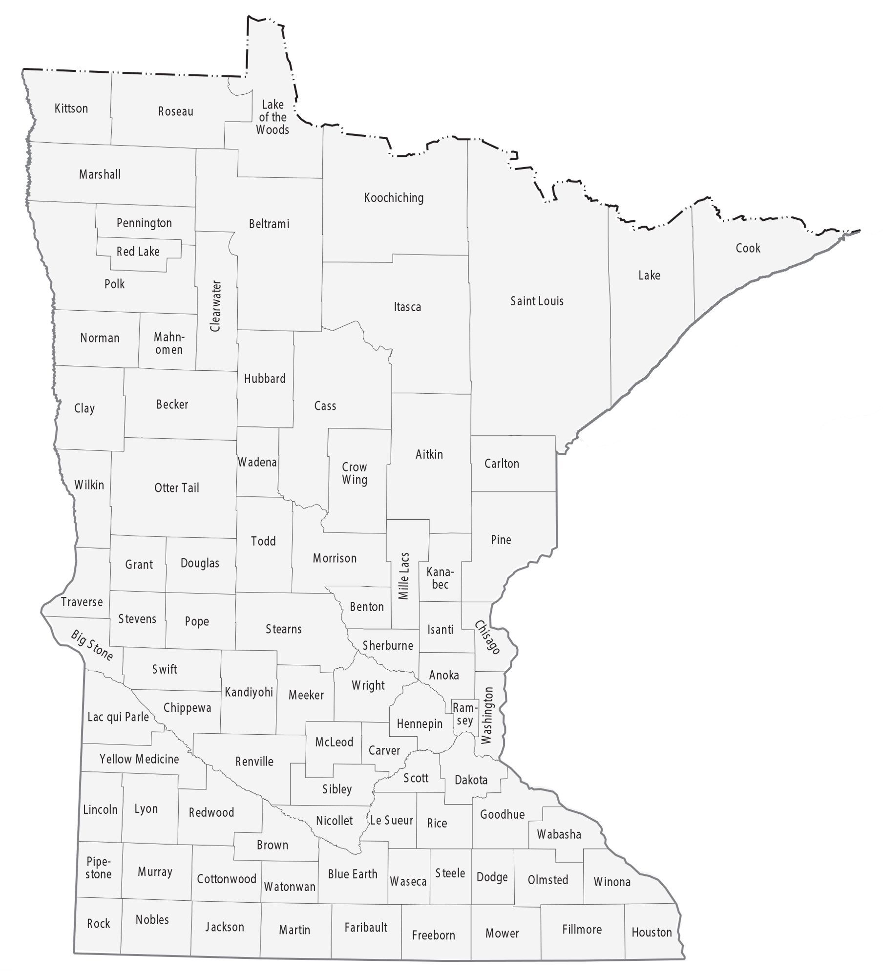
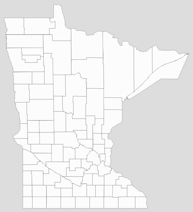
Blank Minnesota County Map
See also
Map of Minnesota State and its subdivision:- Aitkin
- Anoka
- Becker
- Beltrami
- Benton
- Big Stone
- Blue Earth
- Brown
- Carlton
- Carver
- Cass
- Chippewa
- Chisago
- Clay
- Clearwater
- Cook
- Cottonwood
- Crow Wing
- Dakota
- Dodge
- Douglas
- Faribault
- Fillmore
- Freeborn
- Goodhue
- Grant
- Hennepin
- Houston
- Hubbard
- Isanti
- Itasca
- Jackson
- Kanabec
- Kandiyohi
- Kittson
- Koochiching
- Lac qui Parle
- Lake
- Lake of the Woods
- Lake Superior
- Le Sueur
- Lincoln
- Lyon
- Mahnomen
- Marshall
- Martin
- McLeod
- Meeker
- Mille Lacs
- Morrison
- Mower
- Murray
- Nicollet
- Nobles
- Norman
- Olmsted
- Otter Tail
- Pennington
- Pine
- Pipestone
- Polk
- Pope
- Ramsey
- Red Lake
- Redwood
- Renville
- Rice
- Rock
- Roseau
- Saint Louis
- Scott
- Sherburne
- Sibley
- Stearns
- Steele
- Stevens
- Swift
- Todd
- Traverse
- Wabasha
- Wadena
- Waseca
- Washington
- Watonwan
- Wilkin
- Winona
- Wright
- Yellow Medicine
- Alabama
- Alaska
- Arizona
- Arkansas
- California
- Colorado
- Connecticut
- Delaware
- District of Columbia
- Florida
- Georgia
- Hawaii
- Idaho
- Illinois
- Indiana
- Iowa
- Kansas
- Kentucky
- Louisiana
- Maine
- Maryland
- Massachusetts
- Michigan
- Minnesota
- Mississippi
- Missouri
- Montana
- Nebraska
- Nevada
- New Hampshire
- New Jersey
- New Mexico
- New York
- North Carolina
- North Dakota
- Ohio
- Oklahoma
- Oregon
- Pennsylvania
- Rhode Island
- South Carolina
- South Dakota
- Tennessee
- Texas
- Utah
- Vermont
- Virginia
- Washington
- West Virginia
- Wisconsin
- Wyoming


