Phelps County is a county in the U.S. state of Nebraska. As of the 2010 United States Census, the population was 9,188. Its county seat is Holdrege. The county was formed in 1873, and was named for William Phelps (1808–1889), a steamboat captain and early settler.
In the Nebraska license plate system, Phelps County is represented by the prefix 37 (it had the 37th-largest number of vehicles registered in the county when the license plate system was established in 1922).
It is considered part of the Kearney μSA’s development and expansion plans.
| Name: | Phelps County |
|---|---|
| FIPS code: | 31-137 |
| State: | Nebraska |
| Founded: | 1873 |
| Named for: | William Phelps |
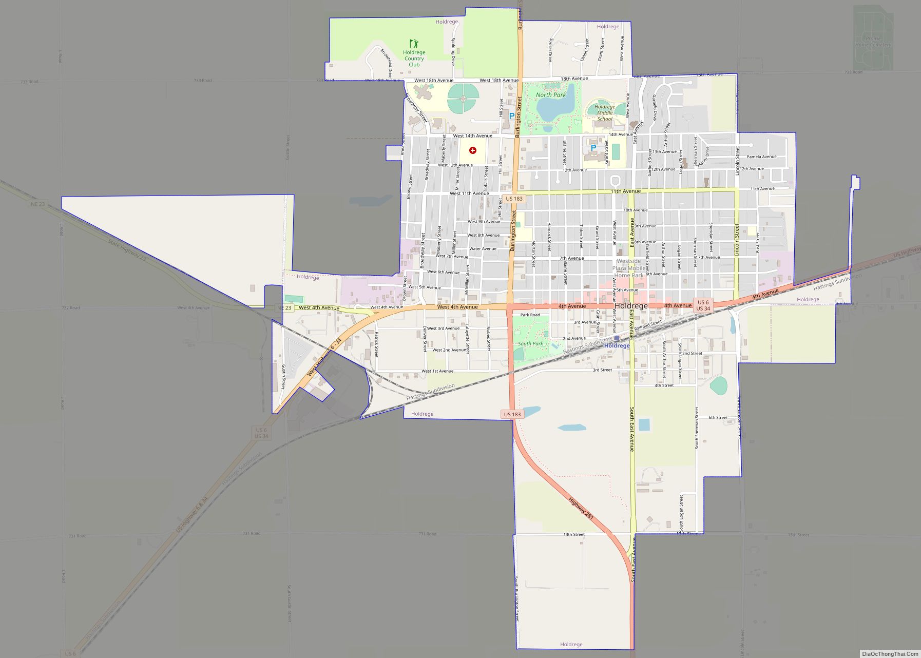
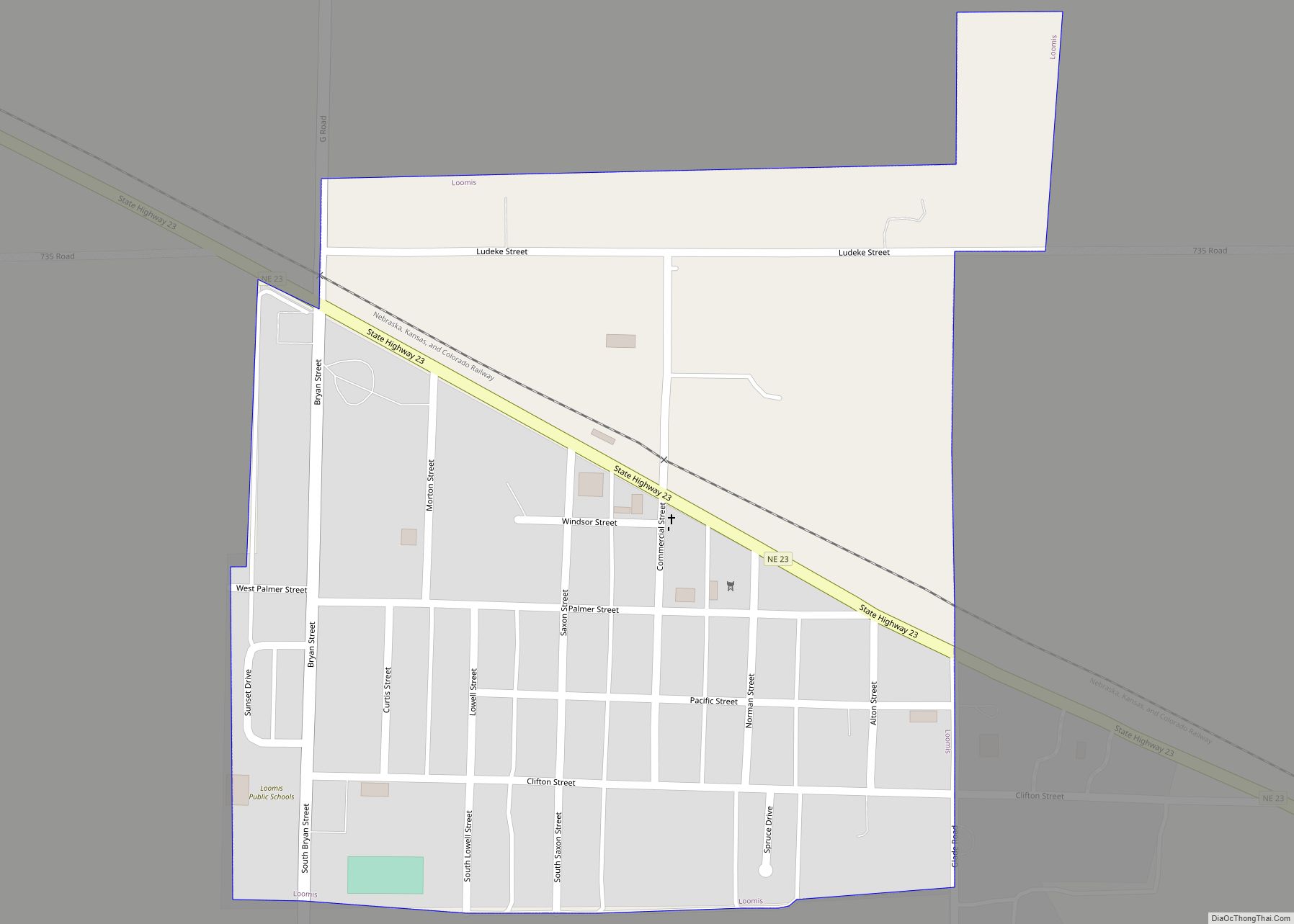
| Seat: | Holdrege |
| Largest city: | Holdrege |
| Total Area: | 540 sq mi (1,400 km²) |
| Land Area: | 540 sq mi (1,400 km²) |
| Total Population: | 8,937 |
| Population Density: | 16.8/sq mi (6.5/km²) |
| Time zone: | UTC−6 (Central) |
| Summer Time Zone (DST): | UTC−5 (CDT) |
| Website: | www.phelpsgov.org |
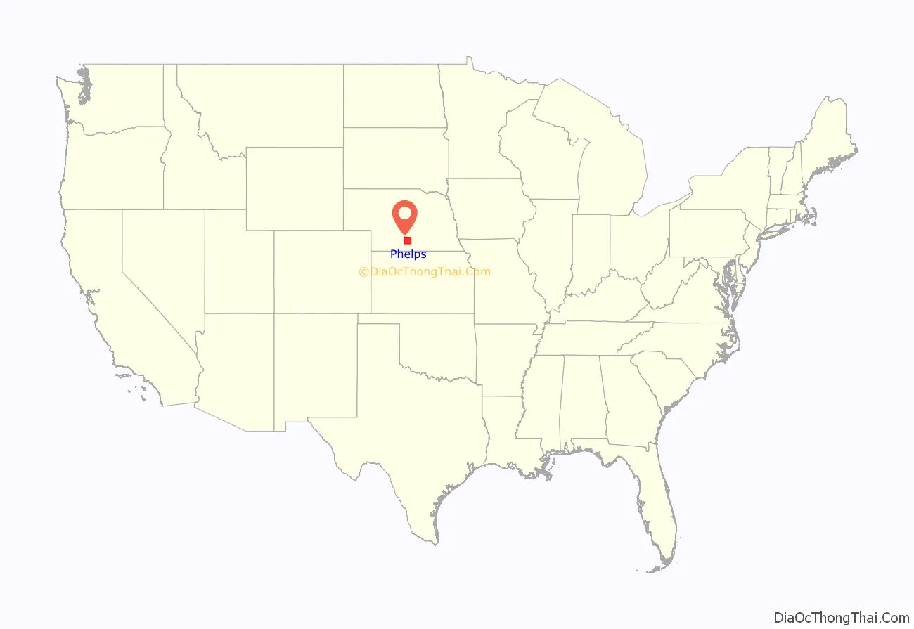
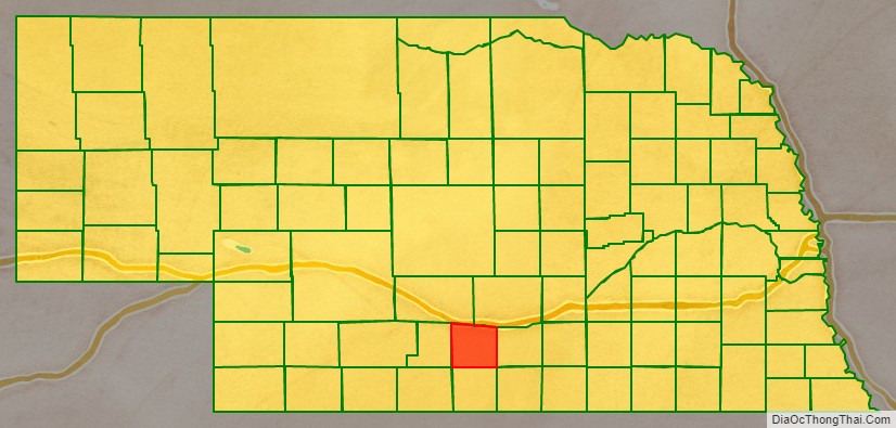
Phelps County location map. Where is Phelps County?
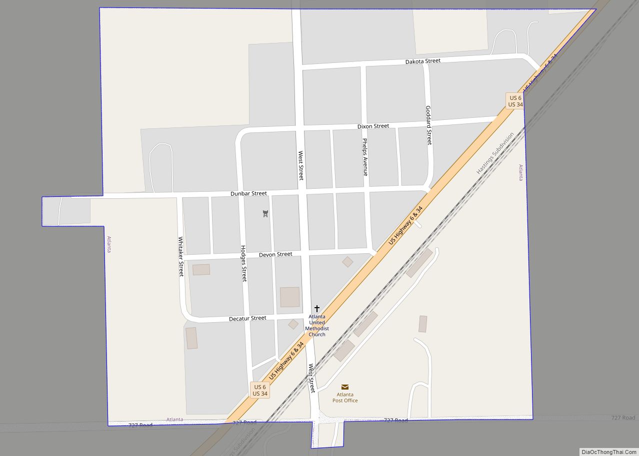
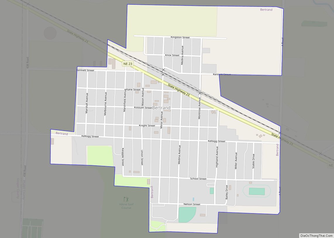
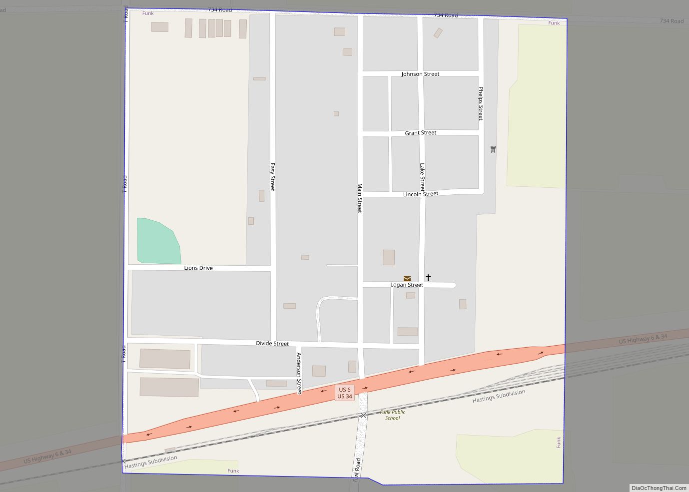
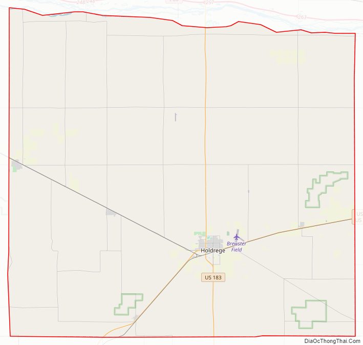
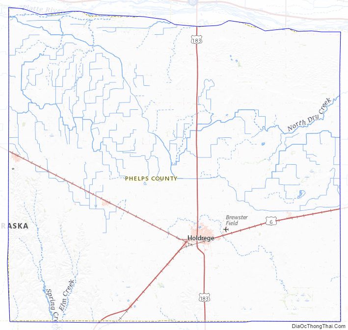
Phelps County Road Map
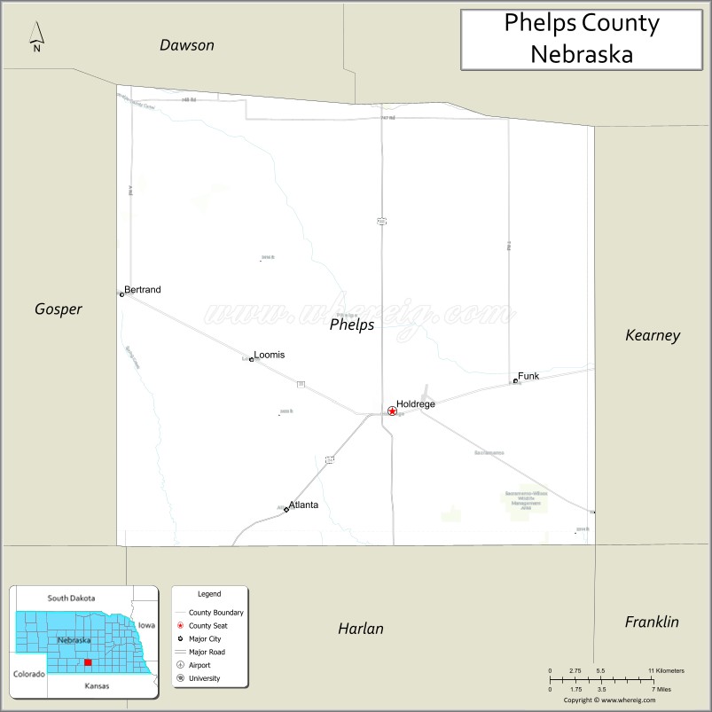
Geography
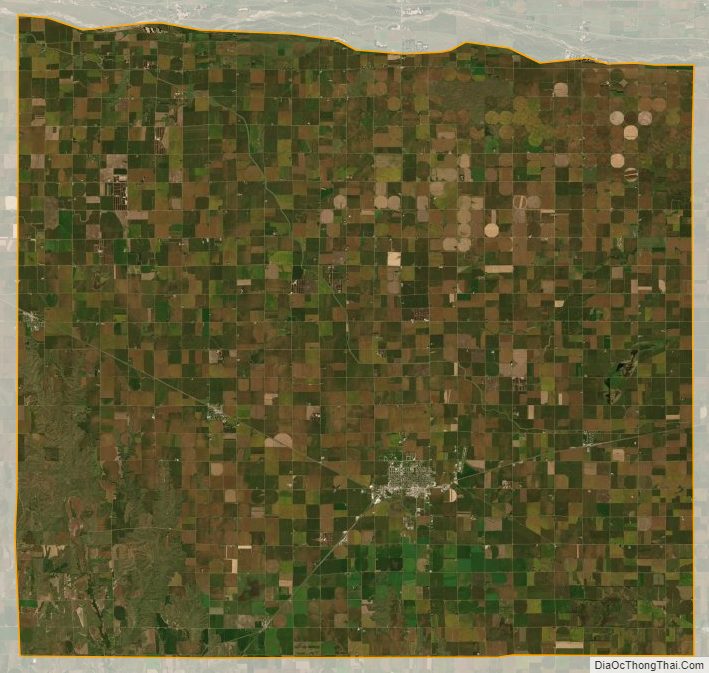
Phelps County terrain consists of low rolling hills, mostly devoted to agriculture, sloping to the east, and dropping off toward the river basin along its northern boundary line. The Platte River flows eastward along the north line.
The county has a total area of 540 square miles (1,400 km), of which 540 square miles (1,400 km) is land and 0.6 square miles (1.6 km) (0.1%) is water.
Major highways
- U.S. Highway 6
- U.S. Highway 34
- U.S. Highway 183
- Nebraska Highway 23
Adjacent counties
- Kearney County – east
- Franklin County – southeast
- Harlan County – south
- Furnas County – southwest
- Gosper County – west
- Dawson County – northwest
- Buffalo County – northeast
Protected areas
- Atlanta Marsh National Wildlife Management Area
- Cottonwood Federal Waterfowl Production Area
- Johnson Federal Waterfowl Production Area
- Jones Federal Waterfowl Production Area
- Lake Seldom Wildlife Refuge
- Lynder Federal Waterfowl Production Area
- Richardson Lagoon State Wildlife Management Area
- Sacramento-Wilcox State Wildlife Management Area
Phelps County Topographic Map
Phelps County Satellite Map
Phelps County Outline Map