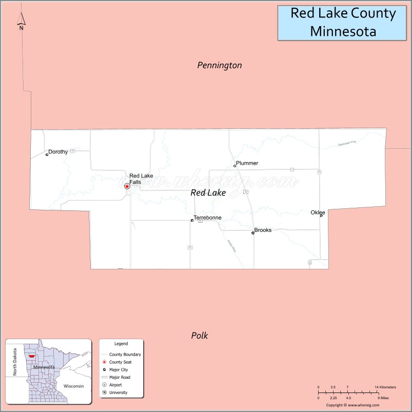
Red Lake County is a county in the Northwestern part of the U.S. state of Minnesota. As of the 2020 census, the population was 3,935, making it the third-least populous county in Minnesota. Its county seat is Red Lake Falls.
| Name: | Red Lake County |
|---|---|
| FIPS code: | 27-125 |
| State: | Minnesota |
| Founded: | December 24, 1896 |
| Named for: | Red Lake River |
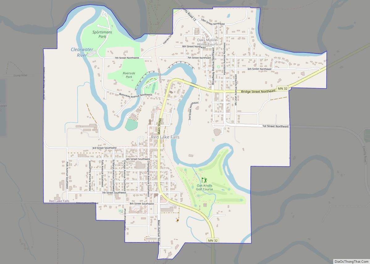
| Seat: | Red Lake Falls |
| Largest city: | Red Lake Falls |
| Total Area: | 432 sq mi (1,120 km²) |
| Land Area: | 432 sq mi (1,120 km²) |
| Total Population: | 3,935 |
| Population Density: | 9.1/sq mi (3.5/km²) |
| Time zone: | UTC−6 (Central) |
| Summer Time Zone (DST): | UTC−5 (CDT) |
| Website: | www.co.red-lake.mn.us |
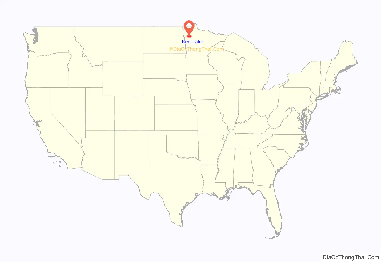
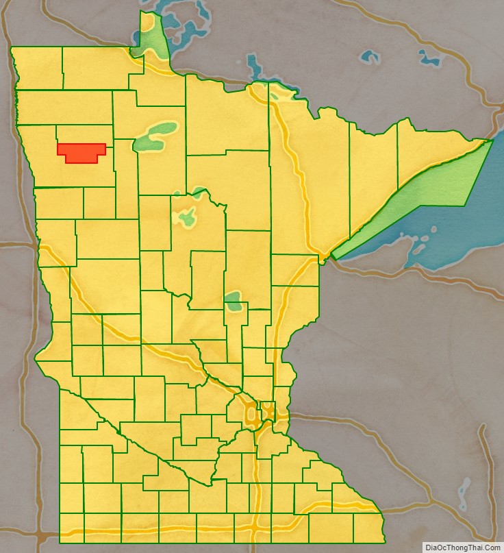
Red Lake County location map. Where is Red Lake County?
History
Red Lake County was formed on December 24, 1896 from sections of Polk County. It was named for the Red Lake River. Its designated county seat was Red Lake Falls, which had been incorporated (as a village) in 1881.
The county has two sites on the National Register of Historic Places: the courthouse and Clearwater Evangelical Lutheran Church.
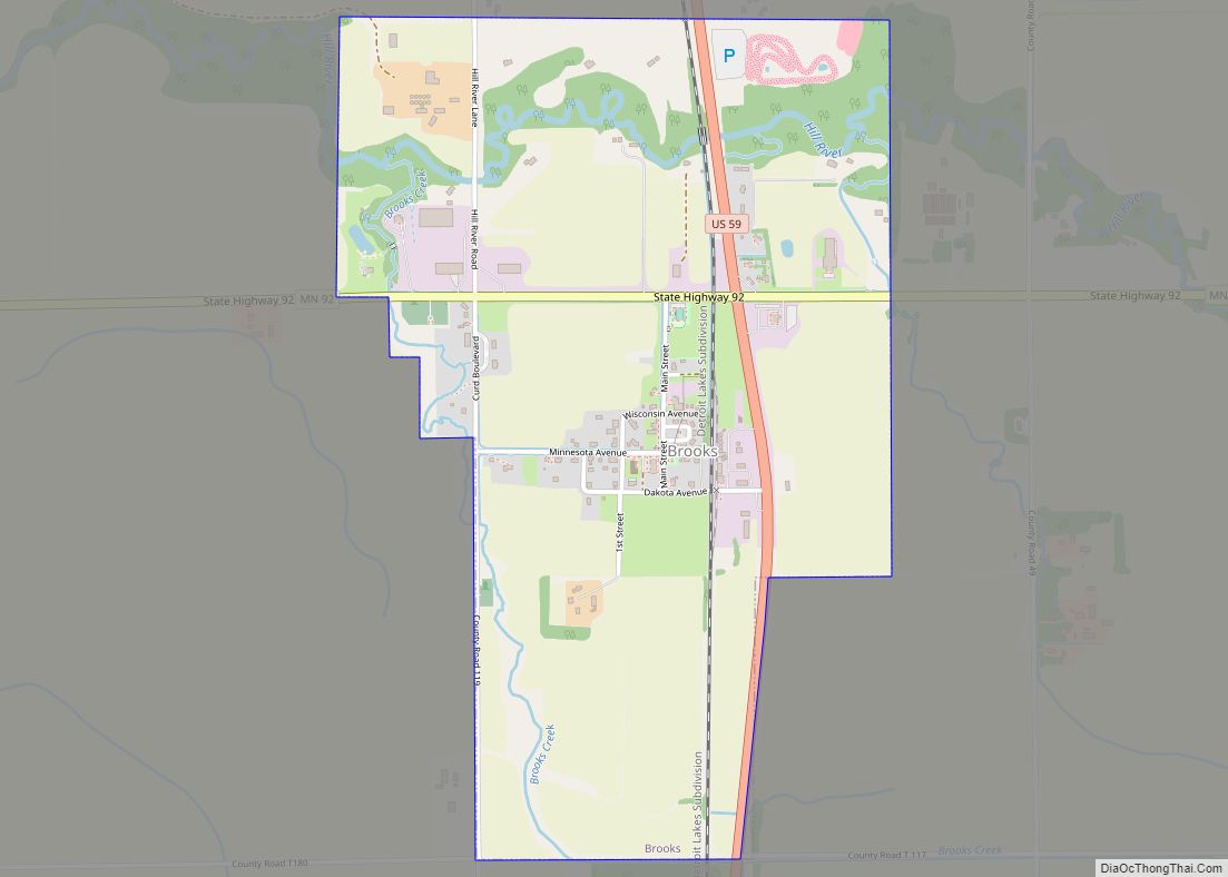
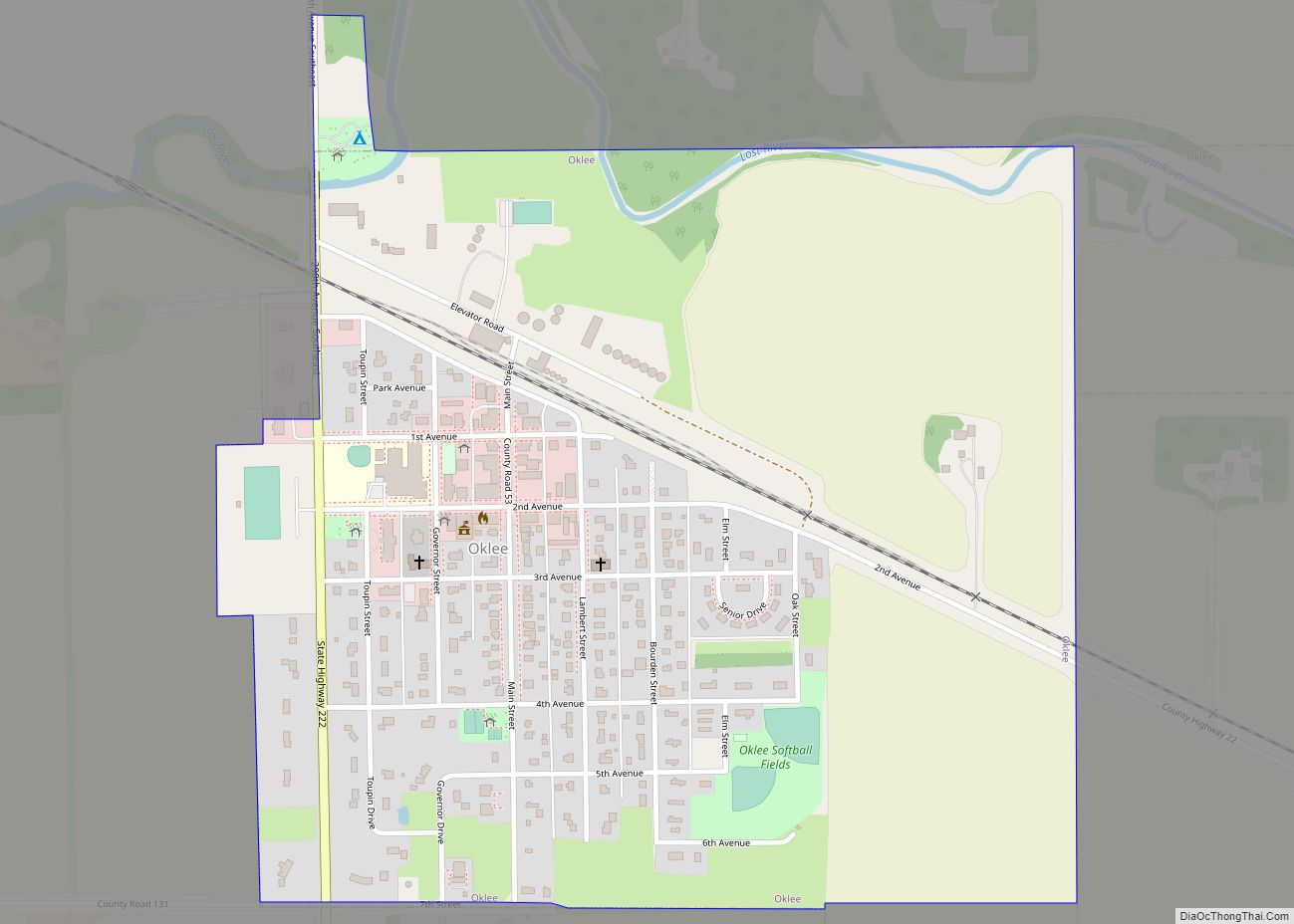
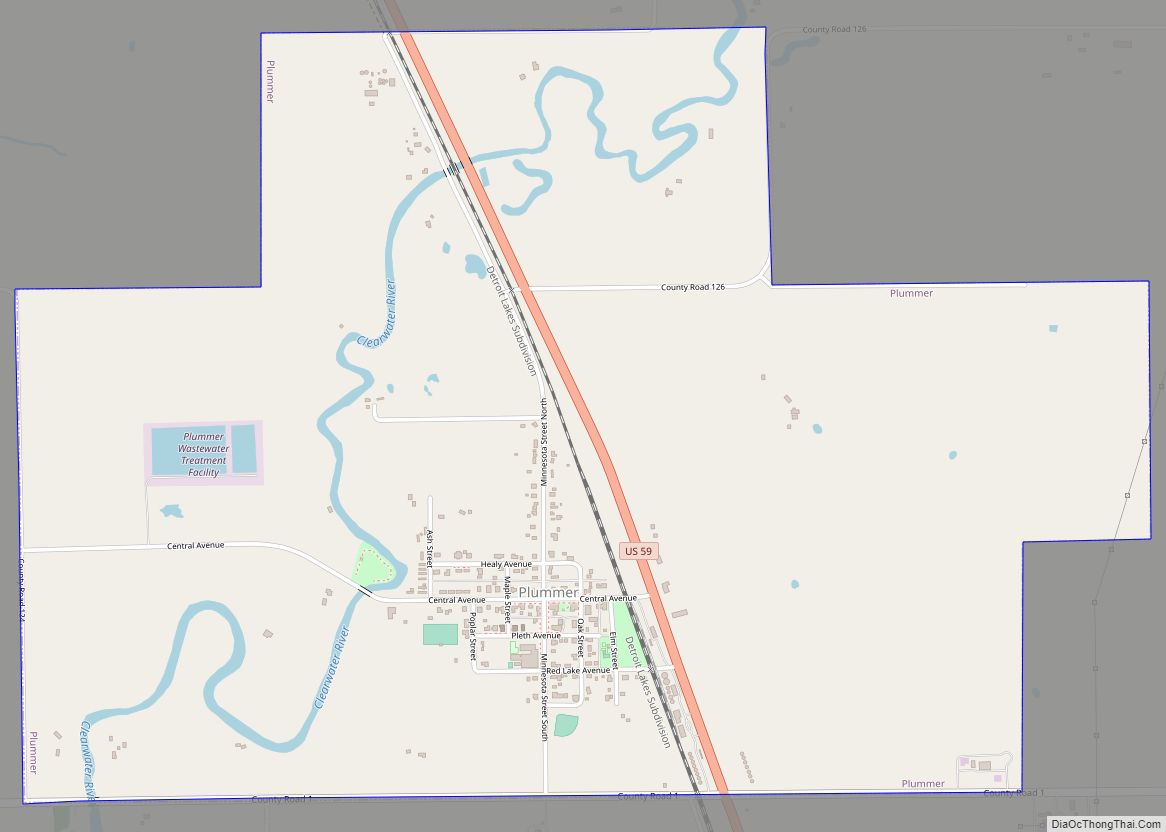
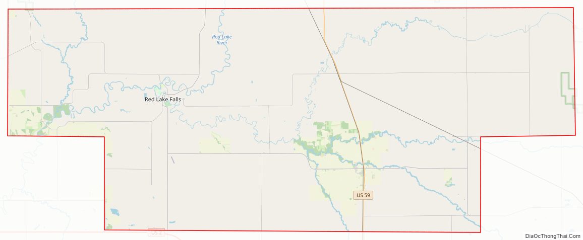
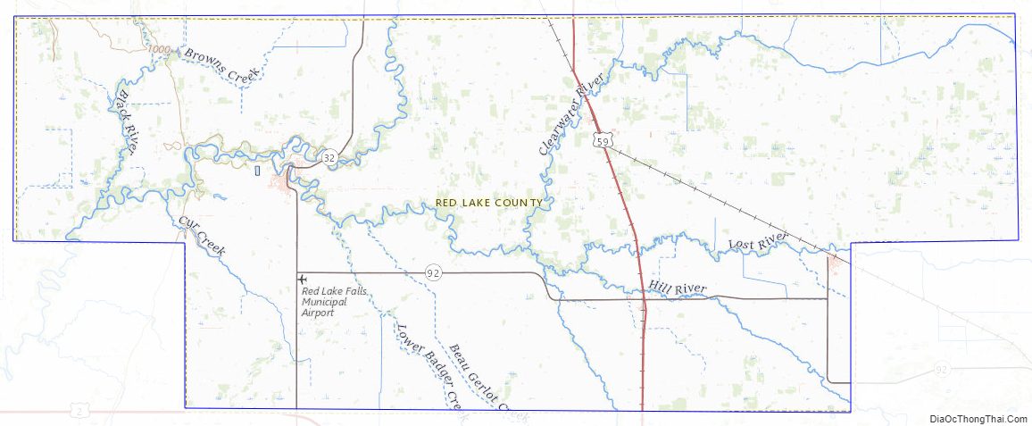
Red Lake County Road Map
Geography
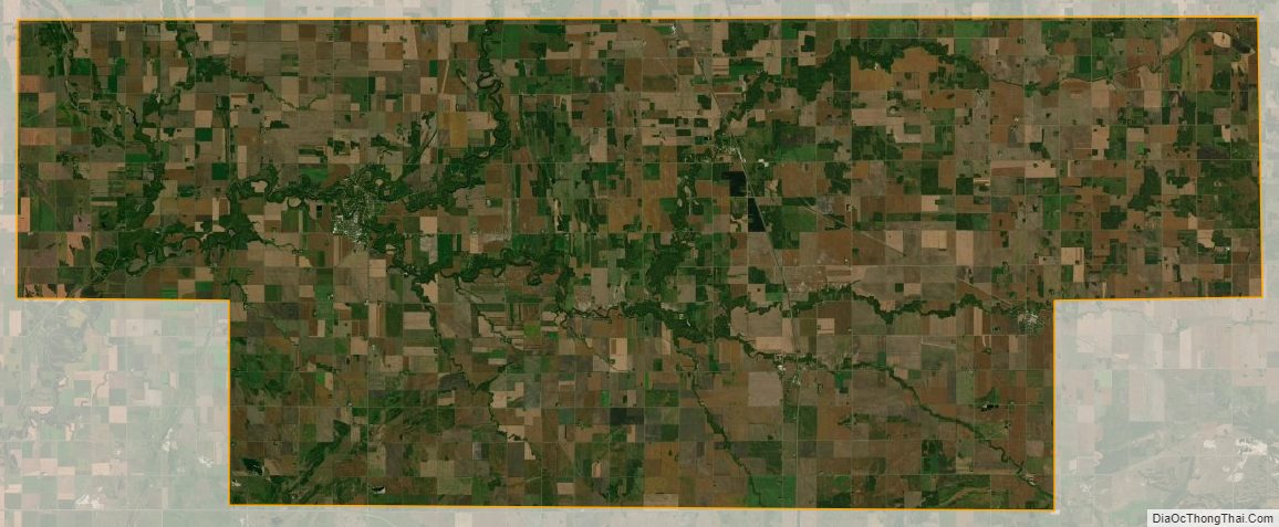
The Red Lake River flows southward into the county from Pennington County. It is joined near Red Lake Falls by the Clearwater River; the combined flow (still known as the Red Lake River) flows southwestward to Huot, where it is augmented by the Black River, which drains the northwestern part of the county. The Red Lake River then flows southwestward into Polk County. The county terrain consists of low rolling hills, etched by drainages and gullies. The area is devoted to agriculture. The county terrain slopes to the west, with its highest elevation on its southeastern corner, at 1,201′ (366m) ASL. The county has a total area of 432 square miles (1,120 km), of which 432 square miles (1,120 km) is land and 0.09 square miles (0.23 km) (0.02%) is water.
Despite its name, Red Lake County contains only one named lake: Moran Lake, near Huot.
Red Lake County is the only landlocked county in the United States (excluding those on international borders) to border exactly two other counties.
Major highways
- U.S. Highway 2
- U.S. Highway 59
- Minnesota State Highway 32
- Minnesota State Highway 92
- Minnesota State Highway 222
Adjacent counties
- Pennington County – north
- Polk County – south
Protected areas
- Moran State Wildlife Management Area
- Old Crossing & Treaty County Wayside Park
Red Lake County Topographic Map
Red Lake County Satellite Map
Red Lake County Outline Map