Red Lake Falls is a city in Red Lake County, Minnesota, United States. The population was 1,339 at the 2020 census. It is the county seat of Red Lake County. The city lies in the middle of Red Lake Falls Township, from which it was separated when incorporated as a village in 1881. Its status was raised to that of a city in 1898.
| Name: | Red Lake Falls city |
|---|---|
| LSAD Code: | 25 |
| LSAD Description: | city (suffix) |
| State: | Minnesota |
| County: | Red Lake County |
| Elevation: | 1,037 ft (316 m) |
| Total Area: | 2.10 sq mi (5.44 km²) |
| Land Area: | 2.10 sq mi (5.44 km²) |
| Water Area: | 0.00 sq mi (0.00 km²) |
| Total Population: | 1,339 |
| Population Density: | 637.62/sq mi (246.19/km²) |
| ZIP code: | 56750 |
| Area code: | 218 |
| FIPS code: | 2753476 |
| GNISfeature ID: | 0649866 |
| Website: | redlakefalls.com |
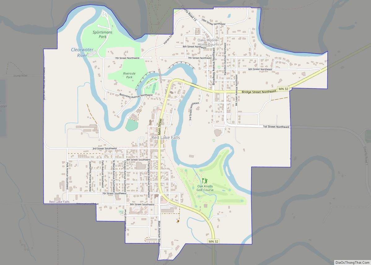
Online Interactive Map
Click on ![]() to view map in "full screen" mode.
to view map in "full screen" mode.
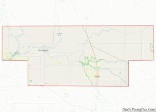
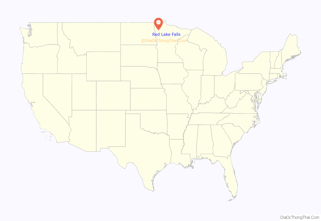
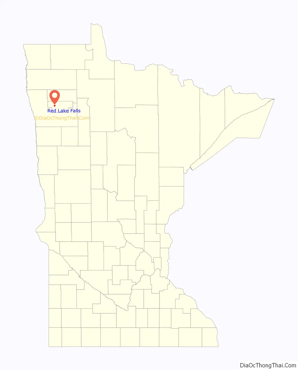
Red Lake Falls location map. Where is Red Lake Falls city?
History
Red Lake Falls was the site of a North West Company fur post as early as 1796 or 1797, making it one of the oldest sites of European occupation in the State of Minnesota. A French Canadian fur trader, Jean Baptiste Cadotte, partner of the noted British-Canadian fur trader, Alexander Henry the elder, established the post as part of a strategy to ward off Hudson’s Bay Company intrusion into the Red River Valley. The famous Canadian explorer David Thompson took shelter from a storm in Cadotte’s cabin here in March 1798. The post was abandoned early in the 1800s, as British fur traders withdrew from United States territory.
The surrounding territory was homesteaded by French-American settlers led by Pierre Bottineau, who were relocating via ox cart from their temporary stopping points in Ramsey and Hennepin Counties, Minnesota, in 1876. These pioneers were augmented in 1878 by a number of French Canadian settlers from Upper Canada. The area developed as a grain farming region. In 1878, Earnest Buse and his partner, Otto Kankel, established a flour mill at the confluence of the two rivers.
The town of Red Lake Falls soon after was platted by Mr. Buse, who then moved on to other environs. The Kankel family continued as a prominent presence in the town through the 1950s. The town prospered for a time, as both the Northern Pacific Railway and the Great Northern Railway ran their lines through the town in the 1880s and early 1890s (both lines are now abandoned), and when Red Lake County split off from Polk County, in 1896, Red Lake Falls became the county seat of the newly formed county, a reason for existence that persists to the present day. The population peaked shortly afterward, in 1900, and has been in decline ever since.
The last significant historic event in Red Lake Falls occurred on August 27, 1927, when the famous aviator Charles Lindbergh and his wife landed at the nearby airport during a barnstorming trip through the Upper Midwest and were taken on automobile rides to Huot and Crookston.
Red Lake Falls Road Map
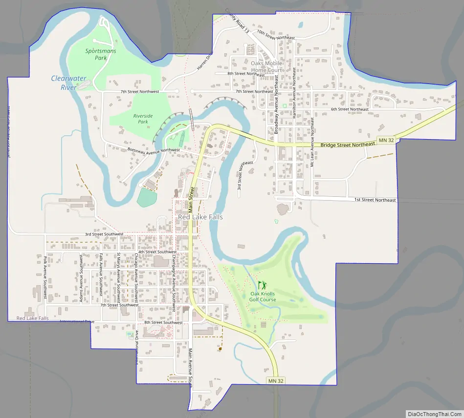
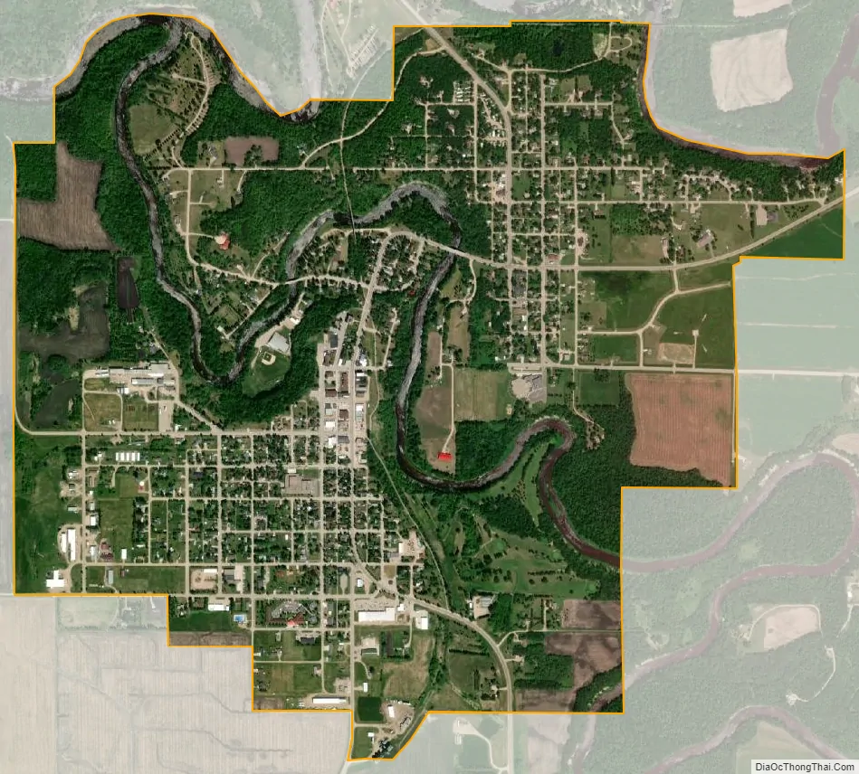
Red Lake Falls city Satellite Map
Geography
Red Lake Falls is located on a tributary of the Red River of the North, the Red Lake River, at its confluence with the Clearwater River. According to the United States Census Bureau, the city has a total area of 2.03 square miles (5.26 km), all land.
Minnesota Highway 32 serves as a main route in the city. Minnesota Highway 92 is nearby.
Climate
See also
Map of Minnesota State and its subdivision:- Aitkin
- Anoka
- Becker
- Beltrami
- Benton
- Big Stone
- Blue Earth
- Brown
- Carlton
- Carver
- Cass
- Chippewa
- Chisago
- Clay
- Clearwater
- Cook
- Cottonwood
- Crow Wing
- Dakota
- Dodge
- Douglas
- Faribault
- Fillmore
- Freeborn
- Goodhue
- Grant
- Hennepin
- Houston
- Hubbard
- Isanti
- Itasca
- Jackson
- Kanabec
- Kandiyohi
- Kittson
- Koochiching
- Lac qui Parle
- Lake
- Lake of the Woods
- Lake Superior
- Le Sueur
- Lincoln
- Lyon
- Mahnomen
- Marshall
- Martin
- McLeod
- Meeker
- Mille Lacs
- Morrison
- Mower
- Murray
- Nicollet
- Nobles
- Norman
- Olmsted
- Otter Tail
- Pennington
- Pine
- Pipestone
- Polk
- Pope
- Ramsey
- Red Lake
- Redwood
- Renville
- Rice
- Rock
- Roseau
- Saint Louis
- Scott
- Sherburne
- Sibley
- Stearns
- Steele
- Stevens
- Swift
- Todd
- Traverse
- Wabasha
- Wadena
- Waseca
- Washington
- Watonwan
- Wilkin
- Winona
- Wright
- Yellow Medicine
- Alabama
- Alaska
- Arizona
- Arkansas
- California
- Colorado
- Connecticut
- Delaware
- District of Columbia
- Florida
- Georgia
- Hawaii
- Idaho
- Illinois
- Indiana
- Iowa
- Kansas
- Kentucky
- Louisiana
- Maine
- Maryland
- Massachusetts
- Michigan
- Minnesota
- Mississippi
- Missouri
- Montana
- Nebraska
- Nevada
- New Hampshire
- New Jersey
- New Mexico
- New York
- North Carolina
- North Dakota
- Ohio
- Oklahoma
- Oregon
- Pennsylvania
- Rhode Island
- South Carolina
- South Dakota
- Tennessee
- Texas
- Utah
- Vermont
- Virginia
- Washington
- West Virginia
- Wisconsin
- Wyoming