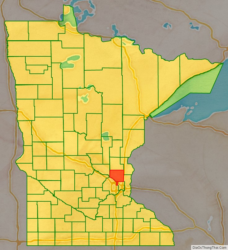
Anoka County (/əˈnoʊkə/ ə-NOH-kə) is the fourth-most-populous county in the U.S. state of Minnesota. As of the 2020 census, the population was 363,887. The county seat and namesake of the county is the city of Anoka, which is derived from the Dakota word anokatanhan meaning “on (or from) both sides,” referring to its location on the banks of the Rum River. The largest city in the county is Blaine, the thirteenth-largest city in Minnesota and the eighth-largest Twin Cities suburb.
Anoka County comprises the north portion of the Minneapolis–Saint Paul statistical area, the largest metropolitan area in the state and the sixteenth-largest in the United States with about 3.64 million residents.
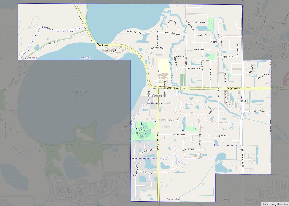
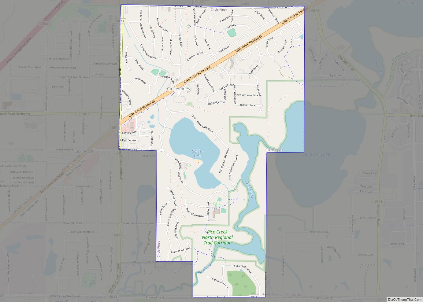
The county is bordered by the counties of Isanti on the north, Chisago and Washington on the east, Hennepin and Ramsey on the south, Sherburne on the west, and the Mississippi River on the southwest. The Rum River cuts through the county and was the site of many early European settlements. It was a common route to the Mille Lacs Lake, the spiritual homeland of the Ojibwe people. Father Louis Hennepin traveled the river in his first exploration of the region. The area became a center of fur trade and logging as French and French Canadian communities grew in the cities of Anoka and Centerville. Organized in 1857, the county’s southern border eventually met Minneapolis and has become a predominantly suburban area following the construction of Interstate 35W. The county is home to local Twin Cities destinations such as the Heights Theater in Columbia Heights and Northtown Mall and the National Sports Center in Blaine.
| Name: | Anoka County |
|---|---|
| FIPS code: | 27-003 |
| State: | Minnesota |
| Founded: | May 23, 1857 |
| Named for: | City of Anoka |
| Seat: | Anoka |
| Largest city: | Blaine |
| Total Area: | 446 sq mi (1,160 km²) |
| Land Area: | 423 sq mi (1,100 km²) |
| Total Population: | 363,887 |
| Population Density: | 862/sq mi (333/km²) |
| Time zone: | UTC−6 (Central) |
| Summer Time Zone (DST): | UTC−5 (CDT) |
| Website: | www.co.anoka.mn.us |
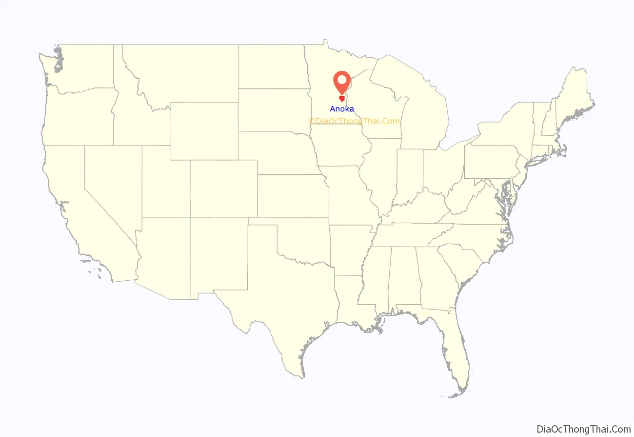
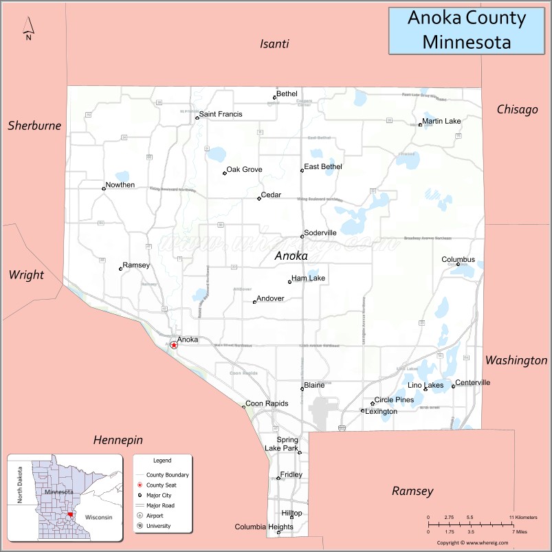
Anoka County location map. Where is Anoka County?
History
Anoka County was organized by an act of the Minnesota Territorial Legislature on May 23, 1857, the year prior to Minnesota’s admission to the Union. It was formed from parts of Ramsey County and Benton County; the Rum River previously divided the line between the two counties. The boundaries were mainly the same as they are now, except for a small part of the southeastern tip along the Mississippi River and at the south, formerly known as Manomin County. It was a small portion that connected to Ramsey and occupied one-third of the congressional township. It was then attached to Anoka County by constitutional amendment November 2, 1869. It became known as Fridley in 1879.
The first European descendants to explore what is now Anoka County were the Franciscan friar Louis Hennepin and his party. Fur traders soon began to settle in the area which is now Ramsey County. They settled on the Rum River and more people were attracted to the area. A community was created which is now called Anoka.
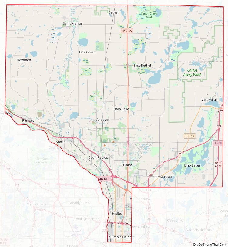
Anoka County Road Map
Geography
The Mississippi River flows southeasterly along the county’s southwestern boundary. The Rum River flows southerly through the western part of the county, discharging into the Mississippi at the county’s southwestern boundary. The terrain consists of low rolling wooded hills. The terrain slopes to the south and east; its highest point is a small hillock 1.2 mile (1.9 km) east of the county’s northwest corner, at 1,100′ (335m) ASL. Otherwise the terrain’s highest point is along the western part of the north boundary line, at 1,083′ (330m) ASL. The county has a total area of 446 square miles (1,160 km), of which 423 square miles (1,100 km) is land and 23 square miles (60 km) (5.2%) is water.
Lakes
- Bunker Lake
- Cedar Lake
- Coon Lake
- Crooked Lake
- Ham Lake
- Laddie Lake
- Lake George
- McKay Lake
- Moore Lake
- Round Lake
- Spring Lake
- Smith Lake
Rivers
- Cedar Creek
- Coon Creek
- Crooked Brook
- Ford Brook
- Hardwood Creek
- Mahoney Brook
- Mississippi River
- Rice Creek
- Rum River
- Sand Creek
- Seelye Brook
- Trott Brook
- Pheasant creek
Major highways
- Interstate 35
- Interstate 35E
- Interstate 35W
- Interstate 694
- US Highway 10
- US Highway 169
- Minnesota State Highway 47
- Minnesota State Highway 65
- Minnesota State Highway 97
- Minnesota State Highway 610
- List of county roads
Adjacent counties
- Isanti County – north
- Chisago County – northeast
- Washington County – east
- Ramsey County – southeast
- Hennepin County – southwest
- Sherburne County – northwest
Protected areas
- Bethel Wildlife Management Area
- Boot Lake Scientific and Natural Area
- Bunker Hills Regional Park
- Carl E Bonnell Wildlife Management Area
- Carlos Avery State Wildlife Management Area
- Cedar Creek Conservation Area
- Coon Rapids Dam Regional Park
- East Bethel Booster Park
- Gordie Mikkelson Wildlife Management Area
- Helen Allison Savanna Scientific and Natural Area
- Lake George Regional Park
- Martin Island-Linwood Lakes Regional Park
- Mississippi National River and Recreation Area (part)
- Rice Creek Chain of Lakes Park Preserve
- Robert and Marilyn Burman Wildlife Management Area
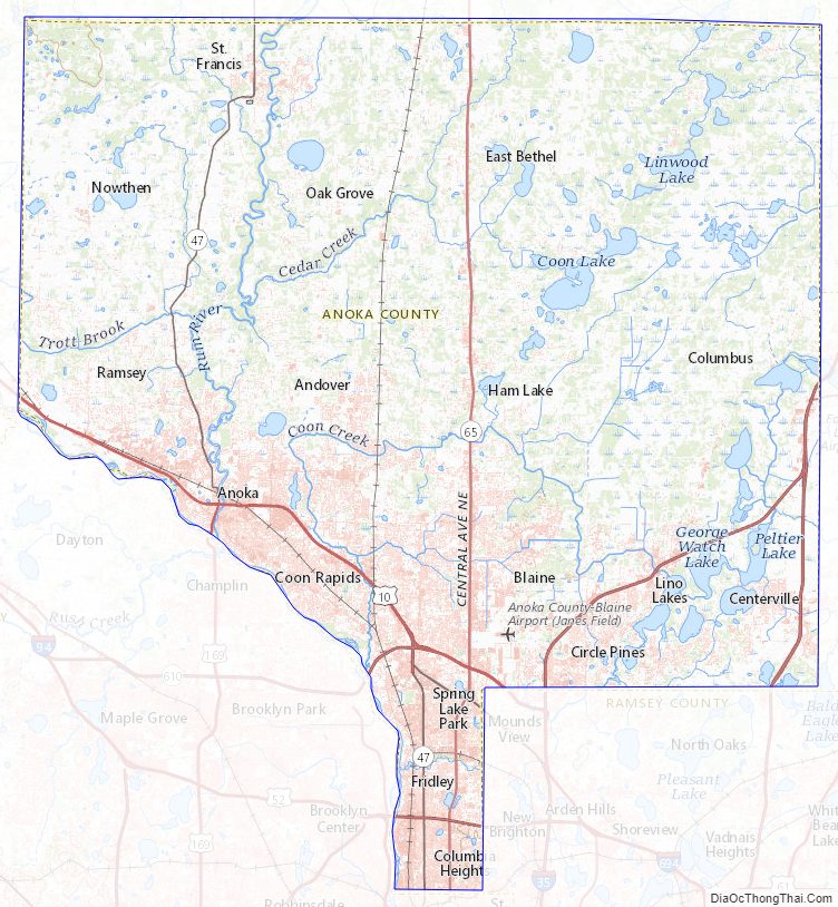
Anoka County Topographic Map
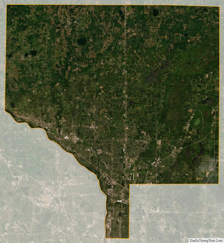
Anoka County Satellite Map
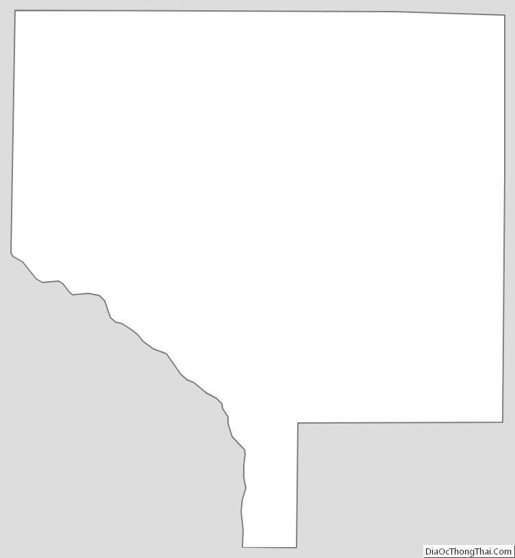
Anoka County Outline Map