Shelby County is a county located in the U.S. state of Iowa. As of the 2020 census, the population was 11,746. The county seat is Harlan. Its name is in honor of Isaac Shelby, the first Governor of Kentucky.
| Name: | Shelby County |
|---|---|
| FIPS code: | 19-165 |
| State: | Iowa |
| Founded: | 1851 |
| Named for: | Isaac Shelby |
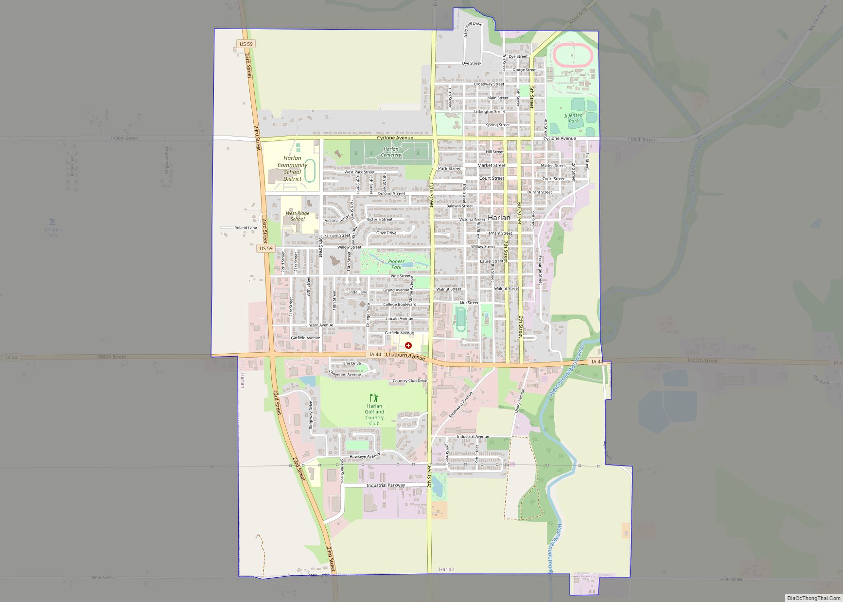
| Seat: | Harlan |
| Largest city: | Harlan |
| Total Area: | 598 sq mi (1,550 km²) |
| Land Area: | 598 sq mi (1,550 km²) |
| Total Population: | 11,746 |
| Population Density: | 20/sq mi (7.6/km²) |
| Time zone: | UTC−6 (Central) |
| Summer Time Zone (DST): | UTC−5 (CDT) |
| Website: | shelbycounty.iowa.gov |
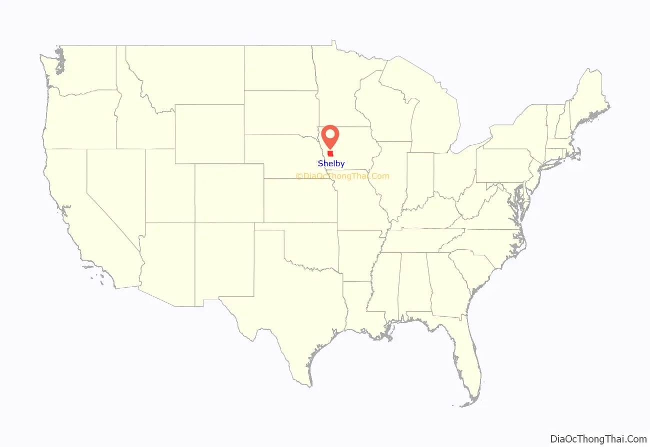
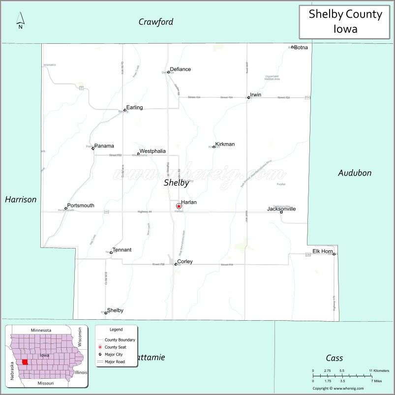
Shelby County location map. Where is Shelby County?

History
Shelby County was established on January 15, 1851. It was named after General Isaac Shelby, a hero in the American Revolutionary War and the first Governor of Kentucky.
Early settling in Shelby County began in 1848 in Galland’s Grove. On February 4, 1855, Shelbyville was designated the county seat. In April, 1859, the seat was moved to Harlan. One year later the first courthouse was erected and a second courthouse was constructed in 1875. In 1892, the construction of the present courthouse was begun, this time of stone and three storeys high. The construction was completed in 1893 with the dedication on September 14. The 1892 Shelby County Courthouse and the surrounding buildings are all listed in the National Register of Historic places effective September 23, 1994. In 1978, the building was extensively restored and still serves as the courthouse.
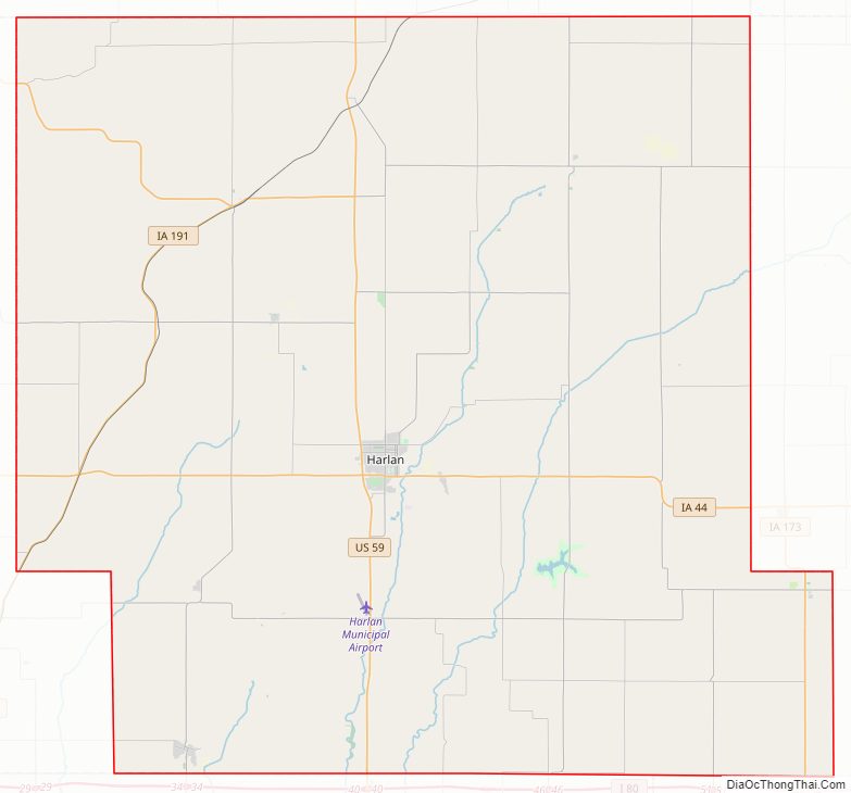
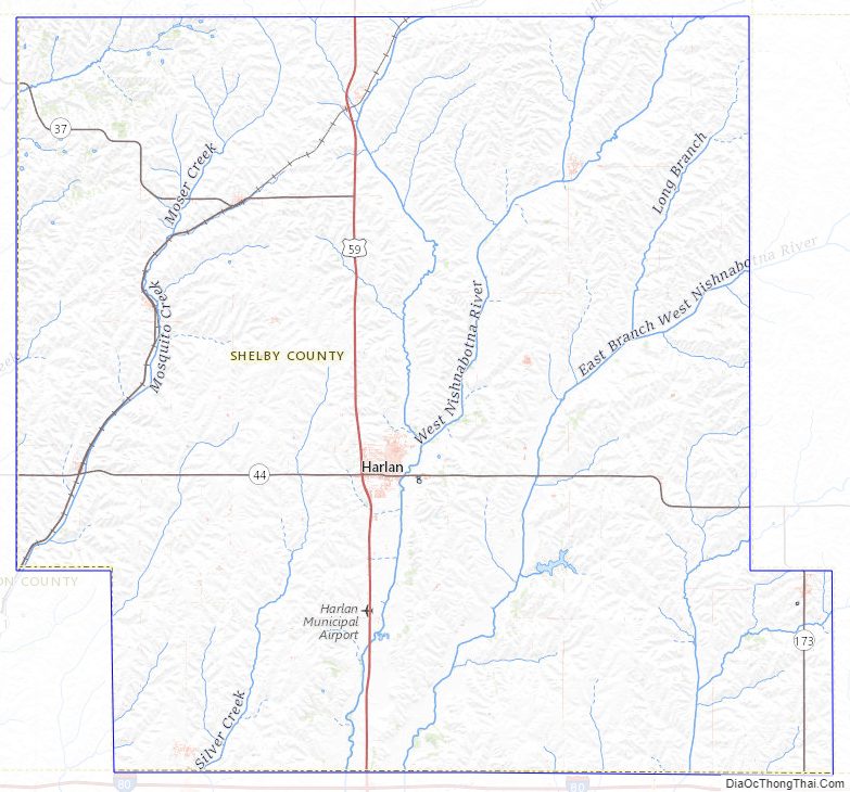
Shelby County Road Map
Geography
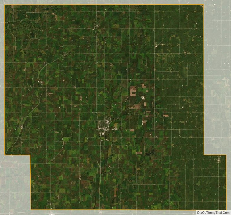
According to the U.S. Census Bureau, the county has a total area of 591 square miles (1,530 km), of which 591 square miles (1,530 km) is land and 0.6 square miles (1.6 km) (0.1%) is water.
Major highways
- U.S. Highway 59
- Iowa Highway 37
- Iowa Highway 44
- Iowa Highway 173
- Iowa Highway 191
- County Highway M16
- County Highway F58
- County Highway F32
- County Highway F24
- County Highway M36
Attractions
- Shelby County Speedway
Adjacent counties
- Crawford County (north)
- Audubon County (east)
- Cass County (southeast)
- Pottawattamie County (south)
- Harrison County (west)
Shelby County Topographic Map
Shelby County Satellite Map
Shelby County Outline Map