Sheridan County is a county in the U.S. state of Nebraska. As of the 2010 United States Census, the population was 5,469. Its county seat is Rushville. The county was formed in 1885, and was named for General Philip H. Sheridan.
In the Nebraska license plate system, Sheridan County is represented by the prefix 61 (it had the sixty-first-largest number of vehicles registered in the state when the license plate system was established in 1922).
| Name: | Sheridan County |
|---|---|
| FIPS code: | 31-161 |
| State: | Nebraska |
| Founded: | 1885 |
| Named for: | Philip Sheridan |
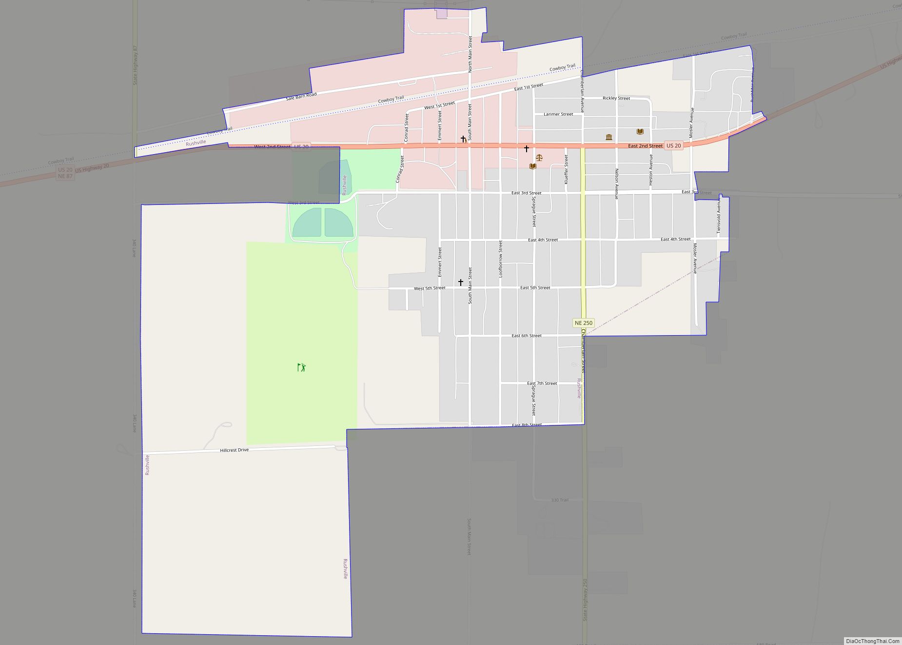
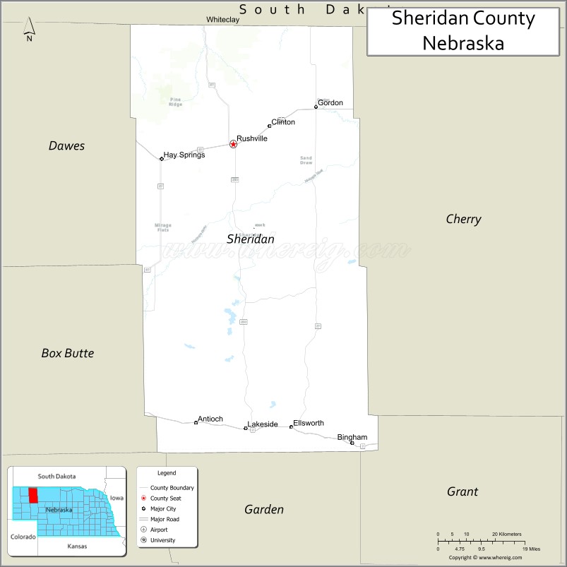
| Seat: | Rushville |
| Largest city: | Gordon |
| Total Area: | 2,470 sq mi (6,400 km²) |
| Land Area: | 2,441 sq mi (6,320 km²) |
| Total Population: | 5,095 |
| Population Density: | 2.17/sq mi (0.84/km²) |
| Time zone: | UTC−7 (Mountain) |
| Summer Time Zone (DST): | UTC−6 (MDT) |
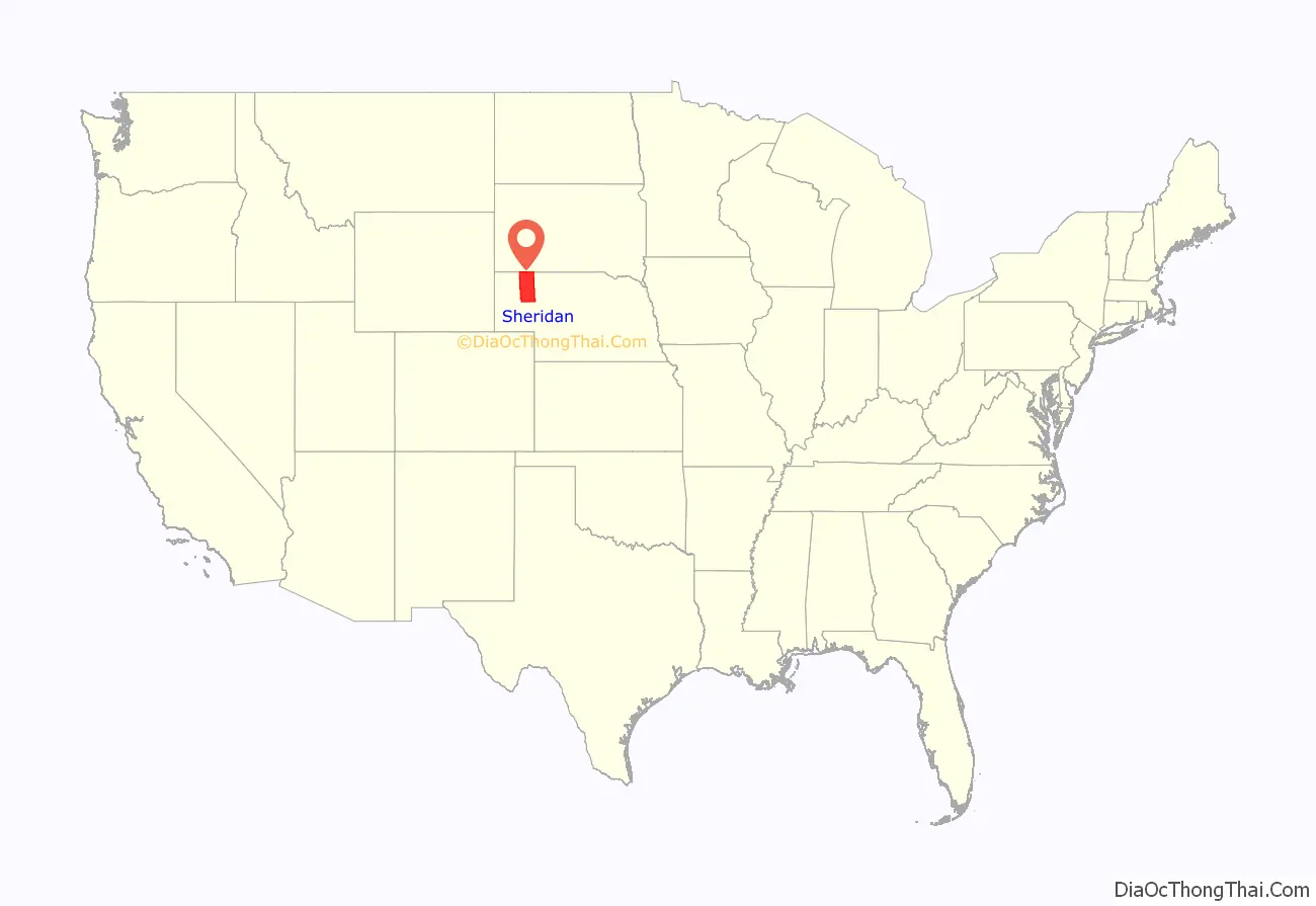
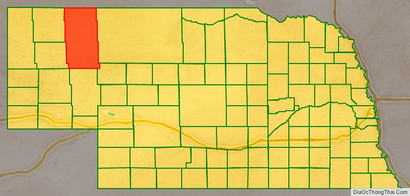
Sheridan County location map. Where is Sheridan County?
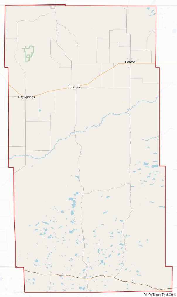
Sheridan County Road Map
Geography
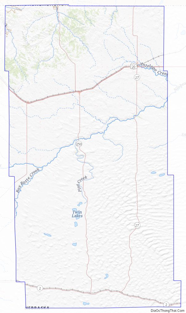
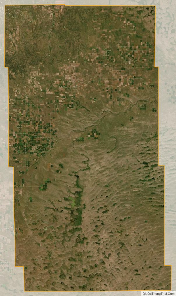
Sheridan County lies on the north line of Nebraska. Its north boundary line abuts the south boundary line of the state of South Dakota. An upper reach of the Niobrara River flows eastward through the upper central part of the county. The terrain consists of arid rolling hills, dotted with small lakes in the eastern and southern parts of the county. The county has a total area of 2,470 square miles (6,400 km), of which 2,441 square miles (6,320 km) is land and 29 square miles (75 km) (1.2%) is water. It is the fourth-largest county in Nebraska by area.
Major highways
- US 20
- Nebraska Highway 2
- Nebraska Highway 27
- Nebraska Highway 87
- Nebraska Highway 250
Adjacent counties
- Oglala Lakota County, South Dakota – north
- Cherry County – east
- Grant County – southeast
- Garden County – south
- Morrill County – southwest
- Dawes County – west
- Box Butte County – west
Protected areas
- Smith Lake State Wildlife Management Area
- Walgren Lake State Recreation Area
Sheridan County Topographic Map
Sheridan County Satellite Map
Sheridan County Outline Map