| Name: | Box Butte County |
|---|---|
| FIPS code: | 31-013 |
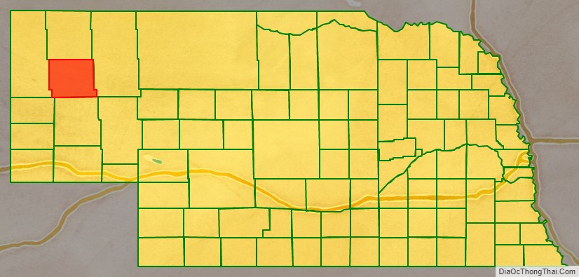
| State: | Nebraska |
| Founded: | 1886 |
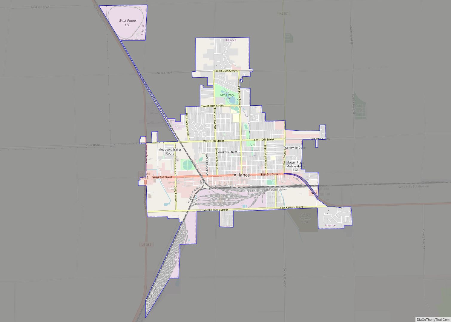
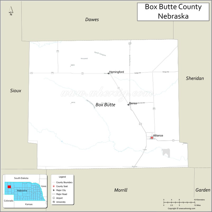
| Seat: | Alliance |
| Largest city: | Alliance |
| Total Area: | 1,078 sq mi (2,790 km²) |
| Land Area: | 1,075 sq mi (2,780 km²) |
| Total Population: | 10,604 |
| Population Density: | 10.1/sq mi (3.9/km²) |
| Time zone: | UTC−7 (Mountain) |
| Summer Time Zone (DST): | UTC−6 (MDT) |
| Website: | boxbuttecounty.us |
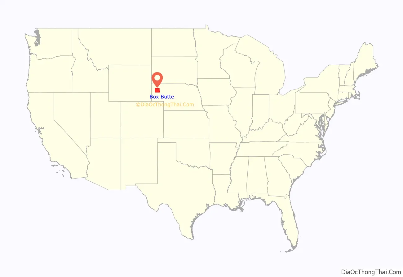
Box Butte County location map. Where is Box Butte County?
History
Box Butte County was formed as part of a series of partitionings of the Nebraska Panhandle. In 1883, the Nebraska legislature divided the Panhandle into two counties, Sioux and Cheyenne. In 1885 the original Sioux County was divided into three counties: Sioux, Dawes, and Sheridan. Because of the distance to the county seat of Chadron, residents of southern Dawes County asked that it be split off; in 1886, the legislature created Box Butte County. The new county was named after a butte in the northern part of the county; prior to the county’s formation, its name had been used in advertisements by railroad companies seeking to entice settlers to the area.
In the Nebraska license plate system, Box Butte County is represented by the prefix 65 (it had the 65th-largest number of vehicles registered in the county when the license plate system was established in 1922).
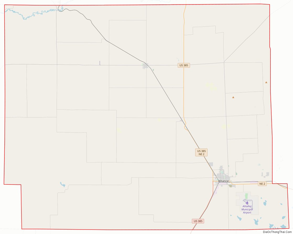
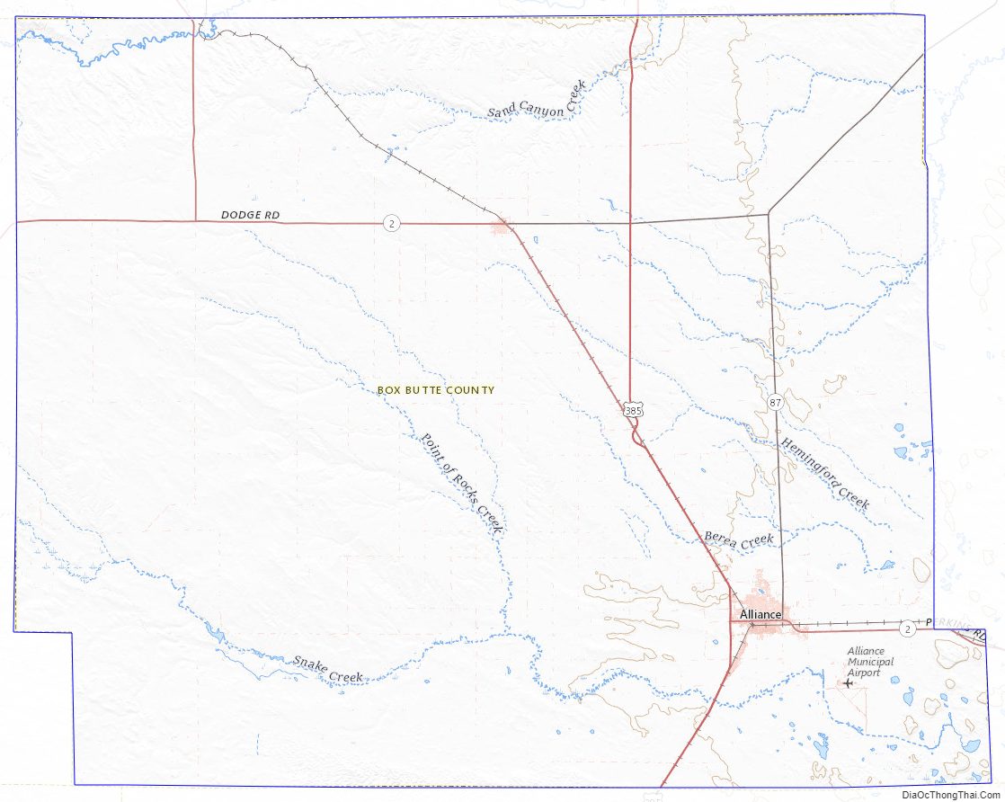
Box Butte County Road Map
Geography
According to the US Census Bureau, the county has an area of 1,078 square miles (2,790 km), of which 1,075 square miles (2,780 km) is land and 2.5 square miles (6.5 km) (11%) is water.
Major highways
- US 385
- Nebraska Highway 2
- Nebraska Highway 71
- Nebraska Highway 87
Adjacent counties
- Dawes County – north
- Sheridan County – east
- Morrill County – south
- Scotts Bluff County – southwest
- Sioux County – west
Box Butte County Topographic Map
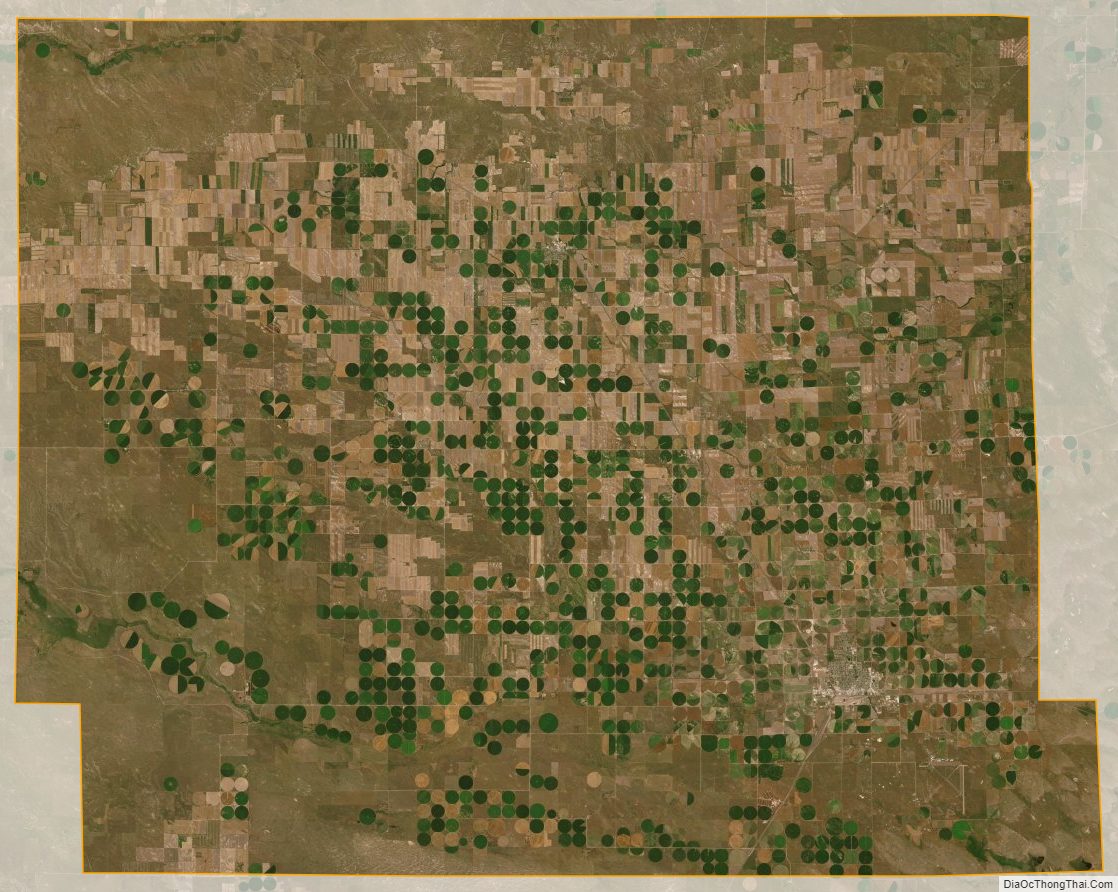
Box Butte County Satellite Map
Box Butte County Outline Map