Map of Five Points town

Map of Five Points town, Alabama

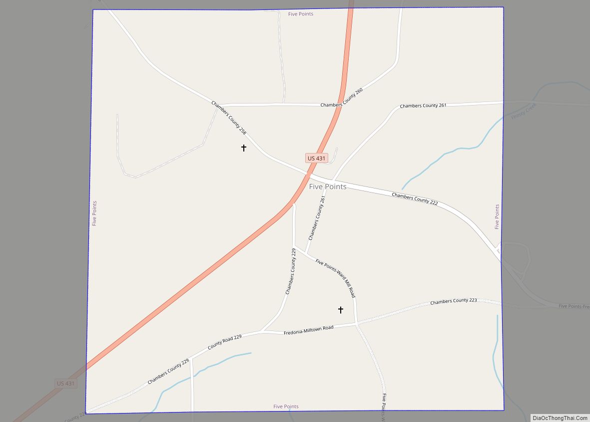
Five Points is a town in Chambers County, Alabama, United States. At the 2020 census, the population was 114. Five Points town overview: Name: Five Points town LSAD Code: 43 LSAD Description: town (suffix) State: Alabama County: Chambers County Elevation: 869 ft (265 m) Total Area: 1.03 sq mi (2.67 km²) Land Area: 1.03 sq mi (2.67 km²) Water Area: 0.00 sq mi (0.00 km²) Total … Read more

Map of Fitzpatrick CDP

Map of Fitzpatrick CDP

Fitzpatrick is an unincorporated community and census-designated place in Bullock County, Alabama, United States. As of the 2010 census, its population was 83. The community is served by Alabama State Route 110. Fitzpatrick CDP overview: Name: Fitzpatrick CDP LSAD Code: 57 LSAD Description: CDP (suffix) State: Alabama County: Bullock County Elevation: 262 ft (80 m) Total Area: … Read more

Map of Fayetteville city

Map of Fayetteville CDP, Alabama

Fayetteville is a census-designated place and unincorporated community in Talladega County, Alabama, United States. Its population was 1,284 as of the 2010 census. The following is found on a sign erected by the Alabama Historical Association: “In 1814, Tennessee Troops joined Andrew Jackson’s force which won the Creek Indian War. After Indian removal in 1836, … Read more

Map of Florence city

Map of Florence city, Alabama

Florence is a city in, and the county seat of, Lauderdale County, Alabama, United States, in the state’s northwestern corner. It is situated along the Tennessee River and is home to the University of North Alabama, the oldest college in the state. Florence is the largest and principal city of the Florence-Muscle Shoals Metropolitan Statistical … Read more

Map of Florala town

Map of Florala town

Florala is a town in Covington County, Alabama, United States. At the 2020 census, the population was 1,923. Florala town overview: Name: Florala town LSAD Code: 43 LSAD Description: town (suffix) State: Alabama County: Covington County Elevation: 262 ft (80 m) Total Area: 10.98 sq mi (28.44 km²) Land Area: 10.53 sq mi (27.28 km²) Water Area: 0.45 sq mi (1.16 km²) Total Population: 1,923 Population … Read more

Map of Flomaton town

Map of Flomaton town

Flomaton is a town in Escambia County, Alabama, United States. At the 2010 census the town’s population was 1,440. It is located next to the Alabama / Florida state line. Flomaton town overview: Name: Flomaton town LSAD Code: 43 LSAD Description: town (suffix) State: Alabama County: Escambia County Elevation: 62 ft (19 m) Total Area: 5.20 sq mi (13.46 km²) … Read more

Map of Forkland town

Map of Forkland town

Forkland is a town in Greene County, Alabama, United States. At the 2020 census, the population was 445. It was incorporated around 1974. Forkland town overview: Name: Forkland town LSAD Code: 43 LSAD Description: town (suffix) State: Alabama County: Greene County Elevation: 151 ft (46 m) Total Area: 3.51 sq mi (9.08 km²) Land Area: 3.49 sq mi (9.05 km²) Water Area: 0.01 sq mi … Read more

Map of Forestdale CDP

Map of Forestdale CDP, Alabama

Forestdale is an unincorporated community and census-designated place (CDP) in Jefferson County, Alabama, United States. It is north of the Birmingham city neighborhood of Ensley. At the 2020 census, the population was 10,409. Forestdale CDP overview: Name: Forestdale CDP LSAD Code: 57 LSAD Description: CDP (suffix) State: Alabama County: Jefferson County Elevation: 646 ft (197 m) Total … Read more

Map of Foley city

Map of Foley city, Alabama

Foley is a city in Baldwin County, Alabama, United States. The 2010 census lists the population of the city as 14,618. Foley is a principal city of the Daphne-Fairhope-Foley metropolitan area, which includes all of Baldwin County. Foley city overview: Name: Foley city LSAD Code: 25 LSAD Description: city (suffix) State: Alabama County: Baldwin County … Read more

Map of Fort Rucker CDP

Map of Fort Rucker CDP

Fort Novosel (formerly Fort Rucker) is a United States Army post located primarily in Dale County, Alabama, United States. It is named in honor of Chief Warrant Officer Michael J. Novosel, an Army aviator and medal of honor recipient. It was previously named for a Civil War officer, Confederate Colonel Edmund Rucker. The post is … Read more

Map of Fort Payne city

Map of Fort Payne city

Fort Payne is a city in and county seat of DeKalb County, in northeastern Alabama, United States. At the 2020 census, the population was 14,877. European-American settlers gradually developed the settlement around the former fort. It grew rapidly in the late 19th century based on industrial resources and manufacturing increasing in the early 20th centuries. … Read more

Map of Fort Deposit town

Map of Fort Deposit town

Fort Deposit is a town in Lowndes County, Alabama, United States. Since 1890, it has been the largest town in Lowndes County. At the 2010 census the population was 1,344, up from 1,270 in 2000. It is part of the Montgomery Metropolitan Statistical Area. This town is named after a fort that was built under … Read more