Foley is a city in Baldwin County, Alabama, United States. The 2010 census lists the population of the city as 14,618. Foley is a principal city of the Daphne-Fairhope-Foley metropolitan area, which includes all of Baldwin County.
| Name: | Foley city |
|---|---|
| LSAD Code: | 25 |
| LSAD Description: | city (suffix) |
| State: | Alabama |
| County: | Baldwin County |
| Elevation: | 79 ft (24 m) |
| Total Area: | 32.65 sq mi (84.57 km²) |
| Land Area: | 32.51 sq mi (84.20 km²) |
| Water Area: | 0.14 sq mi (0.37 km²) |
| Total Population: | 20,335 |
| Population Density: | 625.52/sq mi (241.51/km²) |
| ZIP code: | 36535-36536 |
| Area code: | 251 |
| FIPS code: | 0126992 |
| GNISfeature ID: | 0118464 |
| Website: | http://www.cityoffoley.org |
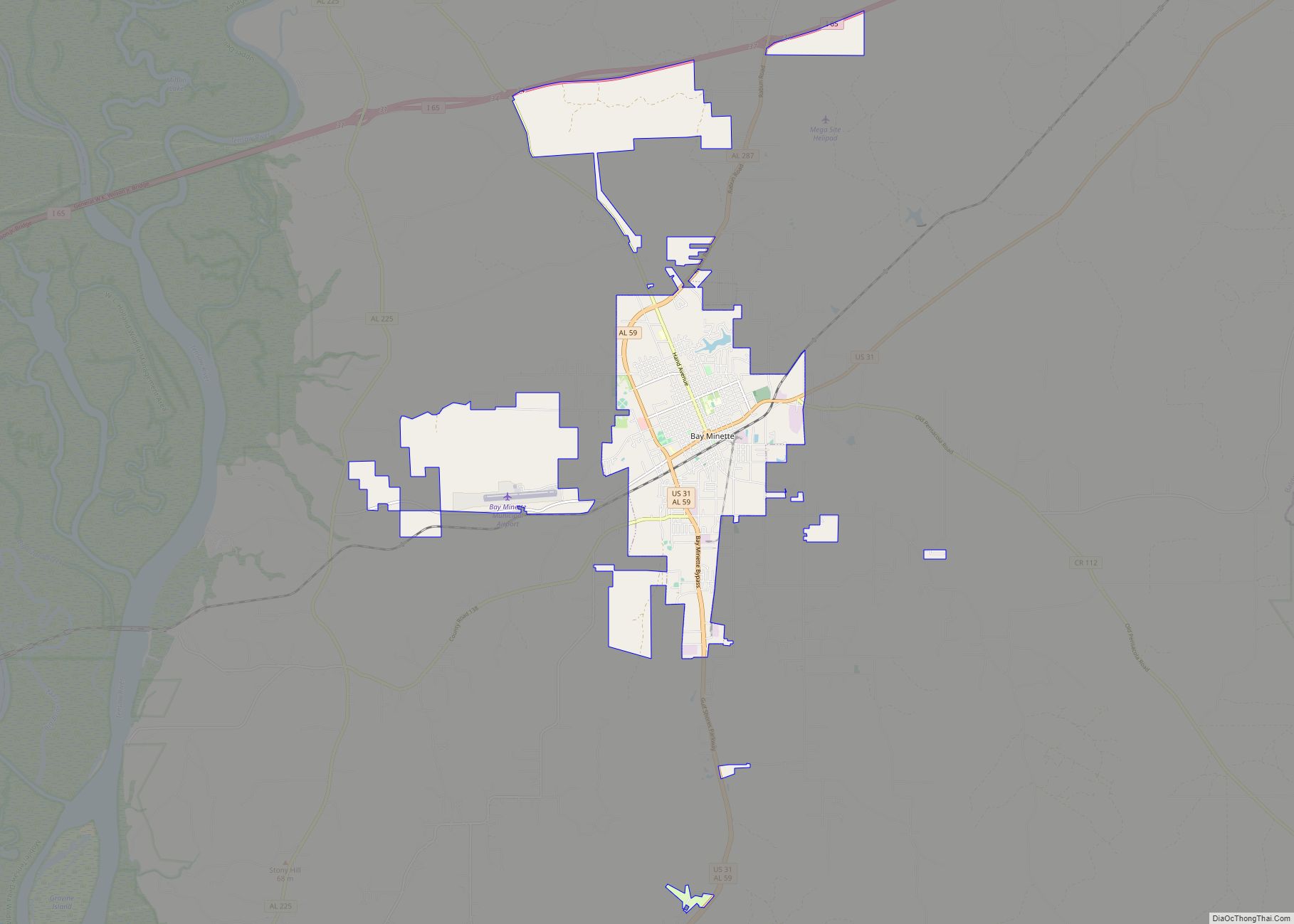
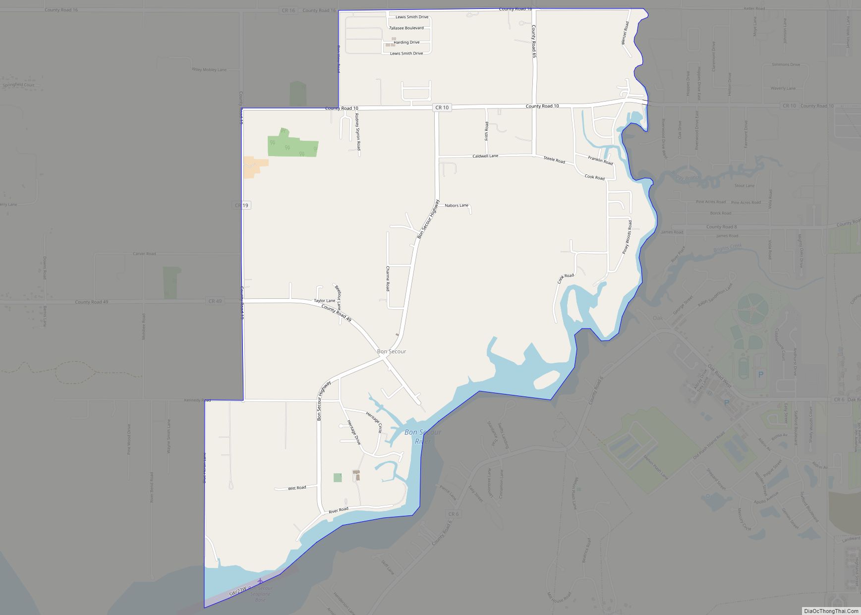
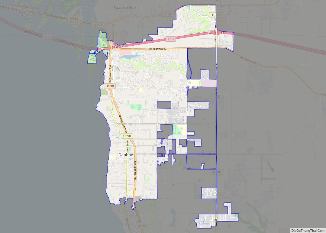
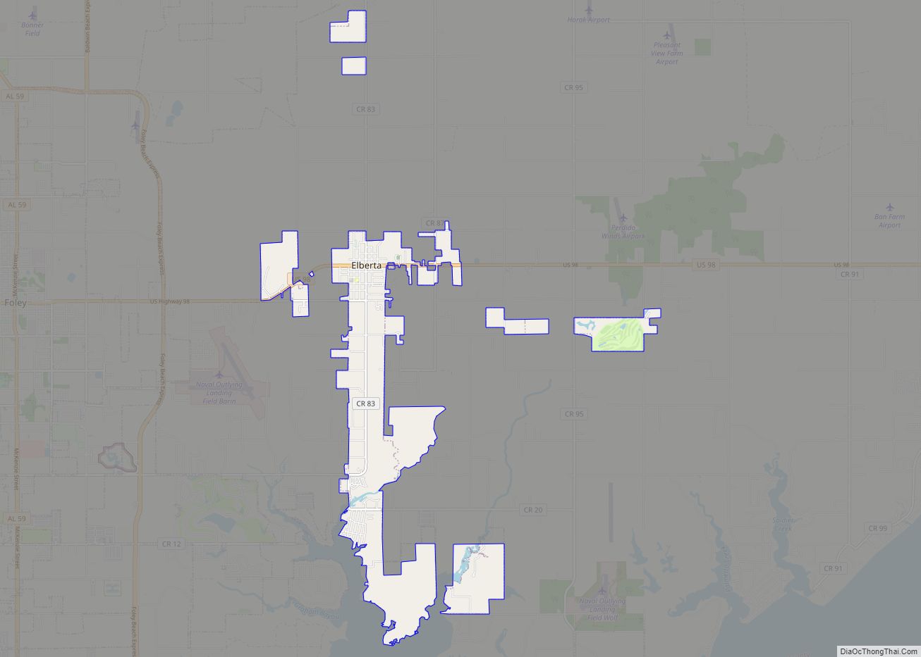
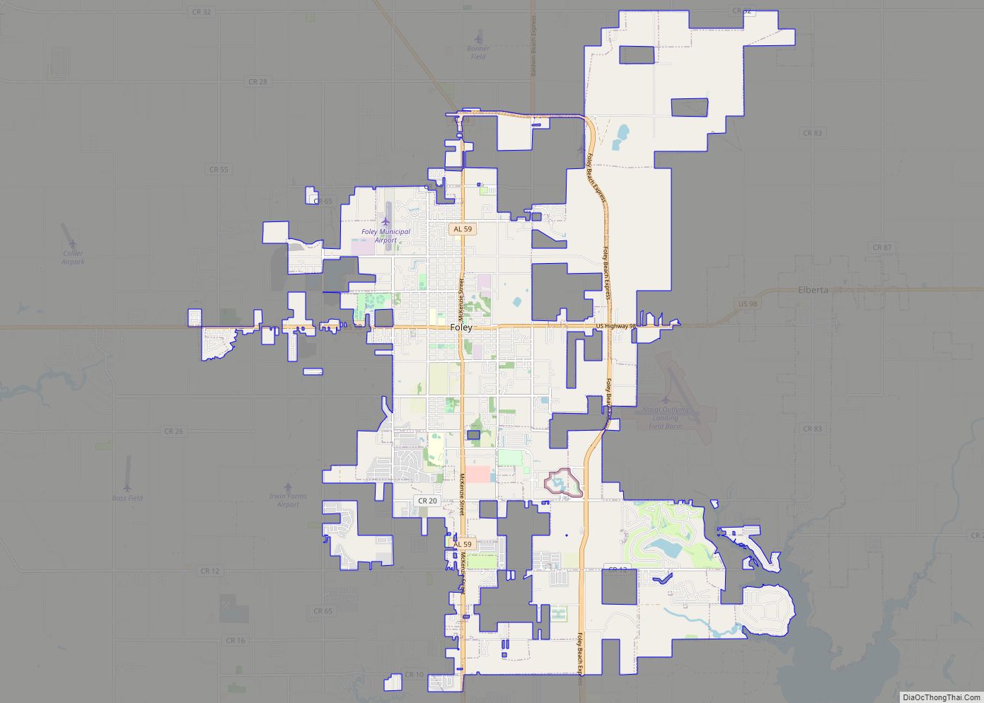
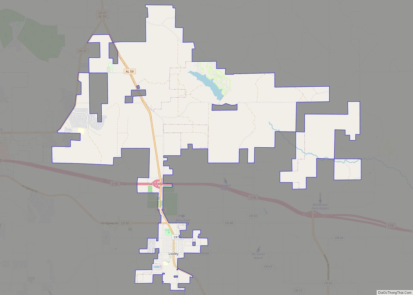
Online Interactive Map
Click on ![]() to view map in "full screen" mode.
to view map in "full screen" mode.
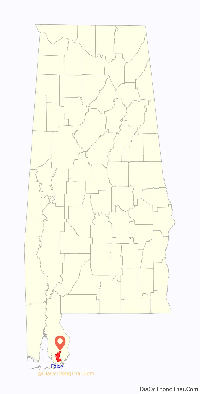
Foley location map. Where is Foley city?

History
Foley was named for its founder, John B. Foley of Chicago. As Foley was traveling to President William McKinley’s funeral in 1901, he met a railroad agent who told him of the area in South Baldwin County. Foley came down the following year, and liked what he saw, buying between 40,000 acres (160 km) and 50,000 acres (200 km) of land. He then returned to Chicago and formed the Magnolia Springs Land Company, currently known as the Magnolia Land Company. As he began to sell off acreage, he realized the need for a better way for the people to come to Foley.
Foley used some of his own money to lay the rails so the train could come from Bay Minette. The first railroad station was built in 1905. The original station burned in 1908 and was replaced the following year by the station that is now the city’s museum. John Foley donated parcels of land for a school, railroad station, park and churches. These included the current Catholic Church, Saint Margaret of Scotland, the Baptist church and the Methodist church. He also invested in a hotel, a demonstration farm, a bank and the utility company.
The first train to service Foley was a wood burner called the “Pine Knot Special.” It would leave Foley in the morning and make a return trip in the afternoon. As people cleared the land, they would place lighter knots in a wood box for the engineer to use as was needed. Foley was incorporated in 1915 with G. I. Weatherly serving as its first mayor.
Foley Road Map

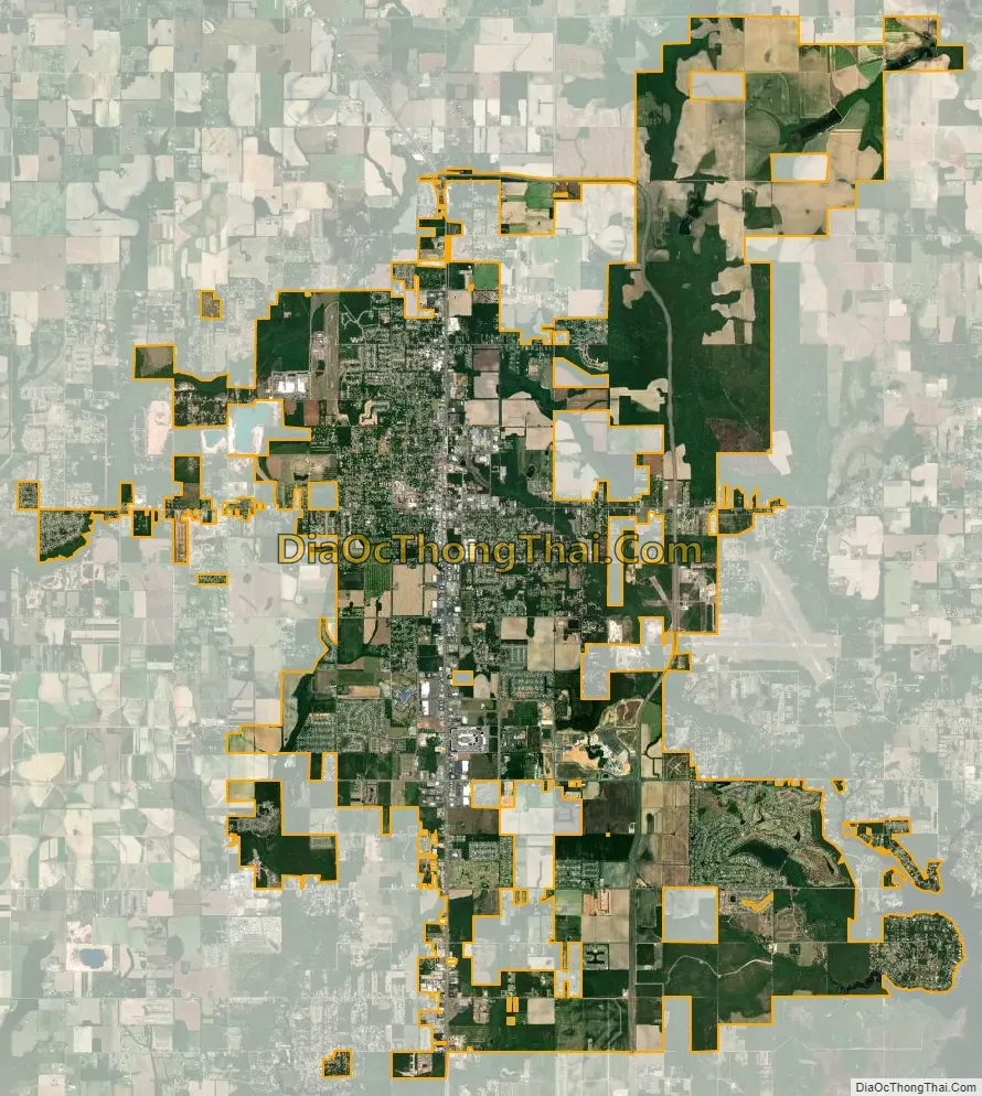
Foley city Satellite Map
Geography
Foley is located at 30°24’20.138″ North, 87°40’53.432″ West (30.405594, -87.681509).
According to the U.S. Census Bureau, the city has a total area of 25.89 sq mi (67.1 km), of which 25.76 sq mi (66.7 km) is land and 0.4% is water.
See also
Map of Alabama State and its subdivision:- Autauga
- Baldwin
- Barbour
- Bibb
- Blount
- Bullock
- Butler
- Calhoun
- Chambers
- Cherokee
- Chilton
- Choctaw
- Clarke
- Clay
- Cleburne
- Coffee
- Colbert
- Conecuh
- Coosa
- Covington
- Crenshaw
- Cullman
- Dale
- Dallas
- De Kalb
- Elmore
- Escambia
- Etowah
- Fayette
- Franklin
- Geneva
- Greene
- Hale
- Henry
- Houston
- Jackson
- Jefferson
- Lamar
- Lauderdale
- Lawrence
- Lee
- Limestone
- Lowndes
- Macon
- Madison
- Marengo
- Marion
- Marshall
- Mobile
- Monroe
- Montgomery
- Morgan
- Perry
- Pickens
- Pike
- Randolph
- Russell
- Saint Clair
- Shelby
- Sumter
- Talladega
- Tallapoosa
- Tuscaloosa
- Walker
- Washington
- Wilcox
- Winston
- Alabama
- Alaska
- Arizona
- Arkansas
- California
- Colorado
- Connecticut
- Delaware
- District of Columbia
- Florida
- Georgia
- Hawaii
- Idaho
- Illinois
- Indiana
- Iowa
- Kansas
- Kentucky
- Louisiana
- Maine
- Maryland
- Massachusetts
- Michigan
- Minnesota
- Mississippi
- Missouri
- Montana
- Nebraska
- Nevada
- New Hampshire
- New Jersey
- New Mexico
- New York
- North Carolina
- North Dakota
- Ohio
- Oklahoma
- Oregon
- Pennsylvania
- Rhode Island
- South Carolina
- South Dakota
- Tennessee
- Texas
- Utah
- Vermont
- Virginia
- Washington
- West Virginia
- Wisconsin
- Wyoming