Map of Ider town

Map of Ider town

Ider is a town in DeKalb County, Alabama, United States. At the 2020 census, the population was 735. It incorporated in October 1973. Ider town overview: Name: Ider town LSAD Code: 43 LSAD Description: town (suffix) State: Alabama County: DeKalb County Elevation: 1,562 ft (476 m) Total Area: 5.43 sq mi (14.06 km²) Land Area: 5.43 sq mi (14.06 km²) Water Area: 0.00 sq mi … Read more

Map of Hytop town

Map of Hytop town

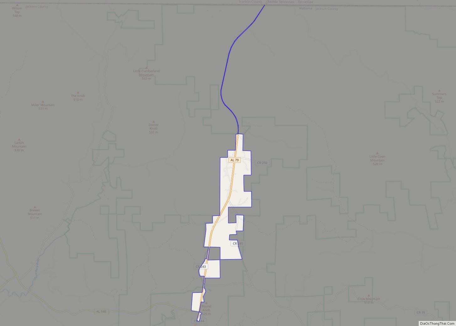
Hytop is a town in Jackson County, Alabama, United States. It incorporated on May 17, 1991. As of the 2010 census, the population of the town was 354, up from 315 in 2000. The Walls of Jericho, a popular hiking area, is located just north of Hytop. Hytop town overview: Name: Hytop town LSAD Code: … Read more

Map of Hurtsboro town

Map of Hurtsboro town

Hurtsboro is a town in Russell County, Alabama, United States. At the 2010 census the population was 553, down from 592 in 2000. It was founded in 1857 as Hurtsville and named for Joel Hurt, Sr. (whose son, Joel Hurt, was an important developer of Atlanta, Georgia). A railroad spur from Columbus, Georgia was completed … Read more

Map of Ivalee CDP

Map of Ivalee CDP

Ivalee is a census-designated place and unincorporated community in Etowah County, Alabama, United States. Its population was 879 as of the 2010 census. Ivalee CDP overview: Name: Ivalee CDP LSAD Code: 57 LSAD Description: CDP (suffix) State: Alabama County: Etowah County Elevation: 669 ft (204 m) Total Area: 7.45 sq mi (19.30 km²) Land Area: 7.45 sq mi (19.30 km²) Water Area: 0.00 sq mi … Read more

Map of Irondale city

Map of Irondale city, Alabama

Irondale is a city in Jefferson County, Alabama, United States. It is a suburb of Birmingham, northeast of Homewood and Mountain Brook. At the 2020 census, the population was 13,497. The city is the site of Catholic radio/television broadcaster Eternal Word Television Network, or (EWTN). The city’s annual Whistle-Stop Festival attracts thousands to its eclectic … Read more

Map of Indian Springs Village city

Map of Indian Springs Village city

Indian Springs Village (often simply called Indian Springs) is a rural town in Shelby County, Alabama, United States, in the Birmingham metropolitan area. It incorporated effective November 14, 1990. At the 2010 census the population was 2,363, up from 2,225 in 2000. An F2 tornado on Palm Sunday, March 27, 1994 damaged business buildings of … Read more

Map of Jacksonville city

Map of Jacksonville city, Alabama

Jacksonville is a city in Calhoun County, Alabama, United States. As of the 2010 census the population was 12,548, which is a 49% increase since 2000. It is included in the Anniston-Oxford Metropolitan Statistical Area. The city is home to Jacksonville State University, which is a center of commerce and one of the largest employers … Read more

Map of Jacksons' Gap town

Map of Jacksons’ Gap town

Jacksons’ Gap town overview: Name: Jacksons’ Gap town LSAD Code: 43 LSAD Description: town (suffix) State: Alabama County: Tallapoosa County FIPS code: 0138248 Online Interactive Map Jacksons’ Gap online map. Source: Basemap layers from Google Map, Open Street Map (OSM), Arcgisonline, Wmflabs. Boundary Data from Database of Global Administrative Areas. Jacksons’ Gap location map. Where … Read more

Map of Jackson city

Map of Jackson city, Alabama

Jackson is a city in Clarke County, Alabama, United States. The population was 5,557 at the 2020 census. It was one of three wet settlements in an otherwise-dry county. Jackson city overview: Name: Jackson city LSAD Code: 25 LSAD Description: city (suffix) State: Alabama County: Clarke County Elevation: 236 ft (72 m) Total Area: 15.83 sq mi (41.00 km²) Land … Read more

Map of Jemison city

Map of Jemison city

Jemison is a city in Chilton County, Alabama, United States. At the 2020 census, the population was 2,642. The center of population of Alabama is located outside of Jemison, an area known as Jemison Division. Jemison city overview: Name: Jemison city LSAD Code: 25 LSAD Description: city (suffix) State: Alabama County: Chilton County Elevation: 719 ft … Read more

Map of Jasper city

Map of Jasper city, Alabama

Jasper is a city in and the county seat of Walker County, Alabama, United States. Its population was 14,352 as of the 2010 census. Named in honor of Sergeant William Jasper, an American Revolutionary War hero, Jasper was settled around 1815 and incorporated on August 18, 1886. The first significant growth of the area was … Read more

Map of Joppa CDP

Map of Joppa CDP, Alabama

Joppa is a census-designated place (CDP) and unincorporated community in Cullman and Marshall counties, Alabama, United States. As of the 2020 census, its population was 556. Joppa CDP overview: Name: Joppa CDP LSAD Code: 57 LSAD Description: CDP (suffix) State: Alabama County: Cullman County Elevation: 997 ft (304 m) Total Area: 1.97 sq mi (5.11 km²) Land Area: 1.94 sq mi (5.04 km²) … Read more