Jacksonville is a city in Calhoun County, Alabama, United States. As of the 2010 census the population was 12,548, which is a 49% increase since 2000. It is included in the Anniston-Oxford Metropolitan Statistical Area. The city is home to Jacksonville State University, which is a center of commerce and one of the largest employers in the area.
| Name: | Jacksonville city |
|---|---|
| LSAD Code: | 25 |
| LSAD Description: | city (suffix) |
| State: | Alabama |
| County: | Calhoun County |
| Elevation: | 709 ft (216 m) |
| Total Area: | 10.92 sq mi (28.28 km²) |
| Land Area: | 10.91 sq mi (28.25 km²) |
| Water Area: | 0.01 sq mi (0.03 km²) |
| Total Population: | 14,385 |
| Population Density: | 1,318.76/sq mi (509.19/km²) |
| ZIP code: | 36265 |
| Area code: | 256 |
| FIPS code: | 0138272 |
| GNISfeature ID: | 0159857 |
| Website: | www.jacksonville-al.org |
Online Interactive Map
Click on ![]() to view map in "full screen" mode.
to view map in "full screen" mode.
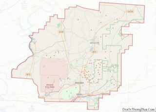
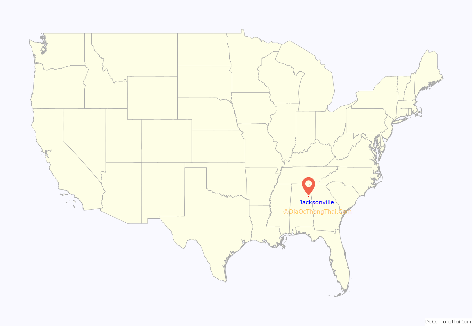
Jacksonville location map. Where is Jacksonville city?

History
Jacksonville was founded in 1833 on land purchased from Creek Indian Chief “Du-Hoag” Ladiga. First called Drayton, the town was renamed to honor President Andrew Jackson in 1834. There are a couple Civil War monuments in town, including a statue of Major John Pelham in the city cemetery and a statue of a Confederate soldier in the middle of the square. Jacksonville served as the county seat for Calhoun County (pronounced Cal’n County) until the 20th century when it moved to Anniston. Jacksonville State University was founded here in 1883.
An EF3 tornado hit Jacksonville on March 19, 2018, causing extensive damage to the city and Jacksonville State University, almost $42 million in damages. The relatively low number of casualties, specifically just four injuries, was attributed by some to the fact that the university was on spring break at the time. More than 1,000 volunteers assisted in the immediate tornado relief. Caleb Howard, then a senior at Jacksonville State University, said that “[i]t’s been amazing to see the university and the community come together.” Classes resumed at the university the following month. Although the university’s usual site for graduation, Pete Mathews Coliseum, was damaged in the tornado along with over 20 other buildings, the first spring graduation since the tornado proceeded as scheduled on May 4 outside the football stadium. Dr. John Beeler, the university’s president, said “It’s a joyous event generally because you’re celebrating the accomplishments of all your graduates, but it’s an even more joyous event because to me it’s a celebration of how far we’ve come in a short time in recovering from these tornadoes.”
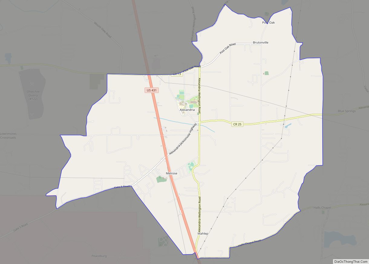
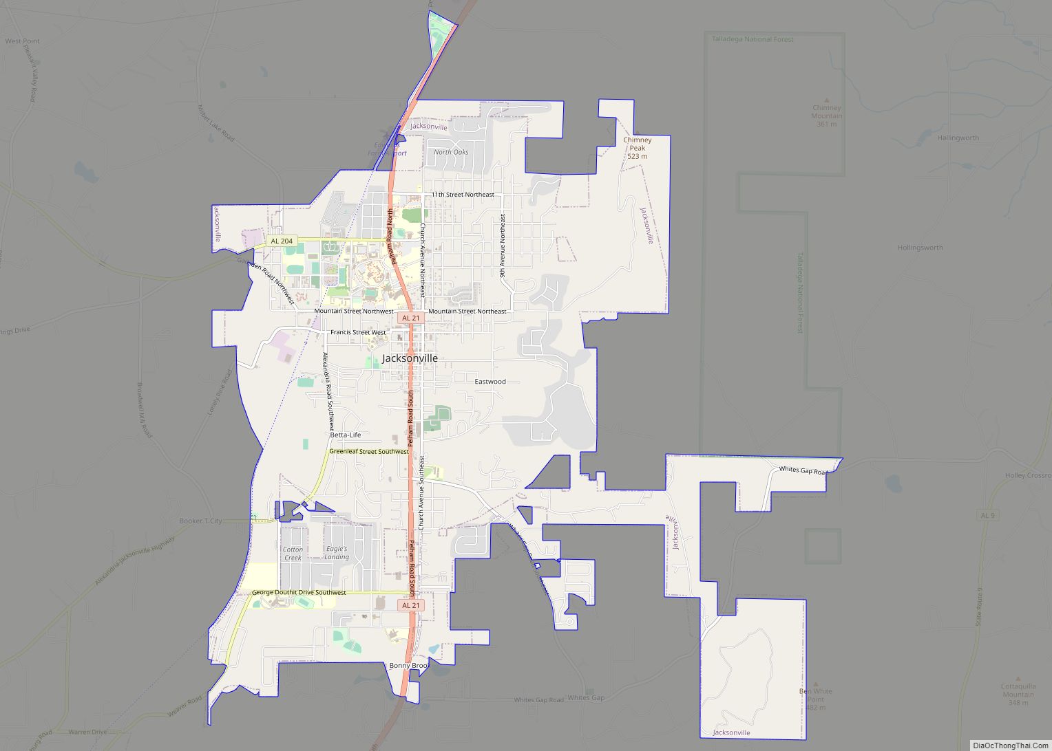
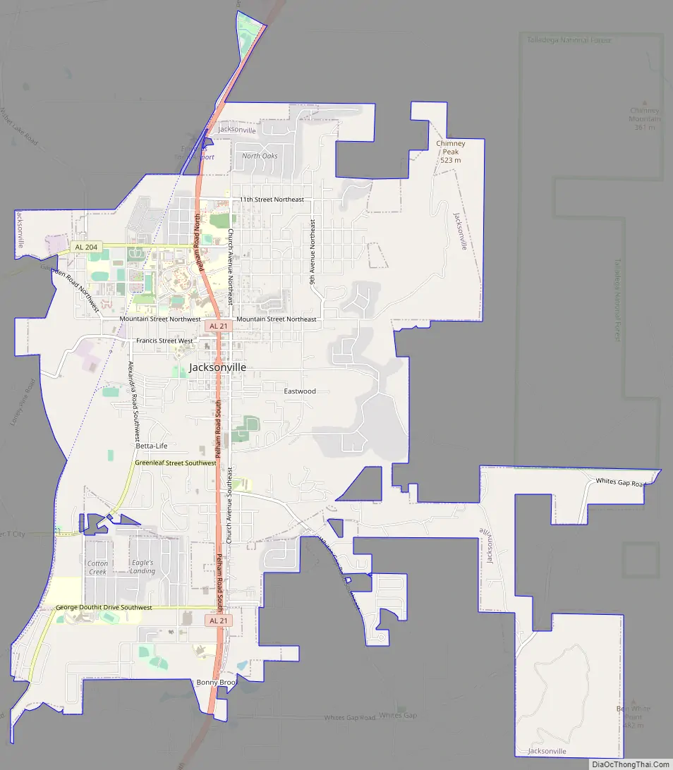
Jacksonville Road Map
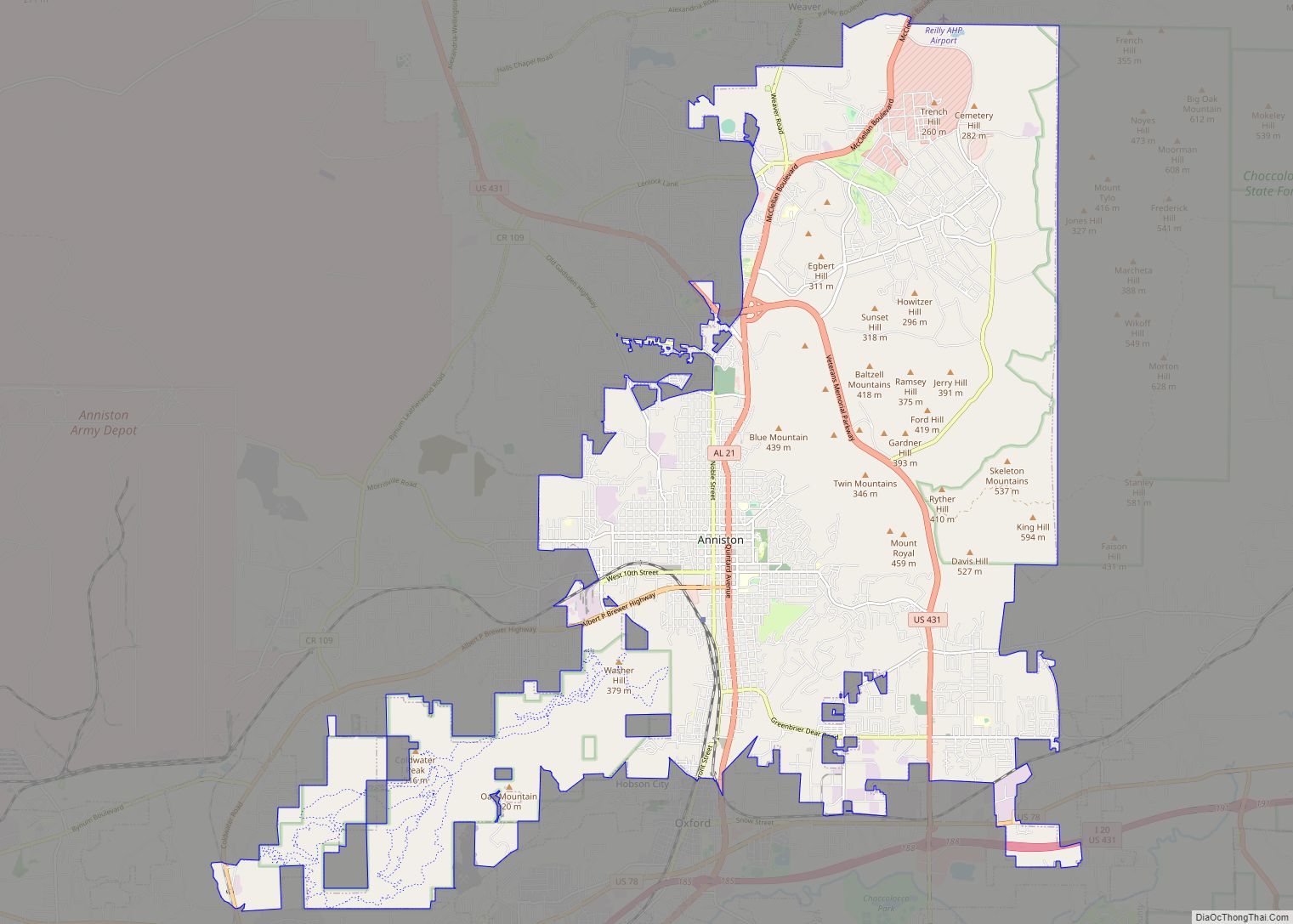
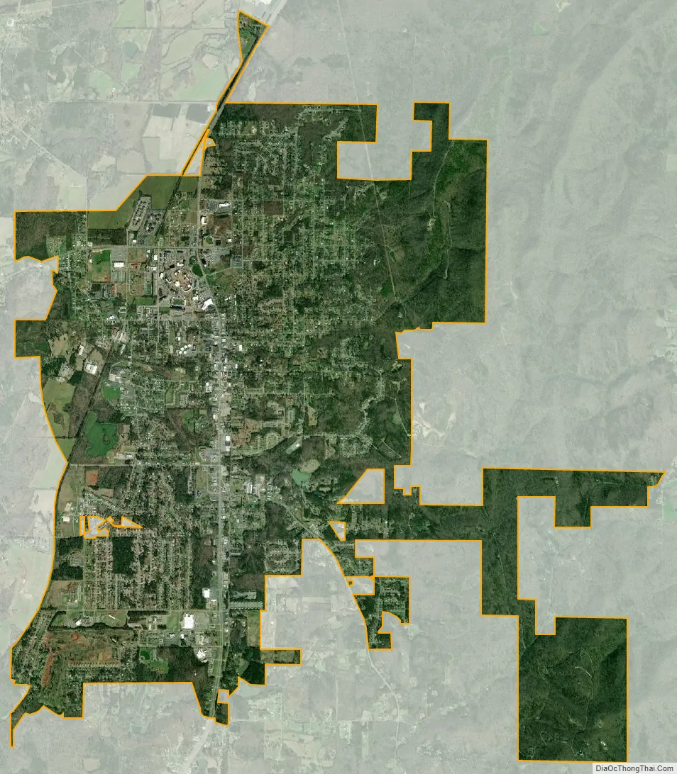
Jacksonville city Satellite Map
Geography
Nestled in the foothills of the Appalachians, Jacksonville is located at 33°48’56.758″ North, 85°45’37.681″ West (33.815766, -85.760467).
According to the U.S. Census Bureau, the city has a total area of 9.8 square miles (25.5 km), of which 0.008 square miles (0.02 km), or 0.10%, is water. Jacksonville is located in a valley between Choccolocco Mountain to the east and smaller ridges to the west.
See also
Map of Alabama State and its subdivision:- Autauga
- Baldwin
- Barbour
- Bibb
- Blount
- Bullock
- Butler
- Calhoun
- Chambers
- Cherokee
- Chilton
- Choctaw
- Clarke
- Clay
- Cleburne
- Coffee
- Colbert
- Conecuh
- Coosa
- Covington
- Crenshaw
- Cullman
- Dale
- Dallas
- De Kalb
- Elmore
- Escambia
- Etowah
- Fayette
- Franklin
- Geneva
- Greene
- Hale
- Henry
- Houston
- Jackson
- Jefferson
- Lamar
- Lauderdale
- Lawrence
- Lee
- Limestone
- Lowndes
- Macon
- Madison
- Marengo
- Marion
- Marshall
- Mobile
- Monroe
- Montgomery
- Morgan
- Perry
- Pickens
- Pike
- Randolph
- Russell
- Saint Clair
- Shelby
- Sumter
- Talladega
- Tallapoosa
- Tuscaloosa
- Walker
- Washington
- Wilcox
- Winston
- Alabama
- Alaska
- Arizona
- Arkansas
- California
- Colorado
- Connecticut
- Delaware
- District of Columbia
- Florida
- Georgia
- Hawaii
- Idaho
- Illinois
- Indiana
- Iowa
- Kansas
- Kentucky
- Louisiana
- Maine
- Maryland
- Massachusetts
- Michigan
- Minnesota
- Mississippi
- Missouri
- Montana
- Nebraska
- Nevada
- New Hampshire
- New Jersey
- New Mexico
- New York
- North Carolina
- North Dakota
- Ohio
- Oklahoma
- Oregon
- Pennsylvania
- Rhode Island
- South Carolina
- South Dakota
- Tennessee
- Texas
- Utah
- Vermont
- Virginia
- Washington
- West Virginia
- Wisconsin
- Wyoming