Map of Lisman town

Map of Lisman town

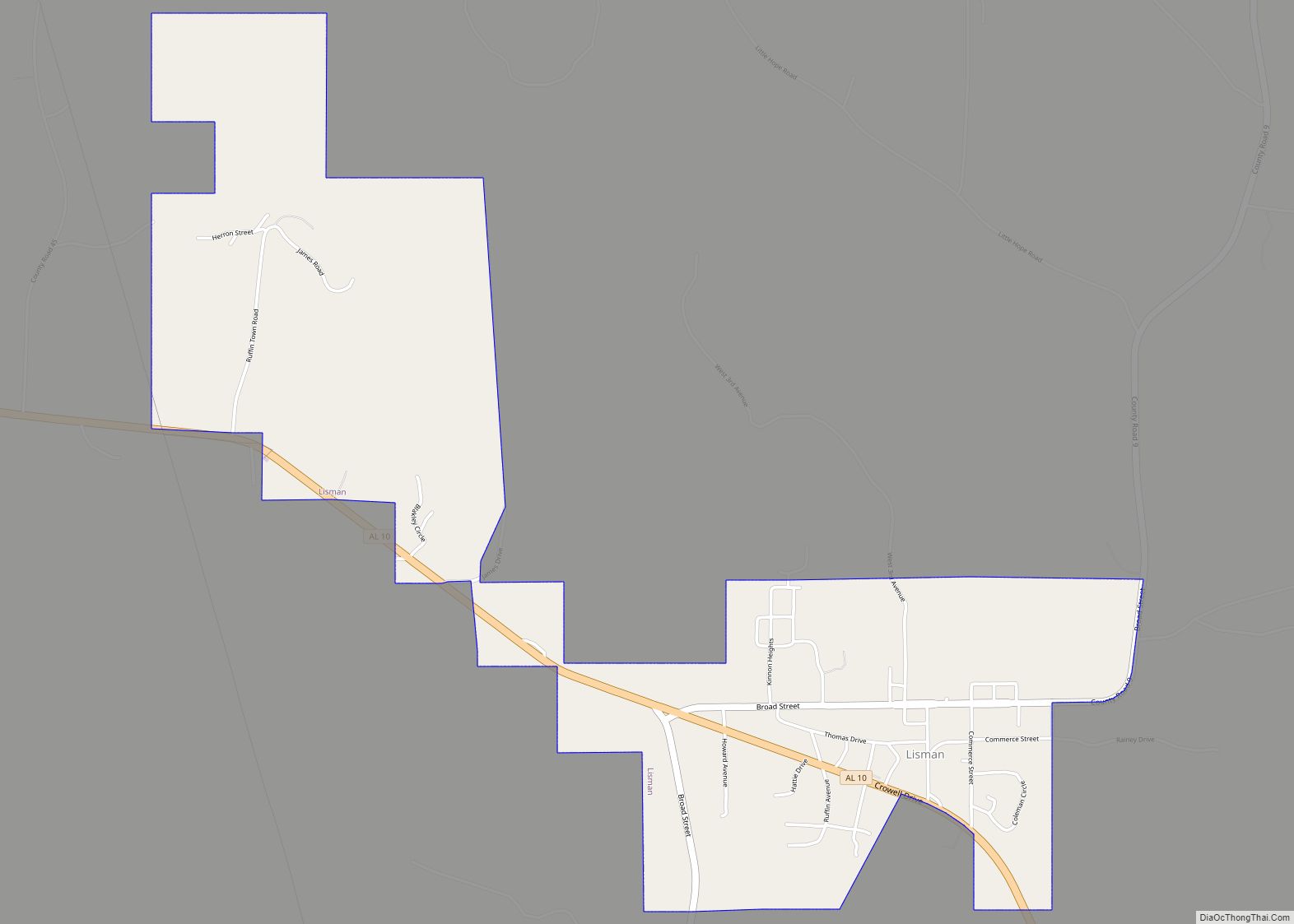
Lisman is a town in Choctaw County, Alabama, United States. At the 2020 census, the population was 427. Lisman was named after a 19th-century railroad investor at the time of construction of the nearby rail line. Lisman town overview: Name: Lisman town LSAD Code: 43 LSAD Description: town (suffix) State: Alabama County: Choctaw County Elevation: … Read more

Map of Lipscomb city

Map of Lipscomb city, Alabama

Lipscomb is a city in western Jefferson County, Alabama. It is part of the Birmingham, Alabama, metropolitan area. At the 2020 census, the population was 2,086. It does not have its own U.S. Post Office or ZIP code, instead sharing the Bessemer ZIP code (35020). Lipscomb city overview: Name: Lipscomb city LSAD Code: 25 LSAD … Read more

Map of Lineville city

Map of Lineville city, Alabama

Lineville is a city in Clay County, Alabama, United States. At the 2020 census, the population was 2,489. Lineville city overview: Name: Lineville city LSAD Code: 25 LSAD Description: city (suffix) State: Alabama County: Clay County Elevation: 1,056 ft (322 m) Total Area: 9.74 sq mi (25.23 km²) Land Area: 9.67 sq mi (25.04 km²) Water Area: 0.07 sq mi (0.19 km²) Total Population: 2,489 Population … Read more

Map of Loachapoka town

Map of Loachapoka town

Loachapoka (/ˌloʊ.tʃəˈpoʊ.kə/) is a town in Lee County, Alabama, United States. It is located less than 1/2 mile west of Auburn and approximately 5 miles (8 km) west of Auburn University, in west-central Lee County. The population was 180 as of the 2010 census. It is part of the Auburn metropolitan area. The name “Loachapoka” means … Read more

Map of Livingston city

Map of Livingston city, Alabama

Livingston is a city in and the county seat of Sumter County, Alabama, United States and the home of the University of West Alabama. By an act of the state legislature, it was incorporated on January 10, 1835. At the 2010 census the population was 3,485, up from 3,297 in 2000. It was named in … Read more

Map of Littleville town

Map of Littleville town

Littleville is a town located on the southern border of Colbert County, Alabama, United States, and extends into Franklin County. It is part of the Florence – Muscle Shoals Metropolitan Statistical Area known as “The Shoals”. As of the 2010 census, the population of the town was 1,011. Littleville town overview: Name: Littleville town LSAD … Read more

Map of Lookout Mountain CDP

Map of Lookout Mountain CDP, Alabama

Lookout Mountain is a census-designated place in Etowah County, Alabama, United States. Its population was 1,621 as of the 2010 census. Lookout Mountain CDP overview: Name: Lookout Mountain CDP LSAD Code: 57 LSAD Description: CDP (suffix) State: Alabama County: Etowah County Elevation: 833 ft (254 m) Total Area: 15.24 sq mi (39.48 km²) Land Area: 15.23 sq mi (39.45 km²) Water Area: 0.01 sq mi … Read more

Map of Locust Fork town

Map of Locust Fork town

Locust Fork is a town in Blount County, Alabama, United States. At the 2010 census the population was 1,186 people, up from 1,016 in 2000. Locust Fork town overview: Name: Locust Fork town LSAD Code: 43 LSAD Description: town (suffix) State: Alabama County: Blount County Elevation: 584 ft (178 m) Total Area: 3.89 sq mi (10.07 km²) Land Area: 3.88 sq mi … Read more

Map of Lockhart town

Map of Lockhart town, Alabama

Lockhart is a town in Covington County, Alabama, United States. At the 2020 census, the population was 445. Lockhart town overview: Name: Lockhart town LSAD Code: 43 LSAD Description: town (suffix) State: Alabama County: Covington County Elevation: 289 ft (88 m) Total Area: 1.13 sq mi (2.92 km²) Land Area: 1.09 sq mi (2.82 km²) Water Area: 0.04 sq mi (0.10 km²) Total Population: 445 Population … Read more

Map of Louisville/Jefferson County metro government (balance)

Map of Louisville town, Alabama

Louisville (/ˈluːɪsvɪl/) is a town in Barbour County, Alabama, United States. Originally named “Lewisville” and still pronounced as such. At the 2020 census, the population was 395. Louisville town overview: Name: Louisville town LSAD Code: 43 LSAD Description: town (suffix) State: Alabama County: Barbour County Elevation: 551 ft (168 m) Total Area: 2.75 sq mi (7.12 km²) Land Area: 2.75 sq mi … Read more

Map of Loxley town

Map of Loxley town

Loxley is a city in Baldwin County, Alabama, United States. As of the 2010 census, the population of the town was 1,632. It is part of the Daphne-Fairhope-Foley metropolitan area. Loxley is becoming a popular location for the expansion of the suburbs from Daphne and Spanish Fort, Alabama, because it is served by an Interstate … Read more

Map of Lowndesboro town

Map of Lowndesboro town

Lowndesboro is a town in Lowndes County, Alabama, United States. At the 2010 census the population was 115, down from 140 in 2000. It is part of the Montgomery Metropolitan Statistical Area. Although initially incorporated in 1856 by an act of the state legislature, it lapsed and was not reincorporated until 1962. As of the … Read more