Lineville is a city in Clay County, Alabama, United States. At the 2020 census, the population was 2,489.
| Name: | Lineville city |
|---|---|
| LSAD Code: | 25 |
| LSAD Description: | city (suffix) |
| State: | Alabama |
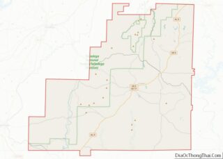
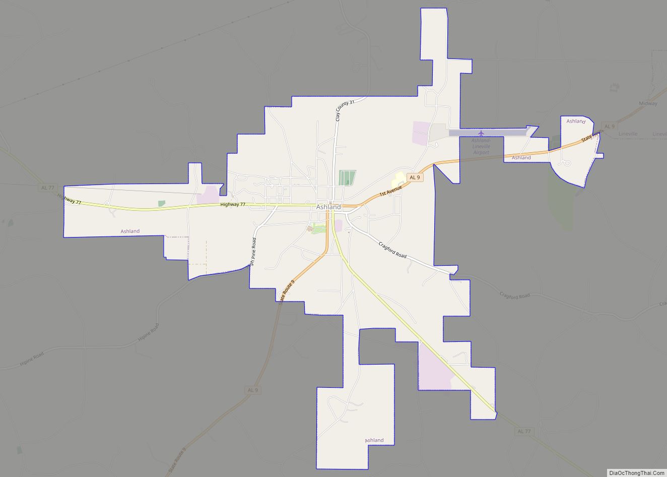
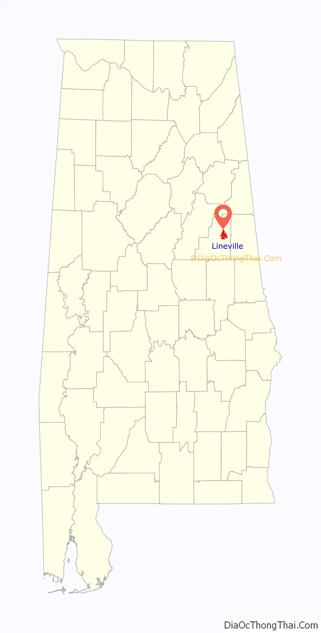
| County: | Clay County |
| Elevation: | 1,056 ft (322 m) |
| Total Area: | 9.74 sq mi (25.23 km²) |
| Land Area: | 9.67 sq mi (25.04 km²) |
| Water Area: | 0.07 sq mi (0.19 km²) |
| Total Population: | 2,489 |
| Population Density: | 257.45/sq mi (99.40/km²) |
| ZIP code: | 36266 |
| Area code: | 256 |
| FIPS code: | 0143264 |
| GNISfeature ID: | 0159953 |
| Website: | www.cityoflineville.com |
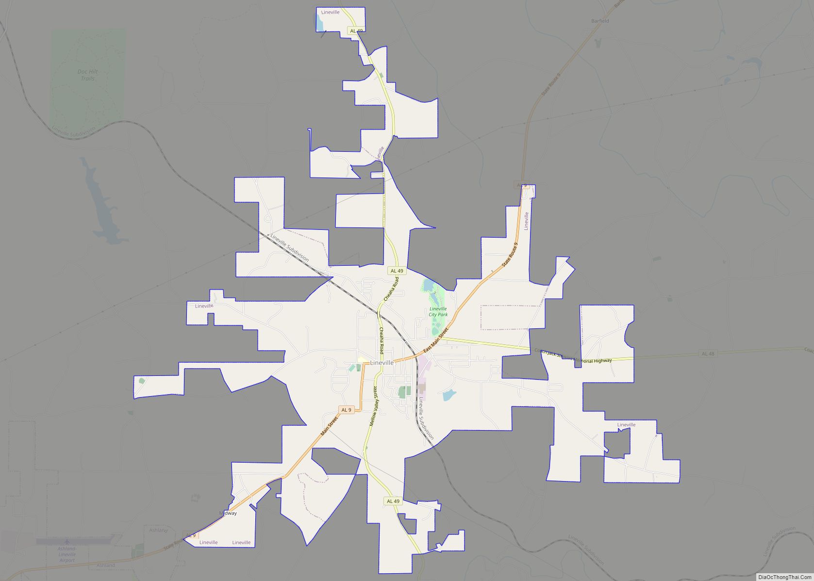
Online Interactive Map
Click on ![]() to view map in "full screen" mode.
to view map in "full screen" mode.
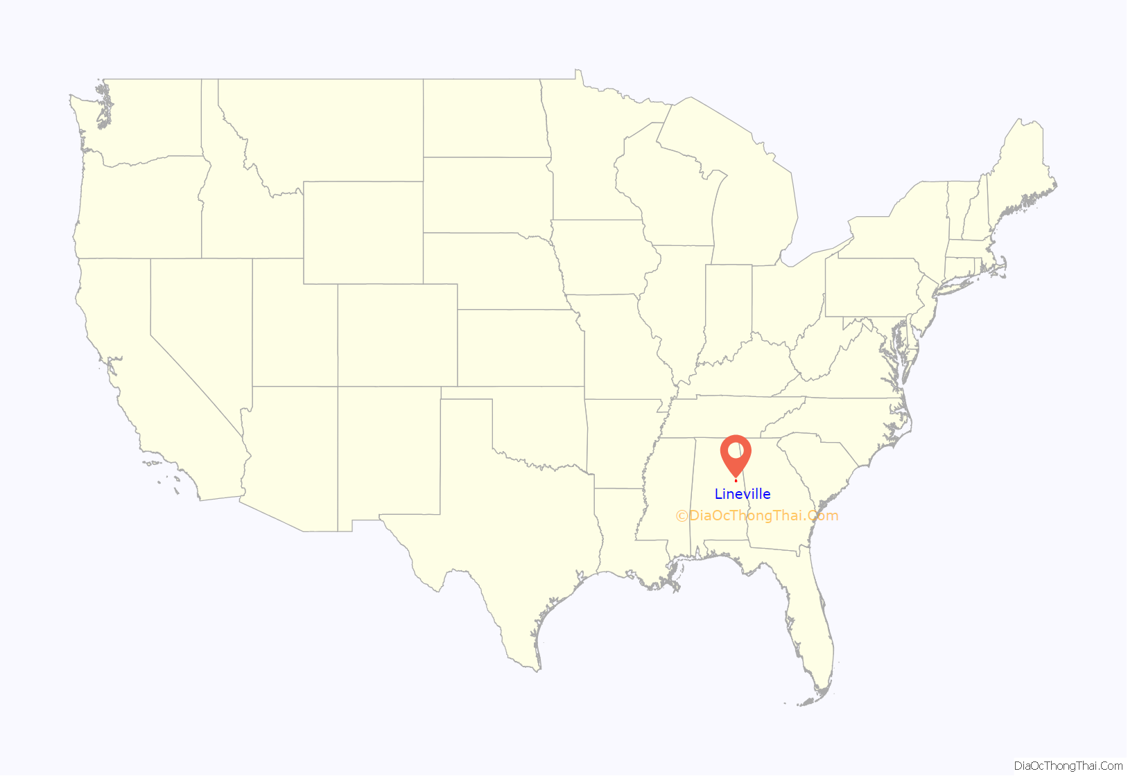
Lineville location map. Where is Lineville city?
History
Native Americans were the first to inhabit the area now known as Lineville. The Creek Indian War of 1813, however, resulted in their removal. The first white settlers in the area were William and Thomas Lundie. Their settlement became known as Lundie’s Cross Roads after a trading post opened in the 1830s to serve pioneers and miners searching for gold. In 1856, Lundie’s Cross Roads became known as County Line, probably for the Baptist Church, founded in 1848 and located on what was then the boundary line between Talladega and Randolph counties. Also in 1856, a post office was established in County Line, schools were consolidated and corn and cotton became cash crops.
The Town of (Crooked Creek) Lineville was built on what was at that time the dividing line between Talladega and Randolph Counties, hence the name, Lineville. John H. Ingram, Sr. of Lineville, Alabama furnishes the following early history: “Crooked Creek Baptist Church, later Lineville, was organized in 1839 and built one and one quarter miles west of the town of Lineville about 200 yards northwest of the home of Frank Pittard; and the first literary school of the community was nearby. Some years later the church was moved a short distance and a house was built on the left side of the public road near the residence of the late Thomas H. Harris. In about 1863 the church was moved into the town of Lineville and a house built just west of the present grammar school building; the name was changed to Lineville Baptist Church in 1881 and legally incorporated in 1912; the first Circuit Court that was held in the new County of Clay, was held in the Lineville Baptist Church in 1867, with John Henderson of Talladega, Alabama, as a judge. The present new brick building was built in 1915 and 1916, with the first service held on March 1st, 1916, with prayer and thanksgiving service conducted by J.H. Ingram, Sr., and C.N. James, pastor.”
One of the newest attractions in Clay County in the 1920s, was the chicken business. Millions of chickens and eggs and long chicken houses In or about 1921, Reverend Secelar Claxton Ray took one hundred, day-old chicks to the Clay County Fair and put them under an oil burning brooder and called attention to the advantage of using chickens on the farm to supplement the ‘all cotton’ cash crop. This was something new, but it did gradually got the attention of the local farmers. He was now fully in the poultry business, and named it Goodwill Poultry Farm and Hatchery. He bought houses then idle at the local graphite mines in Clay County and hired neighbors in their spare time and built the hatchery and chicken houses and an extra tenant house on the farm, southeast of Ashland, Alabama, whose population of close to one thousand had grown considerably from two hundred in 1881.
The Civil War saw some 56 area men interred in the Old Lineville Cemetery. By the end of the war, Confederate money had become useless and the area suffered hardships. Clay County formed in 1866. The town’s name was officially changed to Lineville in 1870 when it became the temporary seat of government for Clay County.
The press came to Lineville in 1884. In 1898, Lineville was incorporated, graphite mining became a major industry and National Bank began operating there. A secondary college opened in Lineville in 1891 with H.J. Willingham, president and first appointed mayor. In 1907 the first railroad began operating in Lineville; the timber and lumber industry expanded; and mandated high schools opened. Lineville received water and electricity in 1917. The Lineville water tank is listed on the Alabama Register of Landmarks and Heritage.
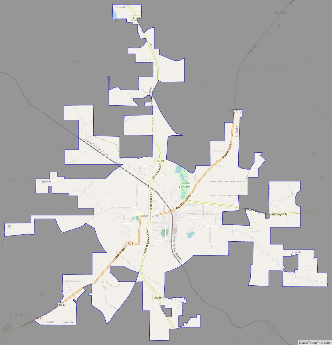
Lineville Road Map
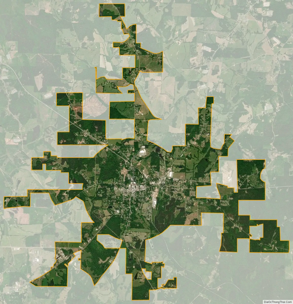
Lineville city Satellite Map
Geography
Lineville is located northeast of the center of Clay County at 33°18’45.122″ North, 85°45’9.274″ West (33.312534, -85.752576).
Alabama State Routes 9, 48, and 49 are the main routes through the city. AL-9 runs through the downtown area, leading northeast 28 mi (45 km) to Heflin along Interstate 20 and southwest 6 mi (9.7 km) to Ashland, the Clay County seat. AL-48 begins in the eastern part of the city and leads east 16 mi (26 km) to Wedowee. AL-49 also runs through the downtown area, leading north 14 mi (23 km) to its end in Cheaha State Park and south 17 mi (27 km) to Goldville.
According to the U.S. Census Bureau, the city has a total area of 9.0 square miles (23.3 km), of which 9.0 square miles (23.2 km) is land and 0.08 square miles (0.2 km), or 0.77%, is water.
Lineville was named for its location on what was then the border between Talladega and Randolph counties.
Alabama’s highest point, Mount Cheaha, is located 18 miles (29 km) north of Lineville via Alabama Highway 49.
Climate
According to the Köppen climate classification, Lineville has a humid subtropical climate (abbreviated Cfa).
See also
Map of Alabama State and its subdivision:- Autauga
- Baldwin
- Barbour
- Bibb
- Blount
- Bullock
- Butler
- Calhoun
- Chambers
- Cherokee
- Chilton
- Choctaw
- Clarke
- Clay
- Cleburne
- Coffee
- Colbert
- Conecuh
- Coosa
- Covington
- Crenshaw
- Cullman
- Dale
- Dallas
- De Kalb
- Elmore
- Escambia
- Etowah
- Fayette
- Franklin
- Geneva
- Greene
- Hale
- Henry
- Houston
- Jackson
- Jefferson
- Lamar
- Lauderdale
- Lawrence
- Lee
- Limestone
- Lowndes
- Macon
- Madison
- Marengo
- Marion
- Marshall
- Mobile
- Monroe
- Montgomery
- Morgan
- Perry
- Pickens
- Pike
- Randolph
- Russell
- Saint Clair
- Shelby
- Sumter
- Talladega
- Tallapoosa
- Tuscaloosa
- Walker
- Washington
- Wilcox
- Winston
- Alabama
- Alaska
- Arizona
- Arkansas
- California
- Colorado
- Connecticut
- Delaware
- District of Columbia
- Florida
- Georgia
- Hawaii
- Idaho
- Illinois
- Indiana
- Iowa
- Kansas
- Kentucky
- Louisiana
- Maine
- Maryland
- Massachusetts
- Michigan
- Minnesota
- Mississippi
- Missouri
- Montana
- Nebraska
- Nevada
- New Hampshire
- New Jersey
- New Mexico
- New York
- North Carolina
- North Dakota
- Ohio
- Oklahoma
- Oregon
- Pennsylvania
- Rhode Island
- South Carolina
- South Dakota
- Tennessee
- Texas
- Utah
- Vermont
- Virginia
- Washington
- West Virginia
- Wisconsin
- Wyoming