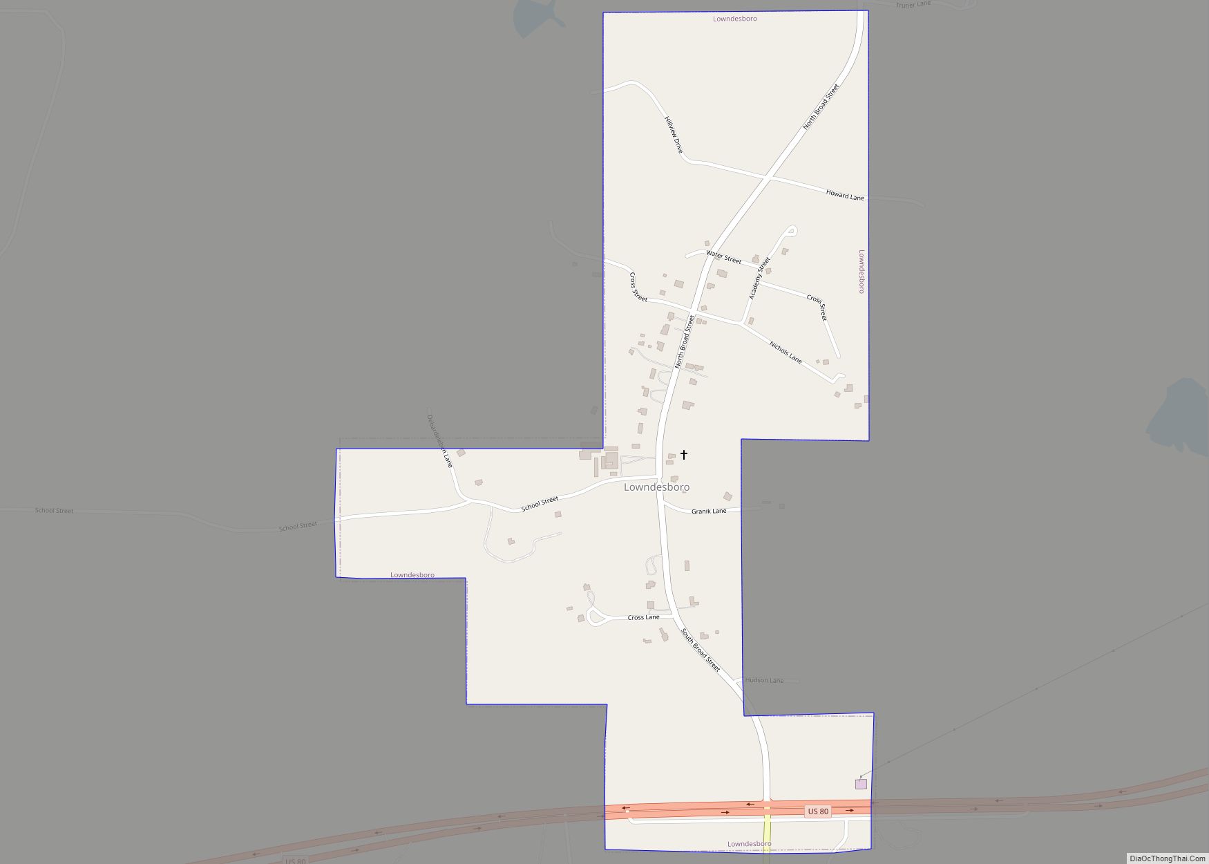
Lowndesboro is a town in Lowndes County, Alabama, United States. At the 2010 census the population was 115, down from 140 in 2000. It is part of the Montgomery Metropolitan Statistical Area. Although initially incorporated in 1856 by an act of the state legislature, it lapsed and was not reincorporated until 1962.
As of the 2000 and 2010 U.S. Censuses, Lowndesboro, along with Benton, are the only two towns (out of 7) in Lowndes County with a white majority of residents. Both are the 6th (Lowndesboro) and 7th (Benton) smallest communities.
| Name: | Lowndesboro town |
|---|---|
| LSAD Code: | 43 |
| LSAD Description: | town (suffix) |
| State: | Alabama |
| County: | Lowndes County |
| Elevation: | 404 ft (123 m) |
| Total Area: | 0.79 sq mi (2.05 km²) |
| Land Area: | 0.79 sq mi (2.05 km²) |
| Water Area: | 0.00 sq mi (0.00 km²) |
| Total Population: | 89 |
| Population Density: | 112.37/sq mi (43.40/km²) |
| ZIP code: | 36752 |
| Area code: | 334 |
| FIPS code: | 0144536 |
| GNISfeature ID: | 0163936 |
| Website: | www.townoflowndesboro.org |
Online Interactive Map
Click on ![]() to view map in "full screen" mode.
to view map in "full screen" mode.
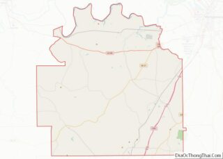
Lowndesboro location map. Where is Lowndesboro town?


History
Originally known as McGill’s Hill, the community began attracting settlers following the conclusion of the Creek War. In 1832, the residents changed the name to Lowndesboro in honor of U.S. Congressman William Lowndes, the son of Rawlins Lowndes, an early South Carolina governor.
With its proximity to the Alabama River, the community had grown into a prosperous town by the 1830s. Many wealthy planters settled in the area, leaving a legacy of historic mid-19th-century architecture that largely survived intact into the modern era. A brief skirmish was fought at Lowndesboro in April 1865 between a group of Confederate cavalry and advance troops of the Union Army during Wilson’s Raid. Federal troops occupied the town after driving off the Confederate force, with very little destruction noted from the occupation, thus preserving many of the antebellum houses and structures in the Lowndesboro Historic District.
Like many small Southern communities with an economy based on cotton production and trade, Lowndesboro declined rapidly in the post-war years. At least partially attributed to this decline was the survival of much of the pre-war architecture into the 20th century, making it a unique assemblage of 19th-century architecture. Today much of the town is included in the Lowndesboro Historic District, listed on the National Register of Historic Places. The Dicksonia Plantation ruins are also a notable place of interest.
Lowndesboro was the site of a number of significant events in the civil rights movement. On March 25, 1965, civil rights worker Viola Liuzzo was shot to death during a high-speed chase by Ku Klux Klan members on U.S. Route 80, while driving to Montgomery to pick up a group of demonstrators waiting to return to Selma after the Selma-to-Montgomery march. The Klansmen spotted the white Liuzzo and her black passenger, Leroy Moton, at a stoplight in Selma, catching up to the pair about two miles (3 km) west of Lowndesboro.
In 1966 a number of Lowndes County African-American families were evicted from their homes in retaliation for their participation in the movement. Twenty of these families set up a tent city outside of Lowndesboro rather than flee the area.
Lowndesboro Road Map

Lowndesboro city Satellite Map

Geography
Lowndesboro is located at 32°16′23″N 86°36′36″W / 32.27306°N 86.61000°W / 32.27306; -86.61000 (32.273118, -86.609915).
According to the U.S. Census Bureau, the town has a total area of 0.8 square miles (2.1 km), all land.
See also
Map of Alabama State and its subdivision:- Autauga
- Baldwin
- Barbour
- Bibb
- Blount
- Bullock
- Butler
- Calhoun
- Chambers
- Cherokee
- Chilton
- Choctaw
- Clarke
- Clay
- Cleburne
- Coffee
- Colbert
- Conecuh
- Coosa
- Covington
- Crenshaw
- Cullman
- Dale
- Dallas
- De Kalb
- Elmore
- Escambia
- Etowah
- Fayette
- Franklin
- Geneva
- Greene
- Hale
- Henry
- Houston
- Jackson
- Jefferson
- Lamar
- Lauderdale
- Lawrence
- Lee
- Limestone
- Lowndes
- Macon
- Madison
- Marengo
- Marion
- Marshall
- Mobile
- Monroe
- Montgomery
- Morgan
- Perry
- Pickens
- Pike
- Randolph
- Russell
- Saint Clair
- Shelby
- Sumter
- Talladega
- Tallapoosa
- Tuscaloosa
- Walker
- Washington
- Wilcox
- Winston
- Alabama
- Alaska
- Arizona
- Arkansas
- California
- Colorado
- Connecticut
- Delaware
- District of Columbia
- Florida
- Georgia
- Hawaii
- Idaho
- Illinois
- Indiana
- Iowa
- Kansas
- Kentucky
- Louisiana
- Maine
- Maryland
- Massachusetts
- Michigan
- Minnesota
- Mississippi
- Missouri
- Montana
- Nebraska
- Nevada
- New Hampshire
- New Jersey
- New Mexico
- New York
- North Carolina
- North Dakota
- Ohio
- Oklahoma
- Oregon
- Pennsylvania
- Rhode Island
- South Carolina
- South Dakota
- Tennessee
- Texas
- Utah
- Vermont
- Virginia
- Washington
- West Virginia
- Wisconsin
- Wyoming