Map of Pike Road town

Map of Pike Road town

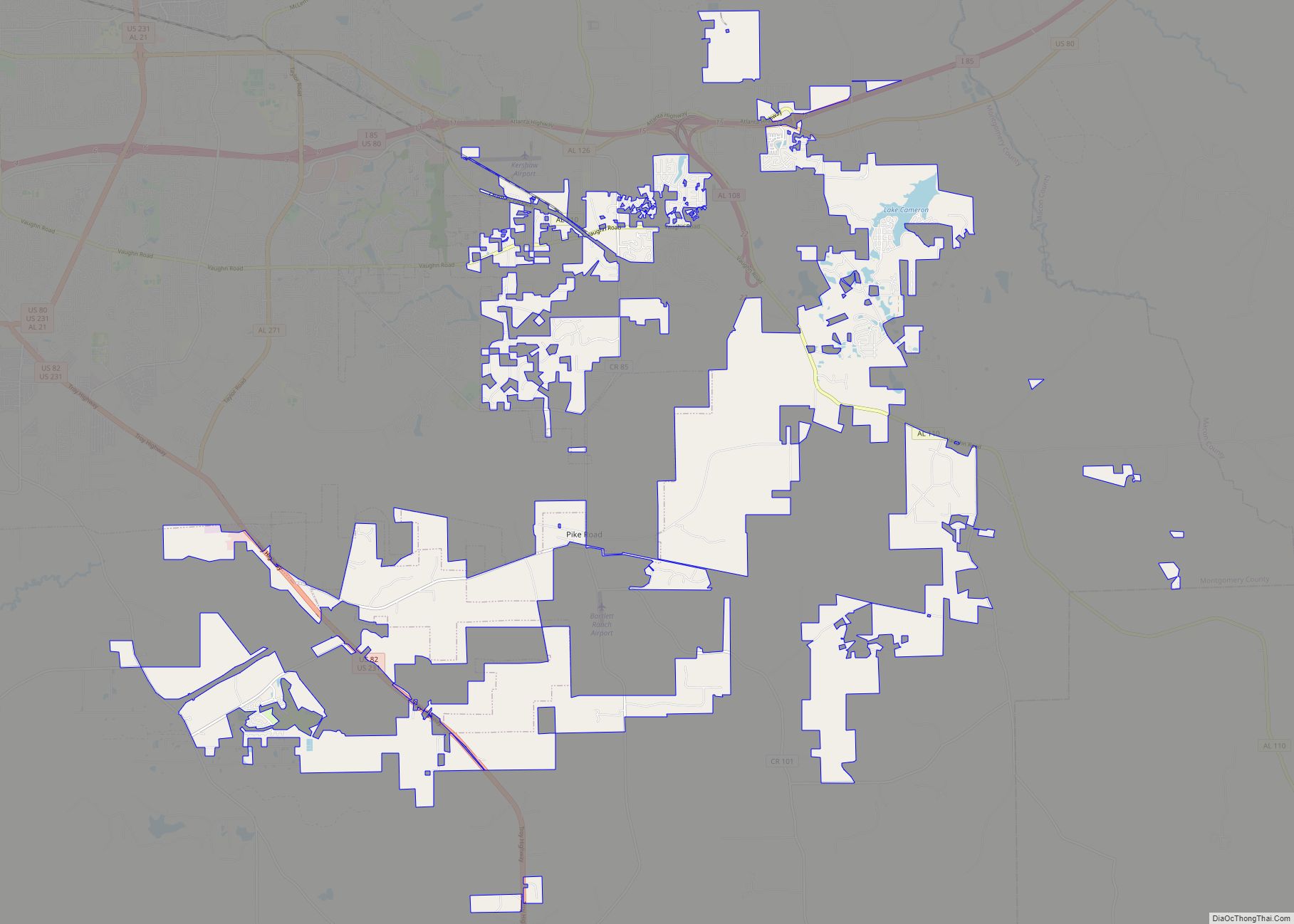
Pike Road is a town in Montgomery County, Alabama, United States. As of the 2020 census, the population was 9,439, up from 5,406 at the 2010 census, and making it the largest town in Alabama by population. It is part of the Montgomery metropolitan area. Pike Road was founded in 1815. Pike Road was incorporated … Read more

Map of Piedmont city

Map of Piedmont city, Alabama

Piedmont is a city in Calhoun and Cherokee counties in the U.S. state of Alabama. The population was 4,400 at the 2020 census. It is included in the Anniston–Oxford, Alabama Metropolitan Statistical Area. The city is approximately one and a half hours west of Atlanta, Georgia via US Hwy 278, one and a half hours … Read more

Map of Pickensville town

Map of Pickensville town

Pickensville is a rural town in Pickens County, Alabama, United States. At the 2010 census the population was 608, down from 662 in 2000. It was initially incorporated in 1839 (although two other sources claim 1825 and 1835) and briefly served before that as the first county seat of Pickens County. Carrollton was designated as … Read more

Map of Pine Hill town

Map of Pine Hill town, Alabama

Pine Hill is a town in Wilcox County, Alabama, United States. It incorporated in 1895. Per the 2020 census, the population was 758. Pine Hill town overview: Name: Pine Hill town LSAD Code: 43 LSAD Description: town (suffix) State: Alabama County: Wilcox County Elevation: 112 ft (34 m) Total Area: 3.82 sq mi (9.89 km²) Land Area: 3.82 sq mi (9.89 km²) Water … Read more

Map of Pine Apple town

Map of Pine Apple town

Pine Apple is a town in Wilcox County, Alabama, United States. It incorporated in 1872. Per the 2020 census, the population was 143. It has two places on the National Register of Historic Places, the Hawthorne House and the Pine Apple Historic District. Pine Apple town overview: Name: Pine Apple town LSAD Code: 43 LSAD … Read more

Map of Pinckard town

Map of Pinckard town

Pinckard is a town in Dale County, Alabama, United States. At the 2020 census, the population was 582. Pinckard incorporated in 1893 and is part of the Ozark Micropolitan Statistical Area. Pinckard town overview: Name: Pinckard town LSAD Code: 43 LSAD Description: town (suffix) State: Alabama County: Dale County Elevation: 348 ft (106 m) Total Area: 5.34 sq mi … Read more

Map of Pine Level CDP

Map of Pine Level CDP, Alabama

Pine Level is a census-designated place and unincorporated community in Autauga County, Alabama, north of Prattville and west of Deatsville. As of the 2010 census, its population was 4,183. Pine Level is home to Pine Level Elementary School and Marbury High School, part of the Autauga County School System. The community is located along U.S. … Read more

Map of Pinson city

Map of Pinson city

Pinson is a city in Jefferson County near Birmingham, Alabama, United States, northwest of Center Point. As of the 2010 census, the population was 7,163. Home to famous “butterbean festival” Pinson city overview: Name: Pinson city LSAD Code: 25 LSAD Description: city (suffix) State: Alabama County: Jefferson County Elevation: 663 ft (202 m) Total Area: 11.59 sq mi (30.02 km²) … Read more

Map of Pine Ridge town

Map of Pine Ridge town, Alabama

Pine Ridge is a town in DeKalb County, Alabama, United States. It incorporated in 1982. At the 2020 census, the population was 263. Pine Ridge town overview: Name: Pine Ridge town LSAD Code: 43 LSAD Description: town (suffix) State: Alabama County: DeKalb County Elevation: 955 ft (291 m) Total Area: 1.33 sq mi (3.45 km²) Land Area: 1.33 sq mi (3.45 km²) Water … Read more

Map of Pleasant Groves town

Map of Pleasant Groves town

Pleasant Groves is a town in Jackson County, Alabama, United States. It incorporated on February 17, 1993. As of the 2010 census, the population of the town was 420, down from 447 in 2000. Pleasant Groves town overview: Name: Pleasant Groves town LSAD Code: 43 LSAD Description: town (suffix) State: Alabama County: Jackson County Total … Read more

Map of Pleasant Grove city

Map of Pleasant Grove city, Alabama

Pleasant Grove is a city in western Jefferson County, Alabama. It is part of the Birmingham metropolitan area. Its nickname is “The Good Neighbor City“. At the 2020 census, the population was 9,544. Pleasant Grove city overview: Name: Pleasant Grove city LSAD Code: 25 LSAD Description: city (suffix) State: Alabama County: Jefferson County Elevation: 669 ft … Read more

Map of Pisgah town

Map of Pisgah town, Alabama

Pisgah is a town in Jackson County, Alabama, United States, and is included in the Huntsville-Decatur Combined Statistical Area. It incorporated in 1947. As of the 2020 census, the population of the town was 681, down from 722 in 2010. Pisgah is located atop Sand Mountain. Pisgah town overview: Name: Pisgah town LSAD Code: 43 … Read more