Pickensville is a rural town in Pickens County, Alabama, United States. At the 2010 census the population was 608, down from 662 in 2000. It was initially incorporated in 1839 (although two other sources claim 1825 and 1835) and briefly served before that as the first county seat of Pickens County. Carrollton was designated as the seat in the early 1830s.
According to the U.S. Census, the incorporation of Pickensville lapsed after 1920. It did not reappear again on the rolls of incorporated towns until 1970.
| Name: | Pickensville town |
|---|---|
| LSAD Code: | 43 |
| LSAD Description: | town (suffix) |
| State: | Alabama |
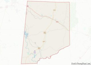
| County: | Pickens County |
| Elevation: | 230 ft (70 m) |
| Total Area: | 10.06 sq mi (26.05 km²) |
| Land Area: | 7.77 sq mi (20.13 km²) |
| Water Area: | 2.29 sq mi (5.92 km²) |
| Total Population: | 557 |
| Population Density: | 71.66/sq mi (27.67/km²) |
| ZIP code: | 35447 |
| Area code: | 205 and 659 |
| FIPS code: | 0159592 |
| GNISfeature ID: | 0152888 |
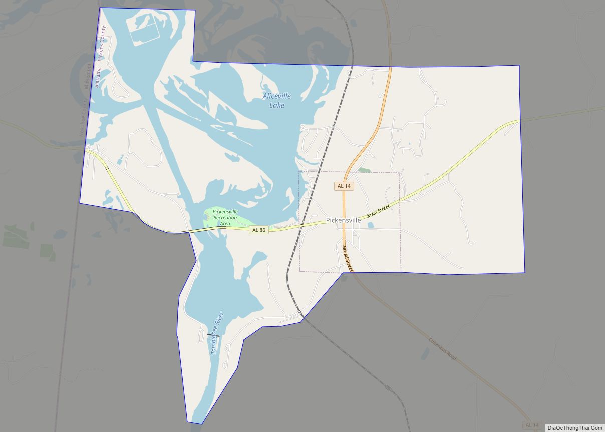
Online Interactive Map
Click on ![]() to view map in "full screen" mode.
to view map in "full screen" mode.
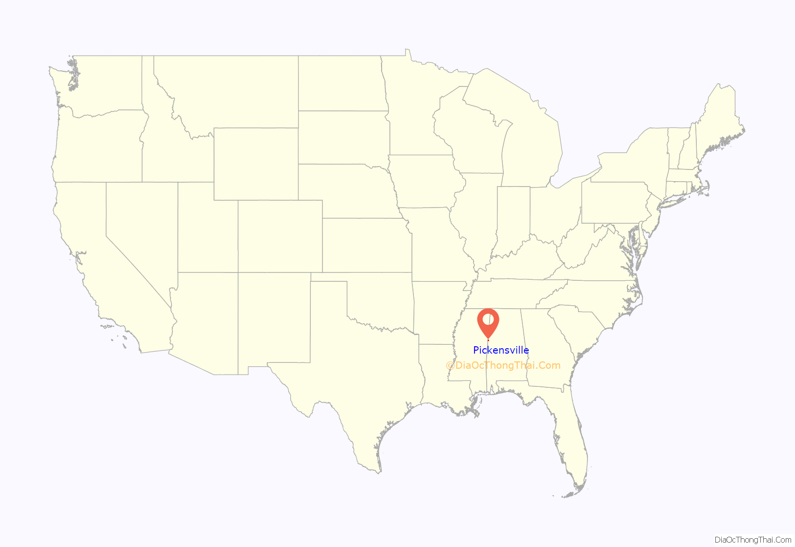
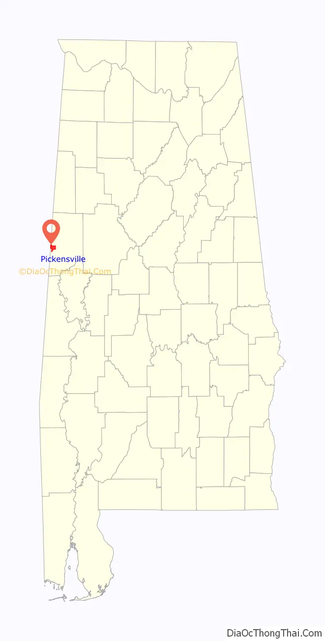
Pickensville location map. Where is Pickensville town?
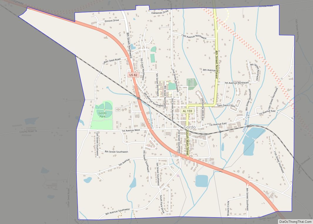
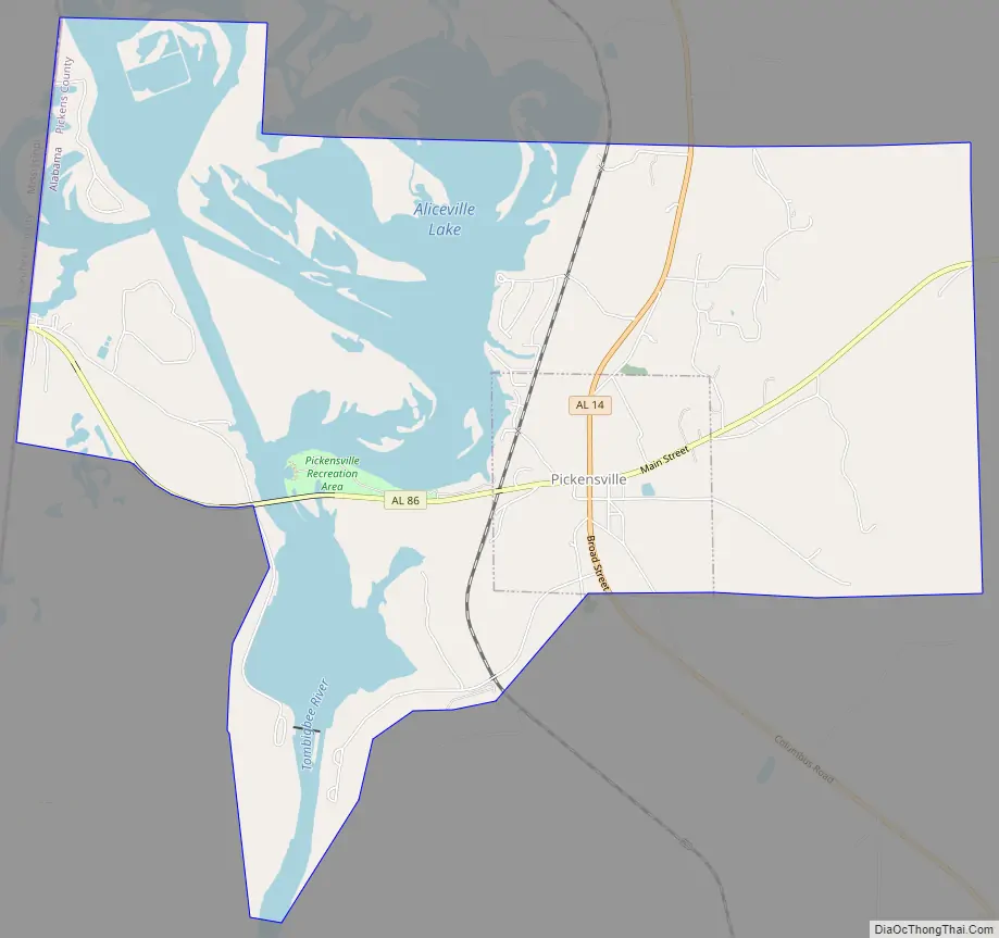
Pickensville Road Map
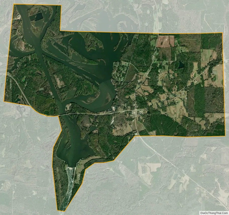
Pickensville city Satellite Map
Geography
Pickensville is located at 33°13′50″N 88°16′21″W / 33.23056°N 88.27250°W / 33.23056; -88.27250 (33.230693, -88.272554).
According to the U.S. Census Bureau, the town has a total area of 10.0 square miles (26 km), of which 7.8 square miles (20 km) is land and 2.3 square miles (6.0 km) (22.73%) is water.
See also
Map of Alabama State and its subdivision:- Autauga
- Baldwin
- Barbour
- Bibb
- Blount
- Bullock
- Butler
- Calhoun
- Chambers
- Cherokee
- Chilton
- Choctaw
- Clarke
- Clay
- Cleburne
- Coffee
- Colbert
- Conecuh
- Coosa
- Covington
- Crenshaw
- Cullman
- Dale
- Dallas
- De Kalb
- Elmore
- Escambia
- Etowah
- Fayette
- Franklin
- Geneva
- Greene
- Hale
- Henry
- Houston
- Jackson
- Jefferson
- Lamar
- Lauderdale
- Lawrence
- Lee
- Limestone
- Lowndes
- Macon
- Madison
- Marengo
- Marion
- Marshall
- Mobile
- Monroe
- Montgomery
- Morgan
- Perry
- Pickens
- Pike
- Randolph
- Russell
- Saint Clair
- Shelby
- Sumter
- Talladega
- Tallapoosa
- Tuscaloosa
- Walker
- Washington
- Wilcox
- Winston
- Alabama
- Alaska
- Arizona
- Arkansas
- California
- Colorado
- Connecticut
- Delaware
- District of Columbia
- Florida
- Georgia
- Hawaii
- Idaho
- Illinois
- Indiana
- Iowa
- Kansas
- Kentucky
- Louisiana
- Maine
- Maryland
- Massachusetts
- Michigan
- Minnesota
- Mississippi
- Missouri
- Montana
- Nebraska
- Nevada
- New Hampshire
- New Jersey
- New Mexico
- New York
- North Carolina
- North Dakota
- Ohio
- Oklahoma
- Oregon
- Pennsylvania
- Rhode Island
- South Carolina
- South Dakota
- Tennessee
- Texas
- Utah
- Vermont
- Virginia
- Washington
- West Virginia
- Wisconsin
- Wyoming