Map of Berlin town

Map of Berlin town, Alabama

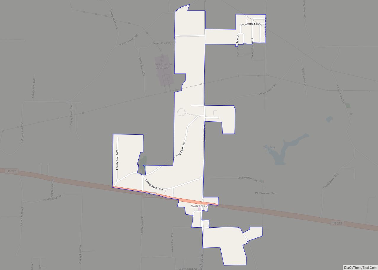
Berlin is a town in Cullman County, Alabama, United States. It is located roughly five miles east of the city of Cullman in northern Alabama. U.S. Route 278 and Cullman County Road 747 intersect at Walker’s Corner, considered to be the center of Berlin. The Berlin Community Center is located on U.S. Route 278, just … Read more

Map of Benton town

Map of Benton town, Alabama

Benton is a town in Lowndes County, Alabama, United States. Its population was 41 at the 2020 census, down from 49 at the 2010 census. Benton town overview: Name: Benton town LSAD Code: 43 LSAD Description: town (suffix) State: Alabama County: Lowndes County Elevation: 141 ft (43 m) Total Area: 0.34 sq mi (0.87 km²) Land Area: 0.30 sq mi (0.78 km²) Water … Read more

Map of Belle Fontaine CDP

Map of Belle Fontaine CDP

Belle Fontaine (/ˌbɛl fɒnˈtɛn/; French: [bɛl fɔ̃ˈtɛn] (listen)) is an unincorporated community and census-designated place (CDP) in Mobile County, Alabama, United States, on the western shore of Mobile Bay. It is located south of the city of Mobile, along the stretch of shore between the Deer River and the Fowl River. As of the 2020 census, … Read more

Map of Billingsley town

Map of Billingsley town

Billingsley is a village in Autauga County, Alabama, United States. At the 2020 census, the population was 125. It is part of the Montgomery Metropolitan Statistical Area. Billingsley town overview: Name: Billingsley town LSAD Code: 43 LSAD Description: town (suffix) State: Alabama County: Autauga County Elevation: 371 ft (113 m) Total Area: 1.18 sq mi (3.05 km²) Land Area: 1.18 sq mi … Read more

Map of Bessemer city

Map of Bessemer city, Alabama

Bessemer is a southwestern suburb of Birmingham in Jefferson County, Alabama, United States. The population was 26,019 at the 2020 census. It is within the Birmingham-Hoover, AL Metropolitan Statistical Area, of which Jefferson County is the center. It developed rapidly as an industrial city in the late 19th and early 20th centuries. In 2019, it … Read more

Map of Berry town

Map of Berry town, Alabama

Berry is a town in Fayette County, Alabama, United States. At the 2010 census the population was 1,148, down from 1,238 at the 2000 census. Berry town overview: Name: Berry town LSAD Code: 43 LSAD Description: town (suffix) State: Alabama County: Fayette County Elevation: 463 ft (141 m) Total Area: 10.77 sq mi (27.90 km²) Land Area: 10.77 sq mi (27.88 km²) Water … Read more

Map of Blue Ridge CDP

Map of Blue Ridge CDP, Alabama

Blue Ridge is an unincorporated community and census-designated place (CDP) in Elmore County, Alabama, United States. At the 2020 census, the population was 1,485. It is part of the Montgomery Metropolitan Statistical Area. Blue Ridge CDP overview: Name: Blue Ridge CDP LSAD Code: 57 LSAD Description: CDP (suffix) State: Alabama County: Elmore County Elevation: 367 ft … Read more

Map of Blountsville town

Map of Blountsville town, Alabama

Blountsville is a town in Blount County, Alabama, United States. As of the 2010 census it had a population of 1,684. Blount County was created by the Alabama territorial legislature on February 6, 1818, from land ceded to the federal government by the Creek Nation on August 9, 1814. It was named for Gov. Willie … Read more

Map of Black town

Map of Black town

Black is a town in Geneva County, Alabama, United States. It incorporated in 1905. It is part of the Dothan, Alabama Metropolitan Statistical Area. At the 2020 census the population was 468, up from 207 in 2010. Black town overview: Name: Black town LSAD Code: 43 LSAD Description: town (suffix) State: Alabama County: Geneva County … Read more

Map of Boligee town

Map of Boligee town

Boligee /ˈboʊləˌdʒi/ is a town in Greene County, Alabama, United States. Per the 2020 census, the population was 301. Although Boligee appeared on the 1880 U.S. Census, according to the 1930 U.S. Census it did not incorporate until 1926, though another source cited 1927. Boligee has one site listed on the National Register of Historic … Read more

Map of Boaz city

Map of Boaz city, Alabama

Boaz is a city in Marshall and Etowah counties in the U.S. state of Alabama. The Marshall County portion of the city is part of the Albertville Micropolitan Statistical Area. As of the 2020 census, the city’s population was 10,107. Boaz was known for its outlet shops. Boaz city overview: Name: Boaz city LSAD Code: … Read more

Map of Blue Springs town

Map of Blue Springs town, Alabama

Blue Springs is a town in Barbour County, Alabama, United States. At the 2020 census, the population was 84. The town is the home of Blue Springs State Park. Blue Springs town overview: Name: Blue Springs town LSAD Code: 43 LSAD Description: town (suffix) State: Alabama County: Barbour County Elevation: 305 ft (93 m) Total Area: 2.90 sq mi … Read more