Boaz is a city in Marshall and Etowah counties in the U.S. state of Alabama. The Marshall County portion of the city is part of the Albertville Micropolitan Statistical Area. As of the 2020 census, the city’s population was 10,107. Boaz was known for its outlet shops.
| Name: | Boaz city |
|---|---|
| LSAD Code: | 25 |
| LSAD Description: | city (suffix) |
| State: | Alabama |
| County: | Etowah County, Marshall County |
| Elevation: | 1,073 ft (327 m) |
| Total Area: | 14.61 sq mi (37.85 km²) |
| Land Area: | 14.55 sq mi (37.68 km²) |
| Water Area: | 0.06 sq mi (0.16 km²) |
| Total Population: | 10,107 |
| Population Density: | 694.64/sq mi (268.2/km²) |
| ZIP code: | 35957, 35956 |
| Area code: | 256 |
| FIPS code: | 0107912 |
| GNISfeature ID: | 2403886 |
| Website: | www.cityofboaz.org |
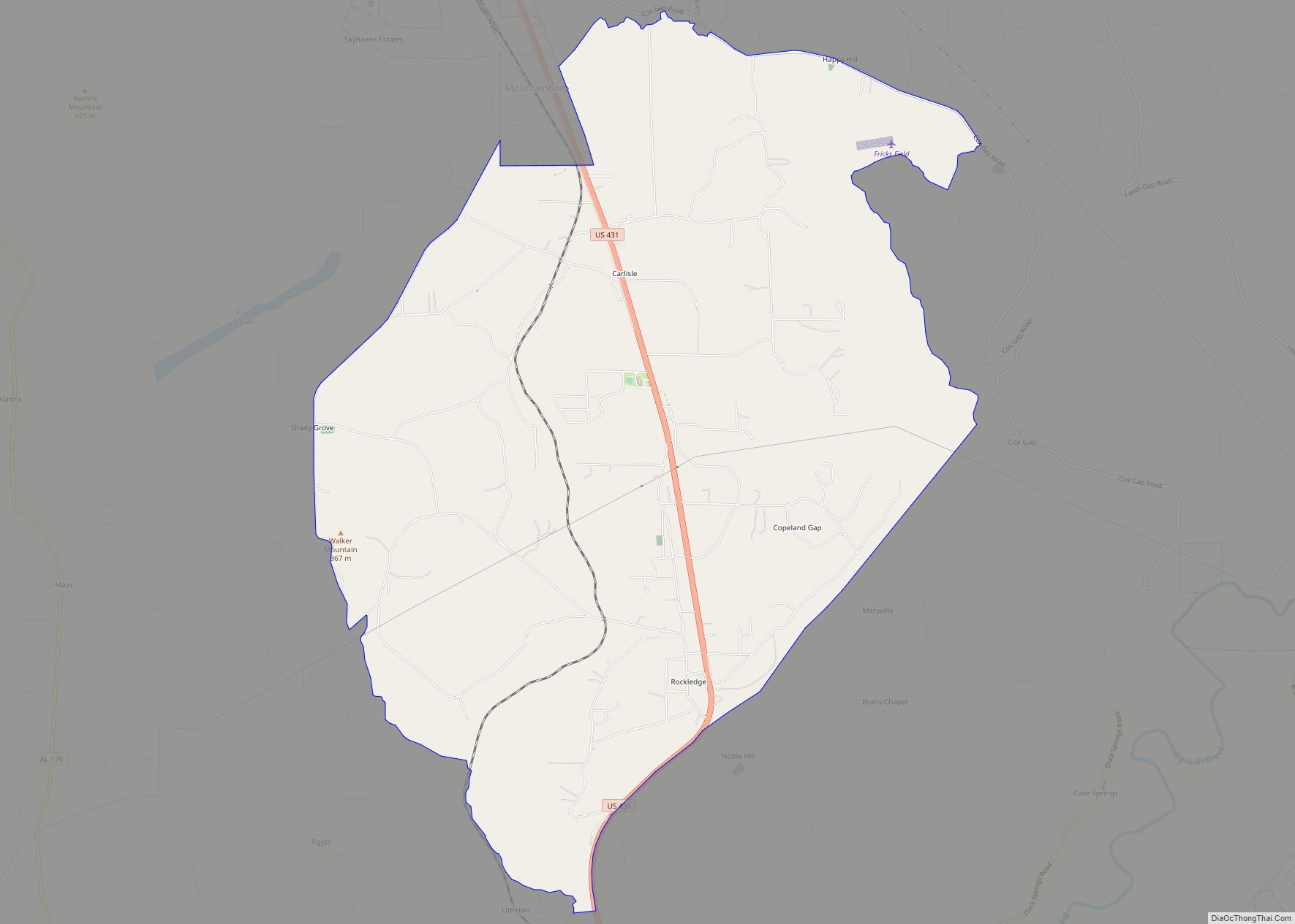
Online Interactive Map
Click on ![]() to view map in "full screen" mode.
to view map in "full screen" mode.
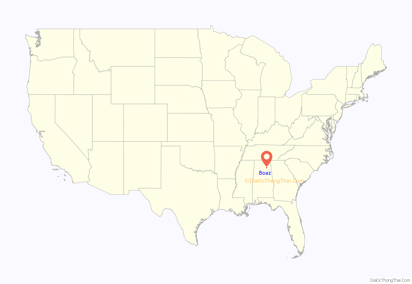
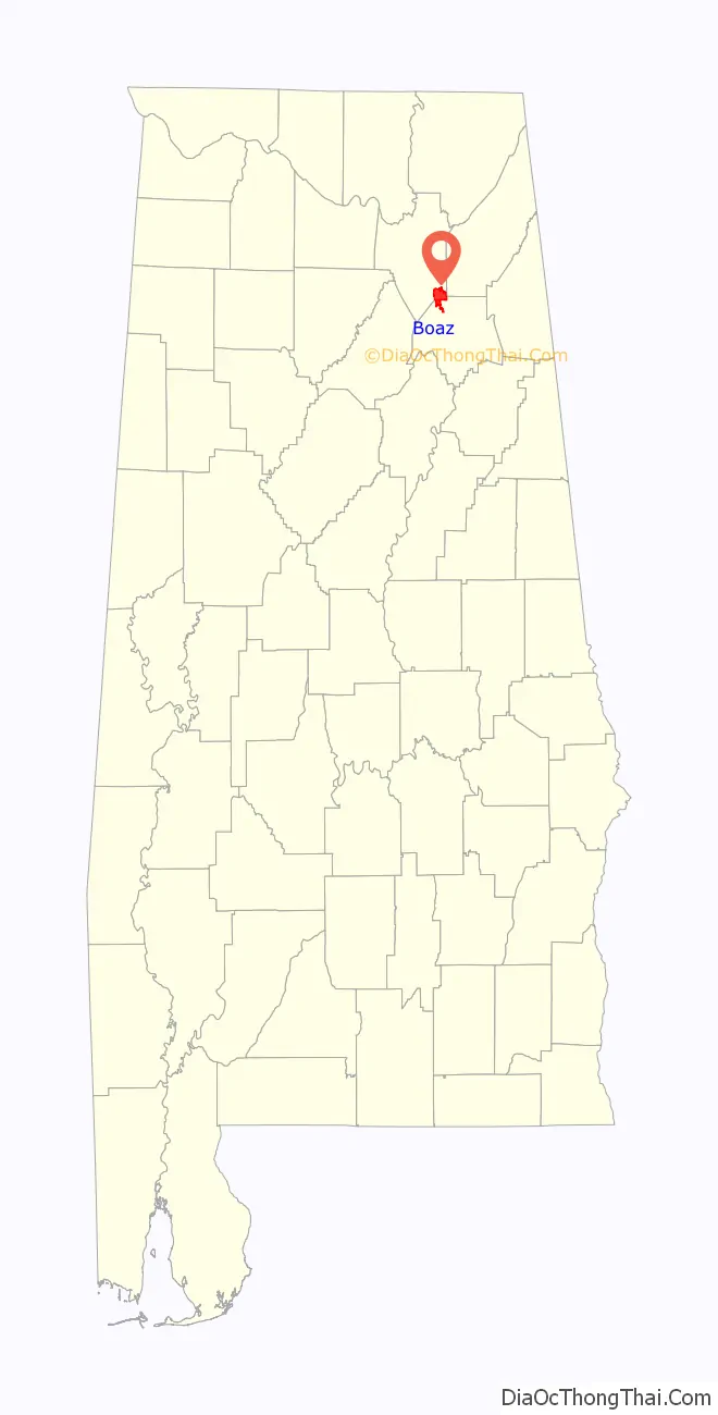
Boaz location map. Where is Boaz city?
History
First settled in the 1850s, the town of Boaz was officially founded November 11, 1878, by the Sparks family of Georgia. A post office has been in operation since 1887. The city was named after Boaz, from the Bible. It was incorporated in 1897.
The Julia Street Memorial United Methodist Church, Snead Junior College Historic District, the Thomas A. Snellgrove Homestead and the Edward Fenns Whitman House are listed on the National Register of Historic Places. The Alabama Register of Landmarks and Heritage lists the Boaz Elementary School, the First Baptist Church and Cemetery, and the Methodist Episcopal Church, South.
In the early 1980s, the VF Corporation opened an outlet store in an abandoned factory, whose success prompted other retailers to open stores. In the late 1980s, Boaz was a tourist attraction with 130 outlet stores, attracting five million people per year. Retailers moved away from Boaz due to a dwindling customer base, dropping to 80 stores in the early 1990s, with the Great Recession of the 2000s driving away even more. In 2016, three buildings of the outlet center were demolished.
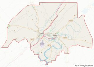
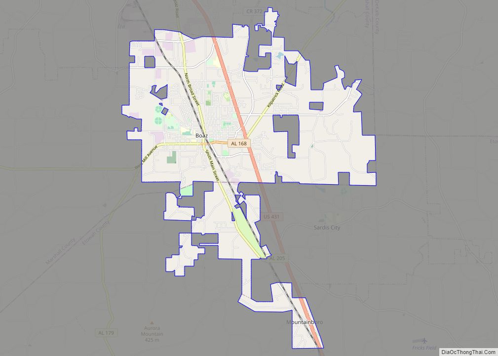
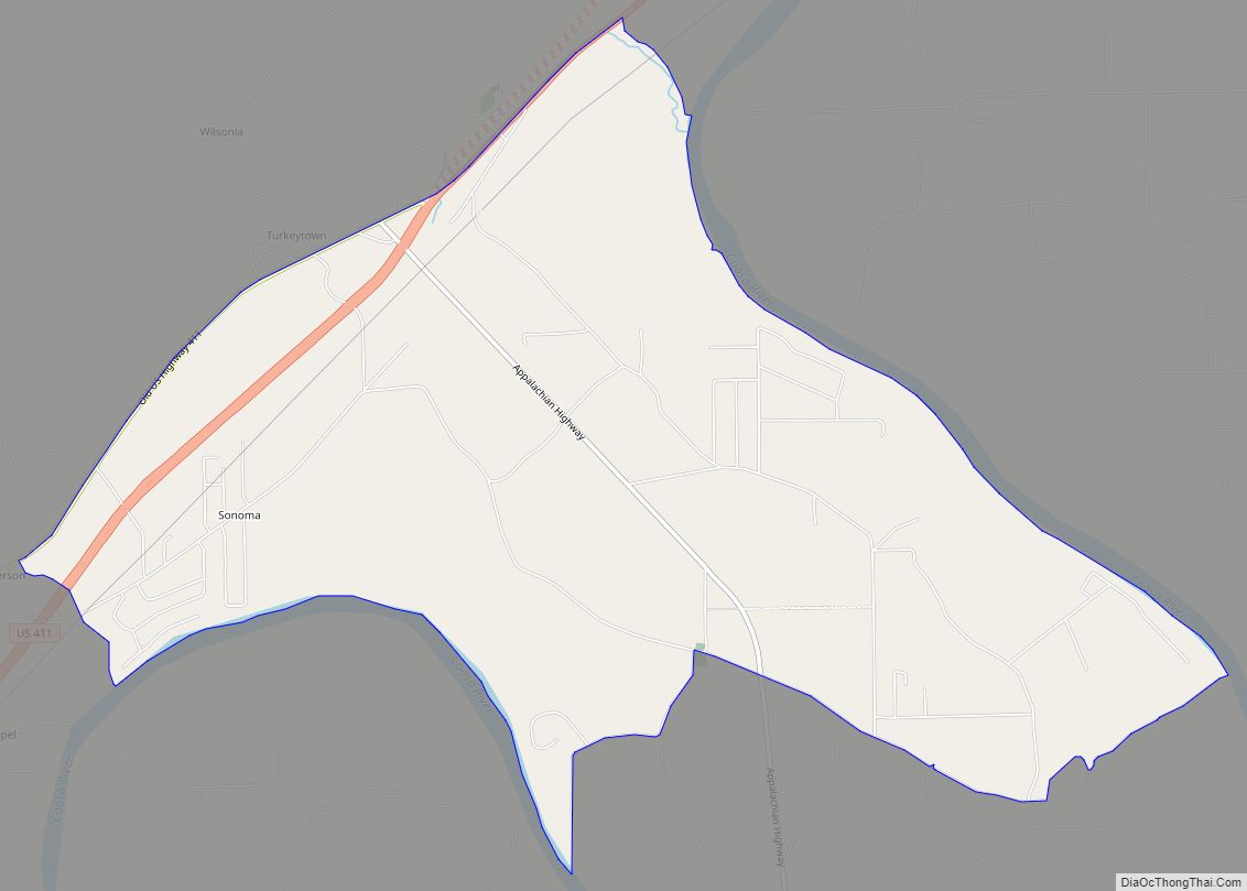
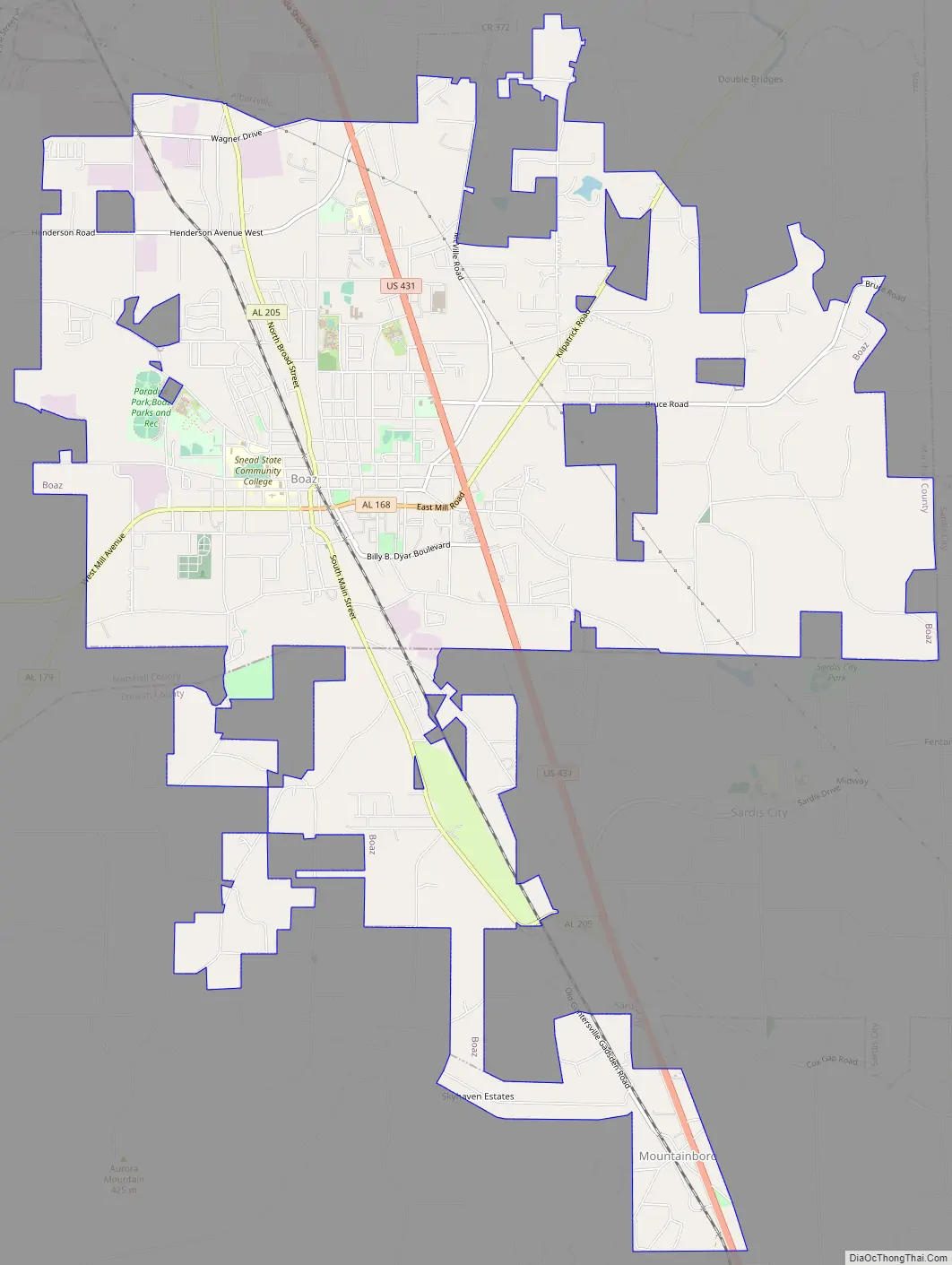
Boaz Road Map
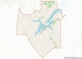
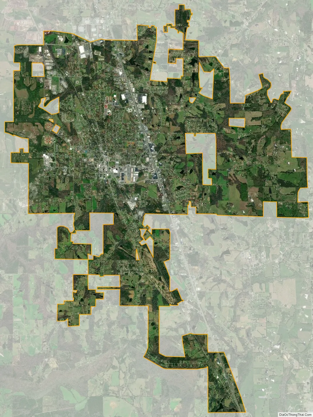
Boaz city Satellite Map
Geography
Boaz is located in southeastern Marshall County at 34°12′10″N 86°9′38″W / 34.20278°N 86.16056°W / 34.20278; -86.16056 (34.202793, −86.160457) and extends south into Etowah County. The city sits atop Sand Mountain (a plateau) at 1,080 feet (330 m) above sea level. It is bordered to the north by Albertville and to the southeast by Sardis City. U.S. Route 431 passes through the east side of the city, leading north 16 miles (26 km) to Guntersville and south 20 miles (32 km) to Gadsden.
According to the U.S. Census Bureau, the city of Boaz has a total area of 14.6 square miles (38 km), of which 0.06 square miles (0.16 km), or 0.43%, are water. Most of the city drains west to either Slab Creek or Clear Creek, tributaries of the Locust Fork of the Black Warrior River. The Tennessee Valley Divide crosses the east side of the city, with the eastern portions of the city draining to Short Creek, a north-flowing tributary of the Tennessee River.
See also
Map of Alabama State and its subdivision:- Autauga
- Baldwin
- Barbour
- Bibb
- Blount
- Bullock
- Butler
- Calhoun
- Chambers
- Cherokee
- Chilton
- Choctaw
- Clarke
- Clay
- Cleburne
- Coffee
- Colbert
- Conecuh
- Coosa
- Covington
- Crenshaw
- Cullman
- Dale
- Dallas
- De Kalb
- Elmore
- Escambia
- Etowah
- Fayette
- Franklin
- Geneva
- Greene
- Hale
- Henry
- Houston
- Jackson
- Jefferson
- Lamar
- Lauderdale
- Lawrence
- Lee
- Limestone
- Lowndes
- Macon
- Madison
- Marengo
- Marion
- Marshall
- Mobile
- Monroe
- Montgomery
- Morgan
- Perry
- Pickens
- Pike
- Randolph
- Russell
- Saint Clair
- Shelby
- Sumter
- Talladega
- Tallapoosa
- Tuscaloosa
- Walker
- Washington
- Wilcox
- Winston
- Alabama
- Alaska
- Arizona
- Arkansas
- California
- Colorado
- Connecticut
- Delaware
- District of Columbia
- Florida
- Georgia
- Hawaii
- Idaho
- Illinois
- Indiana
- Iowa
- Kansas
- Kentucky
- Louisiana
- Maine
- Maryland
- Massachusetts
- Michigan
- Minnesota
- Mississippi
- Missouri
- Montana
- Nebraska
- Nevada
- New Hampshire
- New Jersey
- New Mexico
- New York
- North Carolina
- North Dakota
- Ohio
- Oklahoma
- Oregon
- Pennsylvania
- Rhode Island
- South Carolina
- South Dakota
- Tennessee
- Texas
- Utah
- Vermont
- Virginia
- Washington
- West Virginia
- Wisconsin
- Wyoming