Bessemer is a southwestern suburb of Birmingham in Jefferson County, Alabama, United States. The population was 26,019 at the 2020 census. It is within the Birmingham-Hoover, AL Metropolitan Statistical Area, of which Jefferson County is the center. It developed rapidly as an industrial city in the late 19th and early 20th centuries. In 2019, it was named Alabama’s “Worst City to Live in” by 24/7 Wall Street.
| Name: | Bessemer city |
|---|---|
| LSAD Code: | 25 |
| LSAD Description: | city (suffix) |
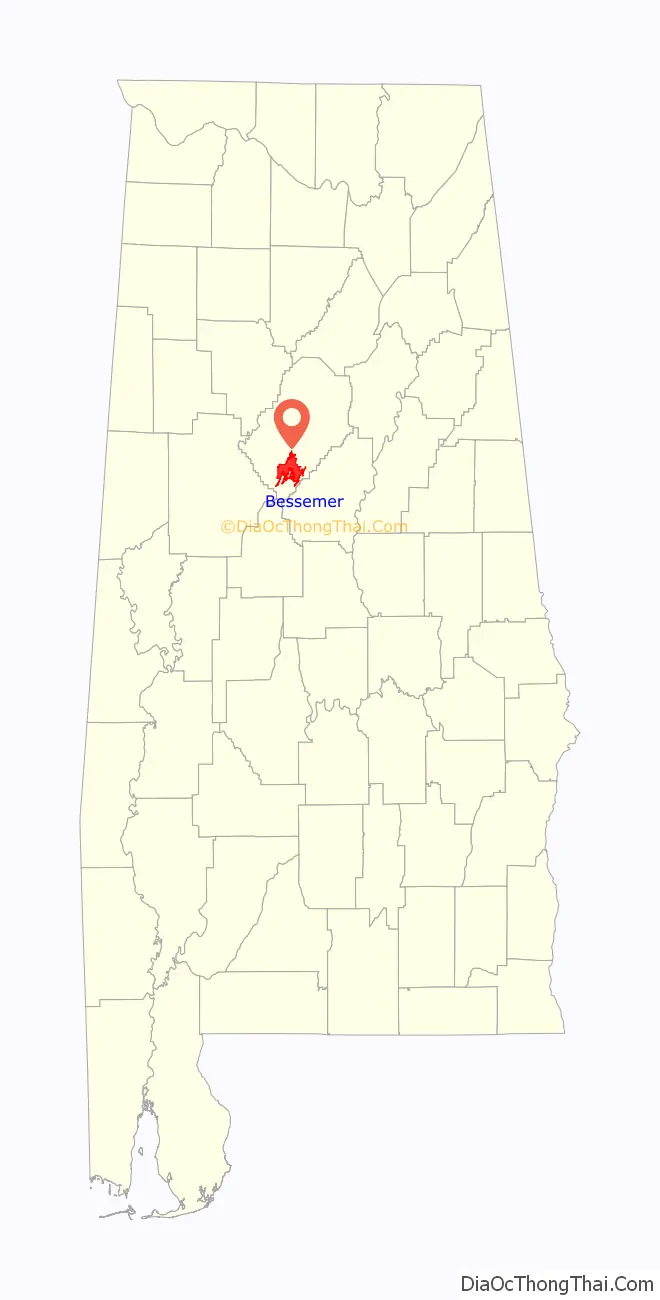
| State: | Alabama |
| County: | Jefferson County |
| Founded: | 1869 |
| Elevation: | 509 ft (155 m) |
| Total Area: | 40.56 sq mi (105.05 km²) |
| Land Area: | 40.35 sq mi (104.51 km²) |
| Water Area: | 0.21 sq mi (0.54 km²) |
| Total Population: | 26,019 |
| Population Density: | 644.80/sq mi (248.96/km²) |
| ZIP code: | 35020-35023 |
| FIPS code: | 0105980 |
| GNISfeature ID: | 2403864 |
| Website: | www.bessemeral.org |
Online Interactive Map
Click on ![]() to view map in "full screen" mode.
to view map in "full screen" mode.
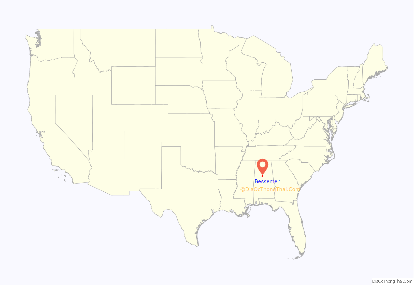
Bessemer location map. Where is Bessemer city?
History
The town was founded in the postbellum era by the Bessemer Land and Improvement Company, named after Henry Bessemer and owned by coal magnate Henry F. DeBardeleben. He had inherited Daniel Pratt’s investments. The mayor and councilmen voted to incorporate the city of Bessemer on September 9, 1887. Located 16 miles southwest of Birmingham, Bessemer grew rapidly and its promoters believed that it might overtake the other city in economic power.
Given the iron ore, coal and limestone deposits in the area, the city became a center of steelmaking from about 1890 through the 20th century. It attracted rural migrants from across the South, as well as European immigrants. By the 1950s, the city was majority African American in population.
The industry went through considerable restructuring in the late 20th century, and jobs moved out of the area. Steel is no longer made there.
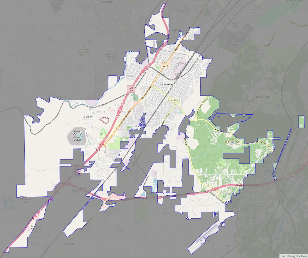
Bessemer Road Map
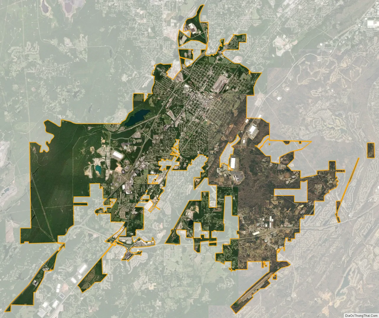
Bessemer city Satellite Map
Geography
Bessemer is located approximately 18 miles (29 km) southwest of Birmingham.
According to the United States Census Bureau, the city has a total area of 40.8 square miles (106 km), of which 40.7 square miles (105 km) is land and 0.1 square miles (0.26 km) (0.17%) is water.
Bessemer is situated in the midst of the iron ore and limestone district of Alabama, in the southern part of Jones Valley (about 3 miles (4.8 km) wide). Iron ore was mined on the hills on the city’s southeast side, coal was (and still is) mined to the north and west, and limestone deposits were also nearby. All three ingredients were necessary for steelmaking, which led to the area becoming a major steel center from about 1890 through the twentieth century. Steel is no longer made within the city limits, but is still manufactured in the neighboring city of Fairfield.
Climate
The climate in this area is characterized by hot, humid summers and generally mild to cool winters. According to the Köppen Climate Classification system, Bessemer has a humid subtropical climate, abbreviated “Cfa” on climate maps.
See also
Map of Alabama State and its subdivision:- Autauga
- Baldwin
- Barbour
- Bibb
- Blount
- Bullock
- Butler
- Calhoun
- Chambers
- Cherokee
- Chilton
- Choctaw
- Clarke
- Clay
- Cleburne
- Coffee
- Colbert
- Conecuh
- Coosa
- Covington
- Crenshaw
- Cullman
- Dale
- Dallas
- De Kalb
- Elmore
- Escambia
- Etowah
- Fayette
- Franklin
- Geneva
- Greene
- Hale
- Henry
- Houston
- Jackson
- Jefferson
- Lamar
- Lauderdale
- Lawrence
- Lee
- Limestone
- Lowndes
- Macon
- Madison
- Marengo
- Marion
- Marshall
- Mobile
- Monroe
- Montgomery
- Morgan
- Perry
- Pickens
- Pike
- Randolph
- Russell
- Saint Clair
- Shelby
- Sumter
- Talladega
- Tallapoosa
- Tuscaloosa
- Walker
- Washington
- Wilcox
- Winston
- Alabama
- Alaska
- Arizona
- Arkansas
- California
- Colorado
- Connecticut
- Delaware
- District of Columbia
- Florida
- Georgia
- Hawaii
- Idaho
- Illinois
- Indiana
- Iowa
- Kansas
- Kentucky
- Louisiana
- Maine
- Maryland
- Massachusetts
- Michigan
- Minnesota
- Mississippi
- Missouri
- Montana
- Nebraska
- Nevada
- New Hampshire
- New Jersey
- New Mexico
- New York
- North Carolina
- North Dakota
- Ohio
- Oklahoma
- Oregon
- Pennsylvania
- Rhode Island
- South Carolina
- South Dakota
- Tennessee
- Texas
- Utah
- Vermont
- Virginia
- Washington
- West Virginia
- Wisconsin
- Wyoming


