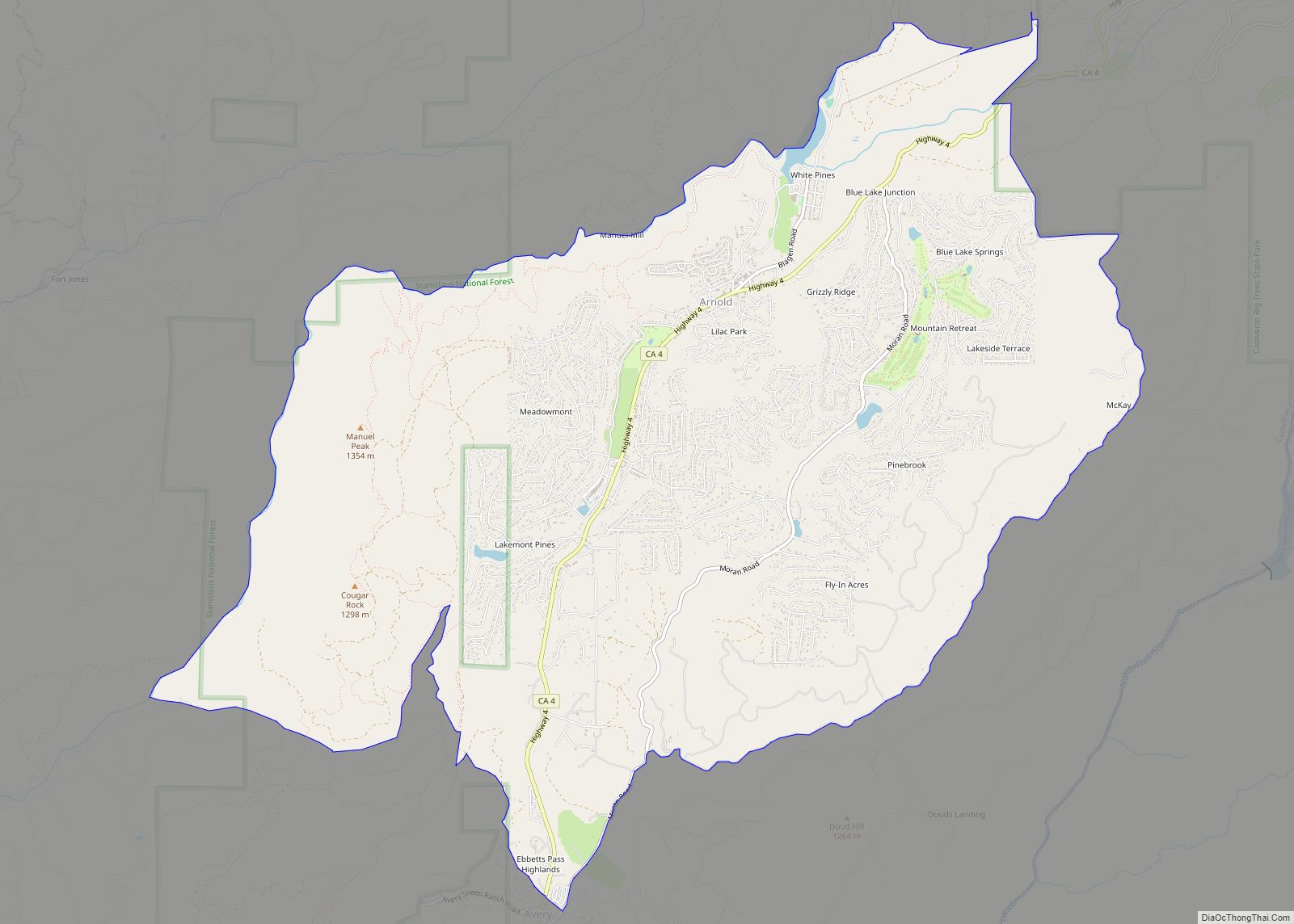
Map of Arvin city

Map of Arvin city

Arvin is a city in Kern County, California. Arvin is located 15 miles (24 km) southeast of Bakersfield, at an elevation of 449 feet (137 m). As of the 2010 census, the population was 19,304, up from 12,956 at the 2000 census. In 2007, the United States Environmental Protection Agency (EPA) listed Arvin as having the highest … Read more

Map of Artois CDP

Map of Artois CDP

Artois (/ˈɑːr.tɔɪs/), formerly known as Germantown, is a census-designated place in Glenn County, California, USA. It is located 5 miles (8 km) north of Willows, at an elevation of 167 feet (51 m), in the northern Sacramento Valley of California. It is located on the former United States Highway 99W, and is bypassed to the west … Read more

Map of Artesia city

Map of Artesia city, California

Artesia (Spanish for “artesian aquifer”) is a city in southeast Los Angeles County, California. Artesia was incorporated on May 29, 1959, and is one of Los Angeles County’s Gateway Cities. The city has a 2010 census population of 16,522. Artesia is surrounded on the west, south, and east sides by Cerritos, with Norwalk to the … Read more

Map of Aspen Springs CDP

Map of Aspen Springs CDP

Aspen Springs is an unincorporated community and census-designated place (CDP) in Mono County, California, United States. It lies at an elevation of 7,109 feet (2,167 m). The population was 70 at the 2020 census. Aspen Springs CDP overview: Name: Aspen Springs CDP LSAD Code: 57 LSAD Description: CDP (suffix) State: California County: Mono County Elevation: 7,109 ft … Read more

Map of Ashland CDP, California

Map of Ashland CDP, California

Ashland is a census-designated place (CDP) and unincorporated community in Alameda County, California, United States. The population was 23,823 at the 2020 census. Ashland is located between the city of San Leandro to the north, the unincorporated community of Cherryland to the south, the unincorporated community of Castro Valley to the east, and the unincorporated … Read more

Map of Atascadero city

Map of Atascadero city

Atascadero (Spanish for “Mire”) is a city in San Luis Obispo County, California, about equidistant from Los Angeles and San Francisco on U.S. Route 101. Atascadero is part of the San Luis Obispo-Paso Robles metropolitan statistical area, which encompasses the extents of the county. Atascadero is farther inland than most other cities in the county, … Read more

Map of Auberry CDP

Map of Auberry CDP

Auberry (/ˈɔːbɛri/) is a census-designated place (CDP) in Fresno County, California, United States. The population was 2,369 at the 2010 census, up from 2,053 at the 2000 census. Auberry is located on Little Sandy Creek 9.5 miles (15 km) west of Shaver Lake Heights, at an elevation of 2,018 feet (615 m). Auberry CDP overview: Name: Auberry … Read more

Map of Atwater city

Map of Atwater city, California

Atwater is a city on State Route 99 in Merced County, California, United States. Atwater is 8 miles (13 km) west-northwest of Merced, at an elevation of 151 feet (46 m). The population as of the 2020 census was 31,970, up from 28,168 in 2010. Atwater city overview: Name: Atwater city LSAD Code: 25 LSAD Description: city … Read more

Map of Atherton town

Map of Atherton town

Atherton (/ˈæθərtən/) is an incorporated town in San Mateo County, California, United States. Its population was 7,188 as of 2020. Atherton is known for its wealth; in 1990 and 2019, Atherton was ranked as having the highest per capita income among U.S. towns that have a population between 2,500 and 9,999, and the area covered … Read more

Map of August CDP

Map of August CDP

August is a census-designated place (CDP) in San Joaquin County, California, United States. The population was 8,628 at the 2020 census, up from 8,390 at the 2010 census. August CDP overview: Name: August CDP LSAD Code: 57 LSAD Description: CDP (suffix) State: California County: San Joaquin County Elevation: 26 ft (8 m) Total Area: 1.26 sq mi (3.25 km²) Land … Read more

Map of Auburn city, California

Map of Auburn city, California

Auburn is a city in and the county seat of Placer County, California, United States. Its population was 13,776 during the 2020 census. Auburn is known for its California Gold Rush history and is registered as a California Historical Landmark. Auburn is part of the Sacramento metropolitan area. Auburn city overview: Name: Auburn city LSAD … Read more

Map of Auburn Lake Trails CDP

Map of Auburn Lake Trails CDP

Auburn Lake Trails is a census-designated place in El Dorado County, California. It lies at an elevation of 1916 feet (584 m). It is a gated community with 23 miles (37 km) of horse trails. As of the 2010 census, the population was 3,426. Auburn Lake Trails CDP overview: Name: Auburn Lake Trails CDP LSAD Code: … Read more