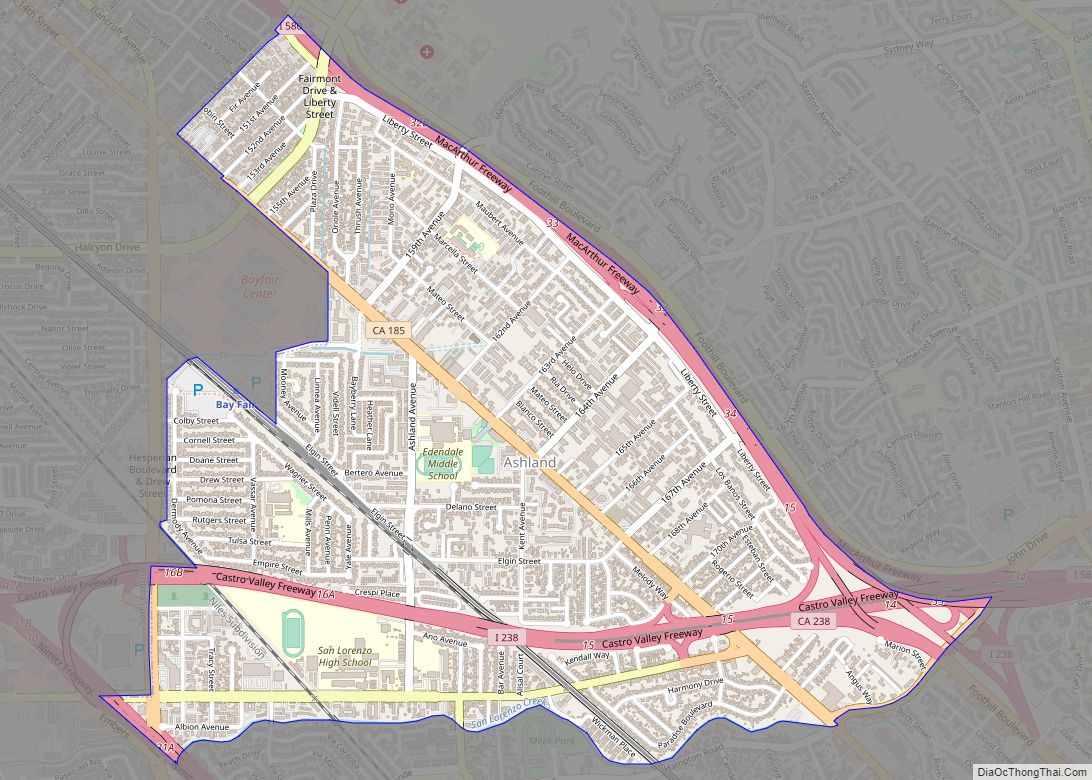
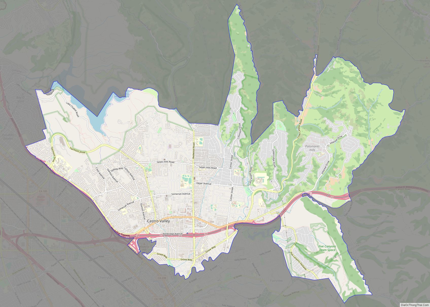
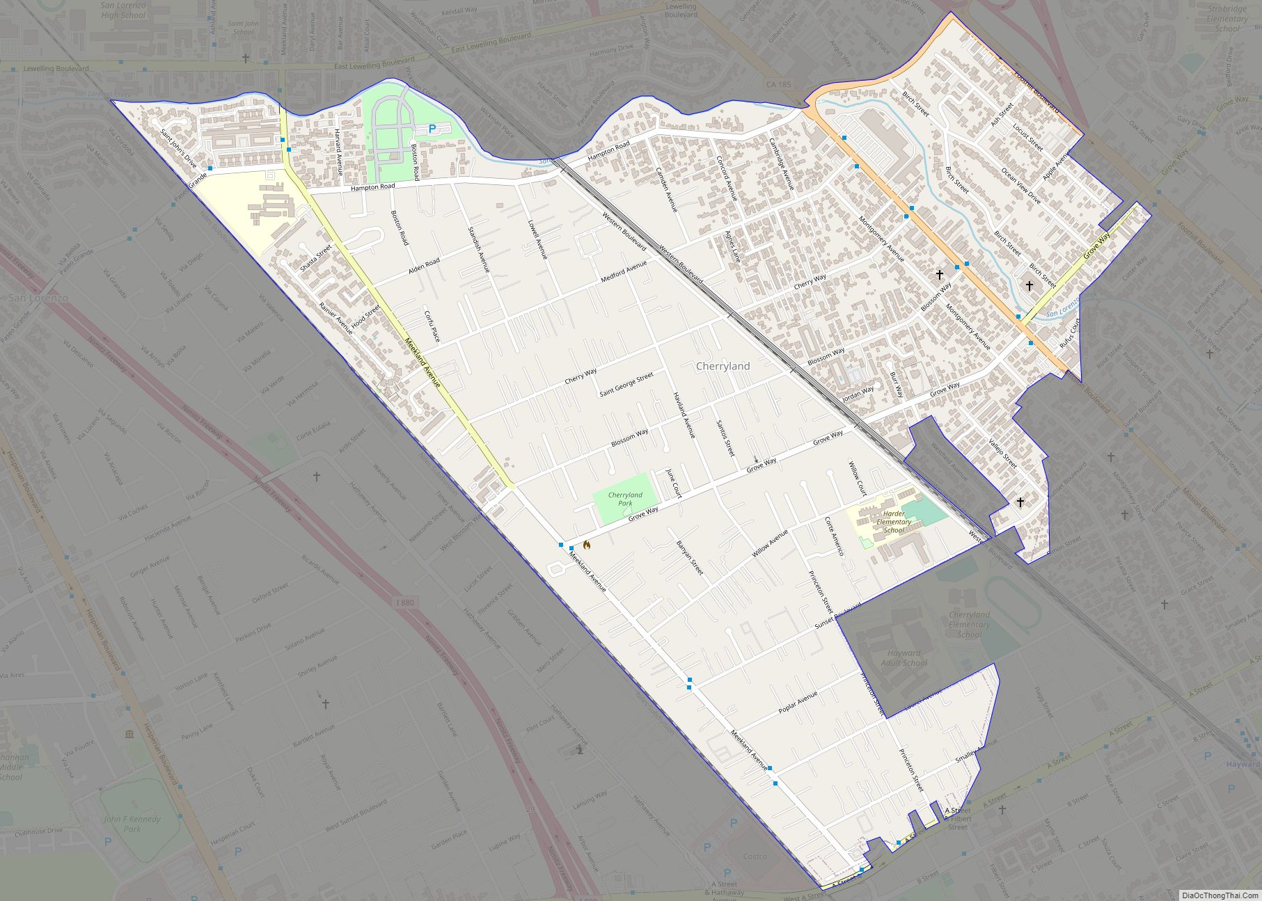
Ashland is a census-designated place (CDP) and unincorporated community in Alameda County, California, United States. The population was 23,823 at the 2020 census. Ashland is located between the city of San Leandro to the north, the unincorporated community of Cherryland to the south, the unincorporated community of Castro Valley to the east, and the unincorporated community of San Lorenzo to the southwest.
Ashland shares a postal zip code with the neighboring unincorporated community of San Lorenzo to the southwest, as well as the close by cities of Hayward to the south and San Leandro to the north. There is no documented evidence that Ashland was ever known as “San Leandro South” but instead has been informally, albeit incorrectly, known as “unincorporated San Leandro” or “unincorporated Hayward” since Ashland does not have its own postal zip code designation.
| Name: | Ashland CDP |
|---|---|
| LSAD Code: | 57 |
| LSAD Description: | CDP (suffix) |
| State: | California |
| County: | Alameda County |
| Elevation: | 43 ft (13 m) |
| Total Area: | 1.84 sq mi (4.77 km²) |
| Land Area: | 1.84 sq mi (4.77 km²) |
| Water Area: | 0.00 sq mi (0.00 km²) 0% |
| Total Population: | 23,823 |
| Population Density: | 12,926.21/sq mi (4,992.00/km²) |
| ZIP code: | 94541, 94578, 94580 |
| FIPS code: | 0602980 |
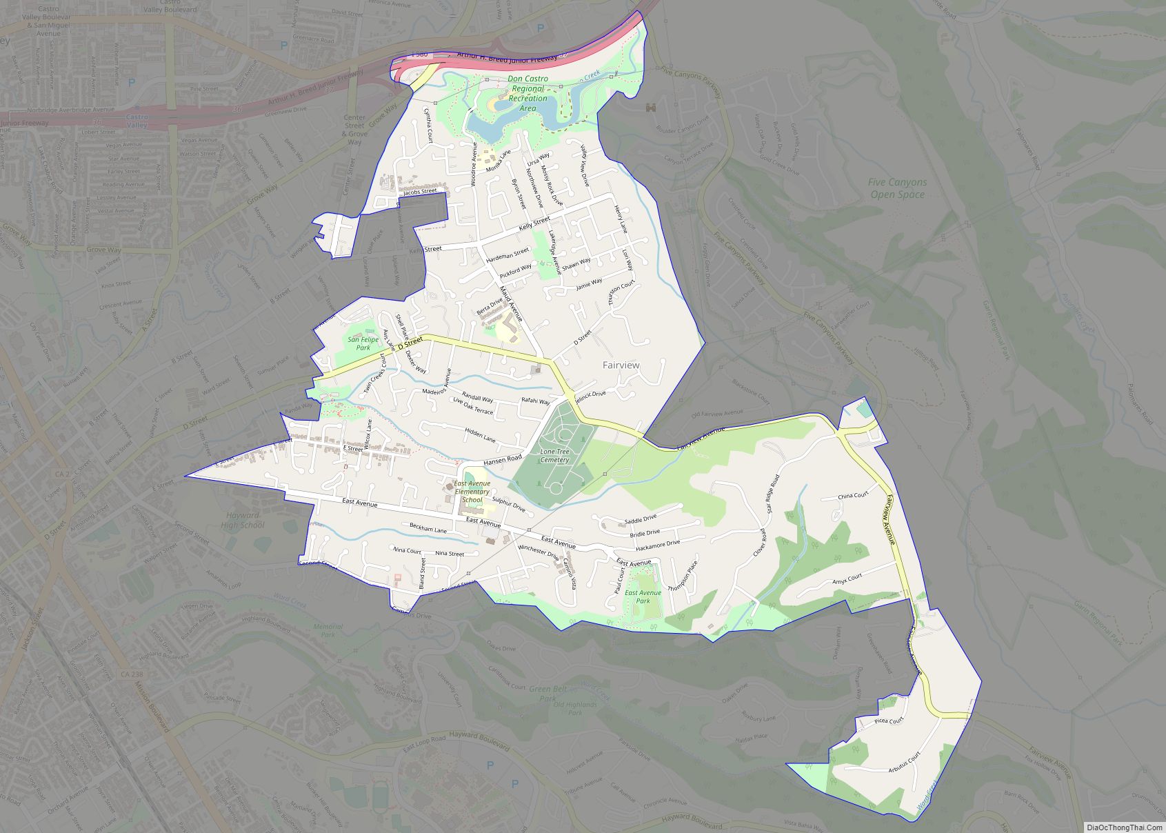
Online Interactive Map
Click on ![]() to view map in "full screen" mode.
to view map in "full screen" mode.
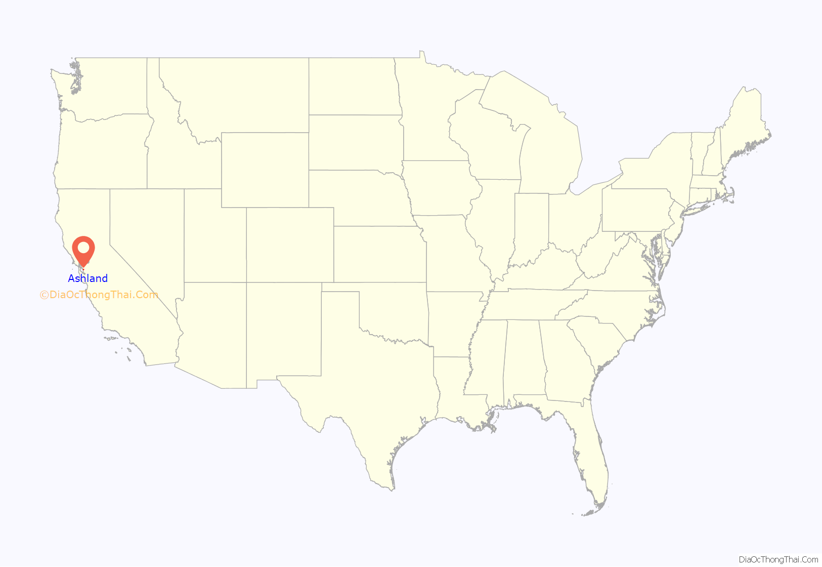
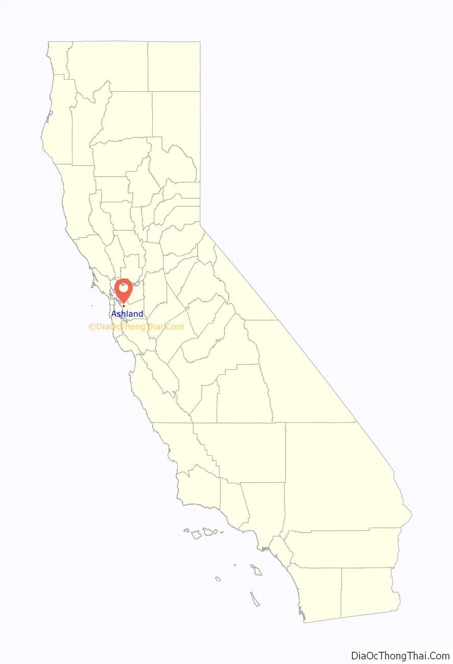
Ashland location map. Where is Ashland CDP?
History
Ashland developed as a residential suburb in the 1940s. It was named for an Oregon ash tree.
The San Lorenzo Creek is the southern border of Ashland.
Ashland Road Map

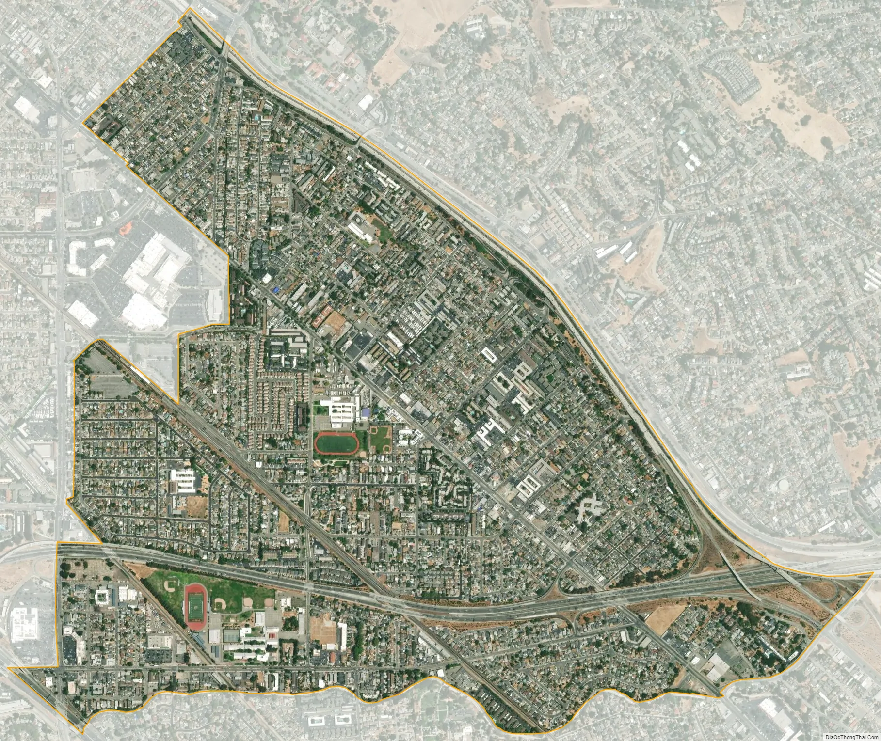
Ashland city Satellite Map
Geography
According to the United States Census Bureau, the CDP has a total area of 1.8 square miles (4.7 km), all of it land and sits at an elevation of 43 feet above sea level.
See also
Map of California State and its subdivision:- Alameda
- Alpine
- Amador
- Butte
- Calaveras
- Colusa
- Contra Costa
- Del Norte
- El Dorado
- Fresno
- Glenn
- Humboldt
- Imperial
- Inyo
- Kern
- Kings
- Lake
- Lassen
- Los Angeles
- Madera
- Marin
- Mariposa
- Mendocino
- Merced
- Modoc
- Mono
- Monterey
- Napa
- Nevada
- Orange
- Placer
- Plumas
- Riverside
- Sacramento
- San Benito
- San Bernardino
- San Diego
- San Francisco
- San Joaquin
- San Luis Obispo
- San Mateo
- Santa Barbara
- Santa Clara
- Santa Cruz
- Shasta
- Sierra
- Siskiyou
- Solano
- Sonoma
- Stanislaus
- Sutter
- Tehama
- Trinity
- Tulare
- Tuolumne
- Ventura
- Yolo
- Yuba
- Alabama
- Alaska
- Arizona
- Arkansas
- California
- Colorado
- Connecticut
- Delaware
- District of Columbia
- Florida
- Georgia
- Hawaii
- Idaho
- Illinois
- Indiana
- Iowa
- Kansas
- Kentucky
- Louisiana
- Maine
- Maryland
- Massachusetts
- Michigan
- Minnesota
- Mississippi
- Missouri
- Montana
- Nebraska
- Nevada
- New Hampshire
- New Jersey
- New Mexico
- New York
- North Carolina
- North Dakota
- Ohio
- Oklahoma
- Oregon
- Pennsylvania
- Rhode Island
- South Carolina
- South Dakota
- Tennessee
- Texas
- Utah
- Vermont
- Virginia
- Washington
- West Virginia
- Wisconsin
- Wyoming