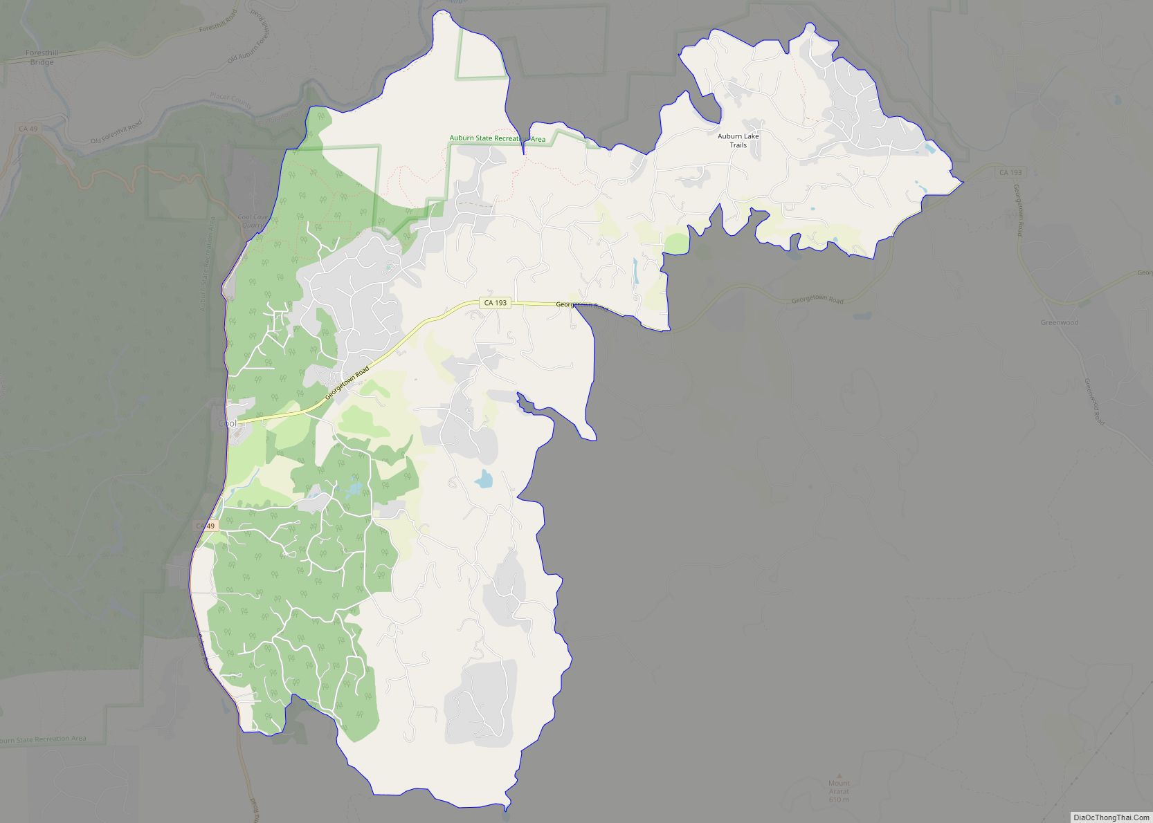
Map of Avery CDP

Map of Avery CDP, California

Avery is a census-designated place (CDP) in Calaveras County, California, United States. The population was 646 at the 2010 census, down from 672 at the 2000 census. Avery is located on State Route 4 and is home to the oldest continually operating hotel in the county, the Avery Hotel Restaurant & Saloon. Built in 1853, … Read more

Map of Avenal city

Map of Avenal city

Avenal (Spanish for “Oat field”) is a city in Kings County, California, United States. Avenal is located 35 miles (56 km) southwest of Hanford, at an elevation of 807 ft (246 m). It is part of the Hanford–Corcoran Metropolitan Statistical Area (MSA Code 25260), which encompasses all of Kings County. In area, it is the fourth-largest city in … Read more

Map of Avalon city

Map of Avalon city, California

Avalon is the only incorporated city on Santa Catalina Island, in the California Channel Islands, and the southernmost city in Los Angeles County. The city is a resort community with the waterfront dominated by tourism-oriented businesses. The older parts of the town on the valley floor consist primarily of small houses and two and three-story … Read more

Map of Azusa city

Map of Azusa city

Azusa (Tongva: Asuksa-nga) is a city in the San Gabriel Valley region of Los Angeles County, California, United States at the foot of the San Gabriel Mountains located 20 miles east of downtown Los Angeles. Its population was 50,000 in 2020, an increase from 46,361 at the 2010 census. Azusa is located along historic Route … Read more

Map of Avocado Heights CDP

Map of Avocado Heights CDP

Avocado Heights (pronunciation) is an unincorporated census-designated place (CDP) in the San Gabriel Valley of Los Angeles County, California, United States. It is almost entirely surrounded by the City of Industry with only a small strip of unincorporated Los Angeles County separating it from South El Monte. It is in close proximity to both the … Read more

Map of Avila Beach CDP

Map of Avila Beach CDP

Avila Beach (Spanish: Ávila) is an unincorporated community in San Luis Obispo County, California, United States, located on San Luis Obispo Bay about 160 miles (257 km) northwest of Los Angeles, and about 200 miles (320 km) south of San Francisco. The population was 1,576 at the 2010 census. For statistical purposes, the United States Census Bureau … Read more

Map of Baldwin Park city

Map of Baldwin Park city, California

Baldwin Park is a city located in the central San Gabriel Valley region of Los Angeles County, California, United States. As of the 2020 census, the population was 72,176, down from 75,390 at the 2010 census. Baldwin Park city overview: Name: Baldwin Park city LSAD Code: 25 LSAD Description: city (suffix) State: California County: Los … Read more

Map of Baker CDP

Map of Baker CDP, California

Baker is a census-designated place located in San Bernardino County, California, US. As of the 2010 census, the CDP had a total population of 735. Baker’s ZIP Code is 92309 and the community is within area codes 442 and 760. Baker CDP overview: Name: Baker CDP LSAD Code: 57 LSAD Description: CDP (suffix) State: California … Read more

Map of Ballard CDP

Map of Ballard CDP, California

Ballard is a census-designated place in Santa Barbara County, California. The town of Ballard is one of the communities that make up the Santa Ynez Valley. The nearest city is Solvang. The population was 467 at the 2010 census. Ballard is the smallest and oldest community in the Santa Ynez Valley. The town history can … Read more

Map of Banning city

Map of Banning city

Banning is a city in Riverside County, California, United States. The population was 29,505 as of the 2020 census, down from 29,603 at the 2010 census. It is situated in the San Gorgonio Pass, also known as Banning Pass. It is named for Phineas Banning, stagecoach line owner and the “Father of the Port of … Read more

Map of Bangor city

Map of Bangor CDP, California

Bangor is a census-designated place in Butte County, California, about 1.5 miles (2.4 km) from the Yuba County line. The U.S. Geological Survey (USGS) feature ID for the community is 218644, and for the census place is 2612459; and the elevation is given as 761 feet (232 m) above mean sea level (AMSL). The community is in … Read more

Map of Ballico CDP

Map of Ballico CDP

Ballico is a census-designated place in Merced County, California, United States. It is located 9 miles (14 km) northwest of Atwater at an elevation of 151 feet (46 m). The population was 347 at the 2020 United States census, down from 406 in 2010. Ballico is located in the northern part of Merced County, just north … Read more