Azusa (Tongva: Asuksa-nga) is a city in the San Gabriel Valley region of Los Angeles County, California, United States at the foot of the San Gabriel Mountains located 20 miles east of downtown Los Angeles.
Its population was 50,000 in 2020, an increase from 46,361 at the 2010 census. Azusa is located along historic Route 66, which passes through the city on Foothill Boulevard and Alosta Avenue.
Azusa is bordered by the San Gabriel Mountains range to the north, Irwindale to the west, the unincorporated community of Vincent to the southwest, Glendora and the unincorporated community of Citrus to the east, and Covina to the south.
| Name: | Azusa city |
|---|---|
| LSAD Code: | 25 |
| LSAD Description: | city (suffix) |
| State: | California |
| County: | Los Angeles County |
| Founded: | 1887 |
| Incorporated: | December 29, 1898 |
| Elevation: | 610 ft (186 m) |
| Total Area: | 9.67 sq mi (25.05 km²) |
| Land Area: | 9.66 sq mi (25.02 km²) |
| Water Area: | 0.01 sq mi (0.03 km²) 0.13% |
| Population Density: | 5,175.45/sq mi (1,998.24/km²) |
| ZIP code: | 91702 |
| Area code: | 626 |
| FIPS code: | 0603386 |
| Website: | www.ci.azusa.ca.us |
Online Interactive Map
Click on ![]() to view map in "full screen" mode.
to view map in "full screen" mode.
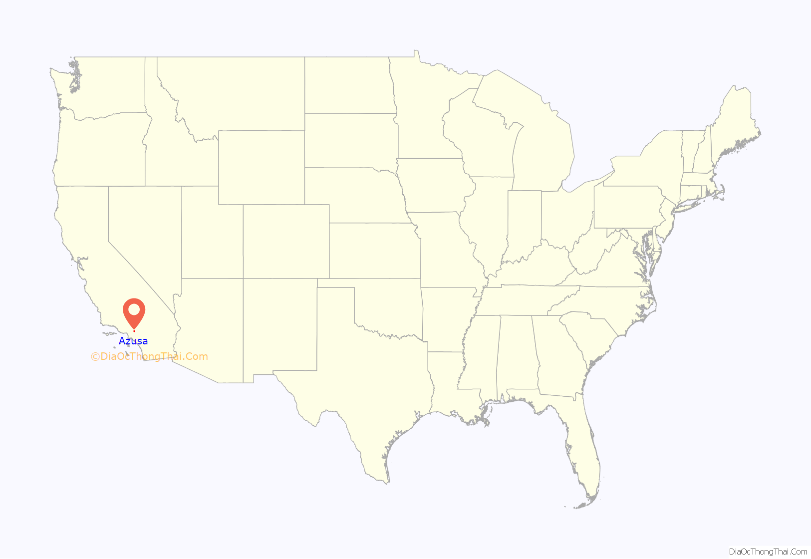
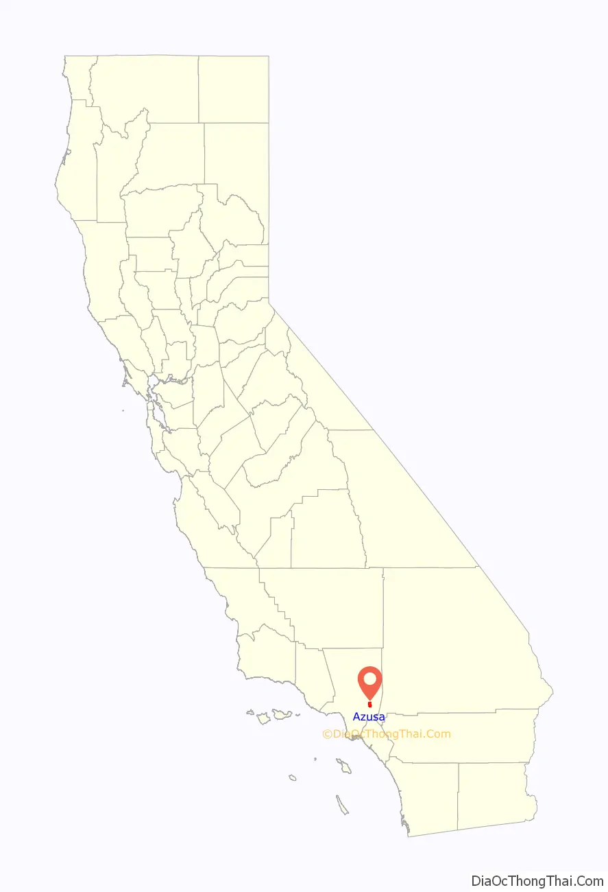
Azusa location map. Where is Azusa city?
History
The place name Azusa dates to the Mexican Alta California era in the 19th century when Azusa was used to refer to the San Gabriel Valley and the San Gabriel River. It appears to have been derived from the Tongva place name Asuksa-nga. The area was part of the homeland of the indigenous Tongva people (Gabrieleño Indians) since at least 55 BC. A backronym, “Azusa stands for everything from A to Z in the U.S.A.”, has been a phrase used to promote the city by organisations such as the Chamber of Commerce for many years.
The first Mexican settlement in Azusa was at the Rancho el Susa in 1841, a Mexican land grant from the Alta California Governor Juan Bautista Alvarado to Luis Arenas. In 1844, Arenas sold the rancho’s land to Henry Dalton, an English immigrant and wealthy merchant from the Pueblo of Los Angeles, for $7,000. He renamed it Rancho Azusa de Dalton, and had built a winery, distillery, vinegar house, meat smokehouse, and flour mill. Also, a vineyard was planted. Dalton built a house here on a place known as Dalton Hill, near 6th Street and Cerritos Avenue in Azusa.
Dalton was also the owner of the large, adjacent Rancho San Francisquito and Rancho Santa Anita properties. In the end, Dalton owned an unbroken expanse of land from present-day San Dimas to the eastern edge of Pasadena. A portion of Azusa west of the San Gabriel River was within adjacent Rancho Azusa de Duarte.
With the cession of California to the United States following the Mexican–American War, the 1848 Treaty of Guadalupe Hidalgo provided that the land grants would be honored. As required by the Land Act of 1851, a claim for Rancho San Francisquito was filed with the Public Land Commission in 1852 and confirmed by the Commission in 1853, but rejected by the US District Court in 1855, on the grounds that Henry Dalton was not, at the time of the grant, a citizen of Mexico. The decree was reversed by the US Supreme Court, and the grant was patented to Henry Dalton in 1867.
Azusa was listed in the 1860 census as a township (encompassing the Azusa de Dalton and Azusa de Duarte ranchos) with a population of 363. The 1870 US Census listed the area as the township of Azusa – El Monte Township and 1880 US Census listed the area as the township of San Jose and Azusa. There were a few corrections to cross out the San Jose name on most of the census pages, but this was done sporadically and there remain many index errors in the online census due to these errors.
Dalton had borrowed money from Los Angeles banker Jonathan S. Slauson to fund 24 years of litigation, and had to sign the land over to him in 1880. Slauson laid out the plan for the city in 1887 and the city was officially incorporated in 1898.
The completion of the Los Angeles and San Gabriel Valley Railroad in January 1887, later sold to the Santa Fe railroad, brought new people looking for homes and investment opportunities in Azusa. The Gold Line Foothill light rail line is being built on the old rail right-of-way. Part of this land boom was the short-lived town of Gladstone in 1887, which merged into Azusa in 1905.
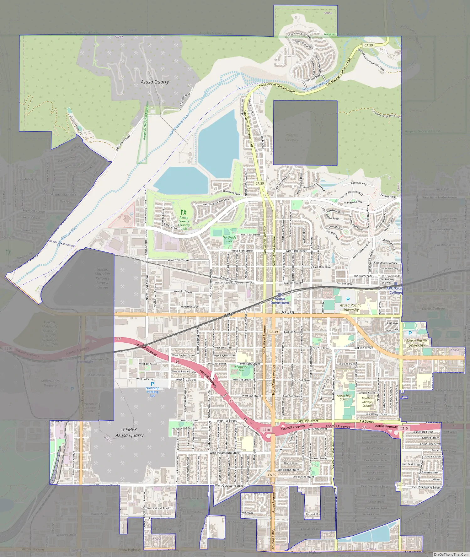
Azusa Road Map
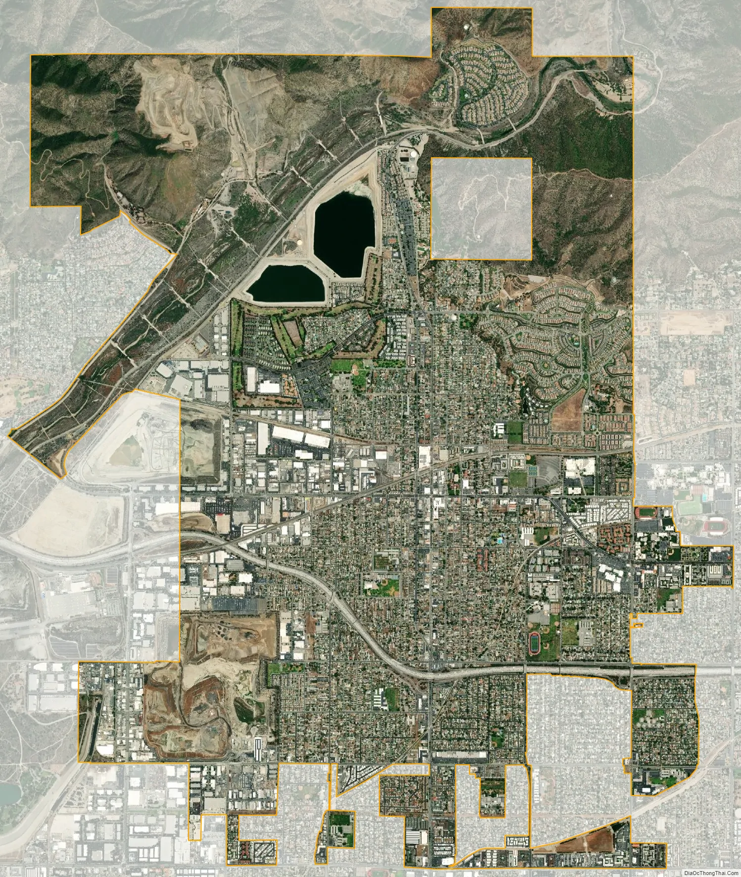
Azusa city Satellite Map
Geography
The city is located at the entrance to the San Gabriel Canyon, giving the city its nickname “The Canyon City.” It is on the east side of the San Gabriel River.
According to the United States Census Bureau, the city has a total area of 9.7 square miles (25 km); over 99% of it is land.
Azusa is located at 34°7′50″N 117°54′25″W / 34.13056°N 117.90694°W / 34.13056; -117.90694.
Azusa has one sister city:
- Zacatecas, State of Zacatecas, Mexico
Climate
This region experiences warm, dry summers, with no average monthly temperatures above 71.6 °F (22.0 °C). According to the Köppen Climate Classification system, Azusa has a warm-summer Mediterranean climate, abbreviated “Csb” on climate maps.
See also
Map of California State and its subdivision:- Alameda
- Alpine
- Amador
- Butte
- Calaveras
- Colusa
- Contra Costa
- Del Norte
- El Dorado
- Fresno
- Glenn
- Humboldt
- Imperial
- Inyo
- Kern
- Kings
- Lake
- Lassen
- Los Angeles
- Madera
- Marin
- Mariposa
- Mendocino
- Merced
- Modoc
- Mono
- Monterey
- Napa
- Nevada
- Orange
- Placer
- Plumas
- Riverside
- Sacramento
- San Benito
- San Bernardino
- San Diego
- San Francisco
- San Joaquin
- San Luis Obispo
- San Mateo
- Santa Barbara
- Santa Clara
- Santa Cruz
- Shasta
- Sierra
- Siskiyou
- Solano
- Sonoma
- Stanislaus
- Sutter
- Tehama
- Trinity
- Tulare
- Tuolumne
- Ventura
- Yolo
- Yuba
- Alabama
- Alaska
- Arizona
- Arkansas
- California
- Colorado
- Connecticut
- Delaware
- District of Columbia
- Florida
- Georgia
- Hawaii
- Idaho
- Illinois
- Indiana
- Iowa
- Kansas
- Kentucky
- Louisiana
- Maine
- Maryland
- Massachusetts
- Michigan
- Minnesota
- Mississippi
- Missouri
- Montana
- Nebraska
- Nevada
- New Hampshire
- New Jersey
- New Mexico
- New York
- North Carolina
- North Dakota
- Ohio
- Oklahoma
- Oregon
- Pennsylvania
- Rhode Island
- South Carolina
- South Dakota
- Tennessee
- Texas
- Utah
- Vermont
- Virginia
- Washington
- West Virginia
- Wisconsin
- Wyoming


