Avila Beach (Spanish: Ávila) is an unincorporated community in San Luis Obispo County, California, United States, located on San Luis Obispo Bay about 160 miles (257 km) northwest of Los Angeles, and about 200 miles (320 km) south of San Francisco. The population was 1,576 at the 2010 census. For statistical purposes, the United States Census Bureau has defined Avila Beach as a census-designated place (CDP).
| Name: | Avila Beach CDP |
|---|---|
| LSAD Code: | 57 |
| LSAD Description: | CDP (suffix) |
| State: | California |
| County: | San Luis Obispo County |
| Elevation: | 430 ft (130 m) |
| Total Area: | 6.31 sq mi (16.34 km²) |
| Land Area: | 6.09 sq mi (15.77 km²) |
| Water Area: | 0.22 sq mi (0.58 km²) 0.29% |
| Total Population: | 1,576 |
| Population Density: | 258.91/sq mi (99.96/km²) |
| ZIP code: | 93424 |
| Area code: | 805 |
| FIPS code: | 0603330 |
| GNISfeature ID: | 2582937 |
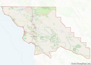
Online Interactive Map
Click on ![]() to view map in "full screen" mode.
to view map in "full screen" mode.
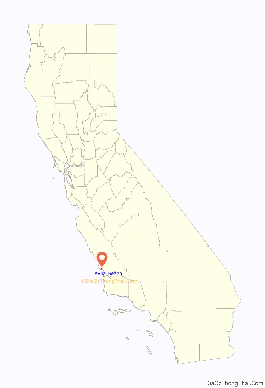
Avila Beach location map. Where is Avila Beach CDP?

History
The name Avila commemorates Miguel Ávila, who was granted Rancho San Miguelito in 1842. The town was established in the latter half of the 19th century, when it served as the main shipping port for San Luis Obispo. Around this time, Luigi Marre built a honeymoon hotel here and steamboats brought customers from San Francisco and Los Angeles.
Although Avila Beach still has a working commercial fishing pier and the inland areas have extensive apple orchards, tourism is now the main industry. There are few historical structures remaining; among the oldest is the Point San Luis Light, built in 1890 after a series of shipping accidents. During World War II the beach and port were used for the Amphibious Training Base Morro Bay.
In the late 1990s, Unocal began the cleanup of decades old oil seepage discovered years earlier from corroding pipes under the township, and which had caused a massive oil spill under the town. Over 6,750 truckloads of contaminated material was sent to a Bakersfield landfill, and replaced with clean Guadalupe Dunes sand. Many of the town’s homes and businesses, including several blocks of Front Street, were razed as a result of the quarter-mile-wide excavation. New buildings, homes, businesses, modern walkways and sea motif walls and benches have been constructed.
Avila Beach Road Map

Avila Beach city Satellite Map

Geography
The beach is less than 0.5 miles (0.8 km) long and sheltered in San Luis Bay, which is formed by Point San Luis on the west and Fossil Point on the east. Avila Beach faces south and the 600 foot elevation of Point San Luis breaks the prevailing northwesterly winds. It is therefore usually warmer than the other beaches on the Central Coast. Most of Avila Beach is undeveloped, except for a few blocks adjacent to the beach with homes, hotels, and small businesses, and a few upscale housing developments inland near a golf course. Avila Beach is also known for its hot springs, which are used for resort spas.
U.S. Route 101 and State Highway 1 bypass this part of the coastline to the east in favor of a more direct route from Pismo Beach north to San Luis Obispo.
According to the United States Census Bureau, the CDP covers an area of 6.0 square miles (15.6 km), 99.71% of it land, and 0.29% of it water.
See also
Map of California State and its subdivision:- Alameda
- Alpine
- Amador
- Butte
- Calaveras
- Colusa
- Contra Costa
- Del Norte
- El Dorado
- Fresno
- Glenn
- Humboldt
- Imperial
- Inyo
- Kern
- Kings
- Lake
- Lassen
- Los Angeles
- Madera
- Marin
- Mariposa
- Mendocino
- Merced
- Modoc
- Mono
- Monterey
- Napa
- Nevada
- Orange
- Placer
- Plumas
- Riverside
- Sacramento
- San Benito
- San Bernardino
- San Diego
- San Francisco
- San Joaquin
- San Luis Obispo
- San Mateo
- Santa Barbara
- Santa Clara
- Santa Cruz
- Shasta
- Sierra
- Siskiyou
- Solano
- Sonoma
- Stanislaus
- Sutter
- Tehama
- Trinity
- Tulare
- Tuolumne
- Ventura
- Yolo
- Yuba
- Alabama
- Alaska
- Arizona
- Arkansas
- California
- Colorado
- Connecticut
- Delaware
- District of Columbia
- Florida
- Georgia
- Hawaii
- Idaho
- Illinois
- Indiana
- Iowa
- Kansas
- Kentucky
- Louisiana
- Maine
- Maryland
- Massachusetts
- Michigan
- Minnesota
- Mississippi
- Missouri
- Montana
- Nebraska
- Nevada
- New Hampshire
- New Jersey
- New Mexico
- New York
- North Carolina
- North Dakota
- Ohio
- Oklahoma
- Oregon
- Pennsylvania
- Rhode Island
- South Carolina
- South Dakota
- Tennessee
- Texas
- Utah
- Vermont
- Virginia
- Washington
- West Virginia
- Wisconsin
- Wyoming