Ballard is a census-designated place in Santa Barbara County, California. The town of Ballard is one of the communities that make up the Santa Ynez Valley. The nearest city is Solvang. The population was 467 at the 2010 census. Ballard is the smallest and oldest community in the Santa Ynez Valley. The town history can be seen in two buildings from the 1880s: the 1883 Ballard School and the Santa Ynez Valley Presbyterian Church, which was erected in 1889. Ballard was founded in 1880.
| Name: | Ballard CDP |
|---|---|
| LSAD Code: | 57 |
| LSAD Description: | CDP (suffix) |
| State: | California |
| County: | Santa Barbara County |
| Elevation: | 646 ft (197 m) |
| Total Area: | 2.80 sq mi (7.25 km²) |
| Land Area: | 2.79 sq mi (7.24 km²) |
| Water Area: | 0.01 sq mi (0.01 km²) 0.02% |
| Total Population: | 768 |
| Population Density: | 274.87/sq mi (106.12/km²) |
| ZIP code: | 93463 |
| Area code: | 805 |
| FIPS code: | 0603694 |
| GNISfeature ID: | 2582938 |
Online Interactive Map
Click on ![]() to view map in "full screen" mode.
to view map in "full screen" mode.
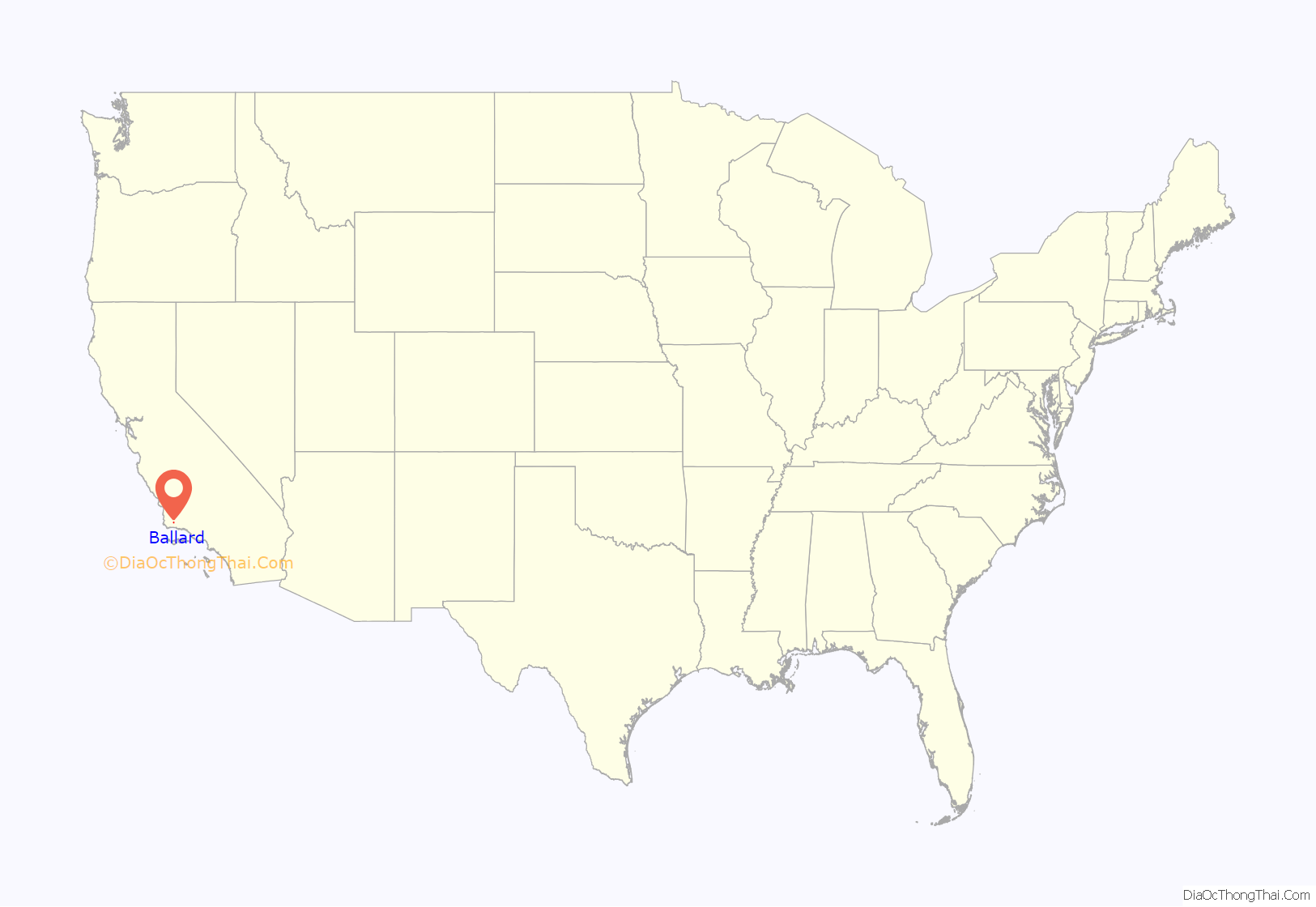
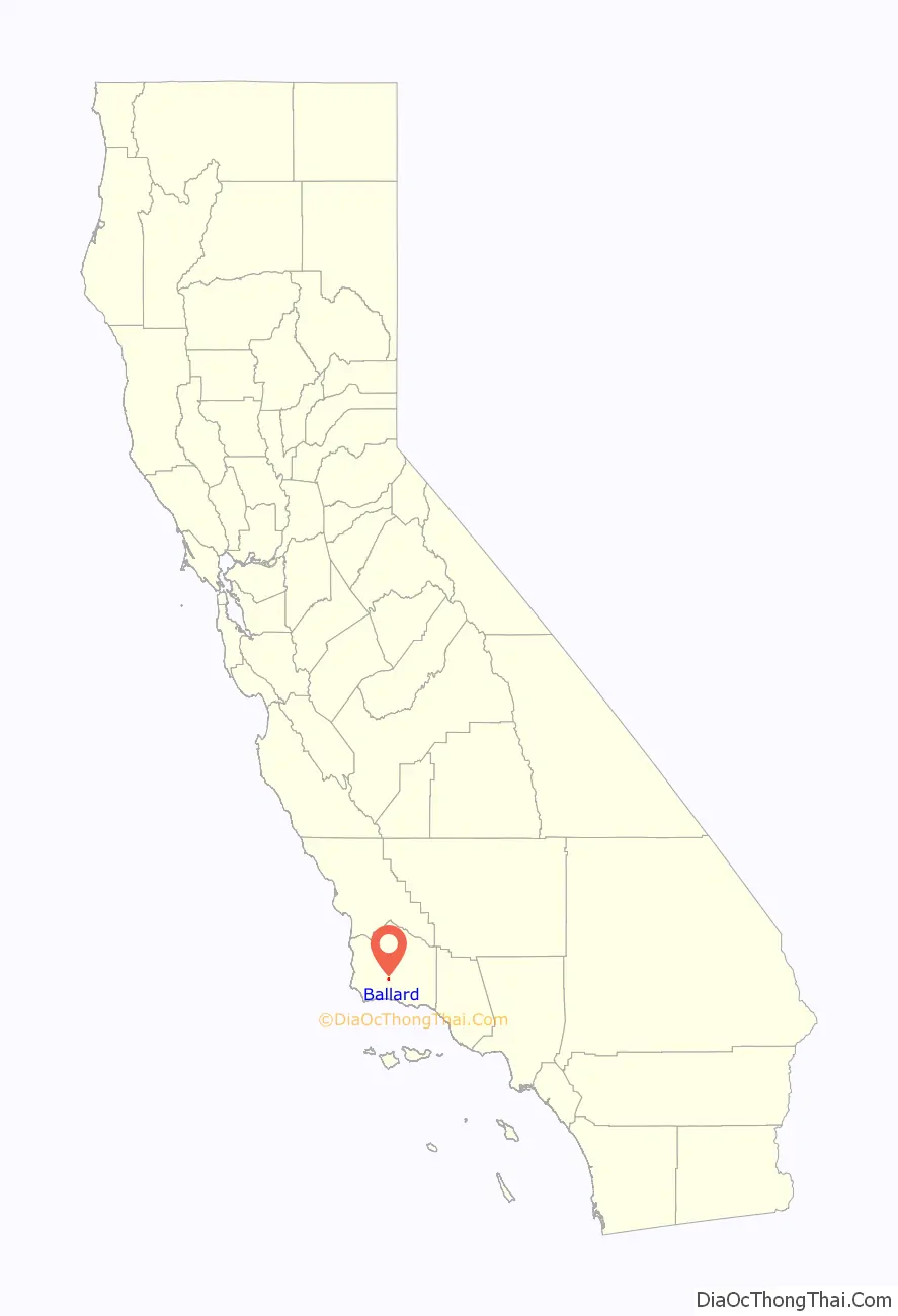
Ballard location map. Where is Ballard CDP?
History
Ballard was founded in 1880 at the location of a Wells Fargo stage line station, being named by George Lewis after William Ballard, the former proprietor, who ran the station from 1862 to 1870. In 1882 it was believed that Ballard would grow into the central metropolis of Santa Barbara County. The first school, Ballard’s Little Red School House, was built in 1882 and is still in operation today, being the primary tourist attraction in what turned out to be a tiny village, bypassed as a city.
Today, Ballard is a combination of sleepy village and upscale bedroom community. Noted for its excellent elementary school, it is a prized residential area. The surrounding area is noted for its thriving and well-respected wine industry. The wine-producing region around Ballard was featured in the Academy Award-nominated film Sideways. A world-renowned equine hospital is located nearby. The only commercial establishment currently operating in the main village is The Ballard Inn, a four-star restaurant and bed and breakfast inn in the heart of the village. A recent addition, across the street form Ballard Inn, is now Bob’s Well Bread Bakery, offering breakfast and lunch, as well as a multitude of artisan breads and pastries.
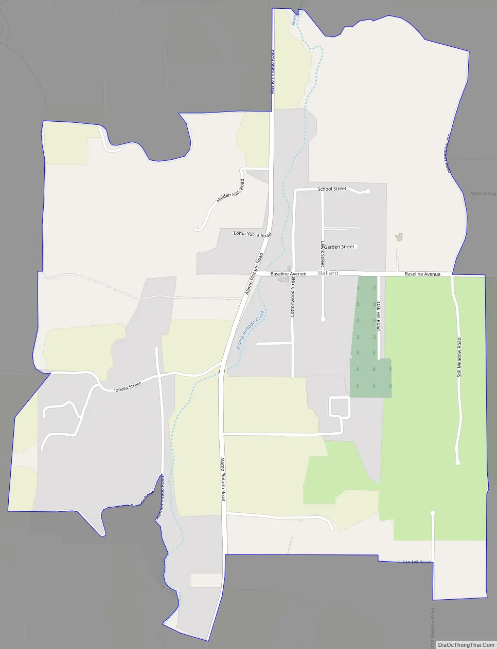
Ballard Road Map
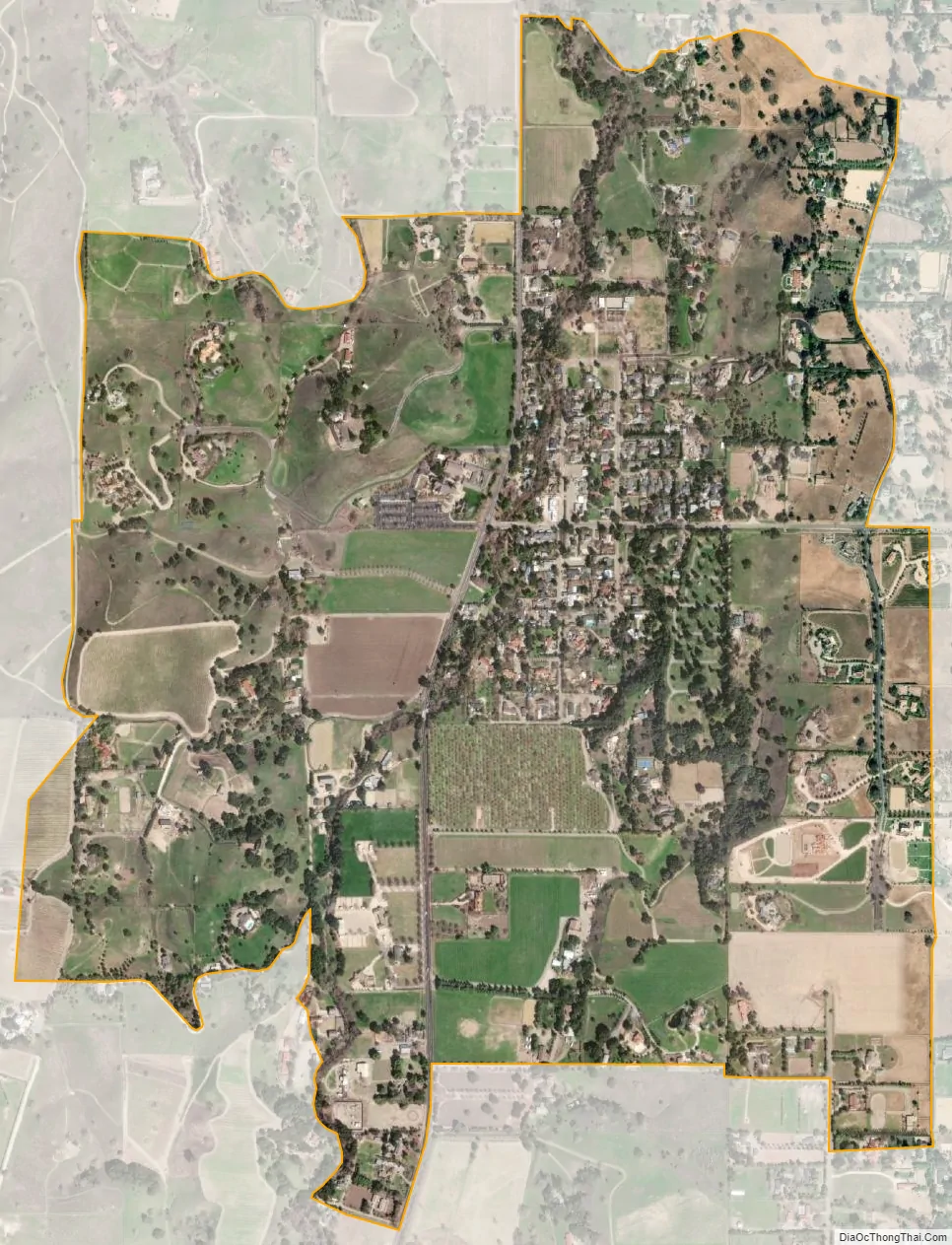
Ballard city Satellite Map
Geography
According to the United States Census Bureau, the CDP covers an area of 1.2 square miles (3.1 km), 99.98% of it land, and 0.02% of it water.
See also
Map of California State and its subdivision:- Alameda
- Alpine
- Amador
- Butte
- Calaveras
- Colusa
- Contra Costa
- Del Norte
- El Dorado
- Fresno
- Glenn
- Humboldt
- Imperial
- Inyo
- Kern
- Kings
- Lake
- Lassen
- Los Angeles
- Madera
- Marin
- Mariposa
- Mendocino
- Merced
- Modoc
- Mono
- Monterey
- Napa
- Nevada
- Orange
- Placer
- Plumas
- Riverside
- Sacramento
- San Benito
- San Bernardino
- San Diego
- San Francisco
- San Joaquin
- San Luis Obispo
- San Mateo
- Santa Barbara
- Santa Clara
- Santa Cruz
- Shasta
- Sierra
- Siskiyou
- Solano
- Sonoma
- Stanislaus
- Sutter
- Tehama
- Trinity
- Tulare
- Tuolumne
- Ventura
- Yolo
- Yuba
- Alabama
- Alaska
- Arizona
- Arkansas
- California
- Colorado
- Connecticut
- Delaware
- District of Columbia
- Florida
- Georgia
- Hawaii
- Idaho
- Illinois
- Indiana
- Iowa
- Kansas
- Kentucky
- Louisiana
- Maine
- Maryland
- Massachusetts
- Michigan
- Minnesota
- Mississippi
- Missouri
- Montana
- Nebraska
- Nevada
- New Hampshire
- New Jersey
- New Mexico
- New York
- North Carolina
- North Dakota
- Ohio
- Oklahoma
- Oregon
- Pennsylvania
- Rhode Island
- South Carolina
- South Dakota
- Tennessee
- Texas
- Utah
- Vermont
- Virginia
- Washington
- West Virginia
- Wisconsin
- Wyoming


