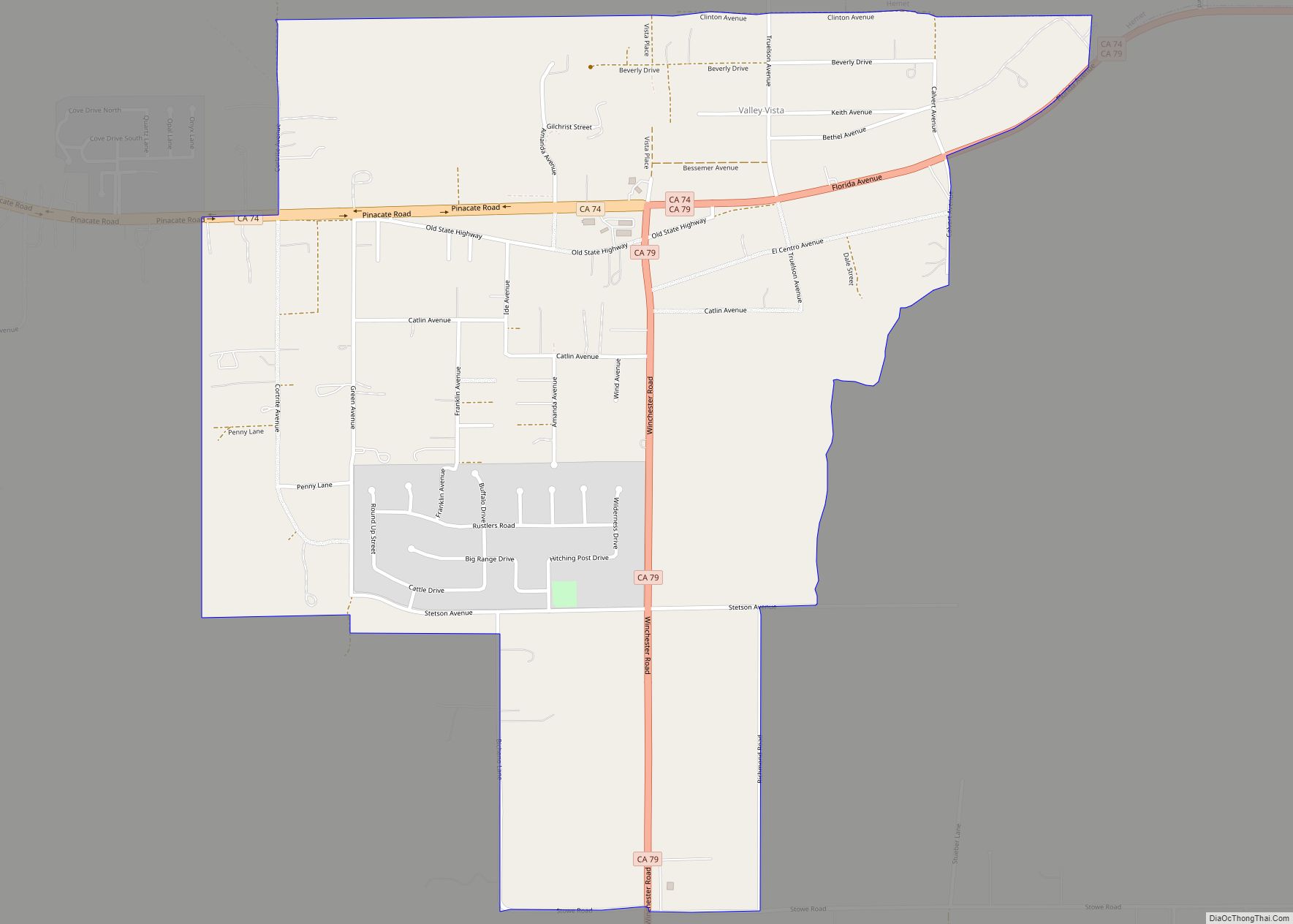
Map of Greenview CDP

Map of Greenview CDP, California

Greenview is a census-designated place (CDP) in Siskiyou County, California, United States. Its population is 208 as of the 2020 census, up from 201 from the 2010 census. Greenview CDP overview: Name: Greenview CDP LSAD Code: 57 LSAD Description: CDP (suffix) State: California County: Siskiyou County Elevation: 2,812 ft (857 m) Total Area: 1.379 sq mi (3.573 km²) Land Area: … Read more

Map of Greenhorn CDP

Map of Greenhorn CDP, California

Greenhorn is a census-designated place (CDP) in Plumas County, California, United States. The population was 236 at the 2010 census, up from 146 at the 2000 census. Greenhorn CDP overview: Name: Greenhorn CDP LSAD Code: 57 LSAD Description: CDP (suffix) State: California County: Plumas County Elevation: 4,436 ft (1,352 m) Total Area: 6.711 sq mi (17.381 km²) Land Area: 6.711 sq mi … Read more

Map of Greenfield CDP

Map of Greenfield CDP, California

Greenfield (formerly, Delkern) is a census-designated place in Kern County, California. It is located 7 miles (11 km) south of Bakersfield, at an elevation of 351 feet (107 m). The population was 3,991 at the 2010 census. The Delkern post office was opened in 1949. That name derives from Kern Delta, a designation for the surrounding … Read more

Map of Greenville CDP, California

Map of Greenville CDP, California

Greenville is a unincorporated community in Plumas County, California, United States, on the north-west side of Indian Valley. Most of the buildings were destroyed by the Dixie Fire in August 2021. The population was 1,129 at the 2010 census, down from 1,160 at the 2000 census. For statistical purposes, the United States Census Bureau has … Read more

Map of Gridley city

Map of Gridley city, California

Gridley is a city in Butte County, California, United States, 29 miles (47 kilometers) south of Chico, California and 56 miles (90 kilometers) north of Sacramento, California. The 2019 State of California population estimate was 7,224. California State Route 99 runs through Gridley and Interstate 5 and California State Route 70 are both nearby. The … Read more

Map of Grenada CDP

Map of Grenada CDP, California

Grenada (/ɡrɪˈneɪdə/ (listen) grin-AY-də) is a census-designated place (CDP) in Siskiyou County, California, United States. Its population is 314 as of the 2020 census, down from 367 from the 2010 census. The ZIP code is 96038 and the community is within area code 530. Grenada CDP overview: Name: Grenada CDP LSAD Code: 57 LSAD Description: … Read more

Map of Groveland CDP

Map of Groveland CDP, California

Groveland is a census-designated place (CDP) in Tuolumne County, California. Groveland sits at an elevation of 3,136 feet (956 m). The 2020 United States census reported Groveland’s population was 540. Groveland was created as a CDP prior to the 2010 census; previously it was part of Groveland-Big Oak Flat CDP. Groveland CDP overview: Name: Groveland CDP … Read more

Map of Grizzly Flats CDP

Map of Grizzly Flats CDP

Grizzly Flats (formerly Grizzly Flat and Chickenmasee) is a census-designated place in El Dorado County, California. It is located southeast of Camino, at an elevation of 3868 feet (1179 m). Grizzly Flats is the town nearest to Baltic Peak, a small peak to the northwest. The population at the 2010 census was 1,066. Grizzly Flats CDP overview: … Read more

Map of Grimes CDP, California

Map of Grimes CDP, California

Grimes (formerly Grimes Landing) is a census-designated place in Colusa County, California on the Southern Pacific Railroad. It lies at an elevation of 46 feet (14 m). The two main roads that run through it are State Route 45 and Grimes-Arbuckle Road. Its ZIP code is 95950, and its area code is 530. Grimes’s population … Read more

Map of Guerneville CDP

Map of Guerneville CDP

Guerneville (/ˈɡɜːrnvɪl, -nivɪl/) is an unincorporated community and census-designated place in the Russian River Valley of Sonoma County, California, United States. The town is historically known for the logging community, formed in the late 1800s. Guerneville is also known for its natural environment, liberal atmosphere, and proximity to wine-tasting and redwood forests. It was founded … Read more

Map of Guadalupe city, California

Map of Guadalupe city, California

Guadalupe is a small city located in Santa Barbara County, California. According to the U.S. Census of 2010, the city has a population of 7,080. Guadalupe is economically and socially tied to the city of Santa Maria, which is about 8 miles (13 km) to the east. It is located at the intersection of Highway 1 … Read more

Map of Grover Beach city

Map of Grover Beach city

Grover Beach is a city in San Luis Obispo County, California, United States. The population was 13,156 at the 2010 census, up from 13,067 in 2000. Grover Beach is the location of the Pacific Crossing cable Landing station. This is where trans-pacific submarine cables come ashore and interface with the North American telecom network. Grover … Read more