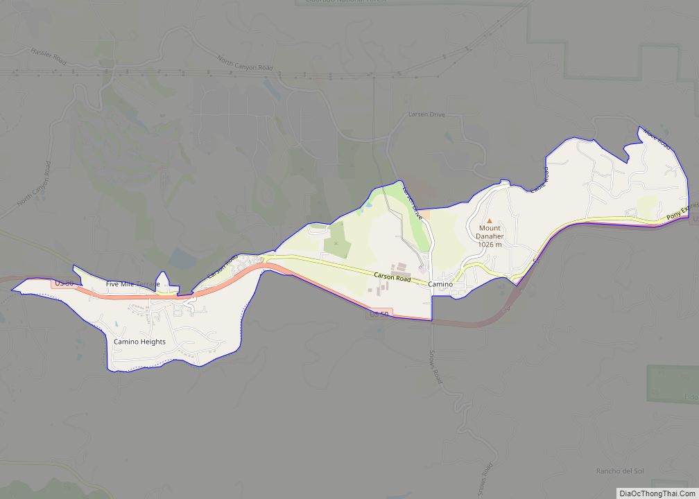
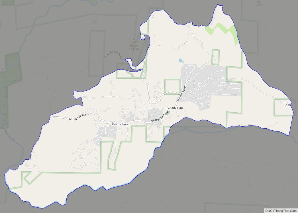
Grizzly Flats (formerly Grizzly Flat and Chickenmasee) is a census-designated place in El Dorado County, California. It is located southeast of Camino, at an elevation of 3868 feet (1179 m). Grizzly Flats is the town nearest to Baltic Peak, a small peak to the northwest. The population at the 2010 census was 1,066.
| Name: | Grizzly Flats CDP |
|---|---|
| LSAD Code: | 57 |
| LSAD Description: | CDP (suffix) |
| State: | California |
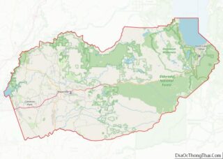
| County: | El Dorado County |
| Elevation: | 3,868 ft (1,179 m) |
| Total Area: | 6.629 sq mi (17.169 km²) |
| Land Area: | 6.629 sq mi (17.169 km²) |
| Water Area: | 0 sq mi (0 km²) 0% |
| Total Population: | 1,066 |
| Population Density: | 160/sq mi (62/km²) |
| ZIP code: | 95636 |
| Area code: | 530 |
| FIPS code: | 0631302 |
Online Interactive Map
Click on ![]() to view map in "full screen" mode.
to view map in "full screen" mode.
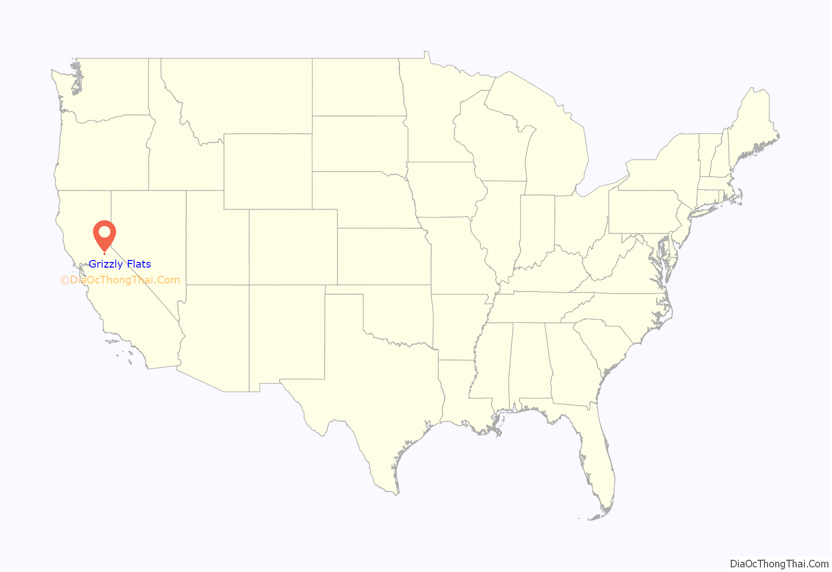
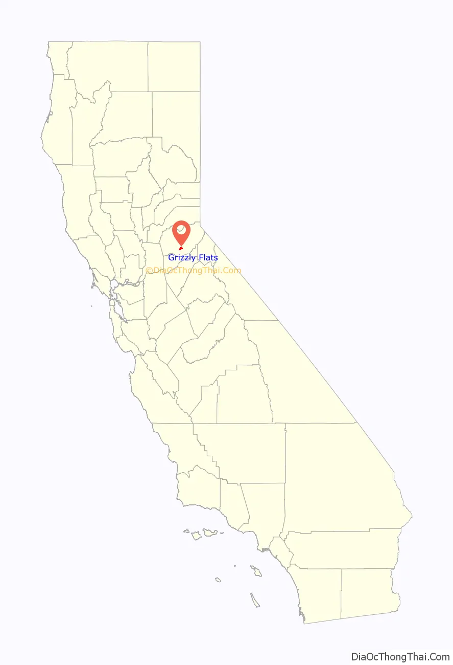
Grizzly Flats location map. Where is Grizzly Flats CDP?
History
Grizzly Flats originated as a gold mining camp in the 1850s. The name was given by prospectors who were surprised by a grizzly bear there in 1850. In 1852 it was described as being on a flat piece of land measuring approximately one mile by three quarters of a mile and having two combination bars, stores, and boarding houses, with more under construction. It was located centrally in a jurisdiction called Mountain Township. A post office opened in 1854, a stagecoach route to Diamond Springs in 1855, and a Wells Fargo office in 1857. Catholic and Methodist churches were also established in the mid-1850s.
Fires in 1866 and 1869 destroyed most of the settlement; the 1869 fire killed one person and destroyed all but two buildings in the business district, which was only partly rebuilt.
On August 17, 2021, the Caldor Fire destroyed around 500 buildings in and near Grizzly Flats, including the original 1850s post office, the modern post office, and Walt Tyler Elementary School. Two people from the area with serious injuries caused by the fire were airlifted to hospitals. The mandatory evacuation order was lifted on September 6.
Grizzly Flats Road Map
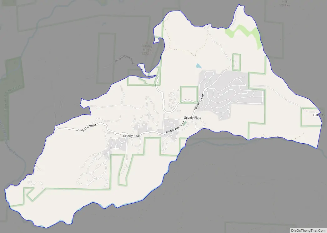
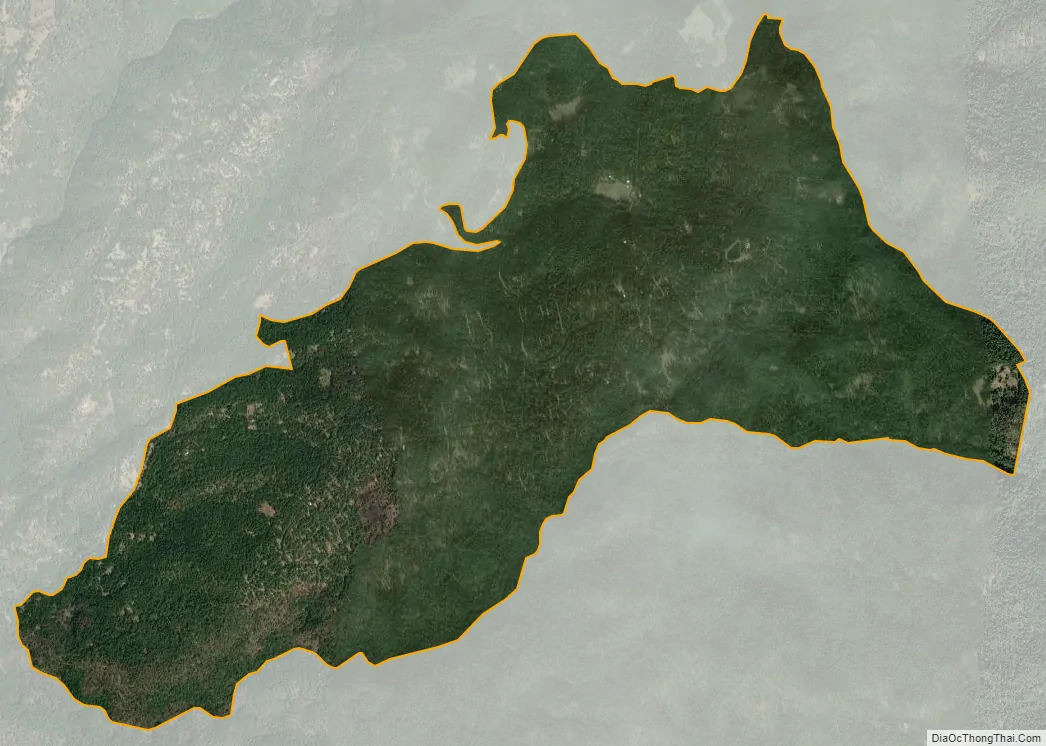
Grizzly Flats city Satellite Map
See also
Map of California State and its subdivision:- Alameda
- Alpine
- Amador
- Butte
- Calaveras
- Colusa
- Contra Costa
- Del Norte
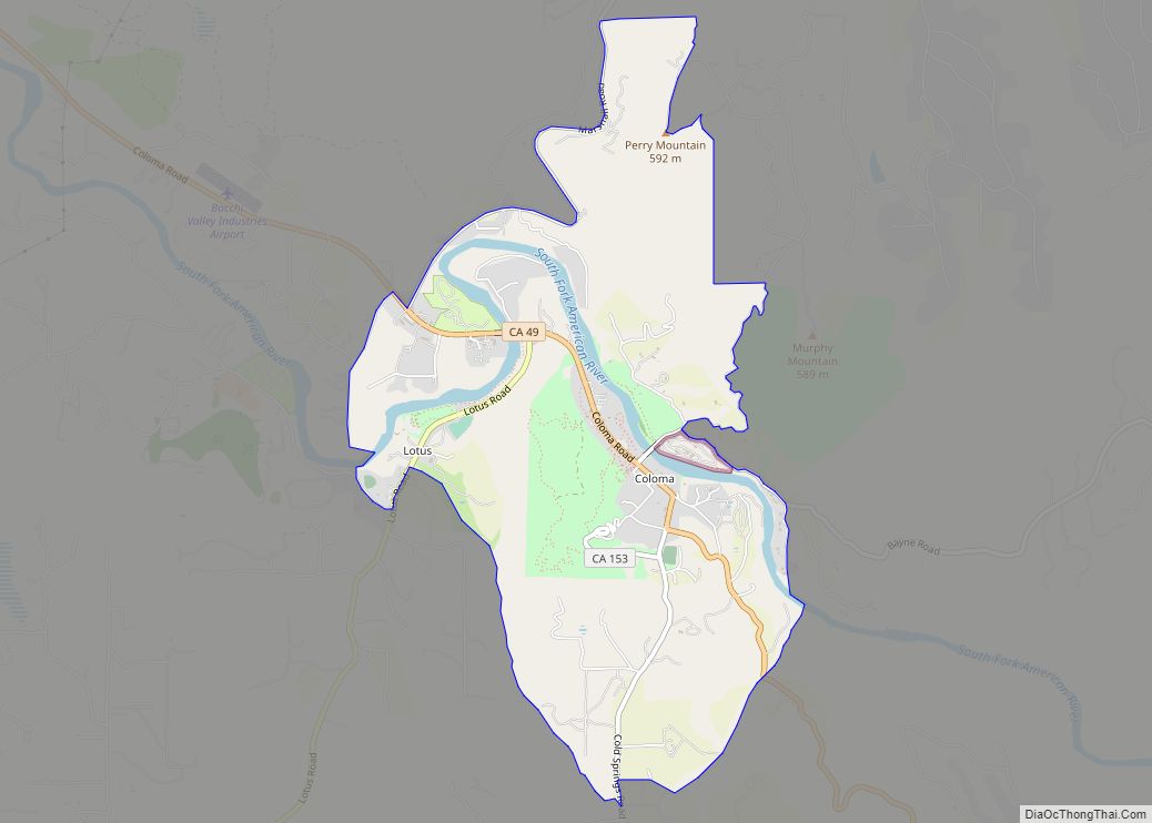
- El Dorado
- Fresno
- Glenn
- Humboldt
- Imperial
- Inyo
- Kern
- Kings
- Lake
- Lassen
- Los Angeles
- Madera
- Marin
- Mariposa
- Mendocino
- Merced
- Modoc
- Mono
- Monterey
- Napa
- Nevada
- Orange
- Placer
- Plumas
- Riverside
- Sacramento
- San Benito
- San Bernardino
- San Diego
- San Francisco
- San Joaquin
- San Luis Obispo
- San Mateo
- Santa Barbara
- Santa Clara
- Santa Cruz
- Shasta
- Sierra
- Siskiyou
- Solano
- Sonoma
- Stanislaus
- Sutter
- Tehama
- Trinity
- Tulare
- Tuolumne
- Ventura
- Yolo
- Yuba
- Alabama
- Alaska
- Arizona
- Arkansas
- California
- Colorado
- Connecticut
- Delaware
- District of Columbia
- Florida
- Georgia
- Hawaii
- Idaho
- Illinois
- Indiana
- Iowa
- Kansas
- Kentucky
- Louisiana
- Maine
- Maryland
- Massachusetts
- Michigan
- Minnesota
- Mississippi
- Missouri
- Montana
- Nebraska
- Nevada
- New Hampshire
- New Jersey
- New Mexico
- New York
- North Carolina
- North Dakota
- Ohio
- Oklahoma
- Oregon
- Pennsylvania
- Rhode Island
- South Carolina
- South Dakota
- Tennessee
- Texas
- Utah
- Vermont
- Virginia
- Washington
- West Virginia
- Wisconsin
- Wyoming